Lower Lehman Creek Campground sits on Wheeler Peak Scenic Drive, 2.5 miles from the Lehman Caves Visitor Center. With nine sites spaced along the creek, it's the closest year-round campground in Great Basin National Park. You can hear the creek from every site - water that's dropped 3,000 vertical feet from the high Snake Range snowfields before passing your tent. As of 2026, this campground is one of the few options for winter camping in the park, but there are some important closures you need to know about before you arrive. Read our complete visitor guide for the full picture on planning a trip here.
NPS via NPS.gov (Public Domain)
Lower Lehman Creek: 9 Sites, Permit Required
6 min read
Campsite Guide
Lower Lehman Creek Campground sits on Wheeler Peak Scenic Drive, 2. 5 miles from the Lehman Caves Visitor Center. Updated for 2026 with 5 Lower Lehman Creek
Your plans
For more, see Campsites at Dump Station (2026 Guide).
For more, see Campsites at Wheeler Peak Campground (2026 Guide).
For more, see Great Basin National Park Weather.
For more, see complete visitor guide, Campsites at Baker Creek Campground (2026 Guide) (2026 Guide), Campsites at Grey Cliffs Campground (2026 Guide) (2026 guide), and Campsites at Upper Lehman Creek Campground (2026 Guide).
Location and Access
Getting to the Campground
From the Lehman Caves Visitor Center, drive 2.5 miles up the paved Wheeler Peak Scenic Drive. The campground entrance appears on your right. The road gains elevation steadily, climbing from the valley floor into the pinyon-juniper zone before reaching the stream corridor.
The road is paved all the way. Most vehicles can handle it, including standard passenger cars and RVs. The park service doesn't list a length limit for sites, but the campground's small size (9 sites) means you'll want to confirm your rig fits if you're over 30 feet.
Seasonal Access
Lower Lehman Creek Campground is open year-round. That's rare for Great Basin - the Upper Lehman Creek Campground and Wheeler Peak Campground close for the winter. However, Wheeler Peak Scenic Drive closes at Mather Overlook during snow season. You can still reach the campground because it's below that closure point. Snake Creek Road is also closed at the park boundary for the season as of early 2026.
Winter camping here means cold nights, potential snow, and limited services. Bring a four-season tent and cold-rated sleeping bag.
Campground Features
Site Layout and What You'll Find
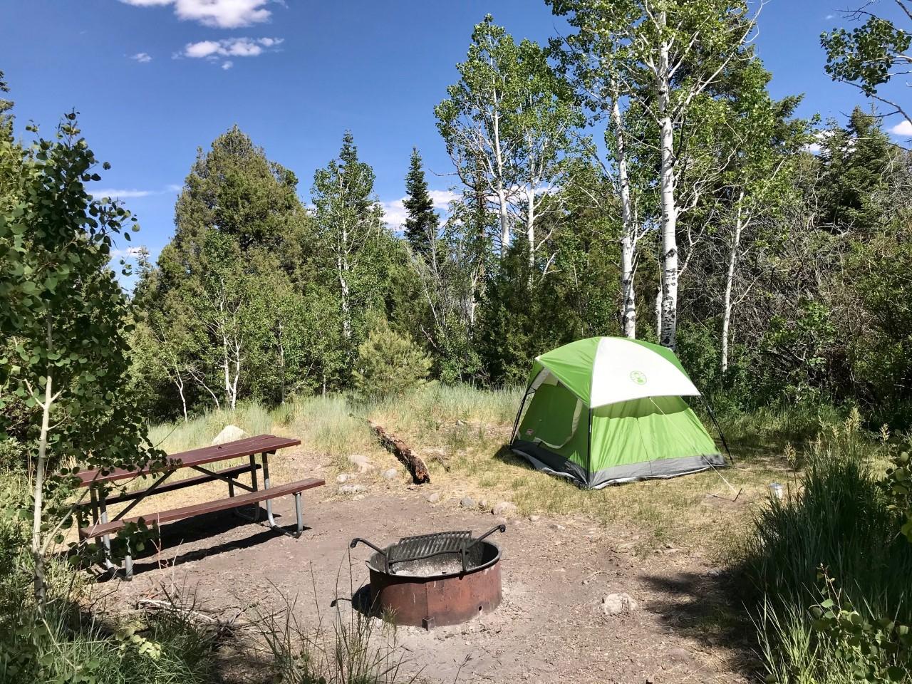
Nine sites, each with a picnic table and fire ring. The sites are spread along the creek, not stacked in rows. You get some privacy from the landscaping: red-barked water birch, aspen, and white fir. A short walk through the vegetation leads to Lehman Creek itself.
The creek is the main draw. It's clear, cold, and runs fast spring through early summer. You can wade or dip your feet in deeper pools. The sound of moving water is constant background noise - some people love it, others might find it hard to sleep. Earplugs are a good idea if you're a light sleeper.
No Potable Water
This is the most important practical detail: there is currently no drinking water available in any campground at Great Basin National Park. That includes Lower Lehman Creek. You must bring all the water you need for drinking, cooking, and cleaning.
Water is available at the Lehman Caves Visitor Center and some local businesses. Lehman Caves tour and visitor-center water access can change with operations — check the official NPS site for current water availability before you go. Plan on bringing at least one gallon per person per day, plus extra for cooking.
Campground Facilities
Vault toilets are the only restroom facility. No showers, no dump station, no electric hookups. Each site has a fire ring with a grill grate. Trash service is limited - pack out what you pack in, especially in winter when bins may not be maintained.
Cell service drops out as you drive up the canyon. Don't count on having reception at the campground or beyond.
Current Conditions and Alerts (2026)
Lehman Caves tours
Lehman Caves is entered on ranger-guided tours (reserve ahead; intermittent work windows can still interrupt). Lower Lehman Creek Campground and the park's surface trails remain the core of a camping trip when roads are open — pair a reserved tour if you want both creek and cave.
Road Closures
- Wheeler Peak Scenic Drive is closed at Mather Overlook due to snow. This affects access to higher-elevation trails and the Wheeler Peak Campground. Lower Lehman Creek is below the closure.
- Snake Creek Road is closed for the season at the park boundary.
Check the park's road conditions page before driving up. Snow can linger on the road even when the campground is open.
Water Advisory
No potable water in park campgrounds. Bring your own. The park service emphasizes this on their website. Ignoring it will leave you without water for your stay.
Reservations and Fees
How to Book
Reservations are required. You cannot just show up and camp - at least not reliably. Book through Recreation.gov. The nine sites fill quickly, especially on summer weekends and holidays. Reserve as far in advance as possible. Some sites may become available last-minute if there are cancellations.
Fees
The nightly fee is $20 per site. If you have a senior or access pass, the fee drops to $10 per night. No checks accepted. Pay with a credit card or cash when you arrive. The reservation system requires payment at booking.
For a list of all campgrounds in Great Basin National Park, including reservation links, see our guide.
Tips for Camping at Lower Lehman Creek
Best Sites
Sites closest to the creek offer the best soundscape but may have more bugs in summer. Sites away from the water are quieter but drier. Walk the loop before setting up if you have the chance - the vegetation screens different sites differently.
What to Bring
- Water, water, water. As noted, none available onsite.
- Firewood. Collecting dead wood is permitted only in limited areas. Better to bring your own, kiln-dried firewood to prevent introducing pests.
- Cooler with ice. No stores nearby.
- Camp stove for cooking. Fire restrictions may apply in dry conditions.
- Warm layers. Even in summer, nights can drop into the 40s at this elevation (around 7,000 feet).
- Headlamp or lantern. No electric lights at the campground.
- Bear-proof food storage. Great Basin has black bears. Store all food and scented items in a hard-sided container or bear locker. The campground may have bear-proof lockers - check at the visitor center or ranger station before arrival.
Fishing in Lehman Creek
Lehman Creek has native Bonneville cutthroat trout. Fishing is allowed with a Nevada state fishing license. Early morning is your best bet for rising fish. The creek is small - focus on pools and deeper runs.
Wildlife Watching
The riparian corridor attracts birds: juncos, chickadees, red-tailed hawks, and the occasional great horned owl. Mule deer come through at dawn and dusk. Keep an eye out for them near the creek.
Practical Takeaways
- Book early. Nine sites go fast. Reservations are required.
- Bring all your water. No potable water at any campground in the park as of early 2026.
- Check alerts before you go. Cave-tour schedules and high-country road gates change with weather and work windows.
- Arrive during daylight. The campground entrance is not well-marked at night. Set up before dark.
- Pack out trash. Limited services mean you're responsible for your waste.
- Prepare for quiet. No hookups, no showers, limited cell service. That's the point of this campground - you're camping, not glamping.
Final Thoughts
Lower Lehman Creek Campground offers something most campgrounds can't: year-round access to a high-desert creek in a national park that sees very few visitors compared to the nearby Utah parks. When high roads are gated or tour slots are scarce, crowds at the creek can be even thinner. That's an advantage if you're here to hike the trails or just sit by the creek and watch the water birch leaves turn in October. Just bring your water and a good book. The creek will do the rest.
For more information, see our complete Great Basin National Park Guide.
Sources
- Official source: NPS — Great Basin National Park nps.gov/grba/index.htm
- Official source: National Park Service nps.gov/grba/planyourvisit/campgrounds.htm
More to Explore

Park Guide
Acadia National Park: Carriage Roads, Cadillac Mountain & 2026 Guide
Discover carriage roads, Cadillac Mountain, and rugged Maine coast. Complete 2026 guide to Acadia National Park — trails, fees, lodging, permits, and what rangers recommend.

Hiking Guide
Grand Canyon Hiking Trails: Day Hikes, Water Sources & Rim to Rim
Compare Grand Canyon hiking trails: Bright Angel, South Kaibab, Hermit, Grandview, and rim to rim, with distances, elevation, water stops, and trailhead access for each.

Best Of
Best of Glacier Bay National Park
The best of Glacier Bay is reached by boat: ranger-led day tours up the bay to the tidewater glaciers. What's worth it, how to book, and when to go (2026).

Campsite Guide
White Sands Backcountry Camping: Closed for 2026 — What to Know
As of 2026, backcountry camping at White Sands National Park is closed for site rehabilitation. What that means, and where to camp nearby instead.

Weather Guide
Guadalupe Mountains National Park Weather: Weather
Guadalupe Mountains National Park: weather guide guide updated 2026. Practical visitor information, reservations, and seasonal tips worth bookmarking before

Best Of
Best of Cuyahoga Valley National Park: Best Things to Do
Seeing a Cleveland Orchestra concert with the woods as your backdrop is a uniquely Cuyahoga Valley experience.
Sign in to join the conversation.
Sources & Attribution
Location data courtesy of the National Park Service (U.S. Department of the Interior). NPS data is public domain. Official NPS page.
Images: NPS.
Map data © OpenStreetMap contributors.
Park operations alerts: NPS.gov · Weather and weather hazards: National Weather Service · Live conditions.
Information may change. Always verify fees, hours, and conditions directly with the official source before visiting.
Did this guide help? Share it with a friend.