Most visitors to Capitol Reef National Park pull into the visitor center lot, walk the quarter-mile to the Fruita Schoolhouse, and call it a day. They miss what the park actually offers - a network of unpaved routes that trace the Waterpocket Fold, the 100-mile geologic wrinkle that defines this stretch of south-central Utah. The Scenic Drive alone is worth the trip, but the jeep trails off it are where the park reveals itself.
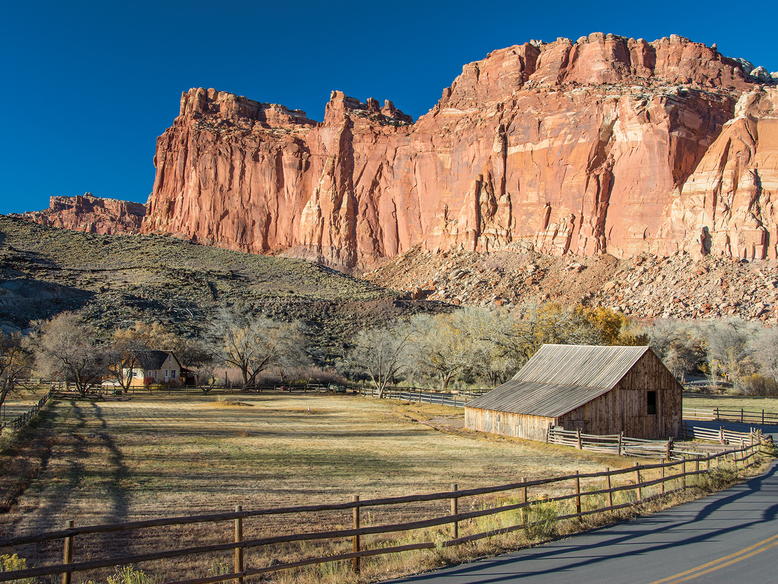
NPS via NPS.gov (Public Domain)
Capitol Reef National Park Scenic Drives: Jeep Trails (2026)
6 min read
Scenic Drives
Most visitors to Capitol Reef National Park pull into the visitor center lot, walk the quarter-mile to the Fruita Schoolhouse, and call it a day.
You may also want hiking trails or best time to visit.
The key to the drive: the dirt roads in and around the park are weather-dependent. Rain or snow can make them impassable in under an hour. Check conditions at the visitor center before you head out. The park has no real-time road status website. You need to talk to a ranger or read the daily weather board posted at the entrance station.
The Drive at a Glance
- Route: The main Scenic Drive runs from the visitor center south along the Waterpocket Fold. It's paved for the first 2.3 miles, then turns to maintained dirt for the remaining distance.
- Distance: Approximately 8 miles one-way to the turnaround at Capitol Gorge. Counting stops, expect 2-3 hours minimum.
- Vehicle requirements: The paved section is fine for any vehicle. The dirt section past the turnoff handles passenger cars in dry conditions, but high-clearance is recommended. The jeep trails beyond - Cathedral Valley, Thousand Lake Mountain Road, and the Notom-Bullfrog Road - require 4WD and high ground clearance.
- Season: The main Scenic Drive is open year-round in good weather. The jeep trails close with snow and mud. June through October is your window for the unpaved routes, though late summer monsoon season (July-September) can close roads with flash flood risk.
- Best direction: Southbound, starting early. The morning light on the Fold is superior, and you'll have the sun at your back for most of the drive.

Stop by Stop
Fruita Historic District (Mile 0)
This is the paved start. Park near the visitor center, walk the orchard, look at the old Mormon settlement buildings. The cottonwood trees here are massive - some date to the 1880s. Most visitors spend 20 minutes here and think they've seen the park.
What most people miss: The petroglyph panel behind the blacksmith shop. Walk the short trail along the Fremont River, maybe 200 yards. The carvings on the cliff face are 1,000 years old and easy to miss if you're not looking.
The Chimney Rock Pullout (Mile 3.7)
From this overlook you can see the 300-foot sandstone pinnacle that gives the formation its name. It's a Fremont culture landmark - the base has granary sites if you know where to look. The rangers at the visitor center can point them out on the best time to visit map before you go.
Photography: Early morning, when the spire catches light before the canyon floor. By 10 AM the face is flat.
Capitol Gorge (Mile 8 - Turnaround)
The road ends at a wide, flat wash between cliff walls maybe 80 feet apart. You park and walk. The old Mormon wagon route went through here - you can still see names and dates carved into the sandstone walls from the 1880s. The hike through the gorge is about a mile to the Pioneer Register and another mile to the natural tanks.
What the park website doesn't mention: The gorge gets hot. Not warm - hot. By 11 AM in July the canyon walls have been baking for hours and there is no shade. Pack extra water for this stretch even if you're only walking 20 minutes in.
Grand Wash (Mile 5.5 - spur road)
This is the turnoff most people drive past. It's a 2.3-mile dirt spur into a narrow canyon with 500-foot walls on both sides. The road ends at a parking area, and from there you walk into the Narrows - a slot that pinches down to about 12 feet wide in places. After rain, don't enter. The park's weather board posts flash flood risk daily, and the warning is not theoretical.
Cathedral Valley (Loop Road - 4WD required)
This is the capitol reef national park jeep trails experience most people come for. The loop road is 57 miles and takes 4-6 hours minimum. You cross the Fremont River twice (fords, not bridges), pass through Bentonite Hills, and end at the Cathedral Valley overlook - a viewpoint that drops 1,200 feet to the valley floor below.
Vehicle requirement: This is not optional. You need high-clearance 4WD. Passenger cars will not make it past the first river crossing. Rangers will tell you that every summer they pull at least two rental sedans out of the Bentonite mud.

Timing and Crowds
The Scenic Drive fills its limited parking early. The lots at Capitol Gorge and Grand Wash hold maybe 20 cars total. By 9 AM in peak season (June-September), you're parking on the road shoulder or turning around entirely.
Alternate strategy: Drive the paved section at sunrise, hit Grand Wash by 8 AM, and save Capitol Gorge for the afternoon when tour buses have left. Most tour groups arrive 9:30-11 AM and are gone by 1:30 PM.
The jeep trails - Cathedral Valley, Notom-Bullfrog, Thousand Lake Mountain - see almost no traffic. You can drive the entire Cathedral Valley loop on a July Saturday and see three other vehicles. The trade-off is that these roads are not maintained weekly. Washouts, rockslides, and fallen boulders are normal. Carry tools (shovel, come-along) if you're going solo.
Reef Ride Bike Days 2026: The Scenic Drive closes to motor vehicles from sunrise to 3 PM on September 19 and September 26 for this event. Plan around it if you're visiting that month.

Driving Logistics
Parking: The visitor center lot fills by 9 AM in summer. Overflow parking exists on the dirt shoulder east of the entrance station - about 20 additional spots. The Scenic Drive pullouts are small. Experienced visitors know to back into pullouts so you can see traffic when re-entering the road.
Cell service: It drops out about 2 miles south of the visitor center. By the time you reach the dirt section, you have nothing. Download the capitol reef national park map before you leave the paved road area.
Gas: The last station is in Torrey, 11 miles west of the visitor center on UT-24. Fill up before entering the park if you're doing the Cathedral Valley loop - the round trip burns through a quarter tank on dirt alone.
RV restrictions: The Scenic Drive is signed for vehicles up to 25 feet past the paved section. Longer RVs will struggle to turn around at Capitol Gorge. The Cathedral Valley Loop is not recommended for any RV or trailer over 20 feet.
What the official website doesn't mention: The water filling station at the visitor center went offline periodically in 2025-2026. Call ahead (435-425-3791) to confirm it's running before you plan to fill jugs there.

Practical Takeaways
- Check weather and road conditions at the visitor center before driving any unpaved route. Rain 20 miles away can still flood the wash you're driving through.
- The Scenic Drive pavement ends at the Grand Wash turnoff. After that, conditions vary weekly in summer and daily in spring.
- For hiking at capitol reef national park, the best trailheads are accessed off the Scenic Drive - Grand Wash, Capitol Gorge, and Cohab Canyon all start from road-adjacent parking.
- The Cathedral Valley Loop is the best capitol reef national park jeep trails experience, but don't attempt it without 4WD, a full tank, and at least 4 hours of daylight remaining.
- Timing matters more than most visitors realize. The parking situation at Grand Wash and Capitol Gorge is genuinely limited - arriving after 9 AM means adding a quarter-mile walk from wherever you find space.
- Bring cash for the entrance fee ($20 per private vehicle as of 2026) - the card reader at the entrance station can be slow or down. And keep your capitol reef national park map handy even if you downloaded the digital version.
- The camping near capitol reef national park options in the park itself are limited to Fruita Campground (first-come, first-served, no reservations). For guaranteed sites, look at the BLM land outside Torrey or the Thousand Lakes area. The camping near capitol reef options on the Notom Road are primitive but free and rarely full.
For more information, see our complete National Park Guide.
Sources
- Official source: NPS — Capitol Reef National Park nps.gov/care/index.htm
Photo Gallery
More to Explore

Park Guide
Acadia National Park: Carriage Roads, Cadillac Mountain & 2026 Guide
Discover carriage roads, Cadillac Mountain, and rugged Maine coast. Complete 2026 guide to Acadia National Park — trails, fees, lodging, permits, and what rangers recommend.

Hiking Guide
Grand Canyon Hiking Trails: Day Hikes, Water Sources & Rim to Rim
Compare Grand Canyon hiking trails: Bright Angel, South Kaibab, Hermit, Grandview, and rim to rim, with distances, elevation, water stops, and trailhead access for each.

Best Of
Best of Glacier Bay National Park
The best of Glacier Bay is reached by boat: ranger-led day tours up the bay to the tidewater glaciers. What's worth it, how to book, and when to go (2026).

Campsite Guide
White Sands Backcountry Camping: Closed for 2026 — What to Know
As of 2026, backcountry camping at White Sands National Park is closed for site rehabilitation. What that means, and where to camp nearby instead.

Weather Guide
Guadalupe Mountains National Park Weather: Weather
Guadalupe Mountains National Park: weather guide guide updated 2026. Practical visitor information, reservations, and seasonal tips worth bookmarking before

Best Of
Best of Cuyahoga Valley National Park: Best Things to Do
Seeing a Cleveland Orchestra concert with the woods as your backdrop is a uniquely Cuyahoga Valley experience.
Sign in to join the conversation.
Sources & Attribution
Location data courtesy of the National Park Service (U.S. Department of the Interior). NPS data is public domain. Official NPS page.
Images: NPS; NPS; NPS; NPS; NPS.
Map data © OpenStreetMap contributors.
Park operations alerts: NPS.gov · Weather and weather hazards: National Weather Service · Live conditions.
Information may change. Always verify fees, hours, and conditions directly with the official source before visiting.
Did this guide help? Share it with a friend.