The single most important thing to understand about hiking in Capitol Reef is that flash flood danger dictates your route choices more than anything else - more than elevation gain, more than trail length, more than your fitness level. Several of the best hikes here run through narrow canyons that become deadly traps when rain falls anywhere in the upper watershed, and the watersheds extend miles beyond what you can see from the trailhead. Check capitol reef trail conditions at the visitor center before you head out, and if rain is forecast anywhere in the region, save the slot canyons for another day.
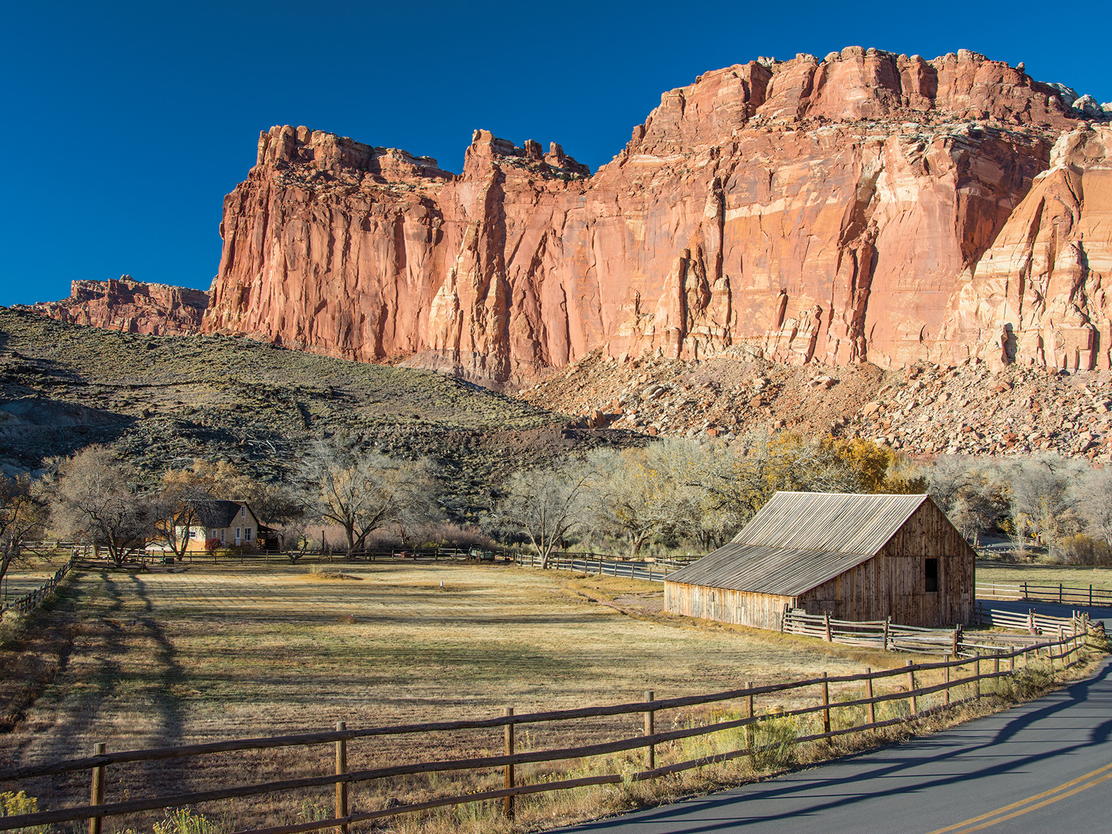
NPS via NPS.gov (Public Domain)
Capitol Reef National Park Hiking: Capitol Reef Trail Conditions
9 min read
Hiking Guide
Check capitol reef trail conditions at the visitor center before you head out, and if rain is forecast anywhere in the region, save the slot canyons for another day.
This article contains affiliate links — we may earn a small commission at no extra cost to you.
What Hiking Here Actually Means
Capitol Reef hiking is defined by two things: the Waterpocket Fold and the absence of crowds. The Fold - that 100-mile geologic wrinkle running north-south through the park - creates a landscape where you walk along the base of cliffs, into narrow cracks in the rock, and up onto the high plateau in the same outing. What most visitors underestimate is how little shade exists. There is almost none. By 10 AM from June through August, you are fully exposed, and the red rock reflects heat upward at you. Plan your hiking at capitol reef national park to start before 8 AM or after 4 PM during summer months.
The other surprise is how many trails are unmaintained or minimally signed. This is not a park with wooden trail markers at every junction. You will navigate by cairns, by wash bottoms, and by paying attention. A capitol reef national park map is essential - download it before you arrive, because cell service drops out at the turnoff from UT-24 and does not return reliably.

Signature Hikes
Grand Wash: The Essential Canyon Walk
Distance: 2.25 miles one way (4.5 miles round trip)
Elevation Gain: Minimal - roughly 50 feet
Trailhead & Parking: The Grand Wash trailhead parking area is 2.5 miles down the Scenic Drive. It holds maybe 20 cars and fills by 9 AM in spring and fall. Overflow parking is limited to roadside pullouts along the Scenic Drive - or skip the wait and park at the Cohab Canyon trailhead and add an extra mile each way.
The Trail: You walk on the floor of a wide, flat-bottomed wash with sheer Navajo Sandstone walls rising 800 feet on both sides. The surface is packed sand and gravel - easy walking. The walls narrow to about the width of a two-lane road in sections. This trail is nearly flat the entire way.
The Moment: About 1.5 miles in, the walls pinch to their tightest point and the light shifts from full sun to filtered glow. You'll hear your own footsteps echo in a way they don't at the mouth.
What Most Underestimate: The flood danger. Grand Wash is one of the park's most notorious flash flood channels. Rangers will tell you - if clouds are building anywhere visible from the trail, turn around. This trail is not worth dying over a photo.
Best Time: Early morning for light on the walls. Late afternoon for temperature. Avoid entirely if any rain is forecast.
Hickman Bridge: The Best Short Hike in the Park
Distance: 1.7 miles round trip
Elevation Gain: 400 feet
Trailhead & Parking: Hickman Bridge trailhead is right on UT-24, 2 miles east of the visitor center. Parking for about 30 cars. The lot fills by 8:30 AM in peak season. There is no overflow - you wait or come back later.
The Trail: A well-maintained, wide trail that climbs steadily up a series of switchcut ledges. The surface is packed dirt and exposed bedrock sections with good traction. You cross a seasonal creek bed early on - dry by mid-June most years. The trail ends at a natural bridge with a 133-foot span.
The Moment: The bridge appears suddenly as you round the final corner. Most people stop and take the photo from the viewing area. Walk under it. The scale is different from beneath the span.
What Most Underestimate: The climb is short but continuous - 400 feet in under a mile. It is not a flat walk. Your legs will feel it on the return, especially in midday heat. Pack extra water for this stretch even though it's short.
Best Time: Morning for light hitting the bridge face. The trail gets direct sun by 9 AM.
Cassidy Arch: The One with Exposure
Distance: 3.4 miles round trip
Elevation Gain: 850 feet
Trailhead & Parking: From the Scenic Drive, turn onto the Grand Wash dirt road (high-clearance recommended after rain) and drive 1.5 miles to the trailhead. Parking for 8-10 cars. The road becomes impassable when wet.
The Trail: This is the most technical trail in the park's front country. The route climbs steeply up a slickrock slope - you are walking on bare Navajo Sandstone for most of the route, following cairns. Near the top, you traverse a narrow ledge section with a drop-off to the right that will bother anyone uncomfortable with exposure. The final approach to the arch crosses the arch itself - you walk across the top of it.
The Moment: Standing on top of Cassidy Arch, looking 200 feet straight down through the opening. The trail keeps going beyond the arch to a high viewpoint, but the arch crossing is the thing.
What Most Underestimate: The exposure is not optional. There is no bypass route. If heights make your knees weak, choose a different hike. Also - the cairns are easy to lose on the slickrock sections if light is flat or if you are descending late in the day.
Best Time: Early morning before the slickrock becomes blinding in direct sun. Descend by noon.
Chimney Rock Loop: The One with Views
Distance: 3.3 miles
Elevation Gain: 600 feet
Trailhead & Parking: Chimney Rock trailhead is on UT-24, 9.5 miles east of the visitor center. Parking for about 15 cars. Less crowded than Hickman Bridge - people drive past it.
The Trail: The first mile climbs steeply up a switchbacking trail onto a mesa top. From there you walk a bench with near-constant views south across the Waterpocket Fold. The loop descends back to the trailhead via a wider, gentler route. The surface changes from loose gravel on the switchbacks to packed dirt on the mesa top to slickrock on the descent.
The Moment: About 1.2 miles in, at the high point of the mesa rim, you can see the entire Henry Mountains range to the east and the bulk of the park stretching south. The Chimney Rock spire sits directly below.
What Most Underestimate: The first half mile is steeper than it looks from the road. Several parties turn around here. Push through - it levels out.
Best Time: Late afternoon for lighting on the Fold. The trail gets full sun.
Sulphur Creek Route: The One That Requires Strategy
Distance: 5.6 miles one way
Elevation Gain: 750 feet (descending)
Trailhead & Parking: Two options. Start at the Chimney Rock trailhead on UT-24 (park here) and end at the visitor center. Or reverse it. Either way, you need two vehicles or a shuttle arrangement. There is no shuttle service in the park.
The Trail: A canyon-bottom hike that follows Sulphur Creek through a series of narrows, pools, and three significant waterfalls. You will get wet - waist-deep in some pools during spring runoff, ankle-deep by August. The route requires route-finding, wading, and some scrambling around the waterfalls. This is not a maintained trail.
The Moment: The third waterfall drops about 20 feet into a deep pool. You can slide down the chute beside it if you are willing - most people climb down the left side.
What Most Underestimate: The water temperature. In April and May, that waist-deep pool is roughly 50 degrees. Also - this route takes 4-6 hours and there is no exit if you realize you do not want to finish. You are committed once you drop into the canyon.
Best Time: Late spring for water flow. Early fall for warmer water. Not recommended June through August when water levels drop and pools stagnate.

Seasonal Trail Conditions
March-April: Snowmelt in the high country keeps some trails muddy through late morning. Sulphur Creek runs high and cold. Hickman Bridge and Grand Wash are typically dry by mid-April. Check capitol reef trail conditions at the visitor center before heading out - the dirt roads (Grand Wash, Capitol Gorge) may be closed after rain or snow.
May-June: The sweet spot. Temperatures in the 70s and 80s. Trails are dry. Water in Sulphur Creek is cold but manageable. Wildflowers peak in late May along the Fremont River. The crowds are not yet heavy - Memorial Day weekend excepted.
July-August: Hot. Highs above 95 degrees are normal. Hike before 8 AM or after 5 PM. The slot canyons (Grand Wash, Capitol Gorge, narrow sections of Sulphur Creek) carry genuine flood risk - afternoon thunderstorms form almost daily. Do not enter narrow canyons after 11 AM in August.
September-October: The best hiking weather. Highs in the 70s and 80s, lows in the 40s. Fall color along the Fremont River peaks in early October. Crowds are moderate on weekends, thin on weekdays. Flood risk drops significantly by mid-September.
November-February: Cold - highs in the 30s and 40s. Snow on the higher trails. The Scenic Drive remains open but dirt roads may close. You will have the trails to yourself. The Chimney Rock Loop and Hickman Bridge are good winter options if the trailheads are accessible.

Trailhead Logistics
The Scenic Drive is the access hub for most trails. It runs 8 miles from the visitor center south to Capitol Gorge. The first 2 miles are paved; the remaining 6 are well-graded dirt that any vehicle can handle when dry. After rain or snowmelt, that dirt section becomes slick adobe clay - rangers will tell you not to drive it.
Parking at every trailhead is limited. Grand Wash holds 20 cars, Hickman Bridge holds 30, Cassidy Arch holds 10, Chimney Rock holds 15. On weekends in spring and fall, the lots at Hickman Bridge and Grand Wash fill by 8:30 AM. The park does not have a shuttle. The only strategies are arriving early or choosing less-popular trails.
Cell service drops out at the turnoff from UT-24 onto the Scenic Drive and does not return until you are back on UT-24. Download your capitol reef national park map before you arrive. The park's printed map is available at the visitor center for $1.
Water is available at the visitor center and at the Fruita Campground. There are no water sources on any trail in the park. For any hike over 2 miles, carry 1 liter per person per hour of hiking in summer.

What to Carry
The terrain here is sandstone - Navajo Sandstone specifically. It is grippy when dry, slick as polished glass when wet. The best footwear for capitol reef hiking is a trail runner or hiking shoe with good tread. Boots are overkill for most trails unless you are doing off-trail routes or winter hiking.
You need sun protection on every hike. A wide-brim hat, long sleeves, and sunscreen. The reflection off the red rock burns exposed skin faster than you expect.
For slot canyon hikes (Grand Wash, Capitol Gorge, Sulphur Creek), carry a headlamp even for short canyons. The light drops dramatically in the narrow sections, and a headlamp makes route-finding safer if you take longer than planned.
No bear canister is required. Bears are not a significant presence here. Rodents will chew through packs for food at the popular overlooks - keep your pack within sight.
Practical Takeaways
- Check the weather board at the visitor center every single day you hike. The park posts current conditions and flood risk there. Do not rely on your phone.
- The slot canyon season is March-May and September-October. June through August afternoon thunderstorms make narrow canyons genuinely dangerous.
- Hickman Bridge is worth the early wake-up. It is the most popular trail for good reason. The parking fills by 8:30 AM.
- Grand Wash is better in the afternoon when the sun is at your back entering the canyon and lighting the walls from above.
- If you only do one hike and have moderate fitness, do Chimney Rock. Better views per mile than any other maintained trail, and half the people of Hickman Bridge.
- Cassidy Arch is genuinely exposed. If you have not tested your comfort with heights recently, this is not the place to discover you do not like edges.
- Sulphur Creek requires a shuttle or two cars. Plan this before you arrive. There is no ride service in the park.
- The best capitol reef hikes often involve some route-finding. Cairns replace trail markers on slickrock sections. Pay attention to where you are.
- Trailhead bathrooms are vault toilets with no running water. The visitor center has flush toilets and water. Use them before you drive to the trailhead.
- The elevation is 5,500-6,500 feet. If you are coming from sea level, plan a half-day of easy activity before attempting a big
For more information, see our complete National Park Guide.
Recommended Gear
What experienced visitors bring to Capitol Reef National Park Hiking: Capitol Reef Trail Conditions
Links may earn us a commission at no extra cost to you. We only recommend gear we believe in.
Hiking Essentials
Hydration Pack (3L)
Hands-free water for long trail days
Trekking Poles (Pair)
Save your knees on steep descents
Hiking Boots (Ankle Support)
Sturdy footwear for rocky, uneven trails
Sun & Heat Protection
Wide-Brim Sun Hat
Full coverage UPF 50+ protection at altitude
Insulated Water Bottle (32oz)
Keeps water cold in desert heat all day
Winter Gear
Microspikes / Traction Devices
Essential for icy rim trails in winter months
Packable Down Jacket
Lightweight warmth that stuffs into a pocket
Sources
- Official source: NPS — Capitol Reef National Park nps.gov/care/index.htm
Photo Gallery
More to Explore

Park Guide
Acadia National Park: Carriage Roads, Cadillac Mountain & 2026 Guide
Discover carriage roads, Cadillac Mountain, and rugged Maine coast. Complete 2026 guide to Acadia National Park — trails, fees, lodging, permits, and what rangers recommend.

Hiking Guide
Grand Canyon Hiking Trails: Day Hikes, Water Sources & Rim to Rim
Compare Grand Canyon hiking trails: Bright Angel, South Kaibab, Hermit, Grandview, and rim to rim, with distances, elevation, water stops, and trailhead access for each.

Best Of
Best of Glacier Bay National Park
The best of Glacier Bay is reached by boat: ranger-led day tours up the bay to the tidewater glaciers. What's worth it, how to book, and when to go (2026).

Campsite Guide
White Sands Backcountry Camping: Closed for 2026 — What to Know
As of 2026, backcountry camping at White Sands National Park is closed for site rehabilitation. What that means, and where to camp nearby instead.

Weather Guide
Guadalupe Mountains National Park Weather: Weather
Guadalupe Mountains National Park: weather guide guide updated 2026. Practical visitor information, reservations, and seasonal tips worth bookmarking before

Best Of
Best of Cuyahoga Valley National Park: Best Things to Do
Seeing a Cleveland Orchestra concert with the woods as your backdrop is a uniquely Cuyahoga Valley experience.
Sign in to join the conversation.
Sources & Attribution
Location data courtesy of the National Park Service (U.S. Department of the Interior). NPS data is public domain. Official NPS page.
Images: NPS; NPS; NPS; NPS; NPS.
Map data © OpenStreetMap contributors.
Park operations alerts: NPS.gov · Weather and weather hazards: National Weather Service · Live conditions.
Information may change. Always verify fees, hours, and conditions directly with the official source before visiting.
Did this guide help? Share it with a friend.