The silence hits you first, broken only by wind moving through the Waterpocket Fold. Then comes the sun—at this elevation and latitude, it has a penetrating quality you can feel in your bones. Capitol Reef's weather isn't about extremes in isolation; it's the daily negotiation between intense sun, thin air, and rock that holds heat and cold with equal tenacity. Most newcomers underestimate the temperature swing—thirty degrees between day and night is common even in summer. You don't just visit this park; you schedule your day around its atmospheric rhythms.
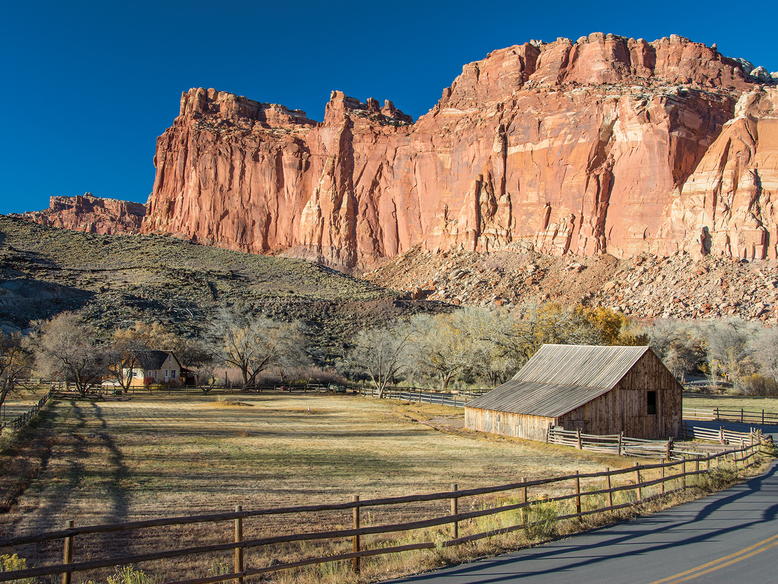
NPS via NPS.gov (Public Domain)
Capitol Reef National Park Weather: Desert Seasons & Best Hiking Windows (2026 Guide)
8 min read
Weather Guide
A forecast for "Torrey, UT" means almost nothing for your hike in the Grand Wash. The single most important climatic truth is the monsoon surge.
The Weather Reality
Capitol Reef sits in a high desert rain shadow, but that term oversimplifies. The park spans a 7,000-foot elevation range, from the low desert near the Fremont River to the conifer forests atop Boulder Mountain. A forecast for "Torrey, UT" means almost nothing for your hike in the Grand Wash. The single most important climatic truth is the monsoon surge. From mid-July through early September, moisture rides up from the Gulf of California, building into towering thunderstorms that can drop a month's worth of rain in twenty minutes. These aren't passing showers. They are localized, violent events that create instant flash floods in narrow canyons. Rangers will tell you the forecast can be "sunny" while a storm is already brewing over Thousand Lake Mountain, ready to send a wall of water down a dry wash ten miles away. This defines daily safety here more than any other factor.

Month by Month
Capitol Reef's seasons each present a clear trade-off between comfort and access.
January & February
Highs: 30s to 40s°F. Lows: Teens to single digits°F.
Snow is intermittent, usually a few inches that dusts the red cliffs white - a photographer's dream. The park is quiet. UT-24 and the paved Scenic Drive remain open unless a major storm hits, but all dirt roads like the Cathedral Valley Loop or the South District road become impassable with mud or snow. Trail conditions are mixed; packed snow and ice linger in shaded canyons like Cassidy Arch. You'll need microspikes. The visitor center has shorter hours. It's a time for short, low-elevation hikes and stark, crowd-free photography. The cold is dry but biting, especially with wind.
March & April
Highs: 50s to 60s°F. Lows: 20s to 30s°F.
This is the shoulder season of change. Daytime temperatures become pleasant for hiking, but nights are still cold. Afternoon rain showers become more frequent, and snowmelt from higher elevations can make dirt roads a slick, clay-heavy mess. Crowds are moderate, picking up around Easter. This is the start of the window for backcountry road travel, but you must check at the visitor center for current conditions. Early wildflowers like globemallow and cliffrose begin to appear in late April.
May & June
Highs: 70s to 80s°F. Lows: 40s to 50s°F.
These are arguably the best all-around months. Days are warm and long, nights are cool but comfortable for camping. The high country on Boulder Mountain begins to open up. Crowds build steadily, peaking in late June. The risk of flash floods is still relatively low before the monsoon arrives. It's prime time for any activity - hiking, canyoneering, scenic drives. The one challenge is that by late June, temperatures on the blacktop of the Scenic Drive or in sun-baked canyons can feel much hotter than the official high.
July & August
Highs: 80s to 90s°F. Lows: 50s to 60s°F.
Monsoon season. Humidity rises slightly, and spectacular thunderstorms erupt most afternoons. The pattern is reliable: clear mornings, clouds building by noon, a potential storm between 2 and 5 PM, clearing evenings. This dictates all hiking plans. You must be out of narrow slot canyons by midday. The rain brings dramatic skies and can cool things down temporarily, but it also brings extreme flash flood danger. Dirt roads can wash out. Despite the heat and storms, these are the busiest months. The Fruit Orchards are open for harvest. It's a season of dramatic beauty and heightened risk.
September & October
Highs: 60s to 70s°F. Lows: 30s to 40s°F.
The park hits its second peak. The monsoon fades by mid-September, leaving clear, stable air. Daytime temperatures are perfect for strenuous hikes. Nights become crisp. Crowds are significant, especially during the fall color peak in late September and October, when the Fremont River cottonwoods and the maples in the higher canyons turn gold and red. Dirt roads are usually in good condition. This is the last reliable window for accessing the park's more remote districts before winter weather closes in.
November & December
Highs: 40s to 50s°F. Lows: 20s to 30s°F.
A return to quiet. Early November can still offer pleasant days, but by December, winter is setting in. Snow becomes more frequent, though it often melts on south-facing slopes. Daylight is short. The park empties out. Most services in Torrey have reduced hours. It's a time for solitude and stark landscapes, but your itinerary will be entirely weather-dependent. Ice is a constant concern on trails.

Best Times for Specific Activities
The timing for your visit should hinge on what you want to do.
Hiking the High Country
The trails that climb into the aspen and fir forests, like those near the park's western boundary along UT-12, are typically snow-free and accessible from late June through mid-October. Before July, you might encounter snow patches in north-facing drainages. After October, early snowstorms can close access.
Technical Canyoneering
The season for descending narrow, technical slots is narrow. May, June, and late September offer the best combination of warm-enough air temperatures, reasonable water temperatures in any potholes, and the lowest risk of life-threatening flash floods. Rangers emphasize that in July and August, a storm ten miles away can be fatal.
Wildlife Viewing
Mule deer are common year-round. Desert bighorn sheep are most often spotted in the early morning or late evening along the cliffs of the Scenic Drive, with spring (April-May) being a good time for seeing lambs. Elk are present in the higher forests in summer. Bird activity peaks during spring and fall migrations along the Fremont River corridor.
Wildflowers
There are two waves. The first, in the lower desert areas, peaks in April and May with cactus blooms, paintbrush, and primrose. The second, in the high country meadows, hits in July and August with lupine, columbine, and sunflowers.
Fall Color
The show starts in the high-elevation canyons in mid-to-late September and moves down to the Fremont River valley by early to mid-October. It's a brief, brilliant window that draws significant crowds on weekends.
Stargazing
Any clear night is superb, but the best conditions are during the dry, stable air masses of fall (September-October) and late spring (May). Winter offers long nights but can be brutally cold for extended viewing.

What to Pack by Season
Forget generic lists. Capitol Reef demands specific gear adjustments.
Spring/Fall (March-May, Sept-Oct): Layers are non-negotiable. A moisture-wicking base layer, insulating fleece, and a windproof/waterproof shell. Gloves and a beanie for mornings. Sturdy hiking boots with good traction for potentially muddy or icy spots. A wide-brimmed hat and sunglasses - the sun is intense even on cool days. Trekking poles are useful for stream crossings and uneven terrain.
Summer (June-August): A technical, sweat-wicking sun shirt is more valuable than sunscreen alone. A wide-brimmed hat with a neck flap. Two to three liters of water per person for a half-day hike; more for full days. Electrolyte tablets. A lightweight rain shell or poncho for the afternoon monsoon downpours. Do not wear cotton. Footwear that can get wet and drain quickly if you're caught in a canyon. A headlamp in case your hike is delayed.
Winter (Nov-Feb): Insulated, waterproof boots. Microspikes or traction devices for your boots - they are essential for hiking on icy trails. A down or synthetic puffy jacket. Thermal base layers. Warm gloves and a neck gaiter. Your vehicle should carry tire chains, extra blankets, water, and food in case you are delayed by snow on UT-24.
Year-Round Essentials: A detailed paper map. Cell service is non-existent in most of the park. A first-aid kit. A physical copy of the daily weather report from the visitor center. More water than you think you need.

What the Forecast Doesn't Tell You
- The Canyon Thermometer: The official temperature is taken in an open field. Inside narrow canyons like the Grand Wash or Cassidy Arch, air stagnates. It can be 10-15 degrees Fahrenheit hotter than the forecast by midday. Conversely, these same canyons lose the sun early and cool down rapidly.
- The Wind Chill Factor on Exposed Ridges: On the rim trails or in Cathedral Valley, a 10 mph wind at 40°F feels like freezing. That wind is constant.
- The Speed of a Flash Flood: It's not just "don't go if it's raining." A flood can arrive from a storm you never saw or heard. If the weather looks at all questionable, the rule is simple: stay out of narrow canyons. No hike is worth the risk.
- The UV Intensity: At nearly 6,000 feet, UV radiation is significantly stronger. You can burn in under 30 minutes on a cloudy day in April. Lip balm with SPF is a must.
- The Dust: Summer winds and dry conditions coat everything in a fine, red silt. It will get into your camera gear, your car vents, and your lunch. Pack electronics in ziplock bags.
- The Microclimate of Fruita: The historic district along the Fremont River is often several degrees cooler and more humid than the surrounding desert due to the shade trees and irrigation. It's a reliable spot to cool off.
- Road Condition Deception: A dirt road can look dry on the surface but have a bottomless layer of clay-slick mud just underneath after a rain. "Passable" for a high-clearance 4WD vehicle does not mean passable for an AWD SUV.
Practical Takeaways
- Plan Your Day Around the Sun and Storms: Hike early. Be off exposed trails and out of slot canyons by early afternoon, especially July through September. Use the late afternoon and evening for scenic drives, orchard visits, and short walks.
- Your Car is Part of Your Gear: In winter, carry chains and an emergency kit. In summer, carry extra water in your vehicle. A full-size spare tire is recommended for any backcountry road travel.
- Stop at the Visitor Center First: Every single day. Get the handwritten weather update and road condition report. Rangers there know what the automated forecasts don't.
- Hydration is a Constant Process: If you feel thirsty, you're already behind. Drink water consistently throughout the day, not just at the trailhead.
- Respect Closure Signs: Annual canyon closures, like those for raptor nesting through August 31, are strictly enforced to protect fragile resources. They mean exactly what they say.
- Check for Event Impacts: Special events like the fall Reef Ride Bike Days can close the Scenic Drive to vehicles until 3 PM on select Saturdays. Verify dates on the park website.
- Your Best Weather Window: For the ideal balance of reliable access, comfortable temperatures, and lower crowd pressure, target the weeks after Labor Day in September or late May before Memorial Day.
Understanding Capitol Reef National Park weather is the key to unlocking the park safely. It's less about checking an app and more about learning to read the sky, feel the air, and respecting the immense power of water in a desert landscape. Pack for extremes, plan with flexibility, and you'll find the conditions that make this place unforgettable. For more detailed planning on hiking trails or camping options, consult our dedicated guides.
For more information, see our complete National Park Guide.
Related: capitol reef national park guide
Sources
- Official source: NPS — Capitol Reef National Park nps.gov/care/index.htm
Photo Gallery
More to Explore

Park Guide
Acadia National Park: Carriage Roads, Cadillac Mountain & 2026 Guide
Discover carriage roads, Cadillac Mountain, and rugged Maine coast. Complete 2026 guide to Acadia National Park — trails, fees, lodging, permits, and what rangers recommend.

Hiking Guide
Grand Canyon Hiking Trails: Day Hikes, Water Sources & Rim to Rim
Compare Grand Canyon hiking trails: Bright Angel, South Kaibab, Hermit, Grandview, and rim to rim, with distances, elevation, water stops, and trailhead access for each.

Best Of
Best of Glacier Bay National Park
The best of Glacier Bay is reached by boat: ranger-led day tours up the bay to the tidewater glaciers. What's worth it, how to book, and when to go (2026).

Campsite Guide
White Sands Backcountry Camping: Closed for 2026 — What to Know
As of 2026, backcountry camping at White Sands National Park is closed for site rehabilitation. What that means, and where to camp nearby instead.

Weather Guide
Guadalupe Mountains National Park Weather: Weather
Guadalupe Mountains National Park: weather guide guide updated 2026. Practical visitor information, reservations, and seasonal tips worth bookmarking before

Best Of
Best of Cuyahoga Valley National Park: Best Things to Do
Seeing a Cleveland Orchestra concert with the woods as your backdrop is a uniquely Cuyahoga Valley experience.
Sign in to join the conversation.
Sources & Attribution
Location data courtesy of the National Park Service (U.S. Department of the Interior). NPS data is public domain. Official NPS page.
Images: NPS; NPS; NPS; NPS; NPS.
Map data © OpenStreetMap contributors.
Park operations alerts: NPS.gov · Weather and weather hazards: National Weather Service · Live conditions.
Information may change. Always verify fees, hours, and conditions directly with the official source before visiting.
Did this guide help? Share it with a friend.