The visitor center opens at 8 AM, and by 8:15 the backcountry permit desk already has a small line. One free permit per group, no charge, no reservations - just a short conversation with a ranger and a map. Most first-time visitors assume they can just head out without stopping here. They can't. Capitol Reef enforces the permit system for all backcountry camping, and the rangers ask about your route, your water plan, and your experience level before handing over the paper. This article covers how the permit system works, what you need to know before you go, and what the park website doesn't always mention.
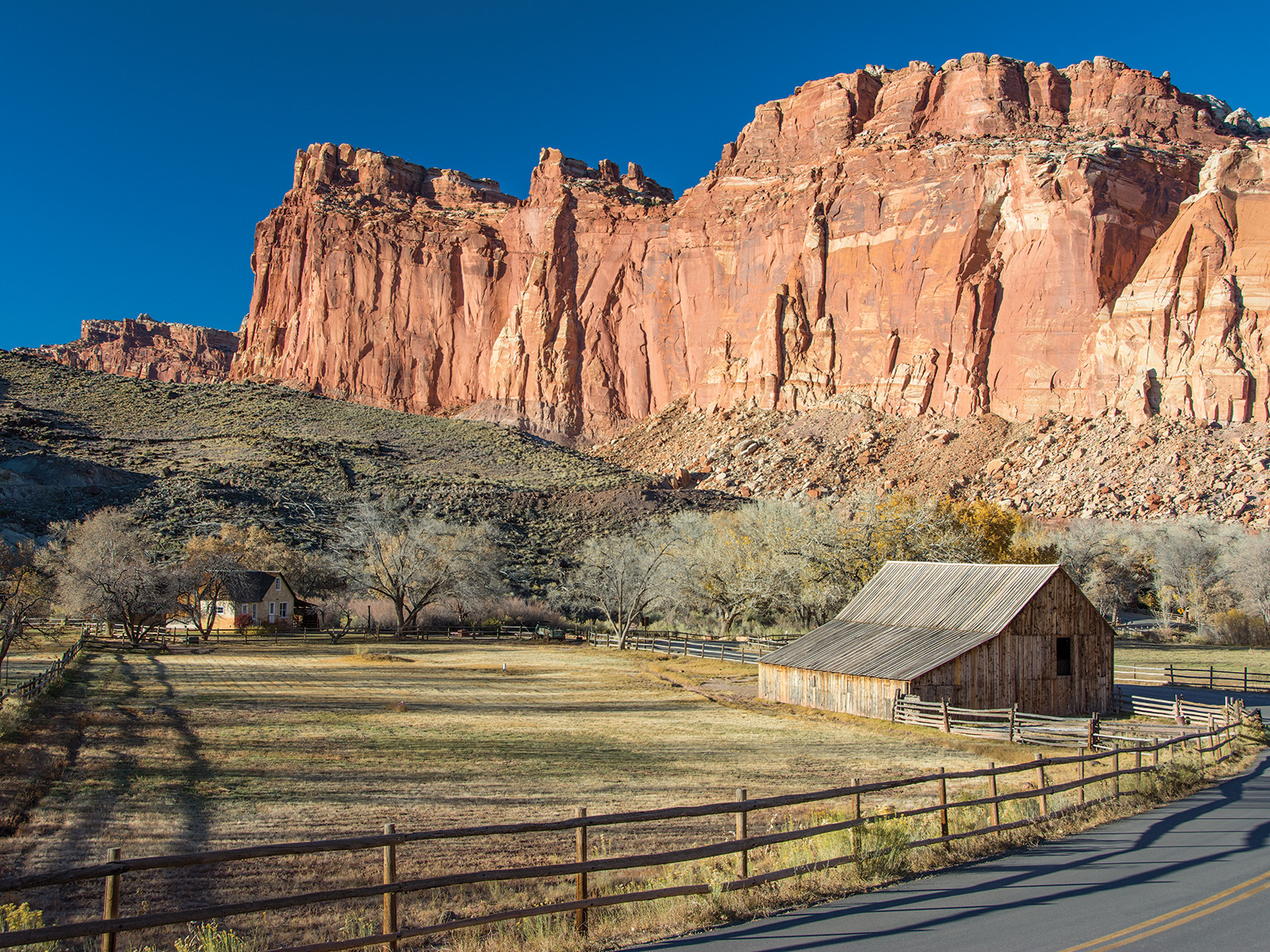
NPS via NPS.gov (Public Domain)
Campsites at Backcountry Camping (2026 Guide) — Planning Tips
7 min read
Campsite Guide
The visitor center opens at 8 AM, and by 8:15 the backcountry permit desk already has a small line. Updated for 2026 with 5 Backcountry Camping: backcountry
Your plans
Plan your visit with complete visitor guide, all campgrounds, and hiking trails.
The Permit System: Free, Required, and Simple
Getting Your Permit
Backcountry camping in Capitol Reef requires a free permit issued at the visitor center. You cannot reserve one online. You cannot call ahead and have one set aside. You walk in, talk to a ranger, and walk out with a permit. As of 2026 the fee remains zero - no charge for the permit itself. That might change, but for now it's one of the few free backcountry permits in the national park system.
The ranger will ask about your intended route, how many nights, and how much water you're carrying. They'll also check if you have a map and know how to read it. Cell service drops out at the park boundary and never really comes back once you're in the backcountry. Rangers will tell you that paper maps are not optional - they're essential. The park provides free route descriptions and maps on its hiking and backpacking page, but printed copies are also available at the visitor center.
Most visitors underestimate how long the permit process takes. Plan for 20-30 minutes at the visitor center, especially during spring and fall when the line backs up. Early morning is your best bet for a short wait - arrive right at 8 AM if you can.
Who Needs a Permit
Anyone camping outside of the developed campgrounds needs a backcountry permit. That includes overnight backpackers, primitive roadside campers, and anyone planning to sleep in the remote canyons. Day hikers do not need a permit. The distinction matters: if you're crossing the park on a multi-day hike, you need the permit. If you're just doing a long day loop from the Fruita area, you don't.
The permit system isn't about revenue. It's about safety and resource protection. Rangers track where people are so they know who to look for if something goes wrong. They also use permits to spread use across the park's canyons and prevent any one area from getting trampled.

Planning Your Backcountry Route
Route Selection and Maps
Capitol Reef's backcountry isn't a single trail network. It's a collection of canyons, washes, and slickrock benches that connect in ways that aren't always obvious on a map. The trail narrows here - literally, in many slot canyons - and the route descriptions become critical. The park's hiking and backpacking page lists recommended routes, but it also includes the kind of detail you won't find in guidebooks: which routes have reliable water after spring snowmelt, which ones require technical scrambling, and which ones are mostly dry washes that turn into impassable quicksand after rain.
For a first backcountry camping trip in Capitol Reef, most experienced visitors pick a short overnight route. The Chimney Rock Canyon loop, the Upper Muley Twist Canyon, and the Halls Creek Narrows are common choices. Each has its own character. Elevation gain varies widely - the Muley Twist traverse has a steady climb that tests your legs, while Halls Creek is mostly flat but long. Pack extra water for this stretch regardless of which route you choose.
Rangers will tell you that the most common mistake is underestimating how slow travel can be on slickrock. Sandstone slabs look smooth from a distance but often require careful foot placement. The surface changes from packed red dirt to exposed rock. Your pace drops. A route that looks like 5 miles on the map can take twice as long as you'd expect.
From this overlook you can see the Waterpocket Fold running north-south for nearly 100 miles. That's the backbone of the park, and many backcountry routes follow its flanks. The scale is hard to grasp until you're standing on it.
Water: The Critical Factor
Water is the single biggest constraint for backcountry camping in Capitol Reef. There are few perennial streams. Most routes rely on seasonal potholes that dry up by late June. The park service recommends carrying at least one gallon per person per day, and that's conservative - in summer when temperatures hit 100°F, you'll want more.
The visitor center sells water for $4 a bottle. Bring your own. Fill up at the Fruita campground spigot or the visitor center before heading out. Once you leave the developed areas, you won't find potable water anywhere.
What the official website doesn't mention: many of the seasonal water sources shown on older maps have dried up or become unreliable. The park updates the backcountry conditions board at the visitor center, but it's worth asking the ranger directly about which routes currently have water. They know which potholes held snow this year and which didn't.

What to Expect on the Trail
Terrain and Navigation
Capitol Reef's backcountry is deceptive. The terrain looks open - wide slickrock benches, long canyon floors - but travel is rarely straight. You'll find yourself contouring around pour-offs, climbing over dryfall obstacles, and backtracking out of dead-end washes. The park's geology creates natural route-finding challenges. Slot canyons can end abruptly in 20-foot pour-offs. Ridge tops that look like easy walking often require exposed scrambling.
Navigation requires constant attention. The trail narrows here in the sense that you're often following cairns across bare rock rather than a defined path. Keep an eye out for the small rock piles that mark the route. They're easy to miss in afternoon glare. And if you don't see one for a while, stop and check your map before continuing. It's easy to wander off route by 50 yards and end up in a different drainage.
Most visitors underestimate how much the desert heat affects them. By 10 AM in July, the exposed rock surface can be hot enough to radiate heat through your boots. Plan your hiking for early morning and late afternoon. Midday is for resting in shade - if you can find it. Many canyons have little shade until the sun gets low.
Wildlife and Solitude
You'll see signs of wildlife long before you see the animals themselves. Bighorn sheep tracks in the sand. Coyote scat on the trail. Ravens circling overhead. Actual sightings are less common but not rare. Mule deer move through the washes at dawn. Desert bighorns use the high cliffs. Lizards are everywhere - the collared lizard with its bright blue and yellow markings is a common sight on sunny rocks.
The backcountry camping experience here is different from the popular parks. Capitol Reef sees far fewer backpackers than Zion or Arches. On a Thursday night in May, you might have a canyon to yourself. On a Saturday in October, you might share it with one or two other groups. That's still less crowded than most frontcountry campgrounds. The solitude is real, and it's one of the main reasons people come back.

Practical Takeaways
- Get your permit at the visitor center before heading into the backcountry. It's free but mandatory. Plan for a 20-30 minute visit.
- Carry at least one gallon of water per person per day. More in summer. Fill up at the Fruita spigot or visitor center before you leave the developed area.
- Bring a paper map and know how to use it. Cell service drops out at the park boundary and doesn't return in the canyons.
- Check the backcountry conditions board at the visitor center for water availability, route closures, and current trail conditions.
- Start early. The heat builds fast, and you'll want to be off exposed slickrock by late morning.
- Practice Leave No Trace. Pack out all waste, including toilet paper. The desert ecosystem is fragile and slow to recover.
- Leave your itinerary with someone who isn't going. Rangers track permits, but it helps to have a backup person who knows where you are and when you plan to return.
For more detailed planning, see the complete visitor guide or browse all campgrounds in the park.

Final Thoughts
Backcountry camping in Capitol Reef rewards the prepared and humbles the careless. The permits are free, the routes are open, and the solitude is genuine. But the desert doesn't forgive mistakes. Every year rangers pull people out of canyons who underestimated the heat, the distance, or the navigational challenge. The system works if you use it: stop at the visitor center, talk to a ranger, take the map. Those steps are not bureaucratic hurdles. They're the difference between a trip you'll remember and one you'd rather forget.
Sources
- Official source: NPS — Capitol Reef National Park nps.gov/care/index.htm
Photo Gallery
More to Explore

Park Guide
Acadia National Park: Carriage Roads, Cadillac Mountain & 2026 Guide
Discover carriage roads, Cadillac Mountain, and rugged Maine coast. Complete 2026 guide to Acadia National Park — trails, fees, lodging, permits, and what rangers recommend.

Hiking Guide
Grand Canyon Hiking Trails: Day Hikes, Water Sources & Rim to Rim
Compare Grand Canyon hiking trails: Bright Angel, South Kaibab, Hermit, Grandview, and rim to rim, with distances, elevation, water stops, and trailhead access for each.

Best Of
Best of Glacier Bay National Park
The best of Glacier Bay is reached by boat: ranger-led day tours up the bay to the tidewater glaciers. What's worth it, how to book, and when to go (2026).

Campsite Guide
White Sands Backcountry Camping: Closed for 2026 — What to Know
As of 2026, backcountry camping at White Sands National Park is closed for site rehabilitation. What that means, and where to camp nearby instead.

Weather Guide
Guadalupe Mountains National Park Weather: Weather
Guadalupe Mountains National Park: weather guide guide updated 2026. Practical visitor information, reservations, and seasonal tips worth bookmarking before

Best Of
Best of Cuyahoga Valley National Park: Best Things to Do
Seeing a Cleveland Orchestra concert with the woods as your backdrop is a uniquely Cuyahoga Valley experience.
Sign in to join the conversation.
Sources & Attribution
Location data courtesy of the National Park Service (U.S. Department of the Interior). NPS data is public domain.
Images: NPS; NPS; NPS; NPS; NPS.
Park operations alerts: NPS.gov · Weather and weather hazards: National Weather Service · Live conditions.
Information may change. Always verify fees, hours, and conditions directly with the official source before visiting.
Did this guide help? Share it with a friend.