This article contains affiliate links — we may earn a small commission at no extra cost to you.
Advertisement
The Booking Reality
Fruita Campground fills every single night from March through October. That is not an exaggeration - it is the only developed campground inside Capitol Reef National Park, with 71 sites serving everyone who wants to sleep inside the park boundaries. Reservations for peak-season dates (March 1 through October 31) open on a rolling six-month window on Recreation.gov, and summer weekends are typically claimed within minutes of becoming available.
Advertisement
The pattern is predictable. Sites for a Friday in July go live at 8:00 AM Mountain Time on the corresponding date six months earlier. By 8:07 AM, the handful of sites with afternoon shade are gone. By noon, the entire month is booked solid.
There is a catch worth knowing: the park holds back roughly a third of Fruita's sites for same-day walk-up camping. These 20-25 sites are first-come, first-served and available only by showing up in person at the campground entrance station. In spring and fall, arriving by 11 AM on a weekday usually gets you one. In June through August, plan to be in line by 8 AM or accept that you might be redirected to dispersed camping outside the park.
The park has more to see than just campsites, but that's a topic for another day.
Campground at a Glance
Campground
Sites
Type
Reservation System
Season
Fee/Night
Elevation
Fruita Campground
71
Tent & RV (no hookups)
Recreation.gov (reservable) + walk-up
Year-round
$25 (as of 2026)
5,400 ft
Cedar Mesa Campground
5
Primitive tent only
First-come, first-served
March-October
$10
6,600 ft
Cathedral Valley Campground
6
Primitive tent only
First-come, first-served
Year-round (weather permitting)
Free
6,900 ft
Backcountry (permit required)
Unlimited
Dispersed
Walk-in permit at visitor center
Year-round
Free + $7 permit fee
Varies
None of the park's campgrounds offer electrical, water, or sewer hookups. If you need hookups, the nearest options are in Torrey (8 miles west on UT-24) or at private RV parks along the highway.
Photo: NPS via NPS.gov (Public Domain)
Fruita Campground: Complete Guide
Setting and Atmosphere
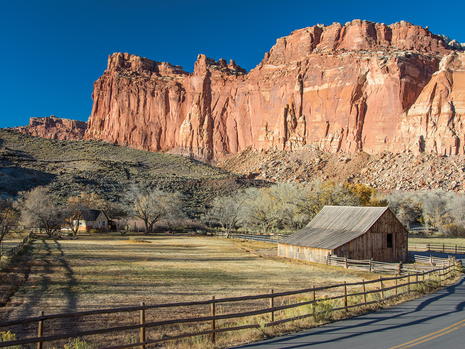
Fruita sits in the Fremont River valley at the heart of the park's developed area, surrounded by orchards that the Mormon settlers planted in the 1880s. The campground is shaded by large cottonwood trees - a genuine luxury in Utah's red rock country. The river runs close enough to hear at night, and the canyon walls rise steeply on both sides, trapping heat during summer afternoons.
Don't expect solitude here. The Scenic Drive traffic, neighboring campers, and the occasional train are part of the soundtrack. What you gain is easy access to the visitor center, general store, and trailheads on foot.
Loop by Loop Breakdown
The campground has one main loop that splits into two sections: the A-loop and the B-loop. There is no meaningful difference between them in terms of facilities or site quality.
Sites 1-18 run along the river side. These are the most requested sites because of the water access and slightly more space between neighbors. Sites 8, 11, and 14 back directly onto the riverbank. The drawback is cottonwood fluff in late spring and heavier mosquito presence near the water.
Sites 19-51 form the main interior loop. These sites are more exposed to sun and neighbor noise but have better road access for larger RVs. Sites 24, 27, and 33 offer the best afternoon shade from mature trees.
Sites 52-71 are the walk-up sites, clustered near the campground entrance. These sites are smaller and closer to the road. Regular visitors tend to avoid them when possible, but they are the only option if you arrive without a reservation.
Specific Site Recommendations
Best for families with kids: Sites 14, 15, and 17. They are close to the river (shallow enough for wading in summer), have flat tent pads, and are a short walk to the restrooms and the campground host.
Best for privacy: Sites 41 and 45. Both sit at the far end of the loop with vegetation blocking sightlines to neighbors. Site 45 backs up against the canyon wall, providing a rock amphitheater effect.
Best for RVs: Sites 22, 29, and 36. These have the longest paved pull-through areas and the fewest low-hanging branches. Most other sites can handle trailers up to 25 feet, but anything over 30 feet will struggle with the tight turns in the loop.
Sites to avoid: Sites 1, 52, and 71. Site 1 is right at the entrance with headlights sweeping across it all night. Sites 52 and 71 are the smallest walk-up sites and sit directly on the road.
Facilities Detail
Restrooms: Flush toilets in the main restroom building near sites 20-25. Vault toilets at the walk-up section. The flush toilets are cleaned daily and are generally well-maintained, but they are the only flush toilets in the entire campground.
Showers: None. The nearest public showers are at the campground in Torrey or at the visitor center (which has a sink but no shower).
Potable water: Three spigots distributed through the campground. One near site 10, one near site 30, and one at the restroom building. The water is treated and safe to drink.
Dump station: Located at the entrance to the campground. Open seasonally (typically April through October). Fee is included in your camping fee - no extra charge.
Campground host: Present daily from March through October. They can answer basic questions and enforce quiet hours.
What the Booking Site Doesn't Show
The Recreation.gov listing makes every site look similar. Here is what you cannot see from the reservation page.
Noise levels vary dramatically by time of day. The Scenic Drive starts getting traffic around 7 AM, and the road noise is constant through late afternoon. Sites near the entrance (52-71) get the worst of it. After 8 PM, traffic drops to near zero.
Generator hour enforcement is inconsistent. The posted generator hours are 8 AM to 8 PM, but enforcement is complaint-driven. If your neighbor runs a generator at 7 AM, you will likely need to flag the host. Bring earplugs regardless.
The road surface is paved but narrow. The campground loop is one lane with pullouts. Meeting another vehicle towing a trailer requires backing up. Larger RVs should have a spotter.
Bear activity is minimal but present. The park has black bears, and they have learned that campsites contain food. All food, cooking equipment, and scented items must be stored in a hard-sided vehicle or bear-proof locker overnight. The lockers at each site are large enough for a standard cooler and a couple of dry bags.
Cedar Mesa Campground
Setting and Atmosphere
Cedar Mesa is the park's best-kept secret. Located 23 miles south of the visitor center on the Notom-Bullfrog Road, this five-site primitive campground sits on a sandstone bench overlooking the Waterpocket Fold. There are no services, no water, and no shade. What you get is solitude and a view that stretches 30 miles across the Henry Mountains.
The road in is graded dirt and can be impassable after rain. Check at the visitor center before heading down. A high-clearance vehicle is recommended - passenger cars can make it when dry, but the washboards will rattle every screw loose.
Site Selection
All five sites are first-come, first-served. Site 3 has the best view - it sits at the edge of the bench with a direct sightline to the Henry Mountains. Site 5 is the most sheltered from wind, tucked behind a piñon-juniper grove.
There are no reservations, no fees, and no host. Fill out the registration envelope at the campground sign and deposit the $10 fee. Vault toilets are available but not always well-maintained.
What to Know
Pack out all trash. There is no garbage service. Bring all your water - there is none on site. The vault toilets are the only facility. Cell service is nonexistent. Fires are not permitted during dry conditions, which is most of the summer. Check fire restrictions at the visitor center before you go.
Photo: NPS via NPS.gov (Public Domain)
Cathedral Valley Campground
Setting and Atmosphere
Cathedral Valley is raw, remote, and absolutely quiet. The six primitive sites sit at the base of the Bentonite Hills in the park's northern section, accessible via the Cathedral Valley Road - a 60-mile loop that requires high clearance and four-wheel drive. The road crosses the Fremont River multiple times (fords, not bridges) and includes stretches of deep sand and bentonite clay that turns to grease when wet.
This campground is for experienced backcountry travelers only. If you break down here, help is a very long walk away.
Site Selection
Sites are unmarked but obvious - flat gravel pads with fire rings. The best site is the one farthest from the road, about 200 yards past the main cluster. It sits against a sandstone fin with a view of the valley opening to the east.
No fees, no reservations, no water, no facilities of any kind. Pack out everything, including human waste if you cannot use a cat hole properly.
Backcountry Camping
Permit System
Backcountry camping is permitted throughout the park's 241,000 acres with a free permit obtained at the visitor center. The permit carries a $7 processing fee as of 2026. Permits are issued same-day only - no advance reservations.
The most popular backcountry zones are the Halls Creek Narrows, the Muley Twist Canyon area, and the Upper South Desert. Each zone has specific regulations about group size, fire restrictions, and camping distances from water sources.
What Rangers Will Tell You
Most visitors underestimate the water situation. There is no reliable surface water in most of the backcountry. You need to carry everything you will drink, cook with, and wash with. Plan on one gallon per person per day minimum, and add a quart for cooking.
The canyon country is unforgiving in summer. Rangers recommend starting hikes by 6 AM and being off exposed ridges by noon. Heat stroke is the most common medical incident they handle.
Route Finding
Many backcountry routes follow wash bottoms that are unmarked. A Capitol Reef National Park map with topographic detail is essential - the free park map is not sufficient for navigation. GPS is unreliable in the narrow canyons. Know how to read a map and compass before heading out.
Photo: NPS via NPS.gov (Public Domain)
Reservation Strategy
Recreation.gov Tactics
Fruita Campground reservations open at 8:00 AM Mountain Time on a rolling six-month window. For a July 15 arrival, the reservation window opens on January 15. Here is what works:
Create a Recreation.gov account in advance. Do not try to create one while sites are going live.
Use the calendar view, not the site list. The calendar shows availability at a glance. Clicking individual dates is faster than scrolling through site numbers.
Target midweek arrivals. Tuesday through Thursday are significantly easier to book than Friday through Sunday.
Cancelations happen. The Recreation.gov cancelation policy allows free cancelations up to two days before arrival. People cancel constantly in the 48 hours before their reservation. Check the site daily in the week before your desired dates.
Walk-Up Strategy
If you cannot get a reservation, the walk-up sites are your backup. Here is the timing:
March, April, October: Show up by noon and you will likely get a site. Midweek is almost guaranteed.
May and September: Arrive by 10 AM. Weekend arrivals should plan on 8 AM.
June through August: Be in line at the campground entrance station by 8 AM. By 9 AM on summer weekends, the walk-up sites are gone.
The entrance station opens at 7 AM. If you arrive earlier, you can pull into the day-use parking area near the visitor center and wait. Do not block the campground entrance.
Group Site Booking
Fruita has one group site that accommodates up to 25 people. It is reservable through Recreation.gov and requires a separate booking process - it does not appear in the standard campsite search. Call the park at 435-425-3791 for group site availability.
What to Know Before You Arrive
Bear Storage Requirements
All food, coolers, cooking equipment, and scented items (toothpaste, sunscreen, soap) must be stored in a hard-sided vehicle or a bear-proof food locker at night and when you are away from your site. Every campsite at Fruita has a bear-proof locker. Use it.
Do not leave food on picnic tables. Do not store food in tents. Rangers check compliance and will issue citations for violations.
Fire Restrictions
Fire restrictions vary by season and current conditions. During dry periods (most of the summer), charcoal fires and wood fires may be prohibited. Propane camp stoves and propane fire rings are typically allowed even during restrictions. Check the park's fire restriction page or call the visitor center before your trip.
The park also enforces a burn ban during extreme fire danger. In 2026, expect restrictions to be in place from June through September.
Quiet Hours Enforcement
Quiet hours are 10 PM to 6 AM. Enforcement is consistent - the campground host will remind noisy groups once, then involve a ranger on the second offense. Generators are prohibited during quiet hours.
The culture here is generally respectful. Most campers are hikers or climbers who turn in early. If you are a night owl, bring headphones.
Cell Service
Cell service at Fruita Campground is unreliable. Verizon and T-Mobile users may get a weak signal near the river, but data speeds are slow to nonexistent. AT&T users should expect no service. The visitor center has free WiFi, but it is not strong enough for streaming.
At Cedar Mesa and Cathedral Valley, there is no cell service at all. Plan accordingly.
Water Situation
Fruita has potable water at three spigots. The water is treated and safe to drink. Fill your containers on arrival - the spigots are not always labeled clearly, and it is easy to miss them in the dark.
Cedar Mesa and Cathedral Valley have no water. Bring everything you need.
The Fremont River runs through the park but is not safe to drink without treatment. Giardia and other pathogens are present. If you plan to filter river water, bring a reliable filter rated for virus removal, not just bacteria.
Checkout Time and Flexibility
Checkout time at Fruita is 11 AM. The campground host is strict about this - they need to clean and reset sites for incoming reservations. Late checkout is not available.
Same-day walk-up sites are held until 11 AM. If you arrive after 11 AM and the site is still empty, you can claim it.
Photo: NPS via NPS.gov (Public Domain)
Practical Takeaways
Book Fruita Campground exactly six months in advance on Recreation.gov. Set an alarm for 7:55 AM Mountain Time on the booking window opener.
If you miss reservations, the walk-up sites are your best option. Arrive by 8 AM in summer, 10 AM in spring and fall.
Cedar Mesa Campground offers the best solitude-to-effort ratio in the park. The dirt road is rough but manageable with a high-clearance vehicle.
Cathedral Valley Campground is for experienced backcountry travelers only. Do not attempt the road without four-wheel drive and a full-size spare.
Bring all your water for Cedar Mesa, Cathedral Valley, and backcountry camping. One gallon per person per day minimum.
Use the bear-proof lockers at every Fruita site. Rangers enforce food storage regulations consistently.
Propane stoves are more reliable than wood fires. Fire restrictions are common in summer and may prohibit charcoal.
Cell service is unreliable at Fruita and nonexistent elsewhere. Download maps and information before you arrive.
The nearest hookups, showers, and supplies are in Torrey, 8 miles west on UT-24. Stock up there before entering the park.
For hiking trails and trail conditions, check the hiking trails guide before heading out.