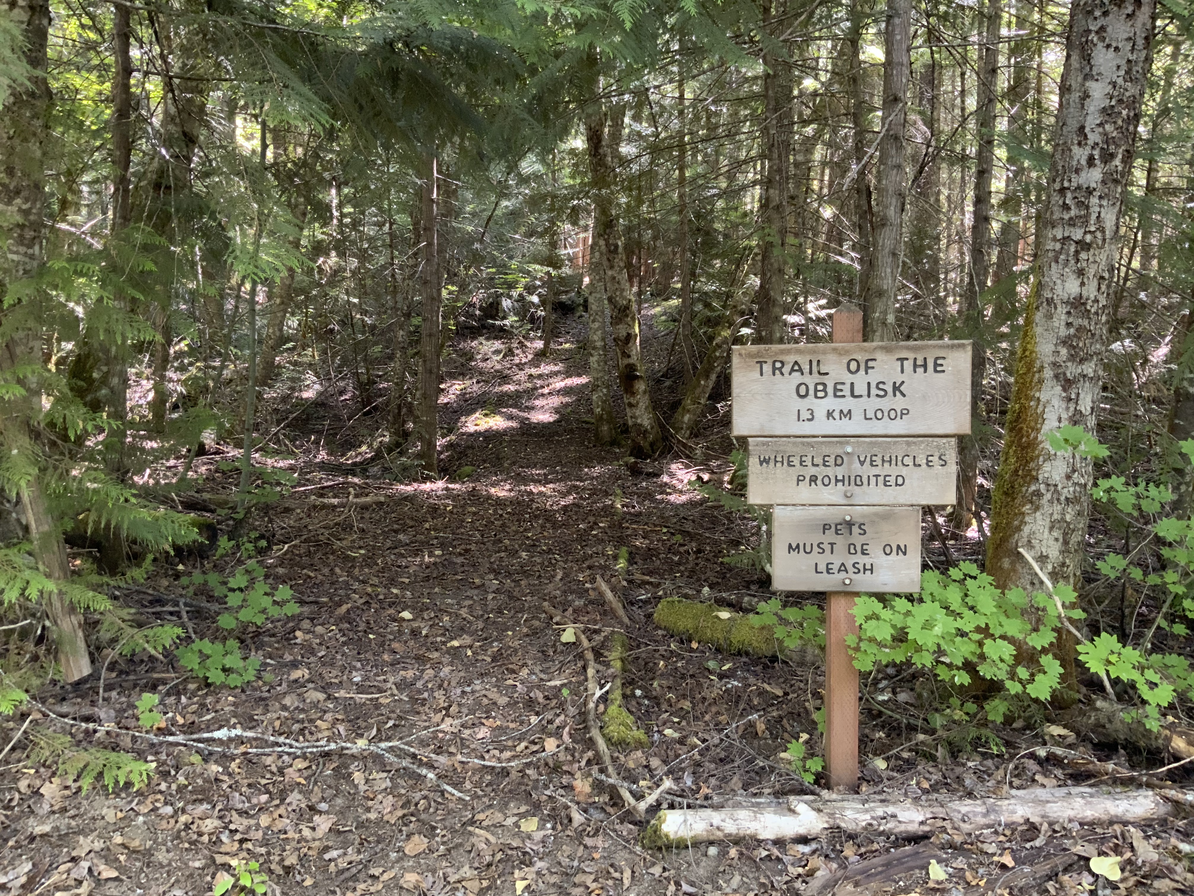
Arrive before 7 AM to secure one of the four parking spots. The Trail of the Obelisk is a short loop near the Canadian border, offering the quiet solitude that's become rare on the park's more popular routes. Here, you'll notice the crunch of your boots on the duff more than any human noise—this trail is about immersion in the subalpine forest and that crisp, thin air.
NPS via NPS.gov (Public Domain)
Trail of the Obelisk
5 min read
Places & Points of Interest
Discover Trail of the Obelisk: trail of the obelisk with our comprehensive guide. Expert tips, practical information, and insider knowledge.
Your plans
Quick Information
There is no entrance fee for North Cascades National Park. The trailhead is accessible whenever State Route 20 is open, typically from late May through October. The best time to visit is July through September when the snow has melted and the trail is clear. It's located in the far northern section of the park in Washington, near the Hozomeen area. The trail is not wheelchair accessible. Cell service is nonexistent here. There are no restrooms or facilities at the trailhead - the nearest vault toilets are at the Hozomeen Campground. Parking is a small, unpaved pull-off that fits about four vehicles. Remove all valuables from your car; break-ins at remote trailheads along SR 20 are not uncommon.
Getting There
This is the most remote trailhead you can drive to in the park. From the west, take State Route 20 (North Cascades Highway) to its terminus at the Ross Lake Dam. Continue north on the unpaved, single-lane Ross Dam Access Road for about 2 miles to reach the East Bank Trailhead. From there, you must hike the East Bank Trail north for approximately 30 miles to reach the Hozomeen area and the trailhead. The practical route is from Canada. Drive south from Hope, British Columbia, on Silver Skagit Road to the Hozomeen border crossing (verify current border crossing requirements and hours). The trailhead is just inside the US border. As of 2026, the Hozomeen gate remains closed to vehicle and foot traffic across the border; you must enter through a designated port of entry, making road access from the US side currently impossible. Check the official park website for the latest border and road status before planning this trip.

What to Expect
Solitude is guaranteed. The trail winds gently through dense fir and hemlock, the ground soft underfoot from years of accumulated duff. That damp, clean scent in the air comes from moss and decaying wood—this is a forest in its full cycle. Don't expect panoramic views; the canopy closes tight overhead. What you get instead is profound quiet, broken only by a red squirrel's chatter or a raven's call in the distance. Elevation gain is negligible, perhaps two hundred feet total. Newcomers frequently remark on the stillness. The surface is packed dirt with root networks; it turns slick after rain. This isn't a hike for checking off landmarks—it's for settling into the rhythm of the woods.
Top Attractions & Points of Interest
The Loop Itself
The trail itself is the experience—a quintessential North Cascades forest walk. It lets you observe the ecosystem intimately, away from the jostle of crowded overlooks. Keep an eye out for nurse logs: fallen old-growth trees that now cradle rows of young hemlocks, a clear lesson in forest regeneration.
Proximity to Hozomeen Lake
The trailhead for the Hozomeen Lake Trail is in the same area. If you've made the considerable effort to get here, extending your day to include the 3.6-mile one-way hike to the lake is a logical move. That trail offers the mountain and lake views this loop deliberately withholds.
International Point
A short drive (or long hike) from the trailhead, International Point on Ross Lake offers a picnic area and boat launch with direct views across the water into Canada. It's a tangible reminder of where you are.

Activities
Day Hiking
This is the primary activity. The Trail of the Obelisk is a perfect short leg-stretcher or a calming cool-down after a longer trek on the Hozomeen Lake Trail. For more ambitious routes, the East Bank Trail connects this area to the rest of the park's trail network.
Backcountry Travel
This zone is a gateway for serious wilderness trips. The East Bank Trail provides access to remote camps and connections to the Pacific Crest Trail. Planning a multi-day trip here requires a backcountry permit, available at the Wilderness Information Center.
Fishing
Hozomeen Lake and the surrounding creeks hold trout. As with all fishing in the park, a Washington State fishing license is required. The park's many fishing opportunities are a major draw.
Seasonal Guide
Late May - June: The road to Hozomeen may open, but expect lingering snow on the trail, especially in shaded areas. Mosquitoes can be fierce. Crowds are zero.
July - September: Prime season. The trail is dry and clear. Days are warm, nights are cool. This is your window.
October: Road and trail access become weather-dependent. Early snows can close the route suddenly. Fall colors in the underbrush are subtle but present. Check for closure alerts.
November - May: The area is inaccessible by road. State Route 20 is closed at milepost 130 (Colonial Creek), and the Canadian access road is not maintained for winter travel.

Practical Information
There are no fees for the trail or parking. Overnight stays require a backcountry permit, which has a fee as of 2026 - check the official website for current rates. The nearest camping options are the Hozomeen Campground (75 sites, free) or backcountry sites along the East Bank Trail. There is no lodging, food, or gas at Hozomeen. The nearest services are in Hope, BC, or back along SR 20 at Ross Lake Resort or the town of Newhalem. For lodging and accommodations with amenities, you'll need to drive back out to the park's western entrances.
Safety & Preparation
Your biggest risk is remoteness. Help is hours away. Cell phones do not work. Tell someone your plan. Carry the Ten Essentials, with extra emphasis on water filtration (streams are available) and layers - weather changes fast. Bear spray is a sensible precaution; this is active black bear country. Be aware of current alerts: as of 2026, the Stehekin area (south of here) is prone to post-fire flooding and debris flows, and break-ins at trailheads are a real concern. Do not leave anything visible in your vehicle.

Insider Tips
- Combine Your Trip: No one drives this far for a 1-mile loop. Make a day of it by hiking to Hozomeen Lake and having lunch at International Point.
- Border Logistics: If entering from Canada, have your passport and be clear on what food and gear you can bring across. Agricultural restrictions apply.
- The Quiet Time: Go in the evening. The low-angle light filters through the trees differently, and you might have the entire forest to yourself.
- Check the Gate: The status of the Hozomeen gate is the single most important piece of beta. A closure notice can void your entire trip plan. Verify, then verify again.
- Water Source: There is no potable water. Filter or treat water from Hozomeen Creek or the lake if you're staying awhile.
- Trail Register: Sign it. In a place this remote, that paper log is your first line of safety.
- Post-Hike Burger: The closest reward after the long drive out is in the town of Marblemount. It's a tradition.
For more information, see our complete North Cascades National Park Guide.
Sources
- Official source: NPS — North Cascades National Park nps.gov/noca/index.htm
- Official source: National Park Service nps.gov/places/trail-of-the-obelisk.htm
Photo Gallery
More to Explore

Park Guide
Acadia National Park: Carriage Roads, Cadillac Mountain & 2026 Guide
Discover carriage roads, Cadillac Mountain, and rugged Maine coast. Complete 2026 guide to Acadia National Park — trails, fees, lodging, permits, and what rangers recommend.

Hiking Guide
Grand Canyon Hiking Trails: Day Hikes, Water Sources & Rim to Rim
Compare Grand Canyon hiking trails: Bright Angel, South Kaibab, Hermit, Grandview, and rim to rim, with distances, elevation, water stops, and trailhead access for each.

Best Of
Best of Glacier Bay National Park
The best of Glacier Bay is reached by boat: ranger-led day tours up the bay to the tidewater glaciers. What's worth it, how to book, and when to go (2026).

Campsite Guide
White Sands Backcountry Camping: Closed for 2026 — What to Know
As of 2026, backcountry camping at White Sands National Park is closed for site rehabilitation. What that means, and where to camp nearby instead.

Weather Guide
Guadalupe Mountains National Park Weather: Weather
Guadalupe Mountains National Park: weather guide guide updated 2026. Practical visitor information, reservations, and seasonal tips worth bookmarking before

Best Of
Best of Cuyahoga Valley National Park: Best Things to Do
Seeing a Cleveland Orchestra concert with the woods as your backdrop is a uniquely Cuyahoga Valley experience.
Sign in to join the conversation.
Sources & Attribution
Location data courtesy of the National Park Service (U.S. Department of the Interior). NPS data is public domain. Official NPS page.
Images: NPS; NPS; NPS; NPS; NPS.
Map data © OpenStreetMap contributors.
Park operations alerts: NPS.gov · Weather and weather hazards: National Weather Service · Live conditions.
Information may change. Always verify fees, hours, and conditions directly with the official source before visiting.
Did this guide help? Share it with a friend.