Start before 9 AM if you want a parking spot at the Thunder Creek Trailhead. The lot is small, and by mid-morning on a summer weekend, you'll see cars parked along the shoulder of State Route 20 for a quarter-mile in either direction.
NPS via NPS.gov (Public Domain)
Thunder Creek Trail: Old-Growth Hike, North Cascades
8 min read
Places & Points of Interest
Plan your 2026 visit to Thunder Creek Trail. Complete guide to trails, fees, lodging, best time to visit, and insider tips.
Your plans
The Thunder Creek Trail leads into the core of the North Cascades backcountry. Don't expect summit views here—the first twelve miles travel through an old-growth forest corridor where damp cedar scent fills the air and the glacial creek provides a steady background rumble. This 23-mile route follows Thunder Creek, its milky turquoise water colored by glacial flour from Mount Logan and Booker, and links to extensive backcountry networks. For a day hike, those initial miles deliver the essential North Cascades character: towering ancient trees, a powerful river, and deep forest silence.
Quick Information
There is no entrance fee for North Cascades National Park Complex. The Thunder Creek Trailhead operates 24/7, but access is seasonal, typically from late May through October, depending on snowpack on State Route 20. The best time to visit is July through September for reliable trail conditions and minimal snow. The trailhead is located in Washington State, off State Route 20 near milepost 130, roughly 2.5 hours east of Burlington. The parking area is paved but not large. The trail itself is a natural surface of dirt and roots and is not wheelchair accessible. Cell service is non-existent at the trailhead and throughout the hike. There are no restrooms at the trailhead; the nearest vault toilets are at the Colonial Creek Campgrounds across the highway. Parking is free but fills early.
Getting There
From the west (Burlington/I-5), take State Route 20 east for about 115 miles. The trailhead is on the north side of the highway at milepost 130, directly across from the entrance to Colonial Creek South Campground. The drive from Burlington takes about 2.5 hours without stops. From the east (Winthrop), take State Route 20 west; the trailhead will be on your left just before you reach the Colonial Creek area. This is a critical detail: the large Diablo Lake Overlook parking is not your trailhead. Your turn is a smaller, signed pull-off. As of 2026, check the Washington State Department of Transportation website for real-time status on State Route 20 closures, as winter snow and events like the December 2025 floods can cause extended shutdowns at MP 130.

What to Expect
The trail surface is soft with fallen needles beneath a canopy of western red cedar, Douglas-fir, and western hemlock—some specimens exceed five centuries in age. Ferns, devil's club, and berry bushes form a dense understory. Thunder Creek's sound accompanies you, varying from a low rumble to a crashing roar as you approach. Air temperature drops and humidity rises noticeably within this forest corridor. While elevation gain is gradual, it's persistent; hikers often find the return trip from the 2-mile bridge involves a steady, gentle climb back to the highway.
Most first-time visitors are caught off guard by two things. First, the sheer size of the trees - their scale doesn't translate in photos. Second, the color of Thunder Creek. Its opaque, milky blue-green comes from glacial flour, fine rock sediment ground by glaciers upstream. It's a color you'll see in several North Cascades waterways, but it's particularly striking against the dark greens and browns of the forest. The trail narrows here, with roots and occasional muddy patches even in summer. You'll feel the isolation within the first mile as the highway noise fades, replaced by birdcall and water sounds.
Top Attractions & Points of Interest
Thunder Creek Bridge (2-mile mark)
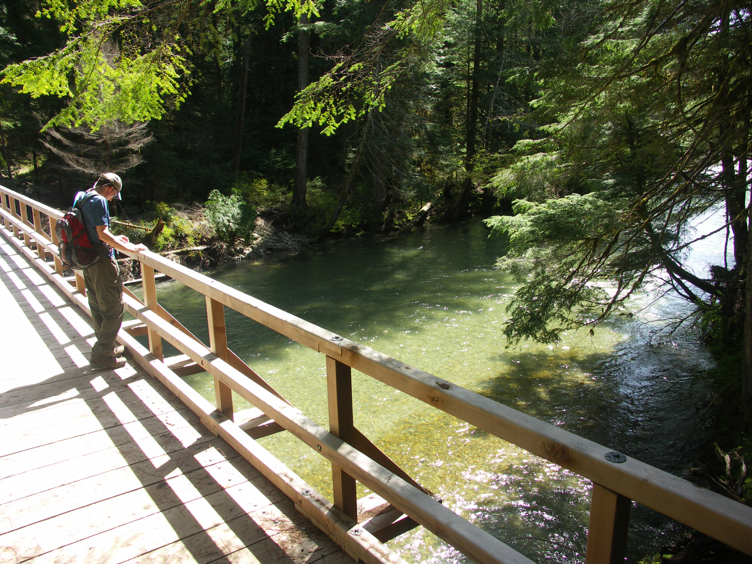
This is the logical turnaround for a standard 4-mile day hike. The bridge is a sturdy suspension span that crosses Thunder Creek, offering the best upfront view of its powerful, glacially-fed flow. It's a good spot to feel the spray and take a break. The far side of the bridge is where the trail begins its more serious commitment into the backcountry.
Old-Growth Forest Corridor
The forest itself is the main attraction for the first several miles. Rangers will tell you this is one of the most accessible and impressive stands of old-growth in the park complex. Look for nurse logs - fallen giants that serve as fertile soil for new lines of hemlock and cedar seedlings growing in a straight row along their length.
Junction with Fourth of July Pass Trail
About 6.5 miles in, a side trail branches off to climb to Fourth of July Pass. This is a common goal for strong day hikers or a first-night stop for backpackers. The junction is deep in the forest, a quiet intersection marked by a sign. The pass itself, another 3.5 miles and 2,000 vertical feet up, offers the first major panoramic views of the surrounding peaks.
McAllister Creek Camp
Located roughly 6 miles from the trailhead, this backcountry camp is the first designated camping area along Thunder Creek. It signals the transition from day-hike territory to true wilderness. The sound of McAllister Creek joining Thunder Creek is a constant white noise here.
Skagit Queen Mine
A historical site about 10.5 miles up the trail, the remnants of this early 20th-century mine are a stark contrast to the natural surroundings. It's a long haul for a day hike, but for backpackers, it's a fascinating piece of human history swallowed back by the forest.

Activities
Day Hiking
This is the primary use for most visitors. The out-and-back distance is up to you. The 4-mile roundtrip to the first bridge is easy and rewarding. Aiming for the 6-mile mark or the Fourth of July Pass junction turns it into a full-day, moderate-to-strenuous effort. Pack extra water for this stretch; while you're near water the whole time, you need to filter it.
Backpacking
The Thunder Creek Trail is a major artery for planning a backcountry trip. It provides access to a network of trails leading to places like Park Creek Pass and eventually, the Stehekin Valley. A permit is required for all overnight stays, which you must secure in person or by phone from the Wilderness Information Center. Most visitors underestimate the physical challenge of a multi-day trip here - the elevation gain is relentless.
Wildlife Viewing
This is prime habitat. Black bears are common (store food properly), and you might see mule deer or the smaller Columbia black-tailed deer. The forest is alive with birds; listen for the hammering of pileated woodpeckers and the croak of ravens. Wildlife viewing here is about patience and quiet.
Photography
The photographic challenge is the low, dappled light of the deep forest. A tripod helps for long exposures of the creek. The bridge offers the clearest compositional shot of the water. For wildflowers, look to the side trails and higher elevations in July and August.
Fishing
While Thunder Creek itself is less known for fishing, the trail provides access to alpine lakes further up the drainage that hold trout. Anyone fishing in the North Cascades needs a valid Washington State fishing license and must know the specific regulations for the national park.
Seasonal Guide
June: The trail is often snow-free at the lower elevations, but higher sections (like the approach to Fourth of July Pass) will still have significant snowpack. Mosquitoes can be fierce. The creek runs high and loud with snowmelt.
July - August: Prime season. The trail is generally clear, wildflowers are out in the higher meadows, and weather is most stable. This is also the busiest time. Start early.
September - Early October: The best time for many experienced hikers. Crowds diminish, mosquitoes vanish, and the fall colors in the understory (vine maple, huckleberry) are spectacular. Nights get cold, and the first dustings of snow can occur at higher elevations.
Late October - May: State Route 20 is typically closed at or near the trailhead (MP 130) due to snow and avalanche risk. The trail is inaccessible for all but experienced winter mountaineers on skis or snowshoes.

Practical Information
No fees or reservations are required for day use. For camping options, the nearest frontcountry campgrounds are Colonial Creek North and South ($24 per night as of 2026), directly across the highway. They operate on a first-come, first-served basis and fill daily in summer. Backcountry camping requires a permit from the Wilderness Information Center in Marblemount.
For lodging and accommodations, the nearest towns with services are Marblemount (about an hour west) and Winthrop (about 1.5 hours east). Ross Lake Resort and the North Cascades Lodge at Stehekin are unique, remote options but require boat or floatplane access. There are no restaurants, gas stations, or cell service at the trailhead. The last reliable gas and groceries are in Marblemount (coming from the west) or Mazama (coming from the east).
Safety & Preparation
Weather: Mountain weather changes fast. Even on a sunny day, carry rain gear and an extra insulating layer. Temperatures can drop significantly in the forest shade or if clouds roll in.
Wildlife: This is bear country. Carry bear spray, know how to use it, and make noise while hiking, especially around blind corners. Store all food, trash, and scented items in a bear-resistant canister, which is required for backcountry camping.
Trail Conditions: The trail is well-maintained but has roots, rocks, and can be muddy. Trekking poles are helpful for stability, especially on the return descent to the bridge. Water from all streams and creeks must be filtered or treated.
Navigation: The main trail is easy to follow, but having a map (paper or offline digital) is essential, especially if you plan to explore beyond the first bridge. Cell service drops out at the highway and does not return.
Theft: A current park alert warns of break-ins at trailheads along SR 20. Remove all valuables, including charging cords, from your vehicle before you leave it.
Emergency: The nearest ranger station is at the North Cascades Visitor Center in Newhalem, about 10 miles west. In a backcountry emergency, you will need to send someone out for help.

Insider Tips
- The parking situation here is competitive. If the main lot is full, do not block the campground entrance across the street. Park fully off the paved roadway on the wide shoulders, facing the direction of travel.
- The first bridge is crowded at midday. For more solitude, go another half-mile up the trail. The crowds thin dramatically past that point.
- The gift shop at the North Cascades Visitor Center sells maps and bear canisters. Get your supplies there or in Marblemount.
- Early morning is your best bet for seeing wildlife, like deer grazing in the mist near the creek banks.
- If the Thunder Creek lot is packed, consider the nearby Thunder Knob Trail or the Diablo Lake Trail. They offer different but equally compelling views and often have more parking turnover.
- The water in Thunder Creek is glacial melt, meaning it's intensely cold year-round and full of fine sediment. It will clog a basic filter quickly. A filter with a pre-filter or a chemical treatment is more effective here.
- What the park website doesn't mention: the sound. On a quiet day, you can hear the deep, sub-audible groan of the glacier that feeds this creek, a reminder of the powerful forces that carved this landscape. Stop hiking for a minute, listen past the water, and you might catch it.
For more information, see our complete North Cascades National Park Guide.
Sources
- Official source: NPS — North Cascades National Park nps.gov/noca/index.htm
- Official source: National Park Service nps.gov/places/thunder-creek-trail.htm
Photo Gallery
More to Explore

Park Guide
Acadia National Park: Carriage Roads, Cadillac Mountain & 2026 Guide
Discover carriage roads, Cadillac Mountain, and rugged Maine coast. Complete 2026 guide to Acadia National Park — trails, fees, lodging, permits, and what rangers recommend.

Hiking Guide
Grand Canyon Hiking Trails: Day Hikes, Water Sources & Rim to Rim
Compare Grand Canyon hiking trails: Bright Angel, South Kaibab, Hermit, Grandview, and rim to rim, with distances, elevation, water stops, and trailhead access for each.

Best Of
Best of Glacier Bay National Park
The best of Glacier Bay is reached by boat: ranger-led day tours up the bay to the tidewater glaciers. What's worth it, how to book, and when to go (2026).

Campsite Guide
White Sands Backcountry Camping: Closed for 2026 — What to Know
As of 2026, backcountry camping at White Sands National Park is closed for site rehabilitation. What that means, and where to camp nearby instead.

Weather Guide
Guadalupe Mountains National Park Weather: Weather
Guadalupe Mountains National Park: weather guide guide updated 2026. Practical visitor information, reservations, and seasonal tips worth bookmarking before

Best Of
Best of Cuyahoga Valley National Park: Best Things to Do
Seeing a Cleveland Orchestra concert with the woods as your backdrop is a uniquely Cuyahoga Valley experience.
Sign in to join the conversation.
Sources & Attribution
Location data courtesy of the National Park Service (U.S. Department of the Interior). NPS data is public domain. Official NPS page.
Images: NPS; NPS; NPS; NPS; NPS.
Map data © OpenStreetMap contributors.
Park operations alerts: NPS.gov · Weather and weather hazards: National Weather Service · Live conditions.
Information may change. Always verify fees, hours, and conditions directly with the official source before visiting.
Did this guide help? Share it with a friend.