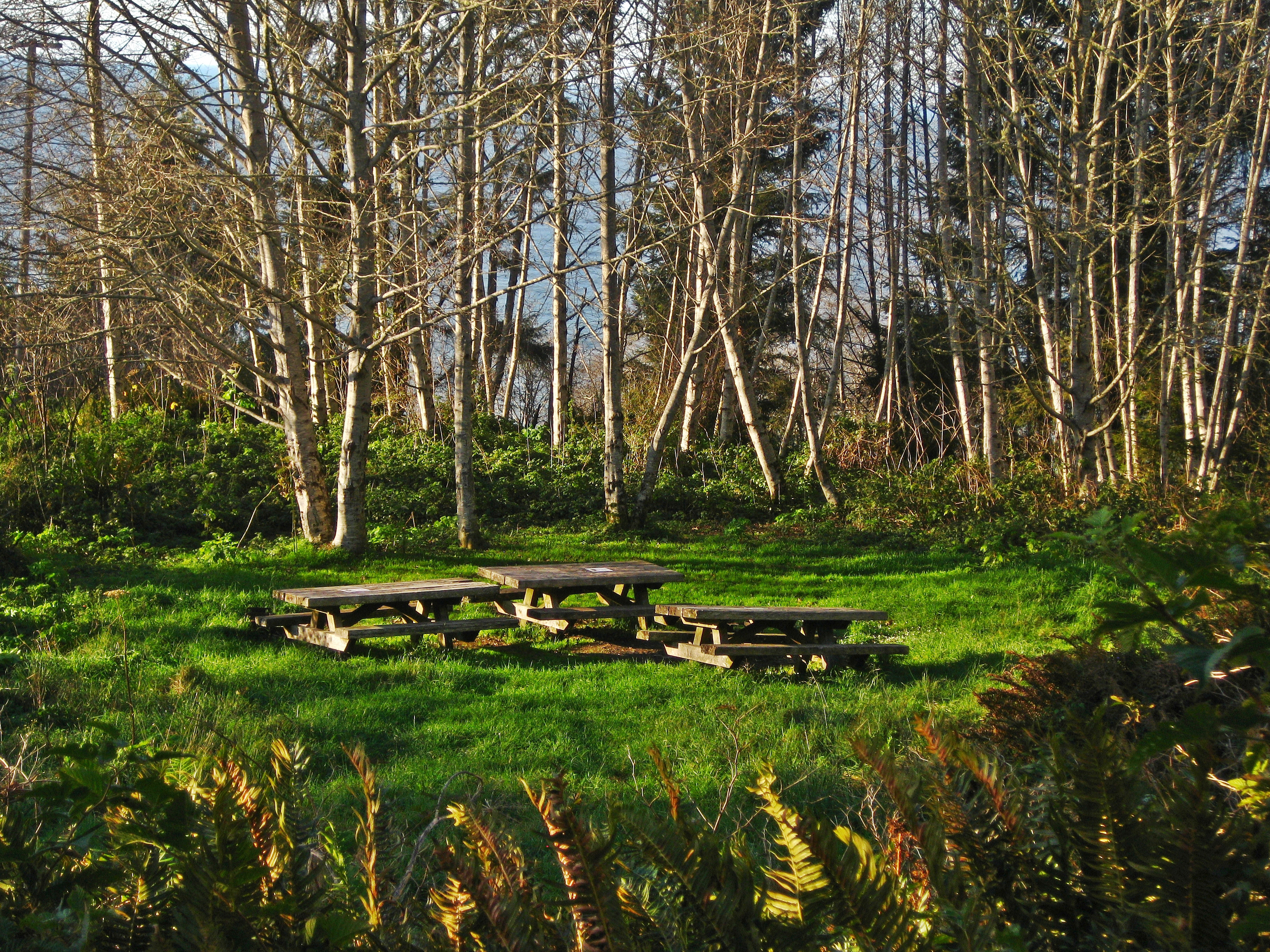
The trail narrows here, the sound of your own footsteps on the duff suddenly louder than the distant Pacific. You're a quarter-mile from the Coastal Drive, but the world has shrunk to a corridor of red alder and Sitka spruce. The air smells of damp earth and salt. This is the approach to Flint Ridge Backcountry Camp, a designated site for those who want to sleep within earshot of the ocean without the crowds of a frontcountry campground. As of 2026, a free backcountry permit is the single non-negotiable requirement to use this site. It's not a drive-up spot; it's a place you earn with a short hike, and that makes all the difference.
NPS via NPS.gov (Public Domain)
Flint Ridge Backcountry Camp
9 min read
Places & Points of Interest
The trailhead for Flint Ridge Backcountry Camp is unmarked—a common point of confusion for first-timers. The camp itself is on a flat bench on the ridge.
Your plans
Overview
Flint Ridge occupies a wooded ridgeline within earshot of the northern California coast. The Park Service designates it as a semi-developed site: you'll find a cleared tent pad, a bear-proof food locker, and a vault toilet, but no water source. What you gain is solitude and the Pacific's constant low rumble filtering through the trees—that sound defines the night here. Situated within Redwood National and State Parks, the camp lies a short distance from more visited attractions yet feels entirely separate. It serves as a basecamp for coastal exploration, not for giant redwood groves, which require a drive or a longer hike. Through-hikers on the Coastal Trail and backpackers seeking a straightforward overnight with reliable infrastructure frequent this site. The experience hinges on the forest-meets-ocean transition zone: cool, damp air, dense afternoon fog, and the chance of waking to sea lion barks carried on the wind.
Quick Information
* Permit: A free backcountry permit is required. No fee for the permit itself.
* Best Time to Visit: Late spring through early fall (May-October) for the driest conditions and most reliable coastal access. Winter is wet, foggy, and less crowded.
* Location: Del Norte County, California. Nearest services are in Crescent City, about a 15-minute drive north.
* Accessibility: The trail from the parking area is not ADA-accessible. It's a natural surface path with roots and minor elevation change.
* Cell Service: Spotty to nonexistent. Assume you will have no signal.
* Restrooms: One vault toilet at the campsite.
* Parking: A small, unsigned pullout near the Coastal Drive mile marker. Fits 3-4 vehicles max. No fee.

Getting There
The trailhead for Flint Ridge Backcountry Camp is unmarked—a common point of confusion for first-timers. Look for a small pullout on the west side of Coastal Drive, roughly 2.5 miles south of its junction with US Highway 101. From Crescent City, take US 101 south, turn left onto Coastal Drive (signed for Enderts Beach), and drive about 2.5 miles. The pullout sits on the ocean side of the road with no "Flint Ridge" sign; instead, watch for a faint trail leading into the woods from the parking area. If you reach the signed trailhead for the Coastal Trail's Last Chance Grade section, you've overshot by a quarter-mile.
Parking is the main logistical hurdle. The pullout fits three, maybe four vehicles if people park efficiently. It fills, especially on summer weekends. There's no overflow parking along the narrow, winding Coastal Drive. Your best bet is to arrive early in the day to claim a spot, or have a backup plan. The coordinates for the pullout are approximately 41.525° N, 124.078° W, but cell service drops out at the junction with Coastal Drive, so don't rely on live navigation.
What to Expect
The half-mile hike in descends gently through a tunnel of shore pine, wax myrtle, and young Sitka spruce. The ground is soft with needles and duff.f the ocean grows steadily, a deep white noise that eventually drowns out the road. The camp itself is on a flat bench on the ridge. You'll see the green metal bear box first, then the single vault toilet, and finally the designated tent pads scattered under the trees.
The weather dictates everything. Summer mornings often start clear, but the marine layer typically pushes in by early afternoon, cloaking the camp in cool, damp fog. Temperatures rarely climb out of the 60s (°F), and nights can dip into the 50s even in August. Wind is a constant factor on the ridge, though the camp is somewhat sheltered. The humidity is high year-round; nothing ever truly dries out. The most common surprise for visitors is the lack of a direct ocean view from the camp. You're in the forest, but you can hear the waves crashing below. To see the water, you need to hike a few minutes further west on the connecting trail to the Coastal Trail proper, where sudden, staggering views of the Pacific and the coastline toward Crescent City open up.

Top Attractions & Points of Interest
The Coastal Trail (Last Chance Grade Section)
This is the primary reason to camp here. The Flint Ridge camp provides direct access to this rugged, spectacular section of trail. Heading north, it's about a 1.5-mile hike to Enderts Beach and its renowned tidepools. Heading south, the trail becomes more challenging, winding along steep, eroded bluffs for miles. The views are raw and expansive, with no guardrails between you and the drop. It's for steady-footed hikers only.
Enderts Beach
A short hike north from camp connects you to the trail down to Enderts Beach. This is a destination for tidepooling - the park service emphasizes checking tide tables and only exploring at low tide for safety and to see the most life. You'll find anemones, sea stars, and crabs in the rocky pools. The beach itself is a mix of sand and cobble, often littered with driftwood. It's rarely crowded because the access is hike-in only.
Crescent Beach Overlook
A short drive north from the trailhead on Coastal Drive brings you to this formal overlook. On clear days, the view stretches north across Crescent Beach to the harbor of Crescent City and the offshore sea stacks. It's a classic spot for sunset photos. It's also a good weather gauge: if you can see the horizon from here, you'll likely have clear views from the Coastal Trail.
Activities
Backpacking & Overnight Hiking
This is the core activity at Flint Ridge. The camp serves as a perfect first-night stop for a multi-day trek along the Coastal Trail, or as a simple overnight destination. The short hike in means you can carry a heavier pack with more comforts, which is a rarity for backcountry trips. The established bear locker means you can skip carrying a bear canister, a significant weight savings.
Day Hiking to the Coast
Many visitors use the camp as a permit-required base for day hikes. From your tent, you can hike north to Enderts Beach for tidepooling, or south along the bluffs for miles of solitude and whale-watching opportunities (gray whale migration peaks December-January and March-April). The trail is often muddy and slippery, even in summer; trekking poles are highly recommended.
Wildlife Viewing
Roosevelt elk are frequently seen in the meadows along Coastal Drive near the trailhead. In the forest around camp, listen for the croak of ravens and the chatter of Steller's jays. The intertidal zone at Enderts Beach is where the real wildlife action is, with a chance to see sea stars, anemones, and shorebirds. Remember to watch wild elk from a distance - they are large, wild, and unpredictable.

Seasonal Guide
May - September: The primary season. Days are longest, fog is common but often burns off. This is when the parking pullout is most competitive. Coastal temperatures are mild, rarely exceeding 70°F. No rain is guaranteed, but storms are less frequent.
October - November: A sweet spot. Crowds diminish significantly after Labor Day. The weather can be volatile, with a mix of brilliant clear days and the first major storm systems of the rainy season. The ocean becomes more dramatic. This is a good time for solitude but be prepared for rain.
December - April: The wet season. This is for experienced backpackers with serious rain gear. Storms can be intense, with high winds and saturated trails. The reward is having the entire coast to yourself and witnessing the power of the Pacific in winter. Landslides can temporarily close sections of the Coastal Trail - always check for alerts before you go.
Practical Information
The only mandatory piece of paperwork is the free backcountry permit. These are not available at the trailhead. You must obtain one in person at the Redwood National and State Parks headquarters in Crescent City (1111 Second Street) or at the Thomas H. Kuchel Visitor Center south of Orick. Permits are issued on a first-come, first-served basis and cannot be reserved online. Rangers use them to manage use and know who's in the backcountry.
There are no fees for the permit or for parking at the trailhead. Your major costs will be camping gear and food. For other camping options with vehicle access, the park's frontcountry campgrounds like Jedediah Smith or Mill Creek are about a 30-minute drive away and cost $35 per night as of 2026.
All supplies - food, fuel, gear - must be purchased in Crescent City before you head to the trailhead. There are no services on Coastal Drive. Pack in all your water; there is no source at the camp. All trash and waste must be packed out - the vault toilet is for human waste only.

Safety & Preparation
Water is your first priority. You must carry in all the water you will need for drinking, cooking, and cleaning. Plan for at least one gallon per person per day, more if you're hiking extensively. There are no streams at the camp that are reliable or safe to drink from without proper treatment.
The coastal climate is deceptively cool. Hypothermia is a real risk, even in summer, if you get wet from fog, rain, or sweat and are exposed to the wind. Pack warm, non-cotton layers, a waterproof shell, and a warm hat. A sleeping bag rated to 30°F is a good minimum.
The trail to Enderts Beach and along the Coastal Trail involves steep, unstable slopes in sections. Footing can be slippery. Never approach the cliff edges. Sneaker waves are a deadly hazard on all Pacific beaches; never turn your back on the ocean and always monitor the tide.
Store all food, trash, and scented items (toothpaste, sunscreen) in the provided bear-proof locker. This is non-negotiable; it protects you and the wildlife.
Insider Tips
- The Unmarked Pullout: The park website doesn't mention the complete lack of signage. Your landmark is the mile marker. Look for the pullout near Coastal Drive mile marker 2.5. If you see a wide gravel area with a trailhead sign for the Coastal Trail, you've gone too far south.
- Permit Strategy: The Crescent City headquarters opens at 9 AM. If you're planning a weekend overnight in summer, be there at 8:45 AM. They can run out of permits for popular sites like Flint Ridge by mid-afternoon.
- Water Cache: If you're planning multiple nights or have a large group, consider caching a jug of water at the bear box before you haul your full packs in. The short hike makes this a viable shuttle tactic.
- Fog Window: The clearest views are almost always in the morning. If you want to photograph the coastline, plan your hike for the first few hours after sunrise. The fog usually pours in by 1 or 2 PM.
- Soundscape: The camp is close enough to Crescent City that on still, clear nights, you can sometimes faintly hear the blast of the harbor foghorn. It's a reminder of how close you are to the edge of the continent.
- Tidepool Timing: Don't guess. Use a tide chart app or get the times from a visitor center. Aim to arrive at Enderts Beach at least an hour before the posted low tide for the best and safest viewing.
- Leave the Chair: The tent pads are small and surrounded by vegetation. A full-size camp chair is often more hassle than it's worth. A small, lightweight sit pad is a better choice for this particular site.
For more information, see our complete Redwood National Park Guide.
Sources
- Official source: NPS — Redwood National Park nps.gov/redw/index.htm
- Official source: National Park Service nps.gov/places/flintridgebackcountrycamp.htm
Photo Gallery
More to Explore

Park Guide
Acadia National Park: Carriage Roads, Cadillac Mountain & 2026 Guide
Discover carriage roads, Cadillac Mountain, and rugged Maine coast. Complete 2026 guide to Acadia National Park — trails, fees, lodging, permits, and what rangers recommend.

Hiking Guide
Grand Canyon Hiking Trails: Day Hikes, Water Sources & Rim to Rim
Compare Grand Canyon hiking trails: Bright Angel, South Kaibab, Hermit, Grandview, and rim to rim, with distances, elevation, water stops, and trailhead access for each.

Best Of
Best of Glacier Bay National Park
The best of Glacier Bay is reached by boat: ranger-led day tours up the bay to the tidewater glaciers. What's worth it, how to book, and when to go (2026).

Campsite Guide
White Sands Backcountry Camping: Closed for 2026 — What to Know
As of 2026, backcountry camping at White Sands National Park is closed for site rehabilitation. What that means, and where to camp nearby instead.

Weather Guide
Guadalupe Mountains National Park Weather: Weather
Guadalupe Mountains National Park: weather guide guide updated 2026. Practical visitor information, reservations, and seasonal tips worth bookmarking before

Best Of
Best of Cuyahoga Valley National Park: Best Things to Do
Seeing a Cleveland Orchestra concert with the woods as your backdrop is a uniquely Cuyahoga Valley experience.
Sign in to join the conversation.
Sources & Attribution
Location data courtesy of the National Park Service (U.S. Department of the Interior). NPS data is public domain. Official NPS page.
Images: NPS; NPS; NPS; NPS; NPS.
Map data © OpenStreetMap contributors.
Park operations alerts: NPS.gov · Weather and weather hazards: National Weather Service · Live conditions.
Information may change. Always verify fees, hours, and conditions directly with the official source before visiting.
Did this guide help? Share it with a friend.