The Bright Angel Point Trail is closed. That's the essential fact for 2026. The entire North Rim developed area—lodge, visitor center, campground, and the trail itself—remains shut down due to extensive damage from the Dragon Bravo Wildfire. This guide is here because that short, paved path to one of the canyon's most iconic viewpoints is a classic, and visitors need to understand its current status. While you can't walk it this year, knowing what it offers—and what you're missing—is crucial for future trip planning and for grasping the scale of the park's recovery. This guide covers what you'd need to know for a visit when it reopens, from the trail's specific character to the logistics of the remote North Rim.
NPS via NPS.gov (Public Domain)
Bright Angel Point Trail: Your Complete 2026 Guide to Planning the Perfect Visit
8 min read
Places & Points of Interest
Discover Bright Angel Point Trail: bright angel point trail with our comprehensive guide. Expert tips, practical information, and insider knowledge.
Your plans
As of 2026, there's no entrance fee for the Bright Angel Point Trail; access is included with the standard Grand Canyon National Park pass. The entire North Rim area is closed, so operating hours don't apply. Historically, visitor services here ran from mid-May to mid-October. For the best visit when open, aim for late May through September for full access, with early June and September offering milder temperatures. The trailhead is at the Grand Canyon North Rim in Arizona, next to the Grand Canyon Lodge. GPS coordinates are 36.1982° N, 112.0525° W. The trail is a narrow, paved path with significant drop-offs and steep sections; it's not wheelchair or stroller accessible. Cell service on the North Rim is notoriously unreliable, often nonexistent. Restrooms and parking are at the Grand Canyon Lodge area, but all facilities are currently closed. When open, the main lot fills quickly, usually by mid-morning.
Getting There
Reaching the Bright Angel Point Trailhead is a commitment. The North Rim is remote. The nearest major airport is in Las Vegas, Nevada, about a 270-mile drive. From there, you take I-15 north to UT-9 east through Zion National Park, then US-89 south to AZ-67 south into the park. The drive from the park entrance to the lodge area is about 40 miles. From the South Rim, it's a 220-mile, 4.5-hour drive around the canyon via Desert View, Cameron, and Jacob Lake. There is no direct road across the canyon. Once the area reopens, you'll drive to the end of the main road at the Grand Canyon Lodge. Parking is limited. The trail begins at the west end of the lodge complex. Rangers emphasize that RVs over 22 feet and vehicle-trailer combinations are prohibited on the Cape Royal Road, which includes the lodge access, so plan your vehicle accordingly.
What to Expect
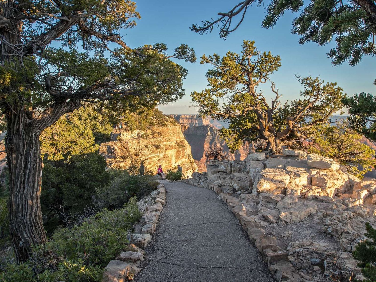
When it reopens, expect a short but intense experience. The Bright Angel Point Trail is a half-mile round-trip paved path that feels much longer due to its exposure. The trail narrows here, with dramatic, unfenced drop-offs on both sides in places. The surface is paved, but certain sections are surprisingly steep. The elevation at the trailhead is around 8,200 feet, and the point itself juts out into the canyon, offering a 270-degree view. You'll feel the altitude; walk slowly. The trail is entirely exposed - no shade. From the point, you look directly into the heart of the canyon. To the south, you can see the South Rim's visitor center area as a faint line on the distant plateau. The Colorado River is a thin, brown-green thread nearly a vertical mile below. The silence is often broken only by the wind and the occasional croak of a raven riding the thermals. First-time visitors are often caught off guard by the sheer exposure of the trail; it's not a casual stroll. Keep an eye out for your footing, not just the view.

Top Attractions & Points of Interest
Since the immediate area is closed, these points of interest are currently inaccessible but represent what makes this location significant.
Bright Angel Point
This is the destination. A narrow fin of rock projecting into the void, it provides one of the most comprehensive views on the North Rim. You can see multiple canyon layers, from the Kaibab Formation at your feet down to the Vishnu Schist at the river. On clear days, the San Francisco Peaks are visible 80 miles to the south. It's a prime sunrise and sunset spot, but bring a headlamp for the walk back.
Grand Canyon Lodge
The historic lodge is the trailhead's anchor. When open, its massive windows and spacious sunroom offer sheltered canyon views. The lodge is the hub for North Rim services, including the only sit-down restaurant, a gift shop, and the visitor center. Its stone construction and timbered ceilings are worth a look even if you're not staying there.
Transept Canyon View
From the lodge patio and sections of the trail, you get a commanding view into Transept Canyon, a major side canyon. The view showcases the canyon's complex drainage patterns and the depth of erosion. It's a quieter, more intimate perspective than the main gorge.
Cape Royal Road
While the point itself is the main attraction, the 23-mile scenic drive to Cape Royal is the North Rim's premier experience, passing multiple other overlooks like Point Imperial and Cape Royal itself. The road is closed at the lodge currently, but when open, it's a full-day adventure.
Arizona Trail Junction
The Arizona Trail, a 800-mile path across the state, crosses the North Rim area. The trail is currently closed within the park due to the fire. When open, long-distance hikers are a common sight near the lodge, and the trail register often has interesting entries from those traversing the entire state.
Activities
With the North Rim closed, activities are severely limited. All hiking trails, including the Arizona Trail, Cape Final Trail, and Cliff Spring Trail, are closed until further notice. Scenic driving on Cape Royal Road is not possible. The primary activities available in the greater park are on the South Rim. There, you can hike the famous Bright Angel Trail or Plateau Point Trail, take a Geology Talk (30 minutes) South Rim Village at 1:30 pm daily, or watch the park films in the South Rim Visitor Center Theater. For camping options, the South Rim's Mather Campground and Desert View Campground are your best bets, though check for water restrictions. Wildlife viewing shifts to the South Rim as well, where elk and mule deer are commonly seen at dawn and dusk.

Seasonal Guide
The North Rim's season is famously short. When operating normally, full services run from about May 15 to October 15 each year.
* May - June: The road (AZ-67) typically opens in mid-May. Early season can still see snow patches and cold nights. Crowds are lighter in late May. Wildflowers bloom in the meadows.
* July - August: Peak season. Daytime temperatures are pleasant (70s-80s F) but afternoon thunderstorms are frequent and violent. The parking lot at the lodge fills by 9 AM. Mosquitoes can be fierce in the meadows after rain.
* September - October: The best weather window. Days are warm, nights are crisp, and crowds diminish after Labor Day. The aspen groves near the entrance station turn gold in October. The road usually closes by December 1 for snow.
* November - April: The North Rim is closed to vehicular access. The park is accessible only by cross-country skis or snowshoes for the determined few. No services whatsoever.
Practical Information
As of 2026, the park entrance fee is $35 per vehicle, valid for 7 days on both rims. America the Beautiful annual passes are accepted. All lodging and accommodations on the North Rim (Grand Canyon Lodge) are closed. On the South Rim, options range from historic lodges like Bright Angel Lodge to the more upscale El Tovar. Reservations are essential and often book up a year in advance. For dining, the Arizona Steakhouse (at Bright Angel Lodge) on the South Rim is open for lunch and dinner. The Canyon Village Market & Deli is your spot for groceries. The Desert View Gas Station is the last fuel before the East Entrance. The Backcountry Information Center on the South Rim is where you'd secure permits for inner-canyon hikes, but many trails are currently under closure review.

Safety & Preparation
Altitude is your first concern on the North Rim. At over 8,000 feet, shortness of breath and fatigue are normal; hydrate and pace yourself. The Bright Angel Point Trail has severe exposure - watch children closely and stay on the paved path. Weather changes rapidly; a sunny morning can become a lightning storm by afternoon. If you hear thunder, return to the lodge immediately. As of April 2026, Stage 3 Water Restrictions are in effect on the South Rim, meaning water spigots at Mather Campground are off and Camper Services (laundry/showers) are closed. Always check the Critical Backcountry Updates/Closures page for the inner canyon weather forecast, trail closures, and heat risk before planning any hike. Cell service drops out at the park boundary; download maps and information in advance. In an emergency, rangers are stationed at the South Rim; dial 911.
Insider Tips
- The park website doesn't mention the specific sound of the wind whistling up the Transept Canyon in the late afternoon - it's a low hum that adds to the atmosphere.
- The gift shop at the lodge sells water for $4 a bottle. Bring your own.
- For photography, the light is best about an hour after sunrise. Midday light flattens the canyon's depth.
- If the lodge parking lot is full, rangers may direct you to a secondary lot. Add 10-15 minutes of walking time to your plan.
- The "steep sections" noted in the trail description are short but can be slippery if frosty in the early morning or late fall.
- Before the closure, the trail register at the point was full of notes from international travelers. It was a quiet, human-scale counterpoint to the immense geology.
- Even when the North Rim reopens, always check the official What's Closed and What's Open page for the latest on visitor services. Recovery from an event like the Dragon Bravo fire is a multi-year process.
Links may earn us a commission at no extra cost to you. We only recommend gear we believe in. When the trail reopens, a good pair of hiking shoes with solid grip is non-negotiable for the paved but uneven surface. A wide-brimmed hat and a filled 32-ounce water bottle per person are the bare minimum for this exposed walk.
For more information, see our complete Bright Angel Point Trail: bright angel point trail Guide.
Sources
- Official source: NPS — Grand Canyon National Park nps.gov/grca/index.htm
Photo Gallery
More to Explore

Park Guide
Acadia National Park: Carriage Roads, Cadillac Mountain & 2026 Guide
Discover carriage roads, Cadillac Mountain, and rugged Maine coast. Complete 2026 guide to Acadia National Park — trails, fees, lodging, permits, and what rangers recommend.

Hiking Guide
Grand Canyon Hiking Trails: Day Hikes, Water Sources & Rim to Rim
Compare Grand Canyon hiking trails: Bright Angel, South Kaibab, Hermit, Grandview, and rim to rim, with distances, elevation, water stops, and trailhead access for each.

Best Of
Best of Glacier Bay National Park
The best of Glacier Bay is reached by boat: ranger-led day tours up the bay to the tidewater glaciers. What's worth it, how to book, and when to go (2026).

Campsite Guide
White Sands Backcountry Camping: Closed for 2026 — What to Know
As of 2026, backcountry camping at White Sands National Park is closed for site rehabilitation. What that means, and where to camp nearby instead.

Weather Guide
Guadalupe Mountains National Park Weather: Weather
Guadalupe Mountains National Park: weather guide guide updated 2026. Practical visitor information, reservations, and seasonal tips worth bookmarking before

Best Of
Best of Cuyahoga Valley National Park: Best Things to Do
Seeing a Cleveland Orchestra concert with the woods as your backdrop is a uniquely Cuyahoga Valley experience.
Sign in to join the conversation.
Sources & Attribution
Location data courtesy of the National Park Service (U.S. Department of the Interior). NPS data is public domain.
Images: NPS; NPS; NPS; NPS; NPS.
Park operations alerts: NPS.gov · Weather and weather hazards: National Weather Service · Live conditions.
Information may change. Always verify fees, hours, and conditions directly with the official source before visiting.
Did this guide help? Share it with a friend.