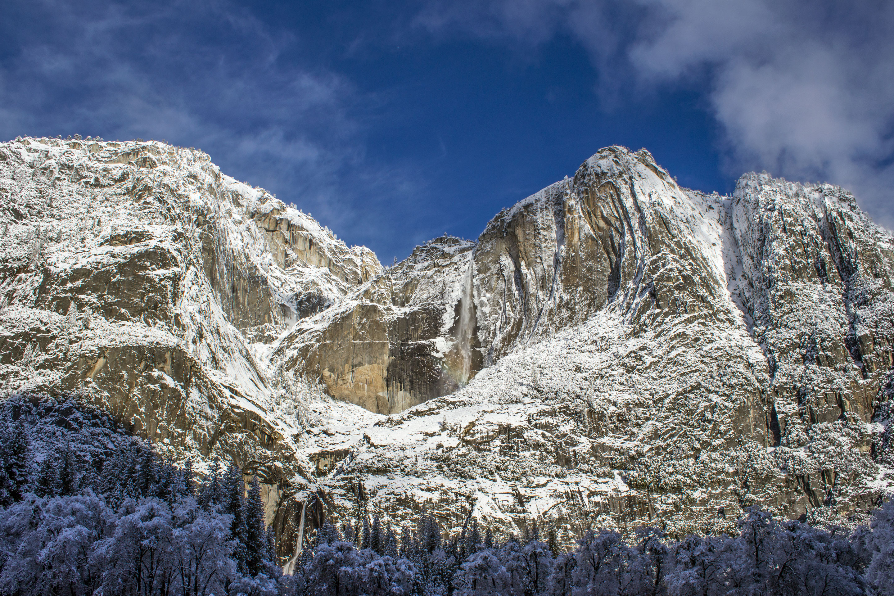
First light on El Capitan's granite face signals your window of opportunity. The parking areas are still quiet, the tour buses haven't arrived. This is when your choice of park entrance matters most—it determines your first view, your traffic experience, and how much morning solitude you'll retain.
NPS via NPS.gov (Public Domain)
Yosemite Entrances: Which One to Use Based on Where You're Going (2026)
8 min read
Best Of
The entrance you choose changes your entire Yosemite trip. Here's which gate to use for the valley, Tuolumne, Hetch Hetchy, and winter access.
This article contains affiliate links — we may earn a small commission at no extra cost to you.
For more, see hiking trails, camping options, and best time to visit.
If You Only Have One Day
Arrive at the Arch Rock Entrance (Highway 140) by 7:30 AM. The $35 per vehicle fee, valid for seven days as of 2026, is your ticket. Drive straight to Curry Village and park. Don't stop for the valley view pullouts yet. From there, walk or take the free shuttle to the Mist Trail trailhead. Start hiking by 8:30 AM.
Your goal is Vernal Fall. The 1.6-mile climb is relentless granite steps, often slick with spray. Your legs will feel it. But reaching the top of that 317-foot cascade, watching the Merced River plunge over the lip, is the single most definitive Yosemite Valley experience. You're in the landscape, not just looking at it. Be back at your car by noon.
Have a quick lunch from your cooler in the Curry Village parking lot. Then, drive the one-way loop through Yosemite Valley. Stop at Valley View for the classic shot of Bridalveil Fall and El Capitan framing the river. Skip the crowded visitor center unless you need a map. Instead, drive out to Tunnel View. This is the panorama you've seen in photographs. It's crowded, but it's essential. Do it last, on your way out.
The mistake that derails one-day visits is trying to do both the valley and Glacier Point or the sequoias. You can't. The roads are too long, the distances too great. Commit to the valley. Use your feet on one real trail. That's the return on your effort.

The Top Experiences, Ranked
#1 - Hiking the Mist Trail to Vernal Fall: The Essential Yosemite Baptism
The Mist Trail to Vernal Fall demands respect—it's not the easiest route, but it's the most direct engagement with the landscape. You'll climb granite steps alongside the waterfall's roar, feel the constant spray, and stand at the 317-foot crest. Allow 2-3 hours, wear footwear that handles wet stone, and be prepared for 600 feet of elevation gain. Start before 9 AM to avoid the human chain that forms by late morning. Many visitors underestimate the mist's intensity; it's a persistent cold spray. Waterproof gear is practical, not excessive. For detailed route planning, consult our Yosemite hiking trails guide.
#2 - Experiencing Tunnel View at Sunset: The Postcard Comes to Life
Yes, it's crowded. Every tour bus stops here. But there's a reason. The view from this parking lot perfectly frames El Capitan on the left, Bridalveil Fall on the right, and the forested valley floor sweeping down between them. It requires no hiking, just the ability to find parking (try the pullouts east of the main lot if it's full). The best tip is to come for the last hour of light. The setting sun warms the face of El Capitan, and the valley sinks into shadow, creating a depth you don't get at midday. Most visitors come at noon, when the light is flat and harsh.
#3 - Biking Yosemite Valley: The Freedom to Roam
A bicycle covers Yosemite Valley's 12 miles of paved paths more efficiently than any vehicle. Rentals are available at Curry Village or Yosemite Valley Lodge. Plan for 1-6 hours depending on your route. The real advantage comes from connecting trailheads—ride from Upper Pines campground to the Mist Trail start at Happy Isles, avoiding shuttle waits and long walks. Few visitors recognize how this bypasses congested roads and parking searches.g.
#4 - Driving Tioga Road to Olmsted Point: The High Sierra Revealed
When it's open (typically late May/June through October), the 46-mile Tioga Road is a journey into a different Yosemite. The air is thin and crisp at 8,000 feet. The goal is Olmsted Point, about an hour from the valley. From here, you look down onto the back of Half Dome, a perspective few ever see. It requires a half-day minimum, and you must check road status - it's closed by snow most of the year. The best tip is to continue another 15 minutes to Tenaya Lake for a picnic by turquoise water. Most visitors never leave the valley, missing this entirely.
#5 - Walking Among Giants in the Mariposa Grove: A Lesson in Scale
Home to over 500 mature giant sequoias, this grove near the South Entrance (Highway 41) forces a recalibration of what "big" means. The Grizzly Giant is roughly 1,800 years old. It requires taking a shuttle from the parking area (which runs seasonally) and at least 90 minutes for the main loop. The best tip is to visit in the late afternoon when the shuttles are less crowded and the light slants through the massive trunks. Most visitors rush through; slow down. Read the signs about fire ecology. These trees need it to survive.
#6 - Watching Climbers on El Capitan: A Silent Spectacle
From the El Capitan picnic area or any pullout along Northside Drive, you can spend an hour with binoculars watching tiny figures ascend the 3,000-foot vertical wall. It requires patience and maybe a picnic lunch. The best tip is to look for portaledges - tiny hanging tents - where climbers spend the night. You might see a pinprick of light from their headlamp after dark. Most visitors give it a quick glance and drive on. Stay a while. It's a masterclass in human endeavor.
#7 - Finding Quiet at the Yosemite Cemetery: Stories in Stone
Tucked away in Yosemite Village, this small, shaded cemetery is the final resting place for early settlers, Native Americans, and park figures. It requires 10-60 minutes of contemplative walking. The best tip is to pick up the self-guiding pamphlet at the nearby museum. Most visitors miss it entirely, but it offers a tangible, quiet connection to the park's layered human history that the grand vistas cannot.

What Most People Miss
The Yosemite History Center at Wawona. Everyone speeds through Wawona on their way to the Mariposa Grove. But the collection of historic buildings here, including a covered bridge and a blacksmith shop, tells the story of tourism before cars. It feels forgotten, in the best way.
The Sound of the Night. After dark, find a pullout away from lodge lights. Turn off your car. Just listen. You might hear the distant rush of the river, the wind in the pines, or the eerie echo of a great horned owl. It's a sensory reset.
Hetch Hetchy Reservoir. While controversial, this valley flooded by a dam in the 1920s offers stark beauty and solitude. The road is open year-round, and the hike to Wapama Falls is superb in spring. You'll see more backpackers than tour groups.
The Museum in Yosemite Village. Next to the crowded visitor center, the museum is often empty. Its exhibits on the Miwok and Paiute peoples provide the crucial context that the rocks and trees alone cannot.

What's Overrated (and Better Alternatives)
The Yosemite Valley Shuttle at Midday. In peak season, the free shuttle becomes a packed, slow-moving ordeal. The better alternative? Your own two feet or a bicycle for distances under two miles. The valley floor is mostly flat. Walking from Curry Village to Yosemite Village takes 25 peaceful minutes along the river path - often faster than waiting for and riding the shuttle.
The "Spirit of Yosemite" Film for Time-Pressed Visitors. It's a fine 20-minute film shown in the theater behind the visitor center. But if you only have a day, your time is better spent outside. The better alternative? Watch the sunset from Valley View. That's the real feature presentation.
Driving Glacier Point Road Just for the Snack Shop. The view from Glacier Point is phenomenal, looking down 3,200 feet onto Half Dome. But the parking lot and facilities can feel like a mall food court. The better alternative? Hike even part of the Four Mile Trail from the valley floor. You'll earn a perspective, not just buy one. Or, if Tioga Road is open, drive to Olmsted Point for a similarly grand, but less crowded, vista.

Practical Takeaways
- Entrance Strategy: For a first-time, one-day valley focus, the Arch Rock Entrance (CA-140) is often the smoothest approach. For sequoias, the South Entrance (CA-41) is logical. The question of which entrance to Yosemite is best is answered by your first stop.
- Parking is the Real Fee: The $35 vehicle pass is the advertised cost. The real currency is a parking spot. Valley lots fill between 9 AM and 10 AM from May through September. Arrive early, or plan to use the year-round shuttles from outlying lots.
- You Cannot Do It All: The park covers nearly 1,200 square miles. Decide between the Valley, Glacier Point, Wawona/Grove, or Tuolumne Meadows. Trying to connect more than two in a day means you'll spend it in your car.
- Water is Non-Negotiable: The air is dry, the sun is intense, and even moderate hikes are dehydrating. Carry at least one liter per person for every two hours you plan to be out. Refill at visitor centers, lodges, or campgrounds.
- Check Road Status Daily: As of spring 2026, Tioga and Glacier Point Roads are closed for snow. This can change rapidly. Call 209/372-0200, press 1 then 1, for the recorded update before you finalize plans.
- Book Ahead for Everything: This applies to lodging, camping options, and even some parking areas. For a complete visitor guide on reservations, see our dedicated page.
- The Best Light is Bookend Light: The valley is deep. Direct sunlight hits the canyon floor from roughly 10 AM to 4 PM. For photography and cooler temperatures, be active early and late. Midday is for rest, museums, or driving to higher elevations.
Your day will be defined by choices made before dawn. Pick an entrance, pick a trail, and commit. The grandeur is a given. Your experience of it is not.
For more information, see our complete National Park Guide.
Related: hiking in yosemite national park guide
Related: hiking in yosemite guide
Recommended Gear
What experienced visitors bring to Yosemite Entrances: Which One to Use Based on Where You're Going (2026)
Links may earn us a commission at no extra cost to you. We only recommend gear we believe in.
Hiking Essentials
Hydration Pack (3L)
Hands-free water for long trail days
Trekking Poles (Pair)
Save your knees on steep descents
Hiking Boots (Ankle Support)
Sturdy footwear for rocky, uneven trails
Sun & Heat Protection
Wide-Brim Sun Hat
Full coverage UPF 50+ protection at altitude
Insulated Water Bottle (32oz)
Keeps water cold in desert heat all day
Electrolyte Mix Packets
Replace what water alone cannot during intense heat
Winter Gear
Microspikes / Traction Devices
Essential for icy rim trails in winter months
Packable Down Jacket
Lightweight warmth that stuffs into a pocket
Sources
- Official source: NPS — Yosemite National Park nps.gov/yose/index.htm
Photo Gallery
More to Explore

Park Guide
Acadia National Park: Carriage Roads, Cadillac Mountain & 2026 Guide
Discover carriage roads, Cadillac Mountain, and rugged Maine coast. Complete 2026 guide to Acadia National Park — trails, fees, lodging, permits, and what rangers recommend.

Hiking Guide
Grand Canyon Hiking Trails: Day Hikes, Water Sources & Rim to Rim
Compare Grand Canyon hiking trails: Bright Angel, South Kaibab, Hermit, Grandview, and rim to rim, with distances, elevation, water stops, and trailhead access for each.

Best Of
Best of Glacier Bay National Park
The best of Glacier Bay is reached by boat: ranger-led day tours up the bay to the tidewater glaciers. What's worth it, how to book, and when to go (2026).

Campsite Guide
White Sands Backcountry Camping: Closed for 2026 — What to Know
As of 2026, backcountry camping at White Sands National Park is closed for site rehabilitation. What that means, and where to camp nearby instead.

Weather Guide
Guadalupe Mountains National Park Weather: Weather
Guadalupe Mountains National Park: weather guide guide updated 2026. Practical visitor information, reservations, and seasonal tips worth bookmarking before

Best Of
Best of Cuyahoga Valley National Park: Best Things to Do
Seeing a Cleveland Orchestra concert with the woods as your backdrop is a uniquely Cuyahoga Valley experience.
Sign in to join the conversation.
Sources & Attribution
Location data courtesy of the National Park Service (U.S. Department of the Interior). NPS data is public domain. Official NPS page.
Images: NPS; NPS; NPS; NPS; NPS.
Map data © OpenStreetMap contributors.
Park operations alerts: NPS.gov · Weather and weather hazards: National Weather Service · Live conditions.
Information may change. Always verify fees, hours, and conditions directly with the official source before visiting.
Did this guide help? Share it with a friend.