This article contains affiliate links — we may earn a small commission at no extra cost to you.
Advertisement
What Hiking Here Actually Means
Most first-time visitors planning a trip focused on hiking in Yosemite Park underestimate one thing: the elevation range. Yosemite National Park covers nearly 1,200 square miles with elevations from about 2,000 feet to 13,000 feet. You can start a hike in 70-degree valley heat and end it in snow at the rim. The park receives 95% of its precipitation between October and May, meaning summer trails are dry but crowded, while spring hikes demand navigating snowfields and swollen creek crossings. Most of Yosemite stays snow-covered from about November through May, so if you're planning hiking in Yosemite National Park between June and October, the window is narrower than you might expect.
Advertisement
This is not a place where you show up and pick a trail randomly. The parking situation at every major trailhead is competitive. The permits for the most famous routes require planning months ahead. Rangers at the visitor center will tell you that the single biggest mistake hikers make is underestimating the distance between trailheads and the time it takes to park, ride the shuttle, and actually start walking.
For a full overview of the park's layout, seasons, and logistics, start with the complete visitor guide.
The One You Should Not Miss
Mist Trail to Nevada Fall
Distance: 7 miles round trip to Nevada Fall. 2.4 miles round trip to Vernal Fall footbridge.
Elevation Gain: 2,000 feet to Nevada Fall. 400 feet to Vernal Fall footbridge.
Trailhead & Parking: Happy Isles Trailhead in Yosemite Valley. The parking lot fills by 8 AM from June through September. Earlier on weekends. Your backup is parking in Curry Village or near Yosemite Village and taking the shuttle. The shuttle stop is a short walk from the trailhead.
The Trail: This is the most popular trail in Yosemite for good reason. It follows the Merced River upstream past two major waterfalls. The lower section to Vernal Fall is paved but steep - granite steps carved into the cliff face. The mist from Vernal Fall soaks everyone who gets within 100 yards of it, and the staircase is essentially a shower in late spring and early summer. Past Vernal Fall, the trail continues climbing granite staircases and a steep section known as the "John Muir Mist Trail junction" before leveling out into a more moderate grade toward Nevada Fall.
The Moment: Standing at the top of Nevada Fall, watching the Merced River drop 594 feet into the canyon below, with Liberty Cap rising across the gorge. You can feel the vibration of the water through the granite under your feet.
What Most Underestimate: How wet the Mist Trail section gets. The granite steps are slick when wet. Waterproof boots help, but traction is more important than dry socks. Also, the 2,000-foot elevation gain feels much harder on the way back down than people expect - your knees will remind you every step of the descent.
Best Time: Late May through June for maximum waterfall flow. But the trail is also good in September when the crowds thin and the heat eases. Start by 7 AM to avoid the midday sun on the exposed granite sections.
Photo: NPS via NPS.gov (Public Domain)
Moderate Hikes
Yosemite Falls Trail
Distance: 7.2 miles round trip to the top. 1 mile round trip to Columbia Rock.
Elevation Gain: 2,700 feet to the top. 1,000 feet to Columbia Rock.
Trailhead & Parking: Camp 4 trailhead in Yosemite Valley. Parking at Camp 4 fills early. The shuttle stops at Camp 4 as well.
The Trail: This is the classic Yosemite Valley waterfall hike. The trail starts with aggressive switchbacks through oak woodland before breaking out into full sun on the canyon wall. The route is steep and sustained - 2,700 feet of gain over 3.6 miles. There are no water sources on trail, so pack extra water for this stretch. The trail to Columbia Rock is a good shorter option at 1 mile round trip with 1,000 feet of gain, giving you a view of Upper Yosemite Fall without committing to the full climb.
The Moment: The view from the top of Upper Yosemite Fall - looking down 2,425 feet of vertical drop into Yosemite Valley, with Half Dome visible to the east.
What Most Underestimate: The exposure. The trail hugs the cliff face in sections with significant drop-offs. Anyone uncomfortable with heights will find the upper third of this trail genuinely challenging. Also, trail runners and sneakers will slip on the loose granite gravel - proper hiking boots with good tread make a real difference here.
Best Time: Late May through early June for the full waterfall flow. By August, the falls are often dry or reduced to a trickle. Early morning is your best bet for cooler temperatures and fewer people.
Sentinel Dome and Taft Point
Distance: 2.2 miles round trip (Sentinel Dome). 2.2 miles round trip (Taft Point). They can be combined into a 5.5-mile loop.
Elevation Gain: 350 feet each. 950 feet combined for the loop.
Trailhead & Parking: Glacier Point Road, approximately 7 miles east of the Glacier Point Road junction. Parking area is small - about 20 spaces.
The Trail: These two short hikes sit along Glacier Point Road and offer some of the best views in the park with relatively modest effort. Sentinel Dome is a granite dome that you can walk up - no climbing required, just a steep but short walk over bare granite. Taft Point offers views directly down into Yosemite Valley from an elevation of about 7,500 feet, with the famous "fissures" - deep cracks in the granite that drop straight down.
The Moment: The 360-degree view from the top of Sentinel Dome - Half Dome, El Capitan, Yosemite Falls, and the High Sierra all visible in a single turn.
What Most Underestimate: The Glacier Point Road opens late in the season - typically May or June, depending on snow. Check road conditions before planning this hike. Also, the dome surface can be treacherous when wet or covered in loose gravel.
Best Time: Late June through October. Late afternoon light is spectacular for photography. Sunset views from Sentinel Dome are among the best in the park.
Strenuous Full-Day Hikes
Half Dome via the Cables
Distance: 14-16 miles round trip, depending on route (Mist Trail or John Muir Trail return).
Elevation Gain: 4,800 feet.
Trailhead & Parking: Happy Isles trailhead. Same parking situation as Mist Trail.
The Trail: This is the hike that defines Yosemite for many visitors. The route follows the Mist Trail to Nevada Fall, then continues past Little Yosemite Valley to the base of Half Dome's iconic granite face. The final 400 feet require ascending the famous cable route - two steel cables running up the steep granite slope. This section is exposed and requires significant upper body strength. Hikers use the cables to pull themselves up the 45-degree granite face.
The Moment: Standing on the summit of Half Dome at 8,842 feet, looking down into Yosemite Valley a mile below, with the entire Sierra Nevada stretching to the horizon.
What Most Underestimate: This is not a hike for beginners. The cables section alone disqualifies anyone with a fear of heights. The total distance and elevation gain make it a legitimate 10-12 hour day. Rangers have pulled multiple hikers off the cables each season for being underprepared. You need gloves - the cables will shred bare hands.
Permits Required: Yes. Half Dome permits are required 365 days per year and are distributed via a lottery system. Apply in March for the season. The park website has exact dates.
Best Time: July through October, after the cables are installed (typically late May) and before winter conditions close the route.
Panorama Trail
Distance: 8.5 miles point-to-point (one way).
Elevation Gain: 2,400 feet total, with 3,200 feet of descent.
Trailhead & Parking: Glacier Point (start) to Happy Isles (end). You need transportation arranged - either park a car at Happy Isles and take the shuttle to Glacier Point, or use the Glacier Point tour bus.
The Trail: Often described as the best one-day hike in Yosemite, this trail connects Glacier Point to the valley floor. It passes Illilouette Fall, Panorama Point (with views of Half Dome, Liberty Cap, and Nevada Fall), and then descends past Nevada Fall into the valley. It effectively combines the Glacier Point overlook with the Mist Trail descent.
The Moment: Panorama Point, roughly 3 miles in, where Half Dome fills the northern view and Nevada Fall crashes below.
What Most Underestimate: The point-to-point logistics. You need transportation from Happy Isles back to Glacier Point if you hiked down, or someone needs to drive the car around. The park shuttle doesn't run to Glacier Point.
Best Time: June through October. The trail uses parts of the John Muir Trail and Mist Trail, both of which can have lingering snow into June. Trail conditions vary by year.
Photo: NPS via NPS.gov (Public Domain)
Short and Easy Hikes
Mirror Lake Loop
Distance: 2 miles round trip (paved) or 5 miles (unpaved loop).
Elevation Gain: Essentially flat.
Trailhead & Parking: Near Curry Village. Parking available but fills. Shuttle stop nearby.
The Trail: A paved path leads to Mirror Lake, set at the base of Half Dome. In early summer, the lake reflects the granite face - the "mirror" effect that gives it the name. By late summer, the lake becomes more of a meadow with a stream running through it. The full loop continues around the lake on a dirt trail.
The Moment: The reflection of Half Dome in the still water of Mirror Lake in May or June.
What Most Underestimate: The mosquitoes in the late afternoon during early summer. Bring repellent.
Best Time: May and June for the actual reflection. The trail is open year-round.
Bridalveil Fall Trail
Distance: 0.5 miles round trip.
Elevation Gain: 80 feet.
Trailhead & Parking: Wawona Road near the Wawona Tunnel entrance. Parking lot holds approximately 100 vehicles.
The Trail: Paved path to the base of Bridalveil Fall, which drops 620 feet. The trail is short enough for anyone, including small children and those with limited mobility. The mist at the base can be heavy in spring.
The Moment: Standing at the base of the fall feeling the cold spray on your face while looking up 620 feet.
What Most Underestimate: The parking lot fills quickly. This is a first stop for many visitors. The trail itself is short but can be slick with water spray.
Best Time: April through June for peak flow. The trail is accessible year-round but be prepared for icy conditions in winter.
Seasonal Trail Conditions
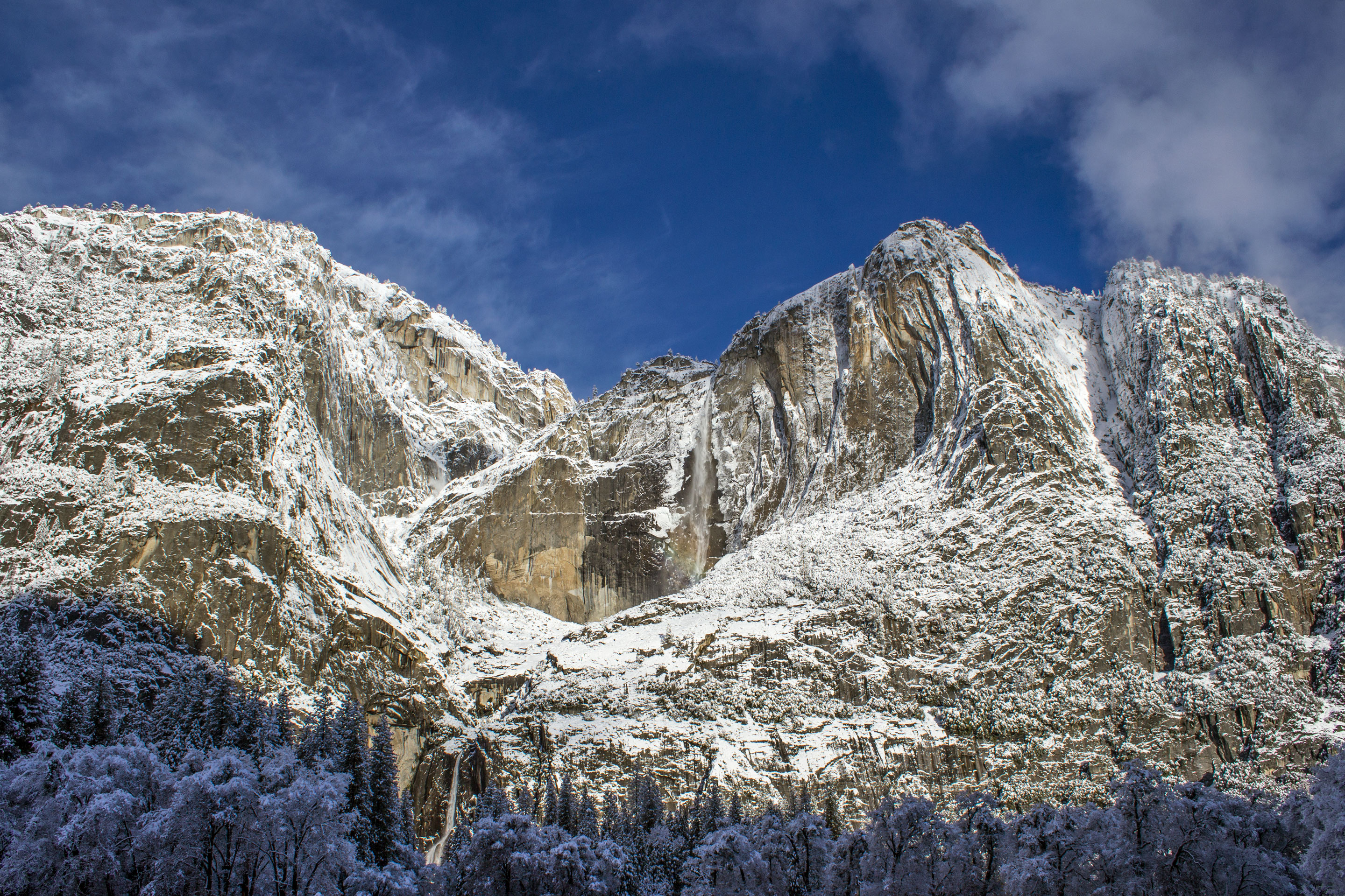
November through May: Most of Yosemite is snow-covered. Trails in Yosemite Valley remain accessible but can be muddy or icy. The Glacier Point Road, Tioga Road, and Mariposa Grove Road all close seasonally. Tioga Pass Entrance closes from approximately November through late May or June. Hiking at higher elevations requires snowshoes or skis.
June: The peak for waterfall flow. Snow lingers on north-facing slopes and at higher elevations. The Mist Trail to Nevada Fall is typically clear by mid-June. Glacier Point Road opens as snow melts - exact timing varies.
July through September: The main hiking season. All trails are generally snow-free above the valley. Water levels drop through the summer - by September, many falls are reduced significantly. This is also fire season. Check air quality before planning long hikes.
October: Excellent hiking conditions. Cooler temperatures, fewer crowds, and fall colors in the valley and lower elevations. Tioga Road often closes by late October. Snow can arrive any time after mid-October at higher elevations.
Photo: NPS via NPS.gov (Public Domain)
Trailhead Logistics
Parking Reality: The Happy Isles lot fills between 7 and 8 AM from June through September. The Yosemite Village lot fills by 9 AM. If you arrive later than that, plan on parking in the Curry Village area or at the Yosemite Village parking structure and taking the shuttle. The shuttle runs every 10-20 minutes during peak season.
Cell Service: Cell service drops out at the valley rim and on most trails. You'll have signal in Yosemite Village and Curry Village. On trail, assume you have no service. Download maps and trail descriptions before you arrive.
Water Sources: Natural water sources on trail (streams, rivers) should be treated - the park recommends boiling or filtering. Most trailheads have water spigots. Fill up before you start. There are no water sources on the Yosemite Falls Trail or the upper section of the Half Dome route.
Bear Canisters: Required for all overnight trips in the Yosemite Wilderness and strongly recommended for day hikes that pass through known bear habitat. The park has bear-proof food storage lockers at many trailheads. If you're backpacking, you must carry an approved canister.
Ranger Station Information: The Yosemite Valley Visitor Center and the wilderness center nearby have current trail conditions, weather forecasts, and permit information. Visit before heading out - conditions change daily, especially in spring.
What to Carry
Footwear: Proper hiking boots with good tread - not trail runners, not sneakers - for the granite slabs and loose gravel found on most Yosemite trails. The Mist Trail's wet granite steps are dangerous in smooth-soled shoes. Boots with ankle support help on the descent, especially on the Yosemite Falls Trail and Half Dome route.
Layers: Elevation changes mean temperature swings of 20-30 degrees. A base layer, fleece or mid-layer, and a windproof shell cover most conditions. The difference between valley floor and Glacier Point can be dramatic.
Water: Yosemite's trails are dry. Carry at least 1 liter per hour of strenuous hiking. For the Half Dome hike, 3-4 liters minimum. There are no water sources on the upper sections of the Yosemite Falls Trail or the upper Mist Trail.
Sun Protection: The combination of high altitude and exposed granite creates intense sun exposure. Sunscreen, a wide-brimmed hat, and sunglasses. The dome hikes (Sentinel Dome, Half Dome) have zero shade.
Traction:Microspikes or similar traction devices for shoulder-season hiking (May, October). The Mist Trail steps can stay icy into June in some years.
Navigation: The trails are well-signed in Yosemite Valley, but the intersecting trails (John Muir Trail, Mist Trail, Pohono Trail) create confusion at junctions. A map or downloaded GPS track prevents going the wrong way.
Bear Safety: Bear spray is not necessary on the valley floor trails - bears here are habituated to humans. Carry it in remote areas if it makes you comfortable, but know that food storage discipline (not leaving food unattended) is more effective than spray in Yosemite.
Photo: NPS via NPS.gov (Public Domain)
Practical Takeaways
Permits for Half Dome are awarded through a lottery system in March. If you don't get one, you can enter the daily lottery two days before your hike - about 50 permits are available through this route.
The Mist Trail is one-way uphill from 8:30 AM to 3:30 PM during peak season. You must use the John Muir Trail for descent during those hours. This rule exists for safety, and rangers enforce it.
Most hikers attempting the Half Dome cables turn around before reaching them. The 400-foot cable section is genuinely intimidating. There is no shame in stopping at the base.
The Glacier Point Road opens in late May or June. Check the park website for the exact date. Don't plan a May hike on Sentinel Dome without confirming road access.
Yosemite receives 95% of its precipitation between October and May. If you're hiking between June and September, rain is unlikely but afternoon thunderstorms in the high country are common - start early and be off exposed ridges by early afternoon.
The shuttle system is free and runs from approximately 7 AM to 10 PM during peak season. It serves all major trailheads in the valley. Use it - parking at trailheads is not reliable after 8 AM.
If you're planning hiking in Yosemite Valley specifically, the Mist Trail to Nevada Fall and the Yosemite Falls Trail are the two signature routes. Pick the one that matches your fitness and start time.
Trail conditions change weekly in spring. Call the ranger station or check the park website before driving to a trailhead that might be snowed in.
Most visitors underestimate the time it takes to complete any hike in Yosemite - the elevation gain is significant even on moderate trails. Plan for 1-2 hours more than the distance would suggest.
The walking trails in Yosemite Valley, including the paved paths and the Mirror Lake Loop, are excellent options for rest days between big hikes. They're also the best hiking trails in Yosemite Valley for families with young children.