The Olympic Trail Scenic Byway follows Highway 101 for roughly 330 miles around the Olympic Peninsula, and the common mistake is trying to do it in a single day. Plan for at least two full days with an overnight stay, or three if you want to actually step into what you're looking at. The byway isn't a point-to-point route so much as a loop circling the park, with spur roads branching off into its distinct ecosystems.
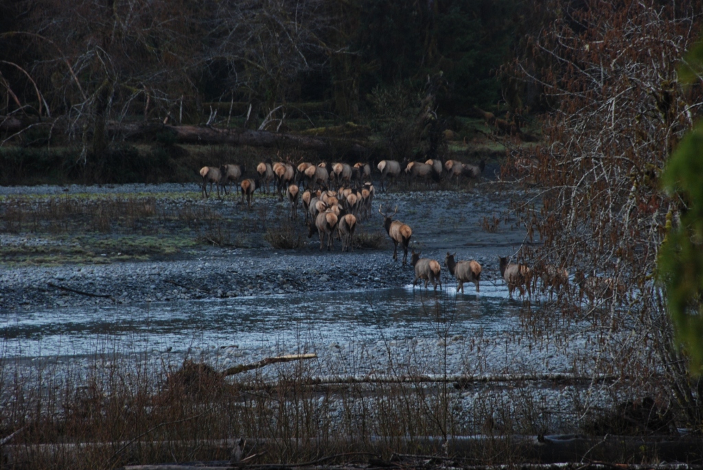
NPS via NPS.gov (Public Domain)
Olympic National Park Scenic Drives: Olympic Trail Scenic Byway
8 min read
Scenic Drives
The Olympic Trail Scenic Byway loops 330 miles around Olympic National Park on Hwy 101. Plan at least two full days with an overnight stay to explore spur roads like Hurricane Ridge.
The Drive at a Glance
- Total distance: Approximately 330 miles around the full loop via Hwy 101
- Typical time: 6-7 hours driving only; 2-3 days with stops and spur roads
- Direction: Two-way loop. Most people drive clockwise from Port Angeles, hitting Hurricane Ridge first, then working south toward the rainforests and coast
- Road surface: Paved throughout. Hwy 101 is a standard two-lane highway
- Vehicle restrictions: None on the main byway. Some spur roads (like Hurricane Ridge Road) have length restrictions for RVs
- Seasonal access: Hwy 101 is open year-round, but spur roads into the park close seasonally. July through September is when everything is accessible
- Best direction: Clockwise from Port Angeles. You hit the mountain views in the morning light and reach the rainforest valleys by afternoon, when coastal fog often burns off
The byway is best driven east to west if you're starting from Olympia - you approach the park through the Hood Canal corridor, which gives you a gradual introduction to the scale of the peninsula. If you're coming from the coast, counterclockwise works fine.

Stop by Stop
Hurricane Ridge (Spur from Port Angeles)
This is the most popular single destination on the byway, and the 17-mile drive up from Port Angeles is the steepest, most dramatic section of road in the park. From the ridge you're looking south across the Olympic Mountains - Mount Olympus itself is visible on clear days, though the Bailey Range tends to hold clouds even when the parking lot is sunny.
What you actually see: A wall of glaciated peaks running east to west. The parking area sits at 5,242 feet. Below you, the Elwha River valley drops away into forest.
Best time: Early morning before 9 AM. Clouds build over the mountains by midday most of the summer. The road is currently closed Monday through Thursday through June 30 due to a water system rehabilitation project, but opens Friday through Sunday. Check the park website for updates before planning your drive.
How long: 30 minutes to look, 1-2 hours if you walk the paved ridge trail
What most visitors miss: The overlook at the end of Hurricane Hill Road (when open) gives a better angle into the Bailey Range than the main parking lot.
Lake Crescent (Hwy 101, mile marker 230)
The lake appears suddenly through the trees - it's 624 feet deep, carved by glaciers, and the water is clear enough to see the bottom near the shore on calm days. The road hugs the south shore for about 12 miles.
What you actually see: A long, narrow lake bordered by steep forested slopes. Storm King Mountain rises 4,500 feet directly from the water's edge.
Best time: Late afternoon light reflects off the water. Morning fog sits on the lake until about 10 AM most summer days.
How long: 20 minutes for a quick pullout stop. The drive along the full shoreline takes about 20 minutes without stopping.
What most visitors miss: The pullout at the east end near the historic lodge has a short path to the water that few people use.
Sol Duc Valley (Spur off Hwy 101)
The 13-mile spur road from Hwy 101 into the Sol Duc Valley follows the Sol Duc River through second-growth forest. The road ends at the Sol Duc Hot Springs area.
From this overlook you can see the Sol Duc River running green through a narrow valley. The old-growth sitka spruce and western hemlock along this road are some of the largest accessible trees in the park.
Best time: Morning light filters through the canopy better before 11 AM.
How long: 30 minutes to drive the spur and back, not counting any stops.
Cell service drops out at about mile 5 on this spur road. Download navigation before you turn off.
Hoh Rain Forest (Spur off Hwy 101)
The 18-mile Hoh River Road takes you from Hwy 101 into the heart of the temperate rainforest. This road ends at the Hoh Rain Forest visitor center. Annual rainfall here exceeds 140 inches.
What you actually see: Moss drapes everything - the branches, the trunks, the fence posts near the ranger station. Bigleaf maple and sitka spruce rise 200 feet. The understory is ferns and sorrel.
Best time: October through April for actual rain forest atmosphere (heavy mist, active streams). Summers are drier and the moss looks less vibrant but the road is easier.
How long: 40 minutes each way on the spur road. The road is narrow with limited pullouts.
What most visitors miss: The turnoff to the Hoh is easy to miss coming from the north - it's at the bottom of a hill with no warning sign until the last moment. The entrance sign is small.
Kalaloch and the Pacific Coast (Hwy 101 along the coast)
The southern section of the byway runs directly along the Pacific coast for roughly 30 miles between Queets and Ruby Beach. This is the flattest, most open stretch of the drive.
What you actually see: Sea stacks rising from the surf, driftwood-covered beaches, and headlands of eroded sedimentary rock. Ruby Beach is the most photographed stop, with its distinctive sea stack formations.
Best time: Late afternoon for direct light on the sea stacks. Low tide exposes tide pools at most beaches.
How long: 15 minutes per pullout. The stretch between beach access points takes about 5 minutes of driving.
What most visitors miss: The trail to the beach at Kalaloch Creek - most people stop at the lodge and miss the beach access a quarter mile south.
Quinault Valley (Spur off Hwy 101)
The 5-mile South Shore Road and 18-mile North Shore Road provide access to the Quinault Rain Forest. Note that the South Shore Road is currently washed out beyond the park boundary as of 2026 and is closed - check the Jefferson County website for updates before heading this way.
What you actually see: Old-growth forest along the shoreline of Lake Quinault. The trees here are among the largest in the park by trunk diameter.
Best time: Morning, when the lake is calm and reflects the surrounding peaks.
How long: The North Shore Road is driveable in about 45 minutes one way.

Timing and Crowds
The byway has a seasonal rhythm that matters more than most scenic drives.
June-September is the window when all spur roads are open. July and August bring the heaviest traffic. Hurricane Ridge parking lot fills by 10 AM in July. The Hoh Rain Forest lot fills by 11 AM. Plan spur road visits for early morning or late afternoon.
September and October bring lighter crowds and good weather. The fall light is better for photography. Hurricane Ridge Road stays open into October depending on snow.
November through May: The low-elevation sections of the byway (Hwy 101, coastal stretch, rainforest valleys) remain accessible. Higher spur roads close with snowfall. Rain is near-daily at lower elevations.
Crowd strategy: Drive the byway clockwise starting from Port Angeles at 7 AM. You'll beat the tour buses by roughly two hours. The busiest section is the Hoh River Road between 10 AM and 3 PM. The least crowded section is the coastal stretch between Kalaloch and Queets - most day-trippers don't push that far south.
Tour buses primarily arrive from Port Angeles and focus on Hurricane Ridge, Lake Crescent, and the Hoh. They tend to arrive between 10 AM and 2 PM. If you're drinking your coffee in the parking lot watching the buses unload, consider yourself warned.

Driving Logistics
Parking at key stops:
- Hurricane Ridge: 150 spaces. Fills by 9:30 AM in summer
- Hoh Rain Forest: 80 spaces. Fills by 10 AM. Overflow parking is along the road, adding a half-mile walk
- Ruby Beach: 40 spaces. Turns over quickly because it's a quick stop
- Lake Crescent Lodge: 50 spaces. Usually available
Gas availability: Port Angeles, Forks, and Aberdeen have gas stations on the loop. The stretch between Forks and Aberdeen is 80 miles with one station in Queets that has irregular hours. Fill up in Forks.
Cell service: Drops out completely on the Hoh River Road, the Sol Duc spur, and most of the coastal section between Kalaloch and Ruby Beach. Service returns in Port Angeles, Forks, and Aberdeen. GPS navigation works offline if you download maps before you leave cell coverage.
RV restrictions: Hurricane Ridge Road has a 20-foot vehicle length limit. Hoh River Road is narrow with tight turns - vehicles over 25 feet will have a difficult time. Hwy 101 itself has no restrictions.
The byway is open 24 hours, but most overlooks and pullouts are unlit. The park has no entrance gates on Hwy 101 itself - you pay at individual developed areas. As of 2026, a private vehicle entrance pass is $30 and covers seven days.

Practical Takeaways
- Start from Port Angeles by 7 AM going clockwise to stay ahead of the bus traffic at the major stops.
- Fill your gas tank in Port Angeles and again in Forks - the 80-mile stretch between Forks and Aberdeen has one unreliable station.
- Download maps offline before you leave cell coverage. Service drops completely on three of the four major spur roads.
- The South Shore Quinault Road is currently washed out and closed - use the North Shore Road instead.
- The 330-mile loop requires at least one overnight. No way around it. Forks makes a practical midpoint.
- July through September is the only window when every spur road and facility is accessible. September gets you better light and fewer crowds.
- Pack rain gear regardless of the forecast. Weather conditions vary dramatically across the park simultaneously - you can drive from 75°F and sunny at Hurricane Ridge into 55°F and drizzle at the Hoh in under 90 minutes.
For a more detailed breakdown of specific destinations and logistics, check the complete visitor guide. If you're planning to combine this drive with actual trail time, the hiking trails page has specifics on trailhead access and conditions. For seasonal timing on specific sections, the best time to visit guide breaks down month-by-month conditions across the park's different elevation zones.
Sources
- Official source: NPS — Olympic National Park nps.gov/olym/index.htm
Photo Gallery
More to Explore

Park Guide
Acadia National Park: Carriage Roads, Cadillac Mountain & 2026 Guide
Discover carriage roads, Cadillac Mountain, and rugged Maine coast. Complete 2026 guide to Acadia National Park — trails, fees, lodging, permits, and what rangers recommend.

Hiking Guide
Grand Canyon Hiking Trails: Day Hikes, Water Sources & Rim to Rim
Compare Grand Canyon hiking trails: Bright Angel, South Kaibab, Hermit, Grandview, and rim to rim, with distances, elevation, water stops, and trailhead access for each.

Best Of
Best of Glacier Bay National Park
The best of Glacier Bay is reached by boat: ranger-led day tours up the bay to the tidewater glaciers. What's worth it, how to book, and when to go (2026).

Campsite Guide
White Sands Backcountry Camping: Closed for 2026 — What to Know
As of 2026, backcountry camping at White Sands National Park is closed for site rehabilitation. What that means, and where to camp nearby instead.

Weather Guide
Guadalupe Mountains National Park Weather: Weather
Guadalupe Mountains National Park: weather guide guide updated 2026. Practical visitor information, reservations, and seasonal tips worth bookmarking before

Best Of
Best of Cuyahoga Valley National Park: Best Things to Do
Seeing a Cleveland Orchestra concert with the woods as your backdrop is a uniquely Cuyahoga Valley experience.
Sign in to join the conversation.
Sources & Attribution
Location data courtesy of the National Park Service (U.S. Department of the Interior). NPS data is public domain. Official NPS page.
Images: NPS; NPS; NPS; NPS; NPS.
Map data © OpenStreetMap contributors.
Park operations alerts: NPS.gov · Weather and weather hazards: National Weather Service · Live conditions.
Information may change. Always verify fees, hours, and conditions directly with the official source before visiting.
Did this guide help? Share it with a friend.