For more, see best time to visit.
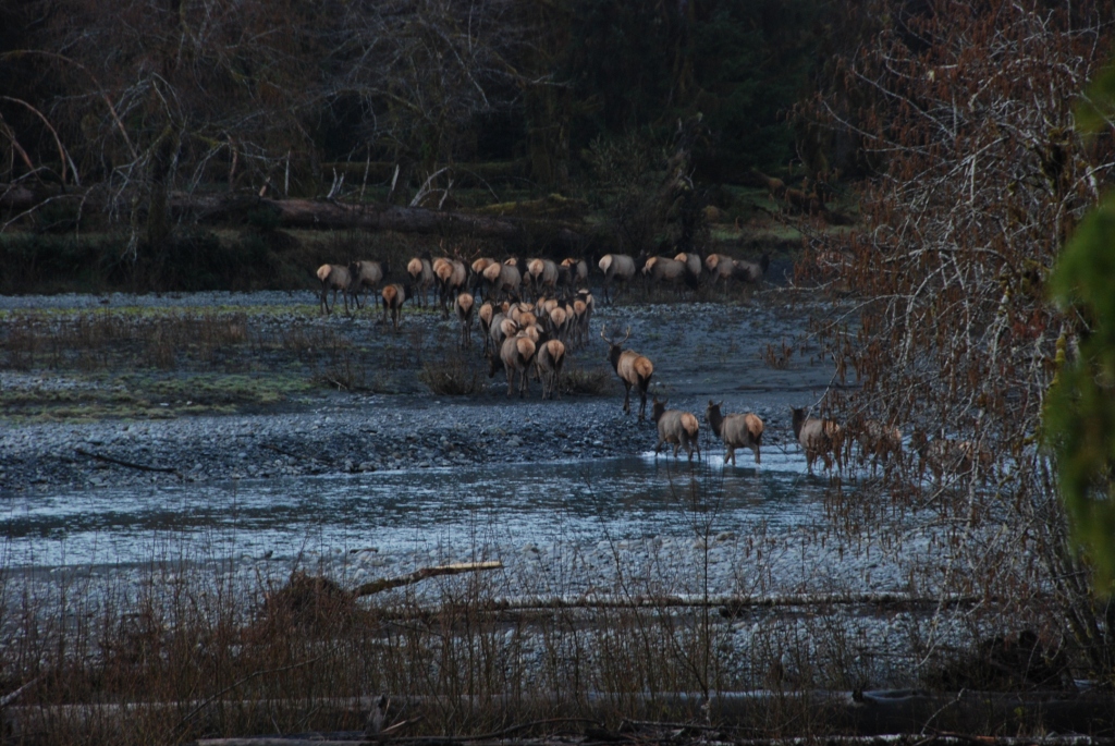
NPS via NPS.gov (Public Domain)
Hiking at Olympic National Park
12 min read
Hiking Guide
Hike rainforests, mountains, and coast in one day? Plan for one Olympic National Park ecosystem daily to avoid the common 101 highway mistake. 2026 guide.
This article contains affiliate links — we may earn a small commission at no extra cost to you.
Flow reliability
Seasonal consistency of median discharge from the curated USGS gauge for this place.
Spring
73%
year-to-year consistency
Summer
78%
year-to-year consistency
Fall
23%
year-to-year consistency
Winter
76%
year-to-year consistency
Median monthly discharge (cfs)
| Jan | Feb | Mar | Apr | May | Jun | Jul | Aug | Sep | Oct | Nov | Dec |
|---|---|---|---|---|---|---|---|---|---|---|---|
| 3090 | 1970 | 1955 | 1885 | 1840 | 1615 | 1170 | 796 | 620 | 1280 | 3280 | 2950 |
In the last 10 falls, roughly 2 of every 7 September–November weeks sat inside this band (1070–2740 cfs); typical flow in those weeks 1750 cfs.
Computed from 10 years of USGS daily records, station 12041200 (3,651 daily values). Last computed Oct 19, 2026.
Hydrological description only — not advice about wading, floating, or whether conditions are safe for recreation. Always check current USGS readings and local guidance before you go.
Olympic National Park Hiking: Hoh Rainforest, Hurricane Ridge & Coastal Trails (2026 Guide)
Hiking Olympic National Park requires you to be ready for three distinct environments in one day. You might begin in a dripping rainforest on soft, root-laced trails, drive an hour to a mountain ridge with thin air and sharp sunlight, and finish on a beach trail of barnacle-crusted logs and slick kelp. That's the core challenge and reward. Most first-timers underestimate travel time between trailheads—the park spans nearly a million acres, and Highway 101 is a winding, slow corridor. A common mistake is trying to sample all three zones in a single hike. It's not feasible. Plan for one ecosystem per day, or you'll spend more time in your car than on the trail.
Your physical preparation needs to match the zone. The rainforest trails are flat but technically demanding on ankles and knees with their endless roots. The mountain trails are all about sustained cardio on exposed switchbacks. The coastal routes are a full-body scramble over tidal obstacles. Hiking here isn't about picking a difficulty level; it's about picking a terrain type and having the right footwear for it. Rangers will tell you that the weather in one zone tells you nothing about the weather in another. It can be 75 and sunny at Lake Crescent while a cold fog shrouds Rialto Beach. Pack for all of it, every time.
Hoh Rain Forest Hall of Mosses & Spruce Nature Trail: The Quintessential Drip
This hike isn't about views; it's about atmosphere. The air is thick with the scent of decaying cedar and wet earth, and the sound is a constant, quiet drip. These two short loops offer the most accessible way to experience a temperate rainforest firsthand.
Distance: 1.2 miles combined for both loops.
Elevation Gain: Minimal, under 100 feet.
Trailhead & Parking: The Hoh Rain Forest Visitor Center lot is the only option. It's a 90-minute drive from Forks. The lot is often full by 10:30 AM on summer weekends. Rangers will turn you away at the entrance station if there's no parking. Your best bet is to arrive before 9 AM or after 3 PM. There is no cell service for the final 45 minutes of the drive.
The Trail: The path is a packed dirt and gravel loop, boardwalked in the wettest sections. The Hall of Mosses loop is the shorter, more popular one, where maple trees are draped with clubmoss that hangs like green velvet. The Spruce Nature Trail follows the glacial-blue Hoh River for a stretch. The ground is a network of roots - watch your footing.
The Moment: Standing perfectly still in the middle of the Hall of Mosses loop, listening to the separate, distinct drips from a hundred different leaves.
What Most Underestimate: The chill. Even on a warm summer day, the temperature under the canopy can be 15 degrees cooler. You'll want a light jacket.
Best Time: Any day of the year, but the green is most intense from April through June. Go at opening to have the boardwalks to yourself.
Hurricane Hill via Hurricane Ridge: The Mountain Payoff
This is the park's signature mountain vista. On a clear day, the 360-degree view takes in the Strait of Juan de Fuca, Vancouver Island, the Bailey Range, and Mount Olympus itself. The trail is paved, which doesn't make it easy - it just makes the incline very, very consistent.
Distance: 3.2 miles roundtrip.
Elevation Gain: 700 feet.
Trailhead & Parking: Start at the Hurricane Ridge Visitor Center parking lot. Note: As of April 2026, Hurricane Ridge Road is subject to sudden closure for weather. Always check the road status line (360-565-3131) before you go. The lot at the ridge fills quickly; on a sunny summer Saturday, it can be full by 9 AM. Overflow parking along the road is not permitted.
The Trail: It's a wide, paved path that climbs steadily through subalpine meadows. The trail narrows here, about halfway up, as it traverses a slope. The pavement is a blessing for early season hiking when other trails are muddy or snow-covered. It's fully exposed to sun and wind.
The Moment: Reaching the summit shelter and looking south to see the massive, white glaciers of Mount Olympus seemingly floating above the sea of green peaks.
What Most Underestimate: The wind. It's almost always blowing, and it cuts through light layers. Bring a windbreaker, even if it's calm at the trailhead.
Best Time: July through September, when the wildflowers are out and the road is reliably open. Start early to beat the crowds and the afternoon haze.

Rialto Beach to Hole-in-the-Wall: The Coastal Trek
This is a hike where your destination is dictated by the Pacific Ocean's schedule. Hole-in-the-Wall is a sea arch you can walk through, but only at low tide. This makes hiking here a tactical exercise in timing.
Distance: 3.8 miles roundtrip to the arch.
Elevation Gain: Negligible.
Trailhead & Parking: Rialto Beach parking lot. It's large but fills up on summer afternoons. There's a vault toilet here. You'll need a wilderness permit for any overnight stay, but not for the day hike.
The Trail: The first section is hard-packed sand and pebbles. After about a mile, you'll reach the "stacks" - massive sea stacks just offshore. The terrain becomes a mix of sand, larger rocks, and driftwood you must climb over or around. Check a tide chart before you go; you need to round Ellen Creek at low tide to reach the arch safely. Rangers post tide tables at the trailhead.
The Moment: Walking through the dripping, barnacle-encrusted tunnel of Hole-in-the-Wall at a low tide, with tide pools on either side holding green anemones and purple sea stars.
What Most Underestimate: The creek crossing. Ellen Creek can be knee-deep and swift, especially after rain. Many people bring sandals to change into for the crossing.
Best Time: Summer, for the lowest tides during daylight hours. Aim to start your hike 1-2 hours before low tide to give yourself maximum time.
Sol Duc Falls Nature Trail: The Shortcut to Spectacle
This is the most waterfall for the least effort in the park. In under a mile, you're standing on a bridge watching the Sol Duc River fracture into four separate channels and plunge into a narrow gorge. The sound is a constant, powerful roar.
Distance: 1.6 miles roundtrip.
Elevation Gain: 200 feet.
Trailhead & Parking: The trail begins at the end of Sol Duc Hot Springs Road, at the Sol Duc Falls parking area. The lot is moderate-sized and often full by midday. If it's full, do not park along the road - rangers ticket. Consider visiting in the late afternoon.
The Trail: A well-maintained dirt path through old-growth forest of Douglas fir and cedar. It's a gentle climb the whole way to the falls. The trail can be muddy, but boardwalks cover the wettest sections. It's family-friendly but not stroller-friendly due to roots and steps.
The Moment: The first glimpse of the falls from the wooden bridge, feeling the spray on your face.
What Most Underestimate: The popularity. This is a social trail. If you want solitude, you won't find it here between 10 AM and 4 PM. For a quieter experience, continue past the falls on the Lovers Lane Trail.
Best Time: Late spring, when the snowmelt swells the river, or fall, when the maple trees along the trail turn gold.

Seven Lakes Basin/High Divide: The Backpacker's Loop
This is the iconic multi-day trek for a reason. It offers a sampler of everything Olympic has to offer: old-growth forest, ridge-top walking with endless views, and alpine lakes so clear you can see the trout. It's also highly competitive to get a permit for.
Distance: 18.2 mile loop.
Elevation Gain: Approximately 4,000 feet.
Trailhead & Parking: Sol Duc Trailhead. A large lot with a vault toilet. It fills with day hikers and backpackers. You must have a bear canister for food storage - they are available for rent at the Wilderness Information Center in Port Angeles.
The Trail: The climb out of the Sol Duc valley is relentless. You'll gain most of your elevation in the first few miles under dense forest canopy. The trail opens up dramatically at the High Divide, a narrow ridge with staggering views into the Hoh River valley and onto the blue ice of Mount Olympus's glaciers. The section past Heart Lake is exposed and can hold snowfields well into August.
The Moment: Waking up at dawn at one of the lakeside campsites (like Lunch Lake) to see the first light hit Mount Olympus, turning the glaciers pink.
What Most Underestimate: The mosquitoes. From late July through August, the basin lives up to its reputation. A head net and strong repellent are non-optional.
Best Time: Mid-July through September, once the snow has melted off the High Divide. Permits are required for all overnight stays and are available via recreation.gov lottery months in advance.
Mount Storm King: The Brutal Climb for a View
This trail answers one question: how badly do you want that photo? It's a short, brutally steep climb that ends with a notorious, non-technical but exposed scramble using fixed ropes. The park service does not maintain the ropes, and they are there because people kept falling.
Distance: 4.0 miles roundtrip.
Elevation Gain: 2,100 feet.
Trailhead & Parking: Starts at the Storm King Ranger Station at Lake Crescent. Use the same parking lot as for the Moments in Time Trail. It fills early.
The Trail: The first mile is a pleasant walk along the lake. Then you hit the sign that says "Mount Storm King Trail" and the trail goes straight up. It's a relentless series of switchbacks on loose dirt and rock. The final 0.2 miles requires pulling yourself up steep, sandy slopes using weathered ropes anchored to trees. This is not a hike - it's a climb.
The Moment: Sitting on the rocky outcrop at the summit, your legs shaking, looking down 1,500 feet to the brilliant blue of Lake Crescent.
What Most Underestimate: The ropes section. It is dangerous when wet or crowded. If there's a line of people, turn around. It's not worth the risk.
Best Time: A dry summer day. Never attempt this in rain or if the forecast calls for it. The ropes and dirt become slick as ice.

Shi Shi Beach to Point of the Arches: The Wilderness Coast
This is the postcard image of the Olympic coast. Sea stacks, tide pools, and a two-mile stretch of wild beach. It's also a muddy, log-strewn journey that requires planning for tides and a shuttle.
Distance: 8.0 miles roundtrip to the Point and back.
Elevation Gain: 200 feet (but countless ups and downs over headlands).
Trailhead & Parking: The trailhead is on the Makah Indian Reservation, not NPS land. You need a Makah Recreation Pass (sold locally) to park. The lot is known for break-ins; leave nothing in your car. The first 2 miles to the beach are on a notoriously muddy trail through private land.
The Trail: Descend to the beach via a rope-assisted drop-off. Once on Shi Shi Beach, you hike on sand, around driftwood, and across several small streams. Reaching the iconic Point of the Arches requires rounding a headland at low tide. A printed tide chart is mandatory.
The Moment: Watching the sunset from the southern end of Shi Shi, with the sea stacks of Point of the Arches silhouetted against the orange sky.
What Most Underestimate: The mud. The initial trail can be shin-deep in places. Gaiters are highly recommended, and you will get dirty.
Best Time: Summer for stable weather and low tides. Consider this a full-day commitment.
Seasonal Trail Conditions
Your hike is dictated by the month on the calendar. Here's what you're actually signing up for.
June: Snow lingers above 4,000 feet. High Divide and other alpine routes are likely still snow-covered and require navigation skills and traction devices. River crossings are high and fast with snowmelt. Rainforest and coastal trails are prime, but expect mud.
July & August: The prime window. Most high-elevation trails become snow-free by mid-July. Mosquitoes peak in the basins. Coastal areas can be foggy in the morning, burning off by afternoon. This is the only reliable time to attempt high alpine loops without significant snow travel.
September & October: The best time for high country hiking. Bugs are gone, crowds thin, and the air is clear. Snow can return to the highest passes by mid-October. This is also when you can see salmon spawning at places like Salmon Cascades on the Sol Duc River.
November through May: Hurricane Ridge Road is open sporadically for winter recreation; check the road status daily. Most high country trails are inaccessible under snow. Rainforest and coastal trails are hikeable year-round, but prepare for relentless rain, shorter days, and the potential for washed-out roads (like the ongoing South Shore Quinault Road closure).

Trailhead Logistics
The parking situation determines your day. Plan your attack.
For Hoh Rain Forest and Hurricane Ridge, the rule is the same: be in the parking lot by 9 AM or plan for a late afternoon arrival. There is no overflow. Rangers will close the entrance when lots are full. For coastal trails like Rialto or Shi Shi, afternoons are often less crowded as day-trippers leave.
Cell service drops out at almost every major trailhead. Download offline maps and trail information before you leave Port Angeles or Forks.
All overnight backpackers must secure a permit in advance via recreation.gov and carry a bear canister. These are checked by rangers. You can rent them from the Olympic National Park Wilderness Information Center in Port Angeles - this is your single best source for current trail conditions, snow levels, and beta.
Water sources are abundant in rainforest and mountain zones, but you must filter it. On the coast, fresh water comes from streams crossing the beach; time your crossings with low tide and filter thoroughly.
What to Carry
Forget the generic list. For hiking at Olympic National Park, these items move from "nice to have" to essential.
Footwear: This is the most important choice. For rainforest and muddy coastal approaches, waterproof hiking boots with aggressive tread are non-negotiable. For the dry, paved Hurricane Hill trail, trail runners are fine. For the rocky, uneven beach hikes, sturdy boots that support your ankles over slippery logs and rocks.
Layers: A moisture-wicking base layer, a warm mid-layer (fleece or puffy), and a waterproof/windproof shell. You will use all three, possibly in the same hour.
Navigation: A physical map and compass. GPS devices are fine until the batteries die or the dense canopy blocks signal. Many trail junctions in the backcountry are poorly signed.
Lighting: A headlamp with fresh batteries. Days are short in the off-season, and forest trails get dark fast.
Water Capacity: Carry at least two liters per person. While you can filter from streams in many areas, long stretches on the coast or ridge tops have no water.
Tide Chart & Watch: For any coastal hike. A digital photo on your phone is fine, but know your turn-around times.
Practical Takeaways
- Treat the park's three zones (coast, rainforest, mountains) as separate parks. Dedicate a full day to exploring one.
- The 9 AM parking deadline is real for Hoh, Hurricane Ridge, and Sol Duc. Plan to arrive early or late.
- Your rain jacket is the most important piece of gear you own here. The second is a pair of waterproof, broken-in hiking boots.
- Check road statuses daily. As of 2026, Hurricane Ridge Road can close for weather any time, and other roads like Graves Creek are under long-term repair.
- For coastal hikes, a tide chart is more important than your map. Know your safe passage windows.
- Backcountry permits for popular loops like Seven Lakes Basin are competitive. Apply for the lottery on recreation.gov months in advance.
- Bear canisters are required for all overnight food storage. Rangers do check, and rentals are available in Port Angeles.
- The weather at your trailhead is irrelevant. Pack layers for cold, wind, and wet conditions regardless of the forecast.
- Download offline maps. Cell service is non-existent at most trailheads and along most trails.
- For a broader context on trip planning, including entrance details, our complete visitor guide can help structure your overall visit. Once your hikes are planned, you can explore the park's camping options for where to stay. Always verify the best time to visit based on current conditions, as weather patterns shift yearly.
For more information, see our complete National Park Guide.
Related: hiking in olympic national park guide
Related: hiking olympic national park guide
Recommended Gear
What experienced visitors bring to Hiking at Olympic National Park
Links may earn us a commission at no extra cost to you. We only recommend gear we believe in.
Hiking Essentials
Hydration Pack (3L)
Hands-free water for long trail days
Trekking Poles (Pair)
Save your knees on steep descents
Hiking Boots (Ankle Support)
Sturdy footwear for rocky, uneven trails
Sun & Heat Protection
Wide-Brim Sun Hat
Full coverage UPF 50+ protection at altitude
Insulated Water Bottle (32oz)
Keeps water cold in desert heat all day
Winter Gear
Microspikes / Traction Devices
Essential for icy rim trails in winter months
Packable Down Jacket
Lightweight warmth that stuffs into a pocket
Sources
- Official source: NPS — Olympic National Park nps.gov/olym/index.htm
Photo Gallery
More to Explore

Park Guide
Acadia National Park: Carriage Roads, Cadillac Mountain & 2026 Guide
Discover carriage roads, Cadillac Mountain, and rugged Maine coast. Complete 2026 guide to Acadia National Park — trails, fees, lodging, permits, and what rangers recommend.

Hiking Guide
Grand Canyon Hiking Trails: Day Hikes, Water Sources & Rim to Rim
Compare Grand Canyon hiking trails: Bright Angel, South Kaibab, Hermit, Grandview, and rim to rim, with distances, elevation, water stops, and trailhead access for each.

Best Of
Best of Glacier Bay National Park
The best of Glacier Bay is reached by boat: ranger-led day tours up the bay to the tidewater glaciers. What's worth it, how to book, and when to go (2026).

Campsite Guide
White Sands Backcountry Camping: Closed for 2026 — What to Know
As of 2026, backcountry camping at White Sands National Park is closed for site rehabilitation. What that means, and where to camp nearby instead.

Weather Guide
Guadalupe Mountains National Park Weather: Weather
Guadalupe Mountains National Park: weather guide guide updated 2026. Practical visitor information, reservations, and seasonal tips worth bookmarking before

Best Of
Best of Cuyahoga Valley National Park: Best Things to Do
Seeing a Cleveland Orchestra concert with the woods as your backdrop is a uniquely Cuyahoga Valley experience.
Sign in to join the conversation.
Sources & Attribution
Location data courtesy of the National Park Service (U.S. Department of the Interior). NPS data is public domain. Official NPS page.
Images: NPS; NPS; NPS; NPS; NPS.
Map data © OpenStreetMap contributors.
Park operations alerts: NPS.gov · Weather and weather hazards: National Weather Service · Live conditions.
Information may change. Always verify fees, hours, and conditions directly with the official source before visiting.
Did this guide help? Share it with a friend.