Crater Lake National Park weather is defined by one number: 41. That's the average annual snowfall in feet at park headquarters. The lake sits at 6,178 feet, and the rim climbs another thousand feet above that. This altitude, combined with its position in the Cascade Range, means the park operates on a different calendar than the valleys below. The single most important climatic truth is that summer is short, winter is immense, and the lake is completely hidden by clouds roughly half the time from November through May. Planning your visit isn't just about comfort - it's about whether you'll see the lake at all. For a broader look at park logistics, our complete visitor guide covers the essentials.
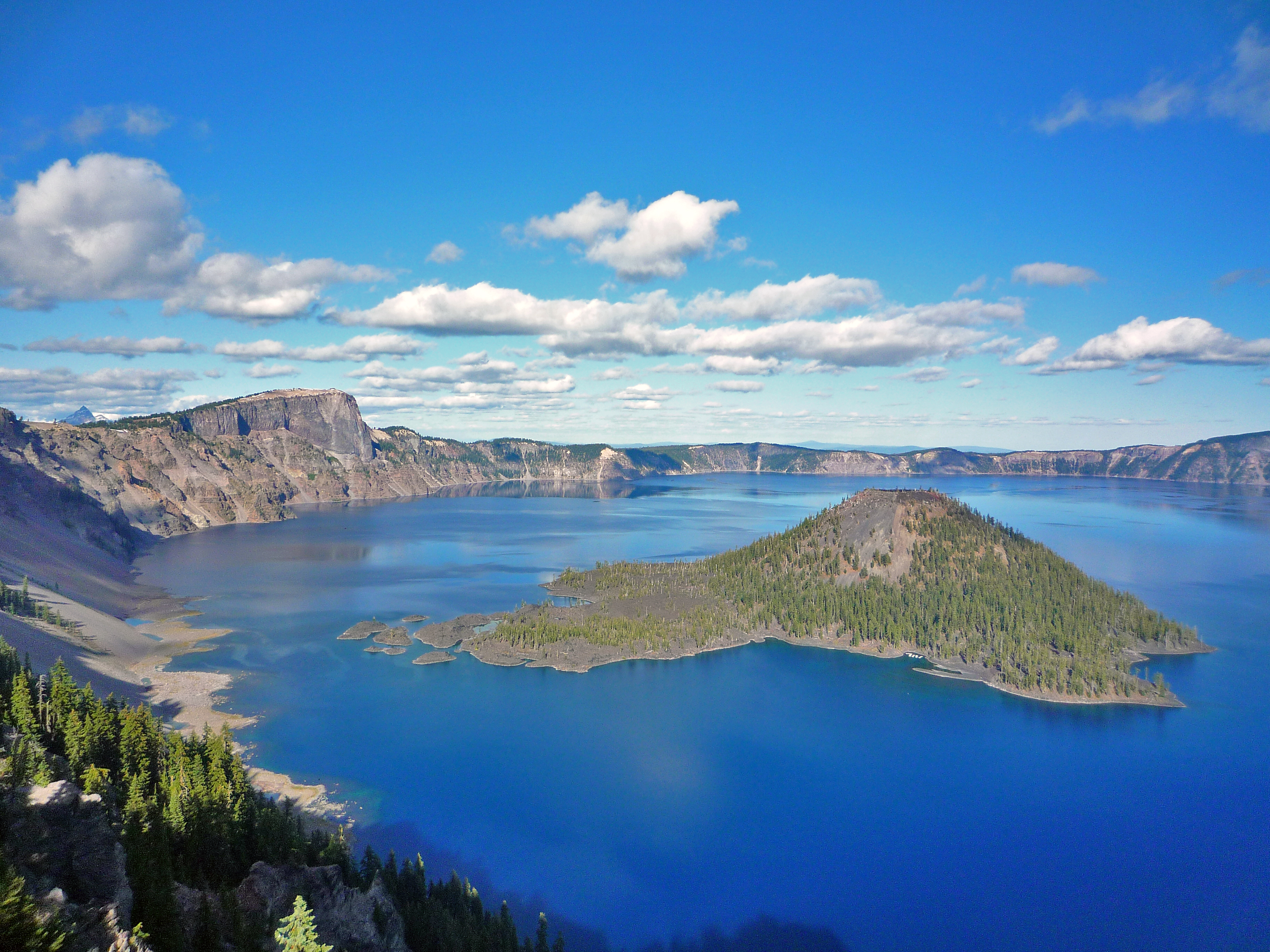
NPS via NPS.gov (Public Domain)
Crater Lake National Park Weather
8 min read
Weather Guide
Crater Lake gets 41 feet of snow annually. Plan your 2026 visit around the short summer and clear lake views with our essential weather guide.
The Weather Reality
The official forecasts for Medford or Klamath Falls are irrelevant. Crater Lake creates its own weather. Storms rolling in from the Pacific hit the high rim and dump their moisture as snow, a process that can happen in any month. The park receives more snowfall than almost any inhabited place in the United States. This creates two distinct realities: a brief, intense window of accessibility from roughly July to September, and a seven-month season defined by deep snowpack and limited access. The sun is intense at this elevation when it shines, but the air temperature can be 30 degrees cooler than in the nearby towns. Rangers will tell you that the most common visitor mistake is underestimating the cold, even on a sunny August afternoon. The wind on the exposed rim can strip heat from you in minutes.

Month by Month
Forget generic seasons. Here's what you'll actually face, month by month.
November - April: The Snow Season
This is winter. The North Entrance and Rim Drive are closed. Access is via the West or South Entrances only, leading to Rim Village. The park is open, but you're visiting a snowfield.
* Temperatures: Highs struggle to reach freezing, often in the 20s (°F). Lows plummet into the single digits or below zero. Wind chill is a serious factor.
* Precipitation: Almost exclusively snow. Storms are frequent, dumping multiple feet at a time. Annual snowfall averages 41 feet (13.5 meters).
* What's Open: The road to Rim Village, the cafeteria, and gift shop at Rim Village (weather permitting). The visitor center at park headquarters is open. All campgrounds are closed. The gas station at Mazama Village is closed for the season - a critical detail.
* Crowds: Very low, except on peak holiday weekends for snow play.
* Activity: This is the domain of snowshoers and cross-country skiers. Rangers lead guided snowshoe walks. The lake is visible only on clear days between storms - about 50% of the time it's shrouded in cloud.
* The Challenge: Extreme cold, road hazards, and the very real possibility of driving for hours only to see a wall of white fog where the lake should be.
May - June: The Thaw (Mostly)
This is the most unpredictable shoulder season. Crews are plowing Rim Drive, a monumental task.
* Temperatures: Daytime highs range from 40s to 60s. Nights are cold, often below freezing. Snow lingers everywhere.
* Precipitation: A mix of rain, sleet, and snow. Sunny mornings can turn to whiteout afternoons.
* What's Open: The West and South Entrances are open. Rim Drive begins to open section by section, typically with the West Rim by early June. The North Entrance and East Rim Drive usually open in late June or early July. Campgrounds start opening in June, weather-dependent.
* Crowds: Moderate and increasing as schools let out.
* Wildlife: Elk are often seen in the meadows near park headquarters as snow recedes.
* Trail Conditions: Most trails are snow-covered, muddy, or impassable. Hiking often requires snow gear well into June.
* The Upside: If you hit a clear day, you get views with fewer people. The contrast of deep blue water against snow-covered rim is what photographers wait for.
July - August: The Short Summer
This is the window everyone aims for. It's also the only time you can reasonably expect dry trails and a full circuit of the lake.
* Temperatures: Pleasant but not hot. Daytime highs at the rim average 65-75°F. Nighttime temps drop into the 40s. The sun is intense; the shade is cold.
* Precipitation: Low chance, but afternoon thunderstorms can pop up, especially in August.
* What's Open: Everything, barring unexpected snow or fire. Rim Drive is fully open. All campgrounds, lodges, and boat tours operate. Note: As of 2026, the Cleetwood Cove Trail is closed for major rehabilitation, meaning there is no lake access for swimming or boat tours.
* Crowds: High, especially on weekends. Parking at popular overlooks fills by mid-morning.
* Wildflowers: Peak bloom in meadows and along Rim Drive happens in late July and August.
* The Reality: This is the only time for standard high-country hiking. For details on trail conditions during this brief season, see our guide to hiking trails.
September - October: The Fall Slide
Days shorten, temperatures drop rapidly, and the first major snowstorms can arrive as early as late September.
* Temperatures: A rapid decline. September highs can be in the 60s, dropping to the 50s in October. Overnight frost is a given by October.
* Precipitation: Increasing rain and snow showers. The first major closure snowstorm can happen anytime in October.
* What's Open: Facilities begin closing after Labor Day. The lodge and some services close by early October. Rim Drive remains open until the first heavy snow closes it, often in late October.
* Crowds: Drop significantly after Labor Day. September weekends are busy, October is quiet.
* Fall Color: Not a broad deciduous display, but aspens and other shrubs in the park's valleys turn gold in late September.
* The Gamble: September can offer summer conditions with fewer people. October is a roll of the dice between glorious, crisp days and a winter storm warning.

Best Times for Specific Activities
* Hiking the High Country: Your window is late July through mid-September. Before that, expect significant snowpack on trails like Garfield Peak or Mount Scott. After, early snow is a threat.
* Wildlife Viewing: Elk are most visible in spring (May-June) in lower meadows and fall during the rut. Clark's nutcrackers and gray jays are common year-round at rim overlooks.
* Wildflowers: Aim for late July and August. Look for lupine, paintbrush, and penstemon in the meadows along the Rim Drive and Castle Crest Wildflower Trail.
* Fall Color: Late September in the Annie Creek Canyon area and along the road to the Pinnacles.
* Stargazing: Excellent year-round on clear nights, but the best combination of warm temperatures and dark skies is August and September. The new moon period is ideal.
* Winter Sports: Prime snowshoeing and cross-country skiing runs from December through March. The park groses trails from Rim Village.

What to Pack by Season
This isn't a generic list. It's what you need for Crater Lake's specific demands.
Summer (July-August): Sun protection is non-negotiable - high-SPF sunscreen, sunglasses, and a wide-brimmed hat. The UV radiation is extreme at this altitude. Pack layers: a moisture-wicking base layer, a fleece or insulated jacket, and a windproof/waterproof shell. Hiking pants are better than shorts. Sturdy boots. Two liters of water per person, minimum. A headlamp.
Shoulder Seasons (May-June, Sept-Oct): Everything from the summer list, but lean heavier on insulation. A warm hat and gloves are essential, even for a daytime visit in May or October. Waterproof boots with good traction for mud and slush. Traction devices like microspikes are a wise precaution for early-season hiking on icy trails.
Winter (Nov-April): This is serious cold-weather expedition packing. Insulated, waterproof boots with thick socks. Heavy winter coat, snow pants, insulated gloves, and a balaclava or neck gaiter. Goggles are better than sunglasses in blowing snow. Always have extra layers, food, and water in your vehicle in case you get stuck. A full tank of gas before you enter the park is mandatory - there is no gas available inside.

What the Forecast Doesn't Tell You
- The Wind Chill Equation: The forecast might say 55°F and sunny. It won't say that a 25-mph wind on the exposed rim makes it feel like 35°F. That shell jacket is your most important layer.
- Microclimates on the Rim: It can be clear and calm at the visitor center and a howling, foggy blizzard at Rim Village ten minutes later. Conditions change over very short distances.
- Road Ice in the Shade: As the alerts state, roads may be icy even on sunny days, especially in mornings and evenings. That shaded curve on Rim Drive can be a skating rink long after the sun has dried other sections.
- The "Snow Ghost" Effect: In winter, rime ice coats the trees on the rim, creating spectacular "snow ghost" formations. This happens during freezing fog events, which also mean zero lake visibility.
- Altitude Sickness is Possible: While not as common as in higher Rockies parks, the sudden ascent to over 7,000 feet can cause headaches or shortness of breath for some visitors. Hydrate more than you think you need to.
- Lightning Risk on High Points: Afternoon thunderstorms in late summer can produce sudden lightning. If you're hiking on a peak like Mount Scott or Garfield Peak, start early to be descending by early afternoon.
- The Gas Station is Seasonal: This bears repeating. The gas station at Mazama Village is closed from fall through spring. Running out of fuel means an expensive tow. Fill up in Chemult, Fort Klamath, or Prospect.
Practical Takeaways
- Target Late July to Early September for reliable access to roads, trails, and clear views of the lake. This is the core of Crater Lake National Park weather.
- Always Pack for Winter, even in summer. At minimum, carry a warm jacket, hat, and gloves in your car. The temperature drop from day to night is drastic.
- Check Road Status Religiously. The park's website updates which roads are open (Rim Drive, North Entrance) daily during the shoulder seasons. A planned July drive around the lake can be scuttled by a late-season snowstorm.
- Winter Visits Require a Contingency Plan. Have alternative activities in mind (snowshoeing, visiting the visitor center) and accept that seeing the lake is a 50/50 proposition. The journey is the destination.
- Hydrate and Use Sunscreen Aggressively during summer. The high elevation means faster dehydration and severe sunburn potential.
- Arrive Early or Late. To avoid peak crowds in summer, be at an overlook by 8 AM or after 5 PM. The light is better then, anyway.
- Verify Current Conditions. Before you go, check the official NPS website or call the visitor center for the latest on trail closures (like the ongoing Cleetwood Cove project), road conditions, and weather alerts. What's true in 2026 may change by your visit.
For details on where to stay during your weather-optimized visit, including seasonal lodge and camping options, consult our dedicated guides.
Sources
- Official source: NPS — Crater Lake National Park nps.gov/crla/index.htm
Photo Gallery
More to Explore

Park Guide
Acadia National Park: Carriage Roads, Cadillac Mountain & 2026 Guide
Discover carriage roads, Cadillac Mountain, and rugged Maine coast. Complete 2026 guide to Acadia National Park — trails, fees, lodging, permits, and what rangers recommend.

Hiking Guide
Grand Canyon Hiking Trails: Day Hikes, Water Sources & Rim to Rim
Compare Grand Canyon hiking trails: Bright Angel, South Kaibab, Hermit, Grandview, and rim to rim, with distances, elevation, water stops, and trailhead access for each.

Best Of
Best of Glacier Bay National Park
The best of Glacier Bay is reached by boat: ranger-led day tours up the bay to the tidewater glaciers. What's worth it, how to book, and when to go (2026).

Campsite Guide
White Sands Backcountry Camping: Closed for 2026 — What to Know
As of 2026, backcountry camping at White Sands National Park is closed for site rehabilitation. What that means, and where to camp nearby instead.

Weather Guide
Guadalupe Mountains National Park Weather: Weather
Guadalupe Mountains National Park: weather guide guide updated 2026. Practical visitor information, reservations, and seasonal tips worth bookmarking before

Best Of
Best of Cuyahoga Valley National Park: Best Things to Do
Seeing a Cleveland Orchestra concert with the woods as your backdrop is a uniquely Cuyahoga Valley experience.
Sign in to join the conversation.
Sources & Attribution
Location data courtesy of the National Park Service (U.S. Department of the Interior). NPS data is public domain. Official NPS page.
Images: NPS; NPS; NPS; NPS; NPS.
Map data © OpenStreetMap contributors.
Park operations alerts: NPS.gov · Weather and weather hazards: National Weather Service · Live conditions.
Information may change. Always verify fees, hours, and conditions directly with the official source before visiting.
Did this guide help? Share it with a friend.