The park road is open 24 hours a day year-round, but that doesn't mean you should show up at noon in July and expect a good experience. The single most important thing to know about driving Arches in 2026: the entrance station sees wait times of 30 minutes to over an hour between 9 AM and 3 PM from March through October. If you can't enter before 8 AM or after 3 PM, plan accordingly - bring snacks, fill your gas tank in Moab, and accept that you'll be sitting in a line of vehicles on US 191.
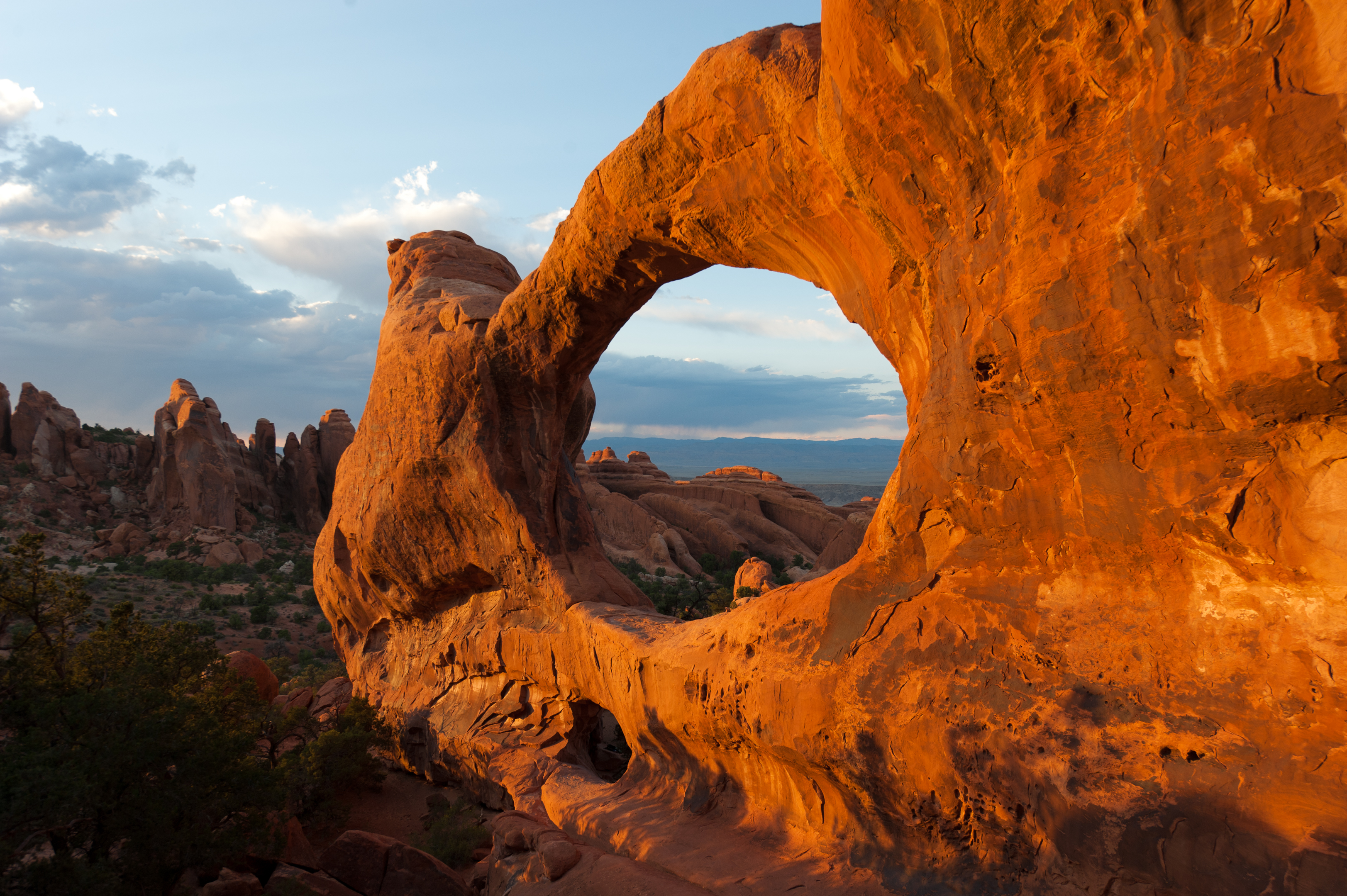
NPS via NPS.gov (Public Domain)
Arches National Park Scenic Drives: Arches Jeep Trails
7 min read
Scenic Drives
Expect 30-minute-plus entrance waits from 9 AM to 3 PM, March through October. The paved 18-mile drive to Devils Garden is best done as an out-and-back (2026).
For more, see best time to visit.
This guide covers the scenic drive, known locally as the Arches Jeep Trails route for those who remember when the park road was unpaved gravel. Today it's fully paved, 18 miles one way from the entrance station to Devils Garden. You'll drive it as an out-and-back - there is no loop. Most of the pullouts and viewpoints are on the right side going in, which means you'll cross traffic to return to them on the way out. The park service recommends doing the full drive to the end first, then stopping at what catches your eye on the way back. That strategy spreads crowds out and keeps you from guessing whether the next viewpoint is better than the one you just passed.
One final note before you head up the road: pick up a free park newspaper at the entrance station or download the NPS app before you arrive. Cell service drops out at several points along the drive, and you'll want the mile-by-mile guide to know what you're looking at.
For a full overview of logistics including fees, reservations, and seasonal conditions, check the complete visitor guide.
The Drive at a Glance
- Total distance: 36 miles round trip from the entrance station to Devils Garden and back
- Typical time with stops: 2 to 4 hours, depending on how many pullouts you hit and whether you walk any of the short paved trails
- Direction: Out-and-back. Drive to the end first, then stop on the return
- Road surface: Fully paved, two lanes. Suitable for any vehicle including RVs up to approximately 40 feet
- Seasonal access: Open year-round, 24 hours a day. No seasonal road closures
- Vehicle restrictions: None on the main road. No oversize vehicle restrictions posted for standard RVs, though some pullouts have limited length
The road climbs steadily from the visitor center at roughly 4,000 feet to Devils Garden at about 5,200 feet. You gain elevation the entire way in, which means the views open up behind you as you drive. The return trip downhill is faster and easier on your fuel.

Stop by Stop
Arches Visitor Center
Stop here on your way in, not on your way out. The visitor center has water filling stations - use them. There are also restrooms, park maps, and rangers who can tell you current trail conditions. The short nature trail behind the building (150 feet round trip) takes you through native desert plantings with interpretive signs, but skip it if you're pressed for time. It's more useful as a leg-stretcher for kids who've been sitting in the car.
Courthouse Towers Viewpoint
About 2 miles past the entrance station, this pullout on the right gives you your first real look at the scale of the place. From this overlook you can see the Park Avenue formation to the north - a corridor of vertical sandstone fins that resembles a city skyline. The Three Gossips formation and the Sheep Rock monolith are visible to the west. Most visitors spend 5 minutes here taking photos and move on. The common mistake is skipping the short walk: the Park Avenue Trail starts from this same parking area and descends into the canyon. Even walking the first 100 yards down gives you a very different perspective than the overlook.
Early morning is your best bet for photography here. The low sun lights up the east-facing cliff of Park Avenue in warm tones, and there's no heat shimmer yet.
Balanced Rock Viewpoint
Roughly 9 miles from the entrance, this is the most photographed single feature in the park after Delicate Arch. The balanced rock sits 55 feet tall and weighs an estimated 3,500 tons. Parking is limited - about 15 spaces in the main lot - and it fills early. A 0.3-mile paved loop trail circles the base of the formation and takes 15-20 minutes. Worth doing. The angle from the trail puts you underneath the caprock in a way the parking lot view doesn't.
The Windows Section
Take the signed right turn about 10 miles in to reach the Windows parking loop. This 1-mile spur road leads to three major features: Double Arch, North Window, and South Window. Double Arch is the tallest arch in the park at 122 feet. The parking lot fills by 8:30 AM in peak season. If the lot is full, the park service recommends returning later rather than parking on vegetation along the road - they ticket for that.
The walk to Double Arch is a flat, gravel path about 0.5 miles round trip. The Windows themselves are visible from the parking area, but the short trail to stand beneath them is worth the extra 0.5 miles. Total time for this section: 30-45 minutes.
Delicate Arch Viewpoint
This is the pullout for people who cannot or choose not to hike the 3-mile round trip to Delicate Arch itself. The Lower Viewpoint is level and wheelchair accessible - a 100-yard paved walk. From here you see the arch at a distance of about 0.5 miles, framed through a natural opening in the rock. The Upper Viewpoint requires climbing about 200 yards of stone steps. Both give you a recognizable view, but neither compares to standing under the arch itself. If you have the fitness and time, the Delicate Arch Trail (538 feet elevation gain, no shade) is the one hike in the park worth prioritizing.
Early morning or late afternoon light works best for photography here. Midday sun flattens the arch against the cliff behind it.
Fiery Furnace Viewpoint
About 14 miles in, this pullout offers an overlook into the Fiery Furnace - a labyrinth of narrow sandstone canyons. You cannot enter the Fiery Furnace without a permit or a ranger-led tour. The viewpoint itself takes 10 minutes. The name comes from how the sandstone glows orange-red in late afternoon light. If you're interested in exploring on foot, permits are available at the visitor center and sell out early. Book ahead.
Devils Garden Trailhead
This is the end of the road, 18 miles from the entrance. The parking lot is large by park standards - roughly 100 spaces - but it fills completely by 8 AM in spring and fall. What most first-time visitors do not realize is that the lot is also the trailhead for multiple hiking trails of varying lengths. The Devils Garden Trail leads to Landscape Arch (0.8 miles one way, easy), then continues past several more arches including Double O Arch for those willing to climb sandstone slabs.
The restrooms at this lot are vault toilets - no flush toilets, no running water. The last flush toilets on the drive are at the visitor center and at the Windows section.

Timing and Crowds
The park road experiences predictable congestion patterns. Tour buses arrive between 9 AM and 11 AM. The Windows parking lot is their first major stop. If you want that lot to yourself, arrive before 8 AM or after 2 PM.
Sunset at Arches is spectacular from almost any viewpoint, but it comes with a price: everyone else wants the same thing. The Delicate Arch Trail sees its heaviest traffic in the hour before sunset. If you plan to photograph sunset from a viewpoint, arrive 45 minutes early to claim a spot. The parking lots at Balanced Rock and the Windows fill up during the golden hour.
Summer visits (June through August, when daytime highs exceed 100°F) require a different strategy. Drive early - enter the park at 6 or 7 AM, finish the scenic drive by 11 AM, and leave before the heat peaks. The road is much quieter after 4 PM, but hiking in late afternoon heat is punishing.
Spring (April-May) and fall (mid-September-October) offer daytime highs between 60-80°F and are by far the most comfortable months. They are also the busiest. Expect entrance station wait times of 30-60 minutes between 9 AM and 2 PM on weekends.
Winter (December-February) sees dramatically fewer visitors. Daytime highs average 30-50°F and lows can drop to 0-20°F. Snow and ice are possible on the road, though the park generally plows quickly. If you want the pullouts to yourself, winter is your best bet.

Driving Logistics
Parking at key stops: The Windows lot fills first, followed by Devils Garden and Delicate Arch viewpoint. There is overflow parking at the Delicate Arch viewpoint but not at the Windows. The Fiery Furnace viewpoint has about 10 spaces and rarely fills completely. If a lot is full, do not park on the road shoulder or on vegetation. Rangers patrol regularly.
Cell service: Works intermittently on the drive. You will get service near the visitor center, at the Windows, and at Devils Garden. It drops out in the middle section between Courthouse Towers and Balanced Rock. Download offline maps before you arrive.
Gas: No gas stations inside the park. The nearest gas is in Moab, 5 miles south of the entrance. Fill up before entering. There is no diesel at some Moab stations - check ahead if you need it.
RV guidance: The road is paved and wide enough for RVs, but the pullouts at Balanced Rock and the Windows section have limited length. RVs longer than 25 feet should park at the Windows overflow lot and walk back to the viewpoints. At Devils Garden, RVs can park in the main lot but may need to use the
For more information, see our complete National Park Guide.
Related: arches hiking trails guide
Related: arches hiking trail guide
Sources
- Official source: NPS — Arches National Park nps.gov/arch/index.htm
Photo Gallery
More to Explore

Park Guide
Acadia National Park: Carriage Roads, Cadillac Mountain & 2026 Guide
Discover carriage roads, Cadillac Mountain, and rugged Maine coast. Complete 2026 guide to Acadia National Park — trails, fees, lodging, permits, and what rangers recommend.

Hiking Guide
Grand Canyon Hiking Trails: Day Hikes, Water Sources & Rim to Rim
Compare Grand Canyon hiking trails: Bright Angel, South Kaibab, Hermit, Grandview, and rim to rim, with distances, elevation, water stops, and trailhead access for each.

Best Of
Best of Glacier Bay National Park
The best of Glacier Bay is reached by boat: ranger-led day tours up the bay to the tidewater glaciers. What's worth it, how to book, and when to go (2026).

Campsite Guide
White Sands Backcountry Camping: Closed for 2026 — What to Know
As of 2026, backcountry camping at White Sands National Park is closed for site rehabilitation. What that means, and where to camp nearby instead.

Weather Guide
Guadalupe Mountains National Park Weather: Weather
Guadalupe Mountains National Park: weather guide guide updated 2026. Practical visitor information, reservations, and seasonal tips worth bookmarking before

Best Of
Best of Cuyahoga Valley National Park: Best Things to Do
Seeing a Cleveland Orchestra concert with the woods as your backdrop is a uniquely Cuyahoga Valley experience.
Sign in to join the conversation.
Sources & Attribution
Location data courtesy of the National Park Service (U.S. Department of the Interior). NPS data is public domain. Official NPS page.
Images: NPS; NPS; NPS; NPS; NPS.
Map data © OpenStreetMap contributors.
Park operations alerts: NPS.gov · Weather and weather hazards: National Weather Service · Live conditions.
Information may change. Always verify fees, hours, and conditions directly with the official source before visiting.
Did this guide help? Share it with a friend.