For more, see best time to visit.
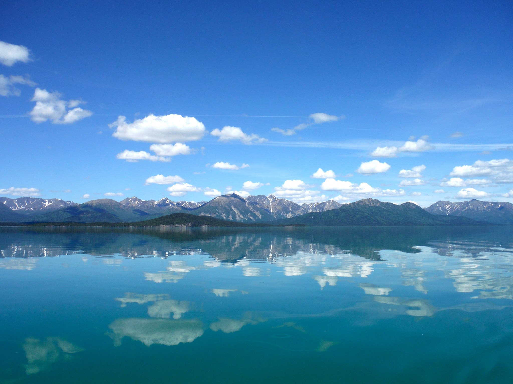
NPS via NPS.gov (Public Domain)
Lake Clark National Park Hiking: Hiking
11 min read
Hiking Guide
Complete 2026 hiking guide for Lake Clark National Park. Trails, difficulty ratings, seasonal conditions, and practical tips for every skill level.
This article contains affiliate links — we may earn a small commission at no extra cost to you.
What Hiking Here Actually Means
Let's get this out of the way immediately: there are no maintained trails in Lake Clark National Park. Zero. Every hike here is off-trail navigation through true wilderness. The park service does not cut, mark, or maintain footpaths. You will be reading terrain, not trail signs. This is fundamentally different from hiking in parks like Rocky Mountain or Yosemite, and it changes everything about how you prepare.
What this means in practice is that hiking in Lake Clark National Park requires genuine backcountry competence. You need to navigate by map and compass (GPS units fail in the mountains here), read drainages and ridgelines, and make route-finding decisions in real time. Most visitors underestimate how slow off-trail travel is. A mile of open tundra might take 45 minutes. A mile of alder thickets or wet muskeg can take two hours. Rangers at the visitor center will tell you the single biggest mistake hikers make is assuming they can cover ground at the same pace as a maintained trail.
The terrain spans two distinct climate zones within the park boundaries. The coast near Cook Inlet is wetter, cooler, and socked in by fog regularly. The interior around the lakes and mountains gets less precipitation but hotter summer temperatures and colder winter conditions. Frost can occur any month of the year at elevation. Your hike will be shaped by which zone you're in and what the weather decides to do that day.
Tanalian Falls: The One Trail-Adjacent Route
Distance: 4 miles round trip
Elevation Gain: 400 feet
Trailhead & Parking: The route starts from the Port Alsworth area, accessible only by air taxi from Anchorage, Kenai, or Homer. There is no parking lot because there are no roads. Your pilot drops you at the gravel airstrip or on the lake. The "trail" is a well-worn path locals and guides use, but it is not officially maintained or signed by the park service. It's the closest thing to a real trail in the entire park.
The Trail: The route follows Tanalian River through mixed spruce and birch forest, then climbs through a narrow canyon to the base of the falls. The surface is packed dirt and exposed roots, with some rocky sections near the canyon. The river crossing early in the hike can be tricky in June during high water - you'll likely get your boots wet. The falls drop roughly 100 feet over a bedrock ledge into a deep pool. On warm afternoons, the spray keeps the immediate area cool.
The Moment: The canyon narrows to about 30 feet wide just before the falls. The river noise amplifies off the rock walls, and the first glimpse of the waterfall through the gap is genuinely surprising for how much water moves through here.
What Most Underestimate: This is not a marked trail. The path is obvious in most sections, but there are spots where it braids across gravel bars and you need to pick the route back up on the far side. The alder can be thick in late summer. Bring a GPS track or a good map.
Best Time: Late June through August. The falls are most impressive in June during snowmelt. By September, flow drops significantly.

Kontrashibuna Lake Ridge
Distance: 5-8 miles depending on route
Elevation Gain: 1,200-2,000 feet
Trailhead & Parking: Accessible via floatplane landing on Kontrashibuna Lake, about 30 minutes from Port Alsworth. This is a common drop point for air taxis. The landing zone is the lake itself - step out of the plane onto the gravel beach.
The Trail: This is pure off-trail terrain. The route climbs from the lake through tundra and scattered alder onto a ridge that runs southwest toward the Neacola Mountains. The lower sections can be wet - expect to punch through moss into ankle-deep water in the muskeg areas. Above treeline, the tundra is firm and easy walking on caribou trails. The ridge offers commanding views of the lake below and the Chigmit Mountains to the west. Route finding is straightforward if you stay on the ridge crest, but descending into drainages can get you into thick brush fast.
The Moment: About 2 miles up, the ridge crest opens onto a view of the entire Kontrashibuna drainage - the lake a deep turquoise below, Redoubt Volcano visible on clear days to the southwest, and the Tordrillo Mountains to the north. The scale is difficult to describe. You can see 50 miles in three directions.
What Most Underestimate: The wind on the ridge. Even calm days at lake level can produce sustained 30 mph winds on the exposed ridge. Bring a wind layer and be ready to turn around if conditions deteriorate. Also: the alder thickets between the lake and treeline are miserable. Route around them if possible.
Best Time: July through mid-September. Snow persists on the upper ridge into June most years.
Crescent Lake Circuit
Distance: 10-14 miles
Elevation Gain: 2,500 feet
Trailhead & Parking: Floatplane drop on Crescent Lake, approximately 45 minutes from Port Alsworth. The lake sits in a glacial valley at roughly 1,500 feet elevation. Multiple air taxi services make this drop regularly.
The Trail: This is a multi-day route for most parties, though strong hikers can push it in a long day. The circuit follows the lake's northern shore, climbs a pass to the west, then loops back along the southern shore. The terrain varies from gravel beaches and lakeside tundra to boulder fields and steep scree slopes on the pass. The pass itself tops out around 3,000 feet and can hold snow patches into August. The boulder field on the west side of the pass is slow going - figure 30 minutes per quarter mile. The southern shore has sections of dense alder that require bushwhacking.
The Moment: From the pass, the lake stretches east-west for 8 miles, with the Neacola Mountains rising directly from the far shore. The water is so clear you can see the lake bottom at 20 feet. On calm mornings, the reflection of the peaks is nearly perfect.
What Most Underestimate: The mileage is deceptive. Ten miles off-trail here is equivalent to 15-18 miles on a maintained trail. The boulder fields eat time. The alder eats morale. Plan for 8-10 hours for the full circuit, and be prepared to camp if you don't make it.
Best Time: Late July through August. Earlier in the season, the pass holds snow and the creek crossings are dangerous.

Tlikakila River Valley
Distance: Variable - 6-20 miles
Elevation Gain: Minimal - 200-500 feet total
Trailhead & Parking: Bush plane landing on a gravel bar along the Tlikakila River, or floatplane on Lake Clark itself with a short hike to the river corridor. This is the most accessible valley in the park for longer trips.
The Trail: The Tlikakila River flows out of the Neacola Mountains into Lake Clark. The valley floor is a mix of gravel bars, wet meadows, and open spruce forest. Hiking follows the river corridor, crossing side streams and working around oxbows. The terrain is mostly flat, but the surface is uneven - cobbles on the gravel bars, tussocks in the meadows, and soft moss in the forest. This is prime brown bear habitat. You will see sign. You may see bears. Make noise, carry bear spray where legal, and store food properly.
The Moment: The valley opens up about 4 miles from the lake, with the Neacola peaks rising 5,000 feet directly above the valley floor. The scale is overwhelming in a way that photos don't capture. The river braids across a half-mile wide gravel bed, and the only sound is water and wind.
What Most Underestimate: The river crossings. Side streams change course with every storm. What was a dry gravel bar in July can be a thigh-deep channel in August. Bring water shoes or be prepared to hike in wet boots. Also: the mosquitoes here are the worst in the park. Bring a head net and treat your clothes with permethrin.
Best Time: July through August. The river is too high and cold in June for safe crossings. September brings cooler temperatures but fewer bugs.
Turquoise Lake Overlook
Distance: 2-4 miles round trip
Elevation Gain: 600-800 feet
Trailhead & Parking: Floatplane drop on Turquoise Lake, about 20 minutes from Port Alsworth. The lake sits at approximately 2,000 feet elevation in a glacial basin.
The Trail: This is a short, steep climb from the lake up a talus slope to a bench that overlooks the entire basin. The route is obvious from the lake - head for the lowest saddle on the ridge to the south. The talus is loose and requires careful footing. Each step slides slightly. Trekking poles help significantly. The top of the bench is tundra and solid rock, with excellent views in all directions.
The Moment: From the overlook, Turquoise Lake sits directly below - the color comes from glacial flour suspended in the water, giving it that distinctive milky blue-green. The lake is roughly 3 miles long and less than a mile wide, with steep walls dropping directly into the water on three sides. On a clear day, you can see Redoubt Volcano to the south.
What Most Underestimate: The talus slope is harder than it looks. Coming down is more dangerous than going up - the loose rock can roll onto your feet or send hikers slipping. Take your time on the descent.
Best Time: Late June through September. The overlook can hold snow into early July in high snow years.

Seasonal Trail Conditions
June is unpredictable. Snow lingers above 2,500 feet through most of the month. River crossings are high and cold. The mosquitoes emerge in force by mid-month. This is the least reliable month for hiking - you might get perfect weather or you might get snowed on at any elevation.
July and August are the prime months. Daytime temperatures in the interior range from 55-75°F. Rain is common but usually comes in showers rather than all-day soakers. The coast is wetter - expect more overcast days and drizzle. Snow is gone from all but the highest passes by late July. River flows drop through August, making crossings safer.
September brings cooler temperatures (40-55°F daytime) and the first snowfalls at elevation by late month. The fall colors in the tundra are excellent in early September - the dwarf birch and blueberry bushes turn brilliant red and orange. Fewer visitors, fewer bugs, but shorter days and more weather risk.
The park phone system was experiencing a disruption as of 2026. Contact via email at LACL_Information@nps.gov for current conditions before your trip.
Trailhead Logistics
Every hike in Lake Clark National Park begins with an air taxi. You cannot drive here. The park has no road access. A one to two-hour flight from Anchorage, Kenai, or Homer gets you to Port Alsworth or directly to a lake landing. Multiple air taxi services operate out of these towns. Book your flights well in advance - June through August fills up.
Cell service drops out at roughly the same moment your plane leaves the ground in Anchorage. There is no service in the park. Satellite messengers (InReach, Zoleo) work but require a clear view of the sky - canyon bottoms and dense forest can block signals. The park visitor center in Port Alsworth has limited connectivity, but don't count on it.
Water sources are abundant in most of the park - lakes, rivers, streams. Treat everything. Giardia is present. Filters work well for lakes and streams. Boiling is the most reliable method. The glacial rivers carry heavy sediment loads - let it settle or pre-filter through a bandana before running through your filter.
Bear canisters are required for food storage in the backcountry. The park recommends hard-sided canisters - Ursacks can work but bears here are persistent. Hang food only if you know proper technique. Most experienced hikers use canisters.
The ranger station in Port Alsworth is the best source for current trail conditions. Stop in before your flight out. They know which passes still hold snow and which river crossings are running high.

What to Carry
This is not a gear list for a day hike at a front-country park. The demands of Lake Clark hiking are specific.
Footwear is critical. Off-trail terrain means wet feet are inevitable. Most experienced hikers use non-waterproof trail runners that drain quickly, paired with gaiters to keep gravel out. Boots that claim to be waterproof will fill up at the first creek crossing and take days to dry. If you prefer boots for ankle support, accept that they will be wet for the duration.
Trekking poles are not optional. They save your knees on talus descents, help with creek crossings, and clear spider webs and brush from your face. Adjustable poles that collapse for bush plane storage are ideal.
Rain gear that actually works. Not a packable shell that wets through after an hour. A three-layer jacket with sealed seams. The coast gets real rain. The interior gets afternoon thunderstorms. You will use it.
Insect protection. The mosquitoes in July are dense enough to make you reconsider your life choices. A head net is not overkill. Treat your clothes with permethrin before the trip. Bring 30% DEET for exposed skin. The combination of permethrin-treated clothes and DEET on skin is the only thing that works in this country.
Navigation tools. Map and compass. Know how to use them. GPS units work inconsistently in the mountains - the terrain blocks satellite signals in narrow valleys. Carry a paper map of the specific area you're hiking. The park visitor center sells USGS topo maps.
Water treatment. A reliable filter or purification tablets. Plan for a liter per hour of hiking in summer. The water is cold and clean-looking, but untreated is a gamble.
Bear spray. Legal in the park. Carry it where you can reach it, not buried in your pack. Know how to deploy it. Practice the motion. Most bear encounters here are non-aggressive, but the Tlikakila Valley and Crescent Lake areas have high bear density.
Practical Takeaways
- You cannot hike here without a bush plane. Factor the flight cost into your trip budget - figure $400-800 round trip from Anchorage depending on distance.
- Off-trail hiking is significantly slower than trail hiking. Plan your daily mileage at half what you'd do on a maintained trail. Experienced off-trail hikers cover 1-2 miles per hour in moderate terrain.
- The Tanalian Falls route is the only hike that approaches a conventional trail experience. Start there if you're new to off-trail navigation.
- Weather changes fast and without warning. A clear morning can turn into a whiteout on the ridge by noon. Carry the gear for the worst conditions, not the current ones.
- The mosquitoes peak in July. Early June and late August have fewer. September has the fewest bugs but the shortest days and coldest nights.
- River crossings are the most dangerous part of any hike here. Never cross a river that's above your knees in current. Wait for water levels to drop, or find a wider, shallower section.
- The park service email address (LACL_Information@nps.gov) is the best contact method as of 2026. The phone system was down. Check for updates before you go.
- Book your air taxi and any lodging in Port Alsworth months ahead. Summer slots fill by March.
- The Tlikakila River valley has the highest bear density. The Crescent Lake area has the most varied terrain. The Turquoise Lake overlook is the best short hike.
- Leave your itinerary with someone outside the park. With no cell service and no maintained trails, if you don't show up when expected, someone needs to know where to start looking.
For more information, see our complete National Park & Preserve Guide.
Related: how to get to lake clark national park guide
Recommended Gear
What experienced visitors bring to Lake Clark National Park Hiking: Hiking
Links may earn us a commission at no extra cost to you. We only recommend gear we believe in.
Hiking Essentials
Hydration Pack (3L)
Hands-free water for long trail days
Trekking Poles (Pair)
Save your knees on steep descents
Hiking Boots (Ankle Support)
Sturdy footwear for rocky, uneven trails
Sun & Heat Protection
Wide-Brim Sun Hat
Full coverage UPF 50+ protection at altitude
Insulated Water Bottle (32oz)
Keeps water cold in desert heat all day
Winter Gear
Microspikes / Traction Devices
Essential for icy rim trails in winter months
Packable Down Jacket
Lightweight warmth that stuffs into a pocket
Sources
- Official source: NPS — Lake Clark National Park nps.gov/lacl/index.htm
Photo Gallery
More to Explore

Park Guide
Acadia National Park: Carriage Roads, Cadillac Mountain & 2026 Guide
Discover carriage roads, Cadillac Mountain, and rugged Maine coast. Complete 2026 guide to Acadia National Park — trails, fees, lodging, permits, and what rangers recommend.

Hiking Guide
Grand Canyon Hiking Trails: Day Hikes, Water Sources & Rim to Rim
Compare Grand Canyon hiking trails: Bright Angel, South Kaibab, Hermit, Grandview, and rim to rim, with distances, elevation, water stops, and trailhead access for each.

Best Of
Best of Glacier Bay National Park
The best of Glacier Bay is reached by boat: ranger-led day tours up the bay to the tidewater glaciers. What's worth it, how to book, and when to go (2026).

Campsite Guide
White Sands Backcountry Camping: Closed for 2026 — What to Know
As of 2026, backcountry camping at White Sands National Park is closed for site rehabilitation. What that means, and where to camp nearby instead.

Weather Guide
Guadalupe Mountains National Park Weather: Weather
Guadalupe Mountains National Park: weather guide guide updated 2026. Practical visitor information, reservations, and seasonal tips worth bookmarking before

Best Of
Best of Cuyahoga Valley National Park: Best Things to Do
Seeing a Cleveland Orchestra concert with the woods as your backdrop is a uniquely Cuyahoga Valley experience.
Sign in to join the conversation.
Sources & Attribution
Location data courtesy of the National Park Service (U.S. Department of the Interior). NPS data is public domain. Official NPS page.
Images: NPS; NPS; NPS; NPS; NPS.
Map data © OpenStreetMap contributors.
Park operations alerts: NPS.gov · Weather and weather hazards: National Weather Service · Live conditions.
Information may change. Always verify fees, hours, and conditions directly with the official source before visiting.
Did this guide help? Share it with a friend.