This article contains affiliate links — we may earn a small commission at no extra cost to you.
Advertisement
What Hiking Here Actually Means
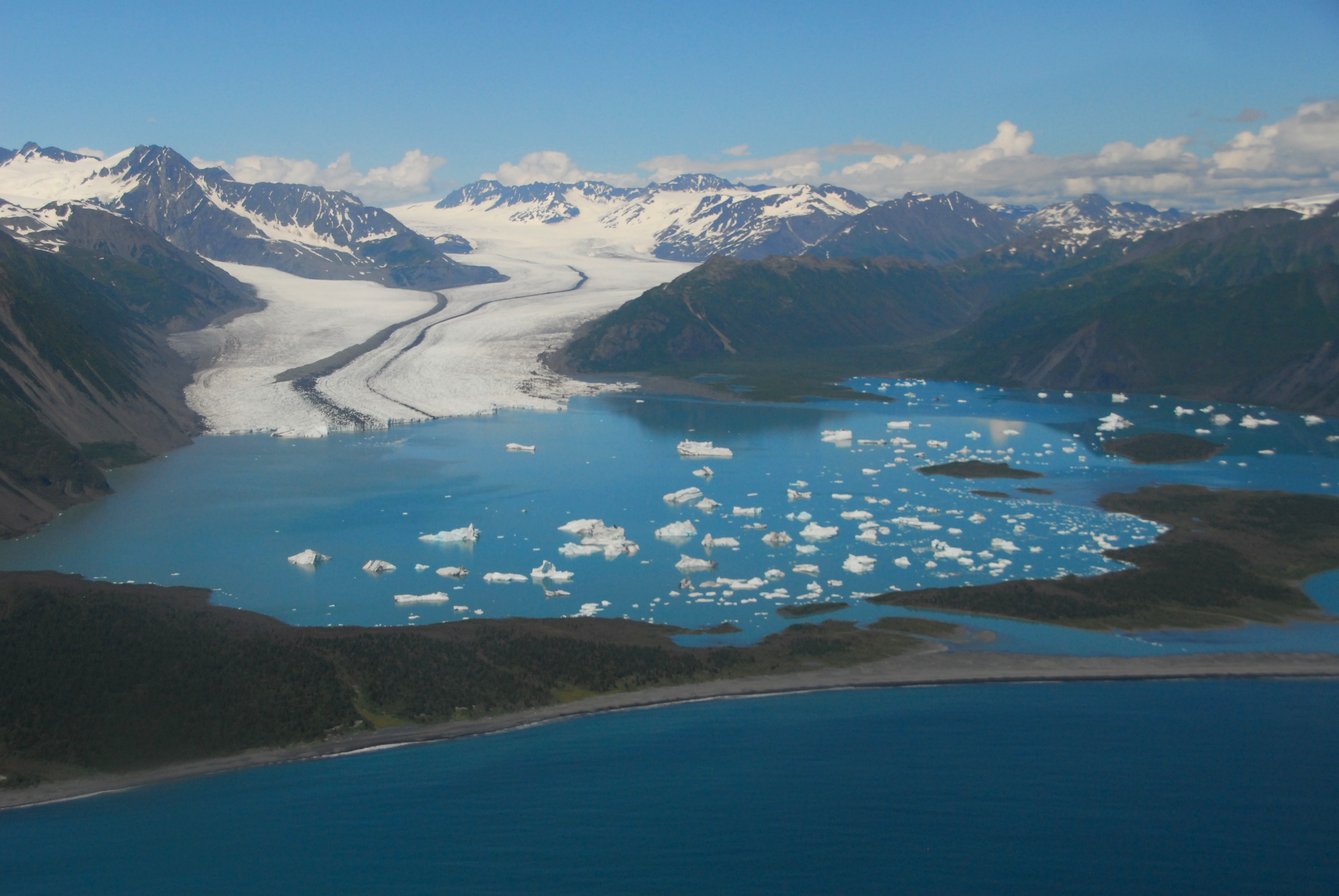
Hiking in Kenai Fjords means committing to a landscape still shaped by active ice. Nearly 40 glaciers flow from the Harding Icefield, and every trail in the park navigates terrain that glaciers carved - or are actively burying. The Harding Icefield Trail is the crown jewel here, and most first-time visitors underestimate what 8.2 miles and 3,000 feet of elevation gain at 60° north latitude actually demands.
Advertisement
The weather will decide your experience. Summer daytime temperatures range from the mid 40s°F to the low 70s°F, but that tells you almost nothing about what any given day will deliver. Overcast and rain are frequent. The trail can go from muddy to icy to sunny in the same hour. If you're looking for the kenai fjords national park best hikes, you're looking at a short list of maintained trails - most of the park is accessible only by water or air. That makes the trails that do exist worth understanding thoroughly before you go. For the broader picture of what the park offers, the complete visitor guide covers logistics beyond hiking.
Harding Icefield Trail: The Hike That Defines the Park
This is the one. If you only do one hike in Kenai Fjords, this is it. Every other trail in the park is either shorter, flatter, or a boat-access backcountry route. The Harding Icefield Trail is the maintained route that takes you from valley floor to the edge of the icefield itself.
Distance: 8.2 miles round trip
Elevation Gain: Approximately 3,000 feet
Trailhead & Parking: The trail starts at the Exit Glacier area, at the end of Herman Leirer Road. The parking lot fills early - by 9 AM in July and August, expect to park along the road. There are no overflow lots. The road to Exit Glacier is closed to vehicles in winter once snow accumulates.
The Trail: You climb through cottonwood and alder forest for the first mile, then break above treeline into alder and willow scrub. Around Marmot Meadow (1.4 miles), you get your first clear view of Exit Glacier below. At Top of the Cliff (2.4 miles), the trail traverses exposed rock slabs. From there to the icefield overlook, you're on open terrain with full exposure to weather. The surface changes from packed dirt to loose scree to snow patches that can persist well into August.
The Moment: The final push to the overlook. You crest the last ridge and the Harding Icefield spreads out in front of you - a white plateau 700 square miles in extent, with nunataks (rock peaks) rising through the ice. It looks more like the interior of Greenland than coastal Alaska.
What Most Underestimate: Two things. First, the elevation gain is relentless - there are no flat sections to recover on. Second, weather at the top is radically different from the trailhead. You can leave in 55°F and drizzle and find 35°F with wind and snow flurries at the overlook. Rangers will tell you to carry a hat, gloves, and a shell layer even on a clear morning.
Best Time: Late June through early September. Snow lingers on the upper trail into June. July and August offer the best chance of clear conditions at the overlook, but also the most crowds. Start before 8 AM to avoid afternoon clouds that often roll in and obscure the view.
Exit Glacier Overlook Trail: The Short Option
Distance: 0.7 miles round trip (to the overlook)
Elevation Gain: Minimal - maybe 200 feet
Trailhead & Parking: Same parking area as the Harding Icefield Trail. This is the paved, accessible path that most visitors use.
The Trail: Paved and wide, it climbs gradually through forest to a viewpoint directly across from the toe of Exit Glacier. Interpretive signs along the way explain glacier recession. The trail narrows at the overlook platform. From here you can see the glacier terminus and the creek that drains from it.
The Moment: Standing at the overlook and reading the signs that mark where the glacier edge stood in previous decades - the recession is measured in hundreds of feet per year.
What Most Underestimate: This is not a workout. It's a short walk. But the glacier view is genuinely good, and the time required means you can combine it with the Harding Icefield Trail start or a ranger-led walk.
Best Time: Any time the road is open, typically May through October.
Photo: NPS via NPS.gov (Public Domain)
Glacier View Loop Trail
Distance: 1.3 miles loop
Elevation Gain: About 350 feet
Trailhead & Parking: Same Exit Glacier area. The loop begins near the nature center.
The Trail: A dirt path through cottonwood and alder forest, with occasional boardwalks over wet sections. It climbs a short ridge and returns through the forest. Not as open as the Harding Icefield Trail, but quieter - most people head straight for the big climb.
The Moment: A mid-trail opening through the trees gives you a different angle on Exit Glacier, with the outwash plain below.
What Most Underestimate: The mosquitoes. This trail stays in the trees and damp ground, and the mosquitoes can be aggressive in July. Pack repellent.
Best Time: Same as above, late spring through early fall.
The Park's Other Hiking: Boat-Access and Backcountry
The maintained trails above are the extent of front-country hiking in Kenai Fjords. Everything else requires a boat, kayak, or air taxi.
Aialik Bay area offers beach walking and unmaintained routes along the shoreline. Kayakers often camp here and explore on foot. No formal trails - route-finding on wet rock and through coastal forest.
Holgate Arm and Northwestern Fjord are similarly accessed by boat tour or water taxi. The terrain is rough, with dense alder, willow, and devil's club. This is not trail hiking in any conventional sense. It's bushwhacking with glacier views.
Pedersen Lagoon area, near Aialik Bay, experienced a landslide-triggered tsunami on August 7, 2024. The park service recommends caution for anyone visiting this area. Check current conditions before going.
For hikers wanting boat-access options, the park's three public use cabins can serve as basecamps. These require reservations and are available in both winter and summer. They are not near road access - you're committing to a multi-day trip.
Photo: NPS via NPS.gov (Public Domain)
Seasonal Trail Conditions
June: Snow lingers on the upper half of the Harding Icefield Trail. Trail crews may not have cleared the full route yet. The lower Exit Glacier trails are typically snow-free by mid-June. Mosquitoes emerge late in the month.
July and August: Peak hiking season. Harding Icefield Trail is fully clear of snow in most years by mid-July, though patches can persist in shaded sections. Trail conditions vary with rain - expect mud. Afternoon cloud buildup is common, so start early for clear views at the icefield overlook. Parking at Exit Glacier fills by 9 AM.
September: Cooler, with first snow possible at elevation by late September. Harding Icefield Trail remains hikeable through early September, but the upper trail can get snow and ice. Fall colors peak in early September - blueberry and cranberry shrubs turn red, and the alder goes yellow. Fewer crowds.
October through May: The road to Exit Glacier closes to vehicles once snow covers it. The Harding Icefield Trail and other maintained routes are not plowed. Winter access is by fat bike, cross-country skis, or snowshoe. Snowmobile use is allowed only after the park superintendent determines adequate snow cover exists. The park's coastal backcountry is largely inaccessible late fall through early spring due to rough seas.
Trailhead Logistics
Exit Glacier Trailhead: The only road-accessible trailhead in the park. Herman Leirer Road runs from the Seward Highway to the parking area, about 12 miles from downtown Seward. The lot holds maybe 60-70 cars. By 9 AM in summer, you're parking along the road shoulder. There is no overflow lot and no shuttle from Seward specifically for the trailhead.
Cell Service: Drops out before you reach the trailhead. Download maps and directions before leaving Seward. The kenai fjords national park map from the visitor center is useful for orientation, though for hiking you'll want the detailed USGS topo of the Exit Glacier area.
Water Sources: There is no potable water at the trailhead. Fill bottles in Seward. On the Harding Icefield Trail, streams cross the trail in the lower section, but treat everything - glacier runoff carries sediment and bacteria.
Bear Canisters: Not required for day hikes, but recommended if you're carrying food on the Harding Icefield Trail. Bears frequent the lower forested sections. Make noise.
Ranger Station: The Exit Glacier Nature Center is open daily in summer, staffed by rangers who can give current trail conditions, weather forecasts, and advice. Check in before heading up.
Current Alerts: Two active advisories as of 2026. The canyon from the toe of Exit Glacier to the outwash plain is susceptible to sudden outburst flood events - stay on designated trails. Pedersen Lagoon in Aialik Bay had a landslide-triggered tsunami in August 2024; use caution there.
Photo: NPS via NPS.gov (Public Domain)
What to Carry
For the Harding Icefield Trail specifically, not a generic list:
Footwear: Boots with ankle support. The trail is rocky and uneven above treeline. Trail runners work for fast hikers, but most people want the stability.
Layers: A base layer, an insulating mid-layer (fleece or light puffy), and a waterproof shell. The temperature difference between the trailhead and the icefield overlook can be 20-30°F. Wind at the top is constant.
Hat and gloves: Even in August. The overlook can be 35°F with wind. You will want them.
Rain gear: Not optional. The weather changes fast and overcast rainy days are frequent.
Water: Two liters minimum for the full Harding Icefield hike. There are stream crossings where you can treat water, but don't rely on them - late season streams can be dry.
Food: More than you think. At 3,000 feet of gain, you'll burn through calories. Trail mix, bars, a sandwich.
Sun protection: The icefield reflects sunlight. Sunburn on the upper trail is common even on overcast days.
Bear spray: For the lower forested sections. Know how to use it before you go.
Headlamp: If you start late or hike slow, you may be descending in dusk. The forest gets dark early.
For the shorter Exit Glacier trails, carry less - but still bring rain gear and water. The weather does not respect short hikes.
Practical Takeaways
The Harding Icefield Trail is 8.2 miles round trip with 3,000 feet of gain. Plan for 6-8 hours. Most people take closer to 8.
Start before 8 AM. Afternoon clouds obscure the icefield view. You also beat the parking crush.
The trail is snow-free from mid-July through early September in most years. Check at the nature center before heading up.
There is no cell service at the trailhead or on the trail. Download navigation ahead of time.
The Exit Glacier parking lot fills by 9 AM in July and August. Arrive early or expect to park along the road and walk.
Weather at the icefield overlook is dramatically colder and windier than at the trailhead. Pack for conditions 30°F colder than Seward.
The canyon below Exit Glacier is subject to sudden outburst flood events. Stay on designated trails.
Most visitors underestimate the physical demand of the Harding Icefield Trail. It is a sustained climb with no flat recovery sections. Be honest about your fitness and hiking speed.
Kayaking and boat tours access other parts of the park, but for trail hiking, the Exit Glacier area is your only road-accessible option. If you want true backcountry hiking, you need a water taxi.
Mosquitoes are aggressive in the forest sections from late June through August. Repellent is not optional - it's why you won't enjoy lunch at Marmot Meadow without it.
For those deciding between hiking and camping as their base approach, the camping options breakdown helps with logistics. And if you're still weighing when to go, the best time to visit guide covers the trade-offs across seasons.
The Harding Icefield Trail is the reason most hikers come here. It delivers. But it demands respect for the cold, the climb, and the reality that this is a landscape still in the grip of an ice age - nearly 40 glaciers flowing off that icefield, and every one of them shrinking. The view from the top is worth the effort. The evidence of change along the way is what stays with you.
Recommended Gear
What experienced visitors bring to Kenai Fjords National Park Hiking: Best Hikes (2026 Guide)
Links may earn us a commission at no extra cost to you. We only recommend gear we believe in.