Most visitors to Carlsbad Caverns National Park never set foot on an above-ground trail. They take the elevator down, walk the Big Room, watch the bats, and leave. That's their loss. The Chihuahuan Desert above the caves holds seven canyons, limestone escarpments, and over 20 miles of trails that see a fraction of the crowds. If you're looking for the best trails in Carlsbad Caverns National Park, you'll find them under a wide New Mexico sky, not underground.
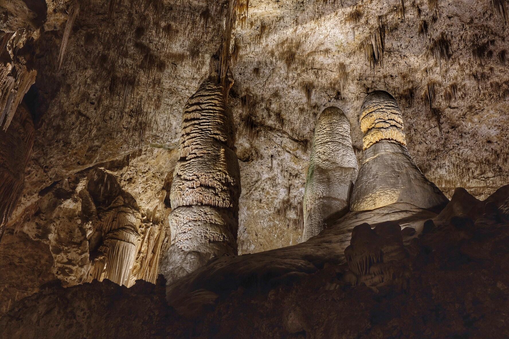
NPS via NPS.gov (Public Domain)
Carlsbad Caverns National Park Hiking: Best Trails in (2026
7 min read
Hiking Guide
Discover Carlsbad Caverns National Park's best above-ground trails in (2026), from the 5.3-mile Slaughter Canyon hike to scenic overlooks.
This article contains affiliate links — we may earn a small commission at no extra cost to you.
This guide covers the surface trails worth your time. The caves are the headliner, but the hiking here earns its own chapter. If you need the full park picture first, read the complete visitor guide. Then come back here for trail specifics.
What Hiking Here Actually Means
Carlsbad Caverns sits in the Chihuahuan Desert at 4,300 feet elevation. The hiking is not a stroll through alpine meadow. You'll walk on exposed limestone, loose scree, and packed desert dirt under 278 sunny days a year. Temperatures from June through September routinely hit 90-100+°F. There is very little shade. Water sources on trail are nonexistent. Cell service drops out at the park gate and does not return until you're back at the visitor center.
The terrain is real desert hiking. Trails range from a 5-minute paved overlook to a 7.7-mile backcountry route with 1,500+ feet of gain. Proper footwear and multiple liters of water per person are non-negotiable.
Most visitors underestimate how much harder hiking feels in dry heat. A 3-mile loop in 95°F with no shade takes more out of you than a 6-mile forest trail. Plan accordingly.

Slaughter Canyon Trail: The Signature Desert Hike
Distance: 5.3 miles (8.6 km) round trip
Elevation Gain: 500 feet to the cave entrance, plus rolling ups and downs
Trailhead & Parking: Located at the Slaughter Canyon parking area, about a 30-minute drive from the visitor center via unpaved road. The lot is small, no more than 15 vehicles. Early morning is your best bet for a spot. There are no services here - no water, no bathrooms.
The Trail: This is the park's premier above-ground hike. The route follows an old mining road up a broad canyon with steep limestone walls rising on both sides. The first mile is gradual. Then it gets steeper and rockier as you approach the Slaughter Canyon Cave entrance. The final 0.5 mile is a rugged 500-foot climb up a trail that gains a 152-meter elevation over half a mile - your calves will remember it. The trail is marked but can be faint in places. Keep an eye out for cairns near the upper sections.
From the cave entrance you can continue another mile or so up the canyon before the trail becomes faint. The views across the Guadalupe Mountains are worth every step.
The Moment: About 2.5 miles in, just below the cave entrance, you round a corner and the canyon opens wide. The escarpment runs north-south for miles, striped with limestone layers that tell 250 million years of ancient seabeds.
What Most Underestimate: The return is downhill but the sun exposure is relentless. Pack extra water for this stretch. Rangers will tell you to carry at least 3 liters per person for this hike. Do not argue.
Best Time: Fall (September-November) and spring (March-May). Summer is doable if you start before 7 AM. The park's best time to visit guide has month-by-month details.

Yucca Canyon Trail: The Suffering That Pays Off
Distance: 7.7 miles (12.4 km) round trip
Elevation Gain: Roughly 1,600 feet
Trailhead & Parking: Trailhead is along Walnut Canyon Desert Drive. Note: Walnut Canyon Desert Drive is currently closed due to flood damage as of 2026. Until repairs are complete, this trail is inaccessible. Do not plan on it without checking current conditions.
The Trail: Rated difficult, and it earns that rating. The route climbs quickly up a side canyon to the top of the escarpment. The first two miles are steady gain on rocky tread, then you hit a series of switchbacks that bring you to the ridge. From the ridge, you get commanding views of the entire park and beyond - on clear days you can see the Guadalupe Mountains in Texas.
The Moment: The ridge itself. You're standing on the edge of the Chihuahuan Desert with the canyon dropping away below and the plains stretching east. No railing, no crowd. Just wind and space.
What Most Underestimate: The elevation gain is concentrated in the middle section. You'll gain 800 feet in under a mile. The trail is unmaintained in spots - expect loose rock and occasional cairn-finding.
Best Time: Late fall or early spring. Avoid mid-summer unless you're conditioned for it.

Three Moderate Trails Worth Your Time
Upper Rattlesnake Canyon Loop Trail
Distance: 6 miles (9.6 km) loop
Elevation Gain: Moderate, roughly 600 feet
Trailhead & Parking: Rattlesnake Canyon Trailhead, accessible from the main park road near the visitor center. Parking for about 10 cars.
The Trail: This loop travels from the Rattlesnake Canyon Trailhead up to the Guadalupe Ridge Trail, down through Upper Rattlesnake Canyon, and back. It's a good sampler of the park's desert canyon ecology. You'll see flowering cactus (prickly pear, claret cup), juniper, and agave. Birdwatching is decent - expect canyon wrens, roadrunners, and raptors overhead.
The Moment: The canyon bottom in late afternoon, when the light turns the sandstone walls orange.
What Most Underestimate: The loop has several wash crossings that can be confusing after rain. Download a map offline.
Best Time: Spring (March-May) when the cactus blooms.
Juniper Ridge Trail
Distance: 3.5 miles (5 km) round trip
Elevation Gain: 300 feet
Trailhead & Parking: On Walnut Canyon Desert Drive, about 1 mile past interpretive marker #9. Again, the drive is closed as of 2026. Check conditions.
The Trail: A mellow out-and-back along a ridge with views of Walnut Canyon and the desert floor. The trail is mostly flat with a few short climbs. Good for a morning hike if you're not up for a full-day effort.
The Moment: The solitude. This trail sees maybe a tenth of the visitors that go through the cavern.
What Most Underestimate: Despite being "easy," the lack of shade makes it feel harder on hot days.
Best Time: Any season except deep summer heat.
Lower Rattlesnake Canyon Trail
Distance: 3 miles (4.8 km) round trip
Elevation Gain: 250 feet
Trailhead & Parking: Approximately 0.25 mile past interpretive marker #4 on Walnut Canyon Desert Drive (closed). When open, parking is roadside.
The Trail: A moderate walk down a canyon floor with Chihuahuan Desert plant life along the way. The trail follows a dry wash for much of the route. Good for a short leg-stretcher with canyon views.
The Moment: The quiet. No elevator noise, no tour groups. Just wind through mesquite.
What Most Underestimate: The wash can be sandy and slow going. Not a fast walk.
Best Time: Spring and fall.

Short Hikes and Quick Smiles
Chihuahuan Desert Nature Trail
Distance: 0.7 mile (1.1 km) loop
Elevation Gain: Minimal
Trailhead & Parking: Starts near the visitor center. Plenty of parking.
The Trail: Labels along the route identify desert plants. The upper section is wheelchair accessible. Good for families or a warm-up hike. It gives you a sense of the desert ecosystem without committing to a long walk.
The Moment: Learning that creosote bushes can live 10,000 years.
What Most Underestimate: How much you'll sweat even on this short loop in summer.
Best Time: Morning, before the heat builds.
Old Guano Trail
Distance: 3.7 miles (6 km) one way
Elevation Gain: 800 feet descent
Trailhead & Parking: Starts at the dirt road adjacent to the Natural Entrance to Carlsbad Cavern. Parking available at the Natural Entrance parking area.
The Trail: This historic route follows the road used to haul bat guano out of the cave in the early 1900s. It descends the escarpment to the White's City area. You'll need a shuttle or second car to get back, or plan to hike it out-and-back (7.4 miles total). The descent is steady, and the views of the Guadalupe Mountains are excellent.
The Moment: The guano mine structures still visible along the route - a piece of oddball park history.
What Most Underestimate: The return climb is significant. Do not underestimate 800 feet of gain in the desert.
Best Time: Early morning in summer, any time in fall/winter.
Walnut Canyon Overlook Trail
Distance: 180 yards (165 m) paved
Elevation Gain: 22 feet
Trailhead & Parking: On Walnut Canyon Desert Drive (closed). When open, it's a pullout.
The Trail: A short paved walk to a viewpoint over Walnut Canyon. Good for sunset viewing. No effort required.
The Moment: Seeing the canyon carved into the desert - a reminder that water shaped this landscape.
What Most Underestimate: The drive to get there is the main event.
Best Time: Sunset.
Guided Cave Tours vs. Hiking
You didn't come here for the caves alone, but the guided tours of Carlsbad Caverns are worth mentioning because they dictate timing. The King's Palace Tour (90 minutes) and Lower Cave Tour (3 hours) are popular. If you're hiking above ground, plan around these tours - don't try to do a 7-mile hike and a 3-hour cave tour in the same day unless you start at dawn.
The carlsbad caverns guided tours require separate tickets and often sell out in advance. Book early.
Seasonal Trail Conditions
Spring (March-May): Best hiking season.
Recommended Gear
What experienced visitors bring to Carlsbad Caverns National Park Hiking: Best Trails in (2026
Links may earn us a commission at no extra cost to you. We only recommend gear we believe in.
Hiking Essentials
Hydration Pack (3L)
Hands-free water for long trail days
Trekking Poles (Pair)
Save your knees on steep descents
Hiking Boots (Ankle Support)
Sturdy footwear for rocky, uneven trails
Sun & Heat Protection
Wide-Brim Sun Hat
Full coverage UPF 50+ protection at altitude
Insulated Water Bottle (32oz)
Keeps water cold in desert heat all day
Electrolyte Mix Packets
Replace what water alone cannot during intense heat
Winter Gear
Microspikes / Traction Devices
Essential for icy rim trails in winter months
Packable Down Jacket
Lightweight warmth that stuffs into a pocket
Sources
- Official source: National Park Service nps.gov/cave
- Official source: NPS — Carlsbad Caverns National Park nps.gov/cave/index.htm
Photo Gallery
More to Explore

Park Guide
Acadia National Park: Carriage Roads, Cadillac Mountain & 2026 Guide
Discover carriage roads, Cadillac Mountain, and rugged Maine coast. Complete 2026 guide to Acadia National Park — trails, fees, lodging, permits, and what rangers recommend.

Hiking Guide
Grand Canyon Hiking Trails: Day Hikes, Water Sources & Rim to Rim
Compare Grand Canyon hiking trails: Bright Angel, South Kaibab, Hermit, Grandview, and rim to rim, with distances, elevation, water stops, and trailhead access for each.

Best Of
Best of Glacier Bay National Park
The best of Glacier Bay is reached by boat: ranger-led day tours up the bay to the tidewater glaciers. What's worth it, how to book, and when to go (2026).

Campsite Guide
White Sands Backcountry Camping: Closed for 2026 — What to Know
As of 2026, backcountry camping at White Sands National Park is closed for site rehabilitation. What that means, and where to camp nearby instead.

Weather Guide
Guadalupe Mountains National Park Weather: Weather
Guadalupe Mountains National Park: weather guide guide updated 2026. Practical visitor information, reservations, and seasonal tips worth bookmarking before

Best Of
Best of Cuyahoga Valley National Park: Best Things to Do
Seeing a Cleveland Orchestra concert with the woods as your backdrop is a uniquely Cuyahoga Valley experience.
Sign in to join the conversation.
Sources & Attribution
Location data courtesy of the National Park Service (U.S. Department of the Interior). NPS data is public domain. Official NPS page.
Images: NPS; NPS; NPS; NPS; NPS.
Map data © OpenStreetMap contributors.
Park operations alerts: NPS.gov · Weather and weather hazards: National Weather Service · Live conditions.
Information may change. Always verify fees, hours, and conditions directly with the official source before visiting.
Did this guide help? Share it with a friend.