For more, see complete visitor guide.
NPS via NPS.gov (Public Domain)
The to National Park of American Samoa Hiking
8 min read
Hiking Guide
Complete 2026 hiking guide for National Park of American Samoa. Trails, difficulty ratings, seasonal conditions, and practical tips for every skill level.
This article contains affiliate links — we may earn a small commission at no extra cost to you.
Hiking in the National Park of American Samoa isn't a casual stroll. The humidity greets you like a damp towel the moment you leave your vehicle. Trails here aren't manicured paths but suggestions through the jungle, where roots form natural staircases and mud remains a constant companion. This terrain is defined by verticality—you're either climbing steeply to a ridgeline for a sliver of ocean view or descending just as steeply to a secluded beach. Most first-timers are caught off guard by the sheer physicality; a two-mile hike here demands more from your legs than a five-mile desert trek. The reward isn't some panoramic overlook from a postcard, but the sound of fruit bats in the canopy, the sudden glimpse of a turquoise lagoon through the foliage, and the profound sense of a place operating on its own, older rhythm.
What Hiking Here Actually Means
Forget switchbacks. Trails here go straight up or straight down, following the natural contours of volcanic slopes. Your skill level matters less than your tolerance for slick conditions and relentless incline. The terrain mixes packed earth, exposed roots, and sections of jagged `a`a lava rock that test any hiking shoe. Physical preparation should focus on quad strength for the descents—your knees will announce their presence on the way back up. The common mistake, and almost everyone makes it, is underestimating hydration. You'll sweat out water faster than you can drink it, and ocean views don't provide fresh water. Rangers at the visitor center emphasize this daily. This isn't a park for ticking off a long list of trails; it's for choosing one or two and experiencing them fully, with time to cool off in the sea afterward.
Mount Alava Trail (via Old Vatia): The Rugged Alternative
Note: As of 2026, the primary Mount Alava Trail from Fagasa Pass is closed for improvement work. The described route is the open, more challenging alternative.
Distance: 6.0 miles roundtrip
Elevation Gain: 1,800 feet
Trailhead & Parking: The trail begins at the end of the road in Vatia village, on Tutuila. You'll see a small pull-off area that can fit 4-5 vehicles. Arrive early. This isn't a major lot, and it's in a residential area - be respectful and don't block driveways. There's no overflow parking. The trailhead is marked, but the sign is weathered.
The Trail: This is the steep, historic route to the summit. The trail narrows almost immediately as you climb a ridge spine through dense rainforest, the ground a network of roots and mud. The incline is relentless, with few flat sections for recovery. Hand-over-foot sections are common. About halfway, you'll hit a stretch of exposed `a`a lava rock—sharp, uneven, and slippery when wet. Trekking poles aren't a suggestion here; they're a necessity for balance.
The Moment: Breaking through the canopy at the 1,600-foot summit platform. The view isn't just of Pago Pago Harbor; you see the entire north coast of Tutuila, the airport runway like a tiny gray scratch, and on exceptionally clear days, the distant outline of Aunu'u Island.
What Most Underestimate: The descent. Going down this trail is often more technically demanding and stressful on the joints than going up. The mud and roots become slick hazards. Budget double the time for your return trip compared to a standard trail.
Best Time: Start at first light (around 6:30 AM). You'll miss the worst of the day's heat and humidity, and have the best chance of clear skies before afternoon clouds build. Avoid entirely during or immediately after heavy rain.
Lower Sauma Ridge Trail: Coastal Views Without the Brutal Climb
Distance: 2.0 miles roundtrip
Elevation Gain: 400 feet
Trailhead & Parking: Located off the road to Fagasa village, just past the signed overlook. A small, unpaved pullout fits about 3 cars. If it's full, do not park on the narrow road shoulder - it blocks local traffic. Wait for a spot or come back later.
The Trail: This is a front-country hike that feels remote. The path is clear and moderately graded, winding along a forested ridge with periodic openings to the north coast. The surface is mostly packed dirt with some roots. It's one of the few trails where you can have a conversation without gasping for air. Keep an eye out for Pacific sheath-tailed bats flitting through the trees in the late afternoon.
The Moment: The final vista point. The ridge drops away sharply to reveal the dramatic sea cliffs of Fagasa Bay and the tiny, perfect crescent of a beach far below, accessible only by boat.
What Most Underestimate: The sun exposure at the viewpoints. The trail itself is shaded, but the overlooks are fully exposed to the tropical sun. You'll bake quickly without a hat and sunscreen.
Best Time: Late afternoon, around 4 PM. The light softens, the heat begins to wane, and you might get a golden-hour view of the coast. It's a good option when clouds shroud the higher peaks.

Tuafanua Trail (To Pola Island): The Beach Reward
Distance: 1.5 miles roundtrip
Elevation Gain: 300 feet (net descent to beach)
Trailhead & Parking: In Vatia village, near the baseball field. Look for the National Park sign. Park considerately along the village road without obstructing access. This trail sees less traffic than others.
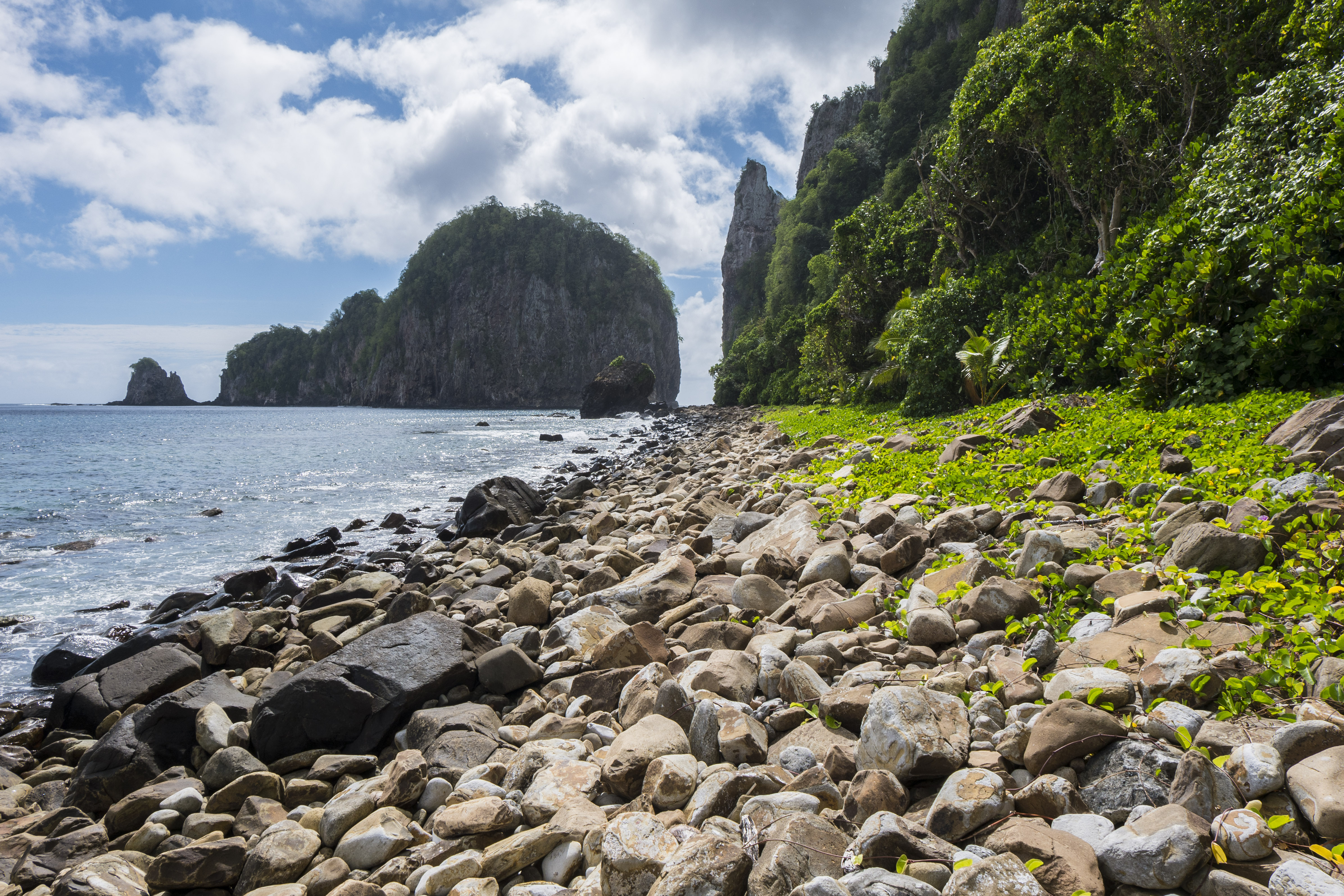
The Trail: A straightforward descent through coastal forest to a rocky shoreline. The trail is clear but can be muddy. The final section involves a short, easy scramble over tidal rocks to reach the view of Pola Island - a towering sea stack just offshore. This is not a swimming beach; it's a viewpoint with powerful surf.
The Moment: Rounding the final bend and seeing Pola Island framed by the jungle canopy, with the surf crashing against its base. It's a scene of raw coastal power.
What Most Underestimate: The tide. Check a tide chart before you go. At high tide, the surge can make the final rock scramble dangerous and wet. Aim for a mid to low tide visit.
Best Time: Morning, before the day's tropical showers often roll in. This gives you the best light for photos of the island and the clearest views.
Ofu Island Coastal Walk: Not a Trail, But the Essential Stroll
Distance: Varies, up to 2.0 miles one-way along the coast road
Elevation Gain: Minimal
Trailhead & Parking: Anywhere along the road in Ofu village. You're walking through the national park unit that encompasses much of Ofu Island. This is less a marked trail and more an immersive walk through a postcard.
The Trail: You walk on the island's main road or along the shoreline between the road and the beach. The "trail" is the corridor between the steep, jungled slopes of Mount Tumutumu and the fringing coral reef in the turquoise waters. You'll pass by local homes and churches - smile and say "talofa."
The Moment: The view south from anywhere along the coast toward To'aga Beach and the dramatic peaks of Olosega Island. It's the iconic image of the park, and you're in it.
What Most Underestimate: The logistics. Getting to Ofu requires a flight from Tutuila to Ta'u, then a boat taxi or prior arrangement. There are no services for gear. You must be entirely self-sufficient, and your hike is entirely weather and flight-dependent.
Best Time: Any time of day during the drier season (June-September). The light is beautiful in the early morning and late afternoon. For detailed climate patterns, see our guide on the best time to visit.
Seasonal Trail Conditions
June-September (Dry Season): This is your window. Trails are at their least muddy, though "dry" is relative - you'll still encounter damp sections. Stream crossings are minimal. This is the peak season for hiking, but "peak" here doesn't mean crowds, just more reliable weather.
October-May (Wet Season): Hiking becomes a serious undertaking. Trails are perpetually slick, with deep mud pits. Flash flooding can make stream crossings on some unmarked routes dangerous. Leech encounters are possible. The upside? You'll have the trails completely to yourself. Rangers may advise against certain routes after heavy rains.
Year-Round Constant: Humidity sits between 70-80%. Sudden, intense rain showers can occur any day, any time, lasting 5 minutes or 5 hours. Always have a rain layer accessible.

Trailhead Logistics
Parking is a village activity, not a park service operation. On Tutuila, trailheads are in or near the villages of Vatia and Fagasa. Parking spots are extremely limited (2-5 cars). If a small pullout is full, do not create your own space. Your options are to wait for a departure or return later. Blocking a road or driveway is a quick way to disrespect the community that hosts the park.
Cell service drops out at most trailheads and is completely absent on the trails themselves. Do not rely on your phone for navigation or emergency communication. Download offline maps and tell someone your plan.
There are no water sources on any trail. The only reliable water is at the park visitor center in Pago Pago or from your own supply. The gift shop sells water, but your hotel or a grocery store is cheaper.
For current trail conditions, the ranger station at the Pago Pago visitor center is your sole source. They know which trails are passable after recent rains.
What to Carry
Your gear list deviates from standard here. Water is priority one. Carry a minimum of one liter per hour of planned hiking, plus an extra liter in the car for when you return drenched in sweat. A hydration bladder is more practical than bottles for constant sipping.
Footwear is critical. Trail runners or hiking shoes with aggressive, sticky rubber soles (like Vibram Megagrip) are ideal. You need traction on wet roots and slick rock. Full leather boots can overheat quickly.
Trekking poles are not optional for any trail with significant elevation change. They provide critical stability on descents and save your knees.
Pack a lightweight, packable rain jacket regardless of the forecast. A small microfiber towel is useful for wiping sweat or drying off after a sudden downpour. Include a headlamp - jungle canopy can make trails dark quickly, even before sunset.
Leave the cotton at your hotel. Quick-dry fabrics from head to toe.
Practical Takeaways
- Water dominates the day. Drink constantly, starting the night before your hike.
- Start early. 6:30 AM is not too early. The heat and humidity only increase.
- Footwear traction is your primary safety feature. Inspect your soles before you come.
- Respect village parking. If the small area is full, your hike is delayed. Plan accordingly.
- There are no trailhead toilets. Use facilities in Pago Pago or at your accommodation before driving out.
- Your hike duration will be 1.5 to 2 times longer than what the distance suggests. Plan your day around one major hike.
- After your hike, your body will crave electrolytes. Coconut water, available locally, is a perfect recovery drink.
- Check the NPS website for the very latest on trail closures like the Alava main route before you finalize plans.
- For extending your stay outdoors, research the limited camping options well in advance, as they are not typical park campgrounds.
- The national park of American Samoa map is helpful for orientation, but the trails are best explained by the rangers at the visitor center. Stop there first.
Recommended Gear
What experienced visitors bring to The to National Park of American Samoa Hiking
Links may earn us a commission at no extra cost to you. We only recommend gear we believe in.
Hiking Essentials
Hydration Pack (3L)
Hands-free water for long trail days
Trekking Poles (Pair)
Save your knees on steep descents
Hiking Boots (Ankle Support)
Sturdy footwear for rocky, uneven trails
Sun & Heat Protection
Wide-Brim Sun Hat
Full coverage UPF 50+ protection at altitude
Insulated Water Bottle (32oz)
Keeps water cold in desert heat all day
Electrolyte Mix Packets
Replace what water alone cannot during intense heat
Winter Gear
Microspikes / Traction Devices
Essential for icy rim trails in winter months
Packable Down Jacket
Lightweight warmth that stuffs into a pocket
Sources
- Official source: National Park Service nps.gov/npsa/index.htm
Photo Gallery
More to Explore

Park Guide
Acadia National Park: Carriage Roads, Cadillac Mountain & 2026 Guide
Discover carriage roads, Cadillac Mountain, and rugged Maine coast. Complete 2026 guide to Acadia National Park — trails, fees, lodging, permits, and what rangers recommend.

Hiking Guide
Grand Canyon Hiking Trails: Day Hikes, Water Sources & Rim to Rim
Compare Grand Canyon hiking trails: Bright Angel, South Kaibab, Hermit, Grandview, and rim to rim, with distances, elevation, water stops, and trailhead access for each.

Best Of
Best of Glacier Bay National Park
The best of Glacier Bay is reached by boat: ranger-led day tours up the bay to the tidewater glaciers. What's worth it, how to book, and when to go (2026).

Campsite Guide
White Sands Backcountry Camping: Closed for 2026 — What to Know
As of 2026, backcountry camping at White Sands National Park is closed for site rehabilitation. What that means, and where to camp nearby instead.

Weather Guide
Guadalupe Mountains National Park Weather: Weather
Guadalupe Mountains National Park: weather guide guide updated 2026. Practical visitor information, reservations, and seasonal tips worth bookmarking before

Best Of
Best of Cuyahoga Valley National Park: Best Things to Do
Seeing a Cleveland Orchestra concert with the woods as your backdrop is a uniquely Cuyahoga Valley experience.
Sign in to join the conversation.
Sources & Attribution
Location data courtesy of the National Park Service (U.S. Department of the Interior). NPS data is public domain. Official NPS page.
Images: NPS; NPS; NPS; NPS.
Map data © OpenStreetMap contributors.
Park operations alerts: NPS.gov · Weather and weather hazards: National Weather Service · Live conditions.
Information may change. Always verify fees, hours, and conditions directly with the official source before visiting.
Did this guide help? Share it with a friend.