Wind Cave National Park Hiking: Hiking (2026 Guide)
13 min read
Hiking Guide
Hike Wind Cave National Park in 2026—bison roam the trails, and rolling prairie hides steep elevation gain. Don't underestimate the sun and wind. Start here.
This article contains affiliate links — we may earn a small commission at no extra cost to you.
Advertisement
What Hiking Here Actually Means
Wind Cave National Park sits on a geological contradiction. Above ground, you're walking mixed-grass prairie and ponderosa pine forest with rolling hills that look gentle but accumulate elevation gain across any route longer than two miles. Below ground is the cave system - but the trails stay above, winding through bison range, past prairie dog towns, and along ridgelines where the Black Hills meet the plains. The hiking here is moderate by mountain standards, but the exposure to sun, wind, and wildlife creates conditions most visitors underestimate.
Advertisement
First-time hikers consistently make two mistakes. They assume flat prairie means easy walking - it doesn't, because the trails dip through drainage after drainage, adding up to more climbing than the topo suggests. And they underestimate how much sun and wind the open grassland sections deliver. A 70-degree day on a protected forest trail feels ten degrees hotter on a ridge with no shade and a 20 mph wind. Pack accordingly.
The One You Should Not Miss
Rankin Ridge Trail
Distance: 1 mile loop
Elevation Gain: 150 feet
Trailhead & Parking: The trailhead sits at the Rankin Ridge picnic area, roughly 2 miles south of the visitor center on US 385. The lot holds about 12 cars. It fills on summer weekends by 10 AM. No overflow lot exists - if it's full, try the Centennial Trail trailhead a mile south.
The Trail: This is the shortest maintained trail in the park and the only one with a fire lookout tower at the end. The surface is packed gravel and dirt, well-maintained, with a steady but not steep climb through ponderosa pine. About halfway up, the trees thin and the prairie opens behind you. The tower itself is open to climb - wooden stairs, about 40 feet up, with a platform that gives you the full 360-degree view.
The Moment: From the tower platform on a clear day, you see the entire park laid out: bison herds as dark dots on the grassland, the Elk Mountains to the north, the Black Hills rising in the distance. The cave entrance isn't visible from here - it's a mile northwest and underground - but the surface landscape that the cave created is fully in view.
What Most Underestimate: The tower stairs. They're steep, narrow, and open. People with vertigo or young children should assess before climbing. The view from the base is still good.
Best Time: Early morning (before 9 AM) for light, or late afternoon (after 4 PM) for the long shadows across the prairie and the best wildlife viewing from the tower.
Centennial Trail (Park Segment)
Distance: 6.5 miles one way (park segment only)
Elevation Gain: Approximately 800 feet
Trailhead & Parking: The southern trailhead is on US 385 about 3 miles south of the visitor center. The lot holds 15 cars. No overnight parking without a camping permit - park rangers ticket vehicles left overnight without one. The northern trailhead connects to Custer State Park near the boundary.
The Trail: This is a through-hiker's trail that crosses the park from south to north. The surface varies from packed dirt to exposed rock to sections of loose gravel where the trail follows old ranch roads. You'll cross open prairie, dip through pine draws, and skirt the edges of bison grazing areas. The trail is well-marked with wooden posts, but in the open grassland sections, the path can be hard to follow in low light - pay attention to the markers.
The Moment: About 2.5 miles north of the southern trailhead, the trail crests a ridge where you can see both the southern prairie stretching toward Hot Springs and the forested hills of the northern park. Bison frequently graze within 100 yards of the trail here. Keep your distance - 300 feet minimum - and be ready to yield.
What Most Underestimate: Water availability. There is no reliable water source along this trail segment. Carry everything you need. The open sections also have zero shade for stretches of a mile or more.
Best Time: May through October. The trail can hold snow well into April and gets icy in November. Summer mornings before 10 AM are ideal.
Photo: NPS via NPS.gov (Public Domain)
Short and Moderate Trails
Prairie Vista Trail
Distance: 1.1 mile loop
Elevation Gain: 100 feet
Trailhead & Parking: Starts directly behind the visitor center. The visitor center lot is large - 200+ spaces - but fills by 10 AM on summer weekends. Overflow parking is available along the access road.
The Trail: This is the park's introductory trail, designed for quick walks and families. It loops through mixed-grass prairie with interpretive signs about the ecosystem. The surface is packed gravel, wide enough for two people to walk side by side. No significant elevation change - just gentle rolling. You'll pass through a prairie dog town about halfway around. The dogs are accustomed to people but not fed - keep them that way.
The Moment: The prairie dog town is active and noisy. Stop for a few minutes and watch the sentinel dogs call out warnings as you approach. The burrow mounds dot the grassland in a pattern that looks random but follows drainage and soil type.
What Most Underestimate: Sun exposure. This trail has zero shade for its entire length. On a 90-degree day, skip it unless you're going very early or late.
Best Time: Early morning for wildlife activity, or sunset for the light across the prairie.
Elk Mountain Trail
Distance: 3.5 mile loop
Elevation Gain: 450 feet
Trailhead & Parking: The trailhead is at the Elk Mountain Campground, about 4 miles north of the visitor center on US 385. The campground lot has parking for about 20 vehicles. The trailhead is at the back of the campground - follow the signs past the group sites.
The Trail: This trail climbs through ponderosa pine forest onto the ridge of Elk Mountain itself. The surface is mostly forest duff and exposed rock, with some sections of loose gravel on the steeper pitches. The loop goes clockwise up the ridge and descends through a drainage on the north side. You'll get views of the northern Black Hills from the ridge, and the forest sections have good birding - look for mountain bluebirds and western tanagers in summer.
The Moment: The ridgeline about 1.5 miles in, where the trail breaks out of the trees and you can see the entire northern half of the park. From here, the Centennial Trail is visible as a faint line across the grassland below.
What Most Underestimate: The climb on the south side of the loop. It's steeper than the trailhead elevation suggests - about 350 feet in 0.7 miles. Not technical, but your legs will feel it on the way back if you're not used to hills.
Best Time: Late afternoon for the light through the pines and the cooling temperatures.
Highland Creek Trail
Distance: 2.5 miles one way
Elevation Gain: 300 feet
Trailhead & Parking: The trailhead is on US 385 about 5 miles north of the visitor center, across from the Centennial Trail northern junction. Pullout parking for 6-8 vehicles. No formal lot - just a wide spot on the shoulder.
The Trail: This is a quiet trail that follows Highland Creek through a narrow valley of ponderosa pine and riparian vegetation. The surface is dirt and pine needles, soft underfoot, with a few creek crossings on rocks or logs. The trail ends at the park boundary where it meets Forest Service land. It's the least-used trail in the park, which means you'll likely have it to yourself - but also means the trail can be overgrown in late summer. Watch for poison ivy along the creek sections.
The Moment: About a mile in, the creek widens into a small beaver pond. The pond is active - look for fresh cuttings and dam repairs. Deer and turkey frequent this area in early morning.
What Most Underestimate: The creek crossings. After spring rain or snowmelt, the rocks can be slick and the water thigh-deep in places. Check at the visitor center for current crossing conditions.
Best Time: Late spring (May-June) when the creek is flowing and the wildflowers are out.
Strenuous and Full-Day Options
Centennial Trail to the South Boundary
Distance: 10 miles round trip
Elevation Gain: 1,200 feet
Trailhead & Parking: Southern trailhead on US 385, same as the shorter Centennial segment. Parking is limited - get there before 8 AM on summer weekends or you'll be walking from the visitor center.
The Trail: This is the full park segment of the Centennial Trail, running from the southern trailhead to the park's south boundary where the trail continues into the Black Hills National Forest. The trail climbs in and out of drainages, crosses open prairie, and follows ridgelines with continuous views. The surface varies - packed dirt, exposed sandstone, sections of loose gravel. No technical climbing, but the constant up-and-down adds up. You'll share the trail with bison, so pay attention to the landscape ahead.
The Moment: At the 4-mile mark, the trail crosses a ridgeline where you can see the entire southern half of the park and the town of Hot Springs 11 miles south. On clear days, the Black Hills stretch north, and the prairie rolls east to the horizon.
What Most Underestimate: The cumulative elevation gain. The trail doesn't have a single big climb - it has a dozen small ones that add up to more than a 1,000-foot day. Bring trekking poles if your knees complain about descent.
Best Time: May-June for wildflowers and moderate temperatures, or September-October for cool weather and fall color.
Lookout Point Trail
Distance: 4 miles round trip
Elevation Gain: 600 feet
Trailhead & Parking: Trailhead is on US 385 about 1 mile south of the visitor center. Small pullout with parking for 4-5 vehicles. There's no sign from the highway - look for the brown trail marker post. If you hit the Rankin Ridge turnoff, you've gone 0.5 miles too far.
The Trail: This is an unofficial but maintained trail that climbs to a high point on the park's southern ridge. The trail follows an old ranch road for the first mile, then narrows to a single track as it climbs through ponderosa pine. The final 0.5 miles are steep - about 250 feet of gain - on loose duff and exposed rock. The trail ends at a rock outcrop with a clear view of the southern prairie.
The Moment: The outcrop at the end. From here, you can see the entire southern park boundary, the Centennial Trail winding below, and on clear days the Nebraska Sandhills 50 miles south.
What Most Underestimate: Trail finding. The old ranch road section is obvious, but the single-track section has several unofficial side trails. Stay left at junctions and aim for the highest point visible through the trees.
Best Time: Late afternoon for the golden light on the prairie. The trail is exposed on the upper section, so shade is minimal.
Photo: NPS via NPS.gov (Public Domain)
Seasonal Trail Conditions
Spring (April-May): Trails are muddy through mid-May, especially the lower elevation sections. Highland Creek runs high and may be impassable without wading. Snow lingers on north-facing slopes and in shaded drainages through early May. The prairie trails dry fastest - Prairie Vista and Rankin Ridge are usually clear by mid-April. Temperatures range from 40-65°F, with afternoon thunderstorms becoming frequent by late May.
Summer (June-August): Daytime temperatures regularly exceed 80°F, with July and August seeing highs in the 90s. Afternoon thunderstorms are common and can produce lightning, hail, and sudden temperature drops of 20 degrees. Get off exposed ridgelines by 2 PM. Trails are dry and dusty by late June. Water sources dry up - Highland Creek may be reduced to pools by August. Early morning is the only comfortable hiking window for open trails.
Fall (September-October): The best hiking season. Temperatures range from 50-70°F with low humidity. Trails are dry and firm. The ponderosa pine forest stays green, but the prairie grasses turn gold and brown. Bison are more active and visible as they gather for the rut. Lows below freezing become common by mid-October. Snow can arrive as early as late October.
Winter (November-March): Snowfall averages 30 inches annually. Park roads close periodically after snow events. Trails are snow-covered and icy. The Rankin Ridge and Prairie Vista trails are packed by hikers and snowshoers after fresh snow. The Centennial Trail is not maintained in winter. Temperatures range from 10-35°F. Wind chill on exposed ridges can drop temperatures below zero. Microspikes are recommended for any trail with elevation change.
Trailhead Logistics
Parking strategy for the Rankin Ridge and Centennial trailheads: Both lots fill by 10 AM on summer weekends. The visitor center lot is larger and stays open longer - if you arrive late, park there and walk the Prairie Vista Trail or drive back to check for openings after 1 PM when the early hikers leave.
Where cell service drops: Cell service is reliable at the visitor center and along US 385 through the park. It drops out completely on the Centennial Trail beyond the first mile from either trailhead, on the Elk Mountain Trail once you leave the campground, and on the upper section of Lookout Point Trail. Download maps before you go.
Water sources on trail: There are no reliable water sources on any trail in the park. Highland Creek has seasonal flow but shouldn't be trusted in dry months. The visitor center has water fill stations. The Elk Mountain Campground has potable water spigots. Carry at least 1 liter per 2 miles on summer days.
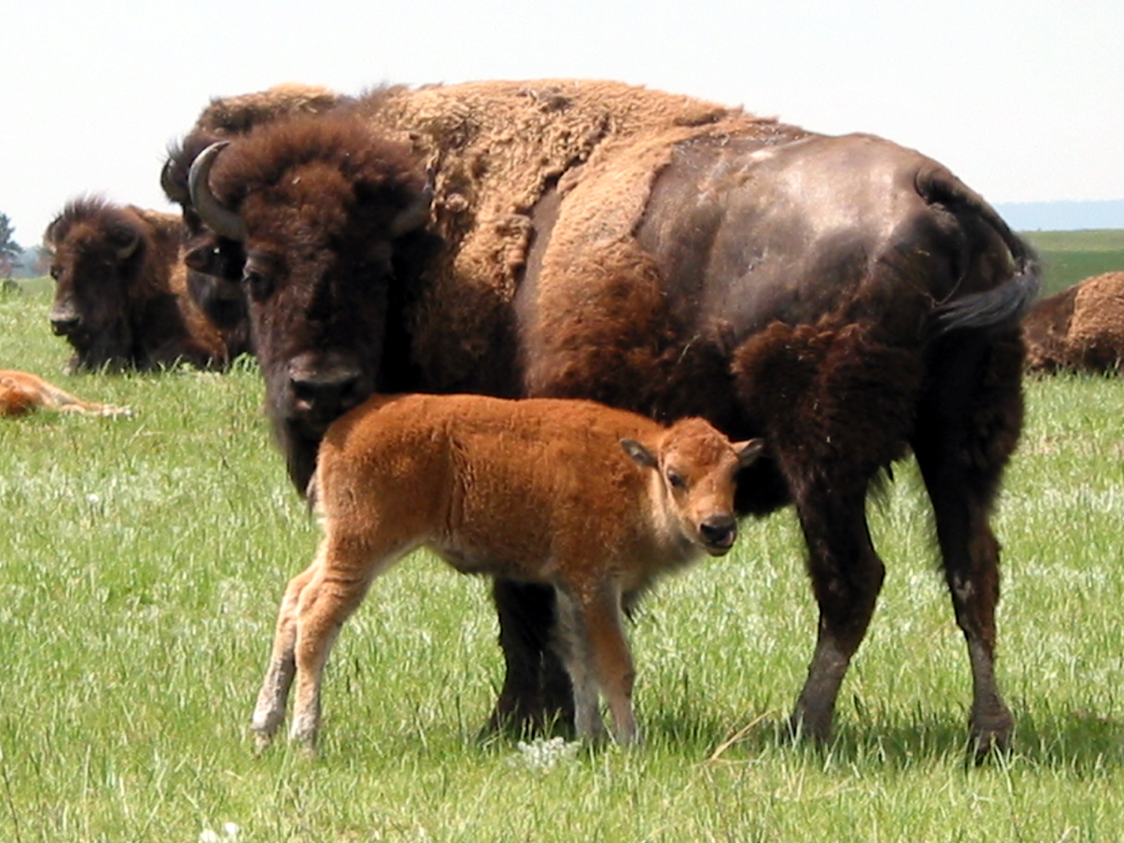
Bison encounters: Bison are present on the Centennial Trail, Prairie Vista Trail, and any trail that crosses open grassland. Keep at least 300 feet (about 100 yards) distance. If a bison raises its tail or snorts, you're too close. Back away slowly - do not run. The park service reports that most bison-related injuries happen when people get too close for photos.
Ranger station for trail conditions: The visitor center is the only ranger station in the park. Stop in before any hike longer than 2 miles to ask about trail conditions, bison locations, and weather forecasts. Rangers post current trail conditions on a whiteboard near the information desk.
Photo: NPS via NPS.gov (Public Domain)
What to Carry
Footwear specific to this terrain: The trails here mix packed dirt, loose gravel, exposed rock, and sections of duff. Trail runners work for the shorter trails (Prairie Vista, Rankin Ridge) in dry conditions. For anything longer than 3 miles, wear mid-height boots with good ankle support. The loose gravel on the Centennial Trail and Lookout Point Trail will test your ankles on the descents. Don't wear new boots - the constant micro-adjustments on uneven surface will blister feet that aren't conditioned.
What makes this park's conditions different: Sun exposure and wind. The open prairie sections have zero shade and the wind amplifies evaporation. Sunscreen, a wide-brimmed hat, and sunglasses are non-negotiable even on cloudy days. The wind also dries out your mouth faster than you expect - you'll drink more water per mile here than in a forested canyon hike at the same temperature.
Water carry requirements: On summer days, plan for 1 liter per 2 miles of hiking. For the full Centennial Trail segment (10 miles round trip), that's 5 liters minimum. No trail has reliable water. The visitor center is the last place to fill bottles before any trailhead.
Trekking poles: Worth bringing for the Centennial Trail and Elk Mountain Trail. The constant small descents on loose gravel will thank you. Not necessary for the short trails.
Bug protection: Mosquitoes are present from late May through July, especially near Highland Creek and in the forested sections of Elk Mountain. Ticks are active April through June. Permethrin-treated clothing is the most effective approach. DEET-based repellent works but will damage synthetic clothing.
Emergency gear: The weather changes fast here. A lightweight rain jacket should go in every pack June through September - those afternoon thunderstorms arrive without much warning. A headlamp is worth carrying even on short trails; the prairie gets dark fast at sunset and the trail markers aren't reflective.
Practical Takeaways
Start the Centennial Trail or any trail longer than 3 miles before 8 AM in summer. The afternoon thunderstorms arrive reliably and you want to be off exposed ridgelines by 2 PM.
The Rankin Ridge Trail is the best short hike in the park, but the fire tower stairs are steep and narrow. Assess your comfort level before climbing with small children.
Bison are not optional scenery - they are active trail users. If you see bison on the trail ahead, stop, assess, and give them space. Do not try to pass within 300 feet. Wait them out or find an alternate route.
The park has no backcountry camping. All overnight parking requires a camping permit at Elk Mountain Campground. Rangers check vehicles left at trailheads after dark.
Cash is not accepted anywhere in the park as of 2026. Cave tour fees, campground fees, and pass purchases require credit cards or digital payments.
The Highland Creek Trail is the quietest trail in the park but also the least maintained. Expect overgrown sections in late summer and check at the visitor center before attempting creek crossings after rain.
Download offline maps before you arrive. Cell service drops on every trail beyond the first mile from the trailhead, and the open prairie trails can be disorienting in low light.
Fall (September-October) is the best season for hiking. The temperatures are comfortable, the crowds thin out after Labor Day, and the bison are more visible and active. Snow can arrive in late October, but the early fall weeks are perfect.
The Elk Mountain Campground has potable water spigots. Fill bottles here if you're hiking from the northern trailheads. The visitor center is the last reliable water source for southern trailheads.
Check the park's website or call 605.745.4600 before your trip for current trail conditions and fire restrictions. Dry conditions can lead to backcountry fire bans that affect where you can cook or smoke.