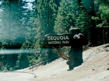
Most first-time visitors planning a review Moro Rock Sequoia National Park weather situation underestimate two things: how cold summer mornings start at high elevation, and how quickly afternoon storms develop. Moro Rock sits at 6,725 feet. The granite dome heats up fast in direct sun, but the air temperature at that elevation rarely hits 80°F even in July. And when clouds build by 2 PM, lightning risk shuts down exposed areas.
The park's weather patterns break into three distinct zones. The foothills (entrance area around 1,500-3,000 feet) run hot and dry in summer, mild in winter. The mid-elevation forests (4,000-7,000 feet where the giant sequoias and Moro Rock are) have short summers with cool nights and deep, snowy winters. The high country above 9,000 feet stays snowbound into June most years.
Winter storms stack up against the Sierra Nevada's western slope, dumping 30-40 feet of snow at the highest elevations. The park's road network closes significantly in winter. The Generals Highway between Sequoia and Kings Canyon closes entirely, cutting off the most direct route between the parks.
Month by Month
January
- Temperature range: 20-45°F at Lodgepole (6,700 ft), 35-55°F in foothills
- Precipitation: Heavy snow above 5,000 feet, rain below
- What's open: Limited. The foothills entrance area stays open. The Generals Highway closes between the parks. Moro Rock and the Giant Forest are accessible only if you have chains and the road is plowed, which is not guaranteed.
- Crowds: Lowest of the year. The park sees maybe 10% of summer visitation.
- Wildlife: Mule deer move to lower elevations. Black bears are less active but not fully hibernated in warmer years.
- Trail conditions: Snow-packed above 5,000 feet. Traction devices required. The Congress Trail and Big Trees Trail are manageable with microspikes. Moro Rock's staircases are icy and dangerous without proper gear.
January is for experienced winter hikers who carry chains and know how to use them. Casual visitors should expect significant road closures.
February
- Temperature range: 22-48°F at mid-elevation
- Precipitation: Peak snow month. Average 40-60 inches at Lodgepole.
- What's open: Same as January. Snowplay areas near the entrance may operate.
- Crowds: Still very low.
- Wildlife: Coyotes become more visible at lower elevations.
- Trail conditions: Deep snow. Snowshoes or skis needed for any trail beyond paved paths.
The shortest month but often the snowiest. Park rangers emphasize that February visitors need to check road conditions before departure - the 20-mile drive from the entrance to Giant Forest can take 90 minutes in active snow.
March
- Temperature range: 25-52°F
- Precipitation: Still significant snow, transitioning to rain at lower elevations by month's end
- What's open: Limited. Spring break brings slightly more visitors.
- Crowds: Low to moderate on weekends during school breaks.
- Wildlife: Bears emerge from dens by late March. Bird migration begins.
- Trail conditions: Variable. Melting snow creates slushy, slippery conditions on trails. The freeze-thaw cycle makes morning ice a real hazard on Moro Rock's steps.
March is unpredictable. A warm year might open more roads by late month; a heavy snow year keeps everything buried until May.
April
- Temperature range: 30-58°F
- Precipitation: Mixed rain and snow. Drier by late month.
- What's open: The Generals Highway typically reopens by mid-April, but this varies by snowpack. Crystal Cave remains closed. The Mineral King Road stays closed until late May.
- Crowds: Moderate on weekends.
- Wildlife: Black bears are fully active. Look for them in meadows at dawn.
- Trail conditions: Mud season. Lower elevation trails become sloppy. Higher trails still have snow. The trail to Moro Rock is usually accessible but may have icy patches on north-facing steps.
Rangers will tell you April is a gamble. You might get clear, 60°F days or a surprise spring storm dumping a foot of snow. Pack for both.
May
- Temperature range: 35-65°F at mid-elevation
- Precipitation: Drying trend. Afternoon thunderstorms become possible by late May.
- What's open: Most park roads open by late May. Crystal Cave opens Memorial Day weekend. The High Sierra Trail below 9,000 feet becomes passable.
- Crowds: Building toward summer. Memorial Day weekend is crowded.
- Wildlife: Fawns appear. Rattlesnakes become active at lower elevations.
- Trail conditions: Improving fast. Lower trails are mostly dry by late May. High country trails above 9,000 feet still have snow crossings.
This is the transition month. The best review Moro Rock Sequoia National Park weather conditions for hiking Moro Rock start appearing in late May - clear mornings, manageable temperatures, and fewer crowds than June through August.
June
- Temperature range: 42-72°F at mid-elevation
- Precipitation: Minimal. Afternoon thunderstorms become regular.
- What's open: Everything at mid-elevation and below. High country trails start opening as snow melts.
- Crowds: High. School is out.
- Wildlife: Active. Marmots at high elevations. Bears in meadows. Watch for rattlesnakes on sunny trails.
- Trail conditions: Mostly dry below 8,000 feet. Mosquitoes emerge in force at mid-elevations by mid-June.
June offers the best balance of accessible trails and comfortable temperatures for most visitors. Morning hikes on Moro Rock are ideal - you beat both the heat and the afternoon thunderstorm risk.
July
- Temperature range: 48-78°F at mid-elevation
- Precipitation: Almost none. Afternoon thunderstorms are the main weather event, typically brief but intense.
- What's open: Everything. The High Sierra Trail is fully open. Mount Whitney trail permits are in high demand.
- Crowds: Peak season. Parking at Moro Rock fills by 8 AM. The Giant Forest Museum lot fills by 9 AM.
- Wildlife: Bears are visible throughout the park. Keep your distance - the park reports dozens of bear-jar incidents each July.
- Trail conditions: Dry and dusty. Water sources run lower by late July.
Cell service drops out at the Moro Rock parking area. Download your maps before you arrive. The parking situation here is tight - the lot holds about 50 cars, and on July weekends you'll wait 30-45 minutes for a spot.
August
- Temperature range: 48-76°F at mid-elevation
- Precipitation: Very dry. Monsoon moisture from the south can bring afternoon clouds and lightning.
- What's open: Full operations. Evening programs at the amphitheater run nightly.
- Crowds: Peak. August is the busiest month.
- Wildlife: Bears are active. Deer are visible in meadows at dawn and dusk.
- Trail conditions: Dry. Fire danger is highest in August. The park may implement fire restrictions.
Early morning is your best bet for Moro Rock. The sun hits the dome around 7 AM in August, and by 9 AM the granite surface is uncomfortable to touch. By noon, lightning risk from building clouds makes the summit a dangerous place to be.
September
- Temperature range: 42-72°F at mid-elevation
- Precipitation: Minimal. First fall storms may arrive late in the month.
- What's open: Full operations through Labor Day, then reduced services mid-week.
- Crowds: High on Labor Day weekend, then dropping sharply after.
- Wildlife: Bears enter hyperphagia (eating constantly to prepare for winter). They are more visible and more food-focused.
- Trail conditions: Dry and dusty. Perfect hiking conditions.
September is the secret sweet spot. Crowds drop after Labor Day, temperatures are still comfortable, and the afternoon thunderstorm pattern weakens. The best hiking weather of the year often falls in the last two weeks of September.
October
- Temperature range: 35-62°F at mid-elevation
- Precipitation: Increasing. First significant rain of the season typically arrives mid-month.
- What's open: Reduced hours. Crystal Cave closes for the season. Campgrounds begin closing by late October.
- Crowds: Low to moderate. Fall color seekers visit for aspen and dogwood displays.
- Wildlife: Bears are highly active. Elk bugling in lower elevations.
- Trail conditions: Good early month. Rain turns trails to mud by late October. First snow dusting possible above 8,000 feet.
The elevation gain is worth it for fall colors. Dogwoods turn red at mid-elevations, and aspens in the high country turn gold. But check road conditions - early snow can close higher roads without warning.
November
- Temperature range: 28-52°F at mid-elevation
- Precipitation: Rain at low elevations, snow above 5,000 feet
- What's open: Limited. Most campgrounds closed. Generals Highway may close temporarily during storms.
- Crowds: Very low. Thanksgiving week brings some visitors.
- Wildlife: Bears are denning by late November. Deer move to lower elevations.
- Trail conditions: Unpredictable. Snow, ice, and mud alternate. Microspikes are essential if hiking above 5,000 feet.
November is for dedicated hikers who don't mind cold and uncertainty. The park is quiet, and you might have Moro Rock to yourself - but you'll need traction devices for the steps.
December
- Temperature range: 24-46°F at mid-elevation
- Precipitation: Snow is the main precipitation. The park averages 30-40 inches at Lodgepole in December.
- What's open: Very limited. The foothills area stays open. Snowplay areas operate. The Generals Highway is closed between the parks.
- Crowds: Low except for Christmas week.
- Wildlife: Minimal activity. Birds at feeders near visitor centers.
- Trail conditions: Deep snow. Snowshoes or skis needed.
The park website doesn't mention that the drive from the entrance to Giant Forest in December can take 2 hours in storm conditions - a trip that takes 45 minutes in summer. Pack patience and chains.
Best Times for Specific Activities
Best months for hiking Moro Rock
Late May through early October. The ideal window is September, when temperatures are comfortable and afternoon thunderstorms are less frequent. If you're doing a review Moro Rock Sequoia National Park weather situation for a specific date, aim for a clear morning forecast with no thunderstorm probability above 20%.
Best months for hiking the high country
July through September. The High Sierra Trail and trails above 9,000 feet are snow-free from roughly July 1 through October 15 most years. August offers the most reliable conditions but the most crowds. September offers better solitude.
Best months for wildlife viewing
May and June for newborn animals and active bears. September and October for bears in hyperphagia - they're more visible but also more dangerous around food. Early morning and late evening are the viewing windows regardless of month.
Wildflower peak timing
Late May through early July at mid-elevations. The Giant Forest meadows bloom with shooting stars, lupine, and paintbrush in June. High country wildflowers peak in July and early August. Lower elevations bloom in April and May.
Fall color timing
Mid-October. Dogwoods turn deep red along the Generals Highway corridor. Aspens in the high country turn gold in late September through early October. The best displays are usually the second and third weeks of October.
Stargazing season
Year-round, but summer offers warmer nights and the Milky Way core is visible. Winter offers clearer air and longer nights but requires serious cold-weather gear. New moon weekends at Lodgepole or Cedar Grove campgrounds offer the darkest skies.
Winter sports window
December through March. Cross-country skiing and snowshoeing are popular on the closed Generals Highway between the parks. The park's snowplay area near the entrance operates when conditions allow. Snow depths of 3-5 feet are typical at Lodgepole by January.
What to Pack by Season
Spring (April-May)
Pack extra water for this stretch - spring is deceptive. Cool mornings make you think you don't need much, but afternoon sun at 7,000 feet is intense. Bring:
- Layers: base layer, fleece, waterproof shell. Temperatures swing 30°F in a day.
- Microspikes or YakTrax. Trails freeze overnight and thaw into mud by afternoon.
- Sunscreen and sunglasses. UV is strong at elevation even when it's cool.
- Rain jacket. Spring storms roll in fast.
Summer (June-September)
Most visitors underestimate how cold summer mornings are at Moro Rock. You'll start in a jacket at 7 AM and strip to a t-shirt by 10 AM. Pack:
- Sun hat, SPF 50+, and lip balm with SPF. The granite dome reflects UV.
- 2-3 liters of water per person for any hike over 2 hours.
- Lightning safety awareness. If you hear thunder, get off exposed ridges immediately. Moro Rock's summit is not safe in a thunderstorm.
- Insect repellent. Mosquitoes are aggressive at mid-elevations in June and July.
- A headlamp. Summer days are long, but afternoon storms can make you lose light if you take shelter.
Fall (October-November)
The weather is stable early in the season and unpredictable later. Bring:
- Warm layers, including a puffy jacket for mornings above 6,000 feet.
- Waterproof boots. Rain and early snow turn trails to slick mud.
- Traction devices by November.
- Extra food and blankets in your car. If a storm closes a road, you might wait hours for plows.
Winter (December-March)
This is serious mountain winter. Pack as if you might be stranded:
- Tire chains. Not optional. California law requires them in your vehicle during winter conditions, and rangers check.
- Full winter hiking gear: insulated boots, gaiters, snow pants, heavy gloves, hat, face protection.
- Hand warmers. The granite steps of Moro Rock conduct cold aggressively.
- Avalanche awareness if venturing into the backcountry. The park has avalanche terrain above 9,000 feet.
What the Forecast Doesn't Tell You
- The temperature at the entrance is meaningless for Moro Rock. The 5,000-foot elevation gain from the Ash Mountain entrance (1,500 ft) to Moro Rock (6,725 ft) means a 15-20°F temperature drop. If it's 85°F at the entrance, it might be 65°F at Moro Rock with a 20 mph wind.
- Afternoon thunderstorms form with almost no warning. The forecast might say "10% chance of thunderstorms," but a clear morning can produce lightning by 1 PM. The park's policy is simple: if you're on exposed granite when thunder is audible within 30 seconds of lightning, you're in danger. Moro Rock's staircase has no shelter.
- "Clear and sunny" at 8 AM does not predict 2 PM. The Sierra Nevada's summer pattern is predictable: clear mornings, building clouds by noon, potential thunderstorms by 2-4 PM. Plan hikes on exposed ridges for before 11 AM.
- Snow depth varies enormously by elevation. A storm that drops 2 feet at Lodgepole (6,700 ft) might leave only rain at the entrance. Conversely, the foothills can be dry while the Giant Forest has impassable snow. Always check conditions for your specific destination elevation.
- The Generals Highway closure between the parks is not a temporary thing. From November through April, the 46-mile road between Sequoia and Kings Canyon is closed. You cannot drive between the parks in winter. This surprises many first-time winter visitors who book lodging in one park planning to visit both.
- Wind at Moro Rock is stronger than you expect. The dome acts as a wind tunnel. Sustained winds of 30-40 mph are common on summer afternoons. On a calm day at the parking area, you might find 50 mph gusts at the summit. The handrails on the staircase exist for this reason.
- UV index at 7,000 feet is 35-50% higher than at sea level. You can burn in 20 minutes on a cloudy day. The combination of high elevation and reflective granite makes sunscreen essential even when it's overcast.
Practical Takeaways
- For a Moro Rock visit, arrive by 7 AM in summer. You'll get parking, avoid the heat, and beat afternoon thunderstorms. By 10 AM the lot is full and the rock is crowded.
- September is the best overall month for weather reliability. Comfortable temperatures, fewer thunderstorms, lower crowds, and all facilities still open.
- Never trust a forecast more than 48 hours out. Mountain weather in the Sierra Nevada is notoriously difficult to predict. Check the National Weather Service's forecast for "Lodgepole, CA" specifically, not a generic Sequoia National Park forecast.
- Pack for 20°F colder than the forecast says. A forecast of 68°F at Lodgepole means morning temperatures near 45°F and wind chill that can drop effective temperature another 10 degrees.
- Thunderstorm safety is non-negotiable. If you're on Moro Rock or any exposed ridge and hear thunder, descend immediately. The summit is not safe. Lightning strikes kill someone in the Sierra Nevada almost every year.
- Microspikes are worth the weight from November through May. Traction on icy granite steps makes the difference between a pleasant hike and a dangerous scramble. They cost $30 and fit in a jacket pocket.
- The park's recorded road conditions hotline (559-565-3341) provides more accurate information than any weather app. Call it before you drive in winter or early spring.
For more information, see our complete Sequoia National Park Guide.
Related: hiking trails at sequoia national park guide
Related: hiking trails in sequoia national park guide