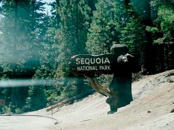
The hiking here splits into two distinct experiences. Below 7,000 feet, you're in giant sequoia groves - relatively flat trails through massive trees, good for all fitness levels. Above 7,000 feet, the terrain opens into alpine granite, exposed ridgelines, and serious elevation gain. Most first-time visitors try to do both in the same day and end up exhausted by lunch. Pick one zone and commit to it.
The parking situation here is genuinely difficult. The main trailhead lots fill by 7:30 AM in July and August. The park runs a shuttle during summer months, but it only covers the main corridor between the Giant Forest Museum and Moro Rock. If your trailhead is outside that corridor, you need to be early or flexible.
The One You Should Not Miss
The Congress Trail: The Definitive Big Tree Walk
Distance: 2.7 miles
Elevation Gain: 300 feet
Trailhead & Parking: Starts from the General Sherman Tree parking lot off the Generals Highway. This lot fills by 7 AM in peak season. Overflow parking is at the Giant Forest Museum, a 0.5-mile walk downhill to the trailhead. The lot reopens as people leave around 2 PM.
The Trail: The Congress Trail is the best maintained trail in the park and for good reason - it's the most popular. The surface is packed gravel and pavement, wide enough for four people to walk side by side. The trail forms a loop that takes you past the General Sherman Tree (the largest tree on Earth by volume), then continues through the heart of the Giant Forest grove. You'll pass the President Tree, the Chief Sequoyah Tree, and dozens of other named sequoias. The trail narrows here and there as it winds between tree bases that measure 30 feet across.
The Moment: About 0.8 miles in, the trail opens into a natural amphitheater of sequoias called the House Group. Stand in the center and look up. The canopy is so high it creates its own weather - you'll feel the temperature drop and the air get noticeably cooler. The trail register is full of comments about this spot.
What Most Underestimate: That 300 feet of elevation gain. At 7,200 feet, the gentle climb back to the parking lot will leave you winded. It's flat on the loop itself, but the return leg to the General Sherman lot is a steady uphill grade.
Best Time: Early morning for light. The morning sun filters through the canopy at low angles and creates long shadows across the trail. By 10 AM the light flattens out. Late afternoon also works well.
Moderate Day Hikes
Moro Rock: The Stairmaster with a View
Distance: 0.5 miles round trip
Elevation Gain: 300 feet
Trailhead & Parking: Moro Rock parking area on the Moro Rock/Crescent Meadow Road, 2.5 miles from the Giant Forest Museum. Parking is extremely limited - maybe 30 spaces. The shuttle runs here from the museum. The lot fills by 8 AM.
The Trail: This is not a trail. It's a granite staircase - 400 steps carved directly into the rock face. The stairs are steep, uneven, and in some sections only wide enough for one person. Handrails are present on the exposed sections. You'll be climbing the spine of a granite dome with drop-offs on both sides. Not great for anyone with a fear of heights.
The Moment: The summit at 6,725 feet. From this overlook you can see the Great Western Divide stretching south for 40 miles. To the west, the San Joaquin Valley spreads out flat and brown. On clear days you can pick out the outline of the Coast Range. The elevation gain is worth it for the 360-degree view.
What Most Underestimate: The physical effort of 400 stairs at 6,400 feet. This is the equivalent of climbing a 30-story building. Most people take 20-30 minutes just for the ascent. Bring water even for this short distance.
Best Time: Late afternoon for photography. The granite face catches the golden hour light and the shadows stretch dramatically across the valley.
Tokopah Falls: Canyon Hike
Distance: 3.7 miles round trip
Elevation Gain: 600 feet
Trailhead & Parking: Marble Fork Bridge on the Generals Highway, right past the Giant Forest Museum. There are about 40 parking spaces at the bridge pullout. Overflow parking at the museum adds 0.3 miles to your walk.
The Trail: This trail follows the Marble Fork of the Kaweah River up a granite canyon. The surface is packed dirt and decomposed granite, with some rocky sections near the waterfall. The trail gains elevation steadily but not steeply - think of it as a long gentle incline. You'll cross several small footbridges over side streams. The canyon walls on both sides are polished granite slabs, and the river noise stays with you the entire way.
The Moment: The waterfall at the end. Tokopah Falls drops 1,200 feet in a series of cascades, with the main drop being about 200 feet. In early summer (May-June), the waterfall is a solid curtain of water. By August it's reduced to a spray. The pool at the base is cold - snowmelt cold - but people swim in it anyway.
What Most Underestimate: The afternoon sun exposure. The canyon runs roughly north-south, and the afternoon sun bakes the granite walls, reflecting heat back onto the trail. The last mile before the falls has zero shade. Start this hike by 9 AM.
Best Time: Late May through June for maximum waterfall flow. Early morning to beat the heat.
Strenuous Day Hikes
Alta Peak: The Full Elevation Experience
Distance: 13.5 miles round trip
Elevation Gain: 4,000 feet
Trailhead & Parking: Wolverton parking area, 3 miles south of the Giant Forest Museum on the Generals Highway. This lot holds about 80 cars and fills by 8 AM. The shuttle does not run to Wolverton.
The Trail: This trail starts in mature sequoia forest, passes through a meadow, then climbs into alpine terrain above treeline. The first 3 miles are a steady climb through forest with good shade. At the Panther Gap junction (3.5 miles in), the trail breaks above treeline and the exposure begins. The final mile is a steep, rocky scramble on loose granite - the trail surface here is ankle-twisting rock with no consistent path. Rangers will tell you the last section is the hardest part of any day hike in this park.
The Moment: The summit at 11,204 feet. From this overlook you can see the entire Sierra Nevada crest from Mount Whitney in the south to the Palisades in the north. The Great Western Divide is directly below you. On a clear day, you can see the outline of the Coast Range 150 miles west.
What Most Underestimate: The altitude. Most hikers who attempt this from sea level feel the elevation by 9,000 feet. Headaches, nausea, and shortness of breath are common. Spend a night at 7,000 feet before attempting this. Also, the trail loses the tree cover at 9,500 feet - you'll be exposed to sun and wind for the final 4 miles.
Permits: No day hike permit required, but you need a wilderness permit for any overnight use of the Alta Peak Trail.
Best Time: July through September. Snow lingers on the upper sections into June. Start by 6 AM.
Lakes Trail: Alpine Lakes Loop
Distance: 11.5 miles round trip
Elevation Gain: 3,200 feet
Trailhead & Parking: Wolverton parking area (same as Alta Peak). This lot fills early - be there by 7:30 AM.
The Trail: This trail climbs through a series of granite basins, passing four named lakes: Heather Lake, Emerald Lake, Pear Lake, and Aster Lake. The trail surface varies from packed dirt in the forest sections to exposed granite slabs above 9,000 feet. There's one section called "The Watchtower" - a cliffside traverse with steel cables bolted into the rock. It's not dangerous if you take your time, but it's exposed and narrow. The trail narrows here significantly.
The Moment: Pear Lake, about 5.5 miles in. The lake sits at 9,600 feet in a granite bowl, surrounded by 12,000-foot peaks. The water is so clear you can see the bottom at 30 feet deep. The trail follows the lake's west shore for about 0.3 miles, giving you multiple viewpoints.
What Most Underestimate: The Watchtower section. It's only about 200 yards long, but it's the single most exposed section of any standard day hike in the park. Anyone with significant fear of heights should consider turning around at Heather Lake (4.5 miles in) and heading back.
Permits: No day hike permit required.
Best Time: July through September. The Watchtower section can hold snow into late June. Start by 7 AM.
Short and Accessible
Big Trees Trail: Paved Loop for All
Distance: 0.6 miles
Elevation Gain: Minimal
Trailhead & Parking: Giant Forest Museum. The museum parking lot is large and turns over frequently. The trail starts at the back of the museum.
The Trail: Fully paved and wheelchair accessible. The trail circles Round Meadow, a classic sequoia grove with a wet meadow in the center. Interpretive signs along the way explain the sequoia lifecycle and fire ecology. This is the trail you take with grandparents, small children, or anyone who can't handle stairs.
The Moment: The meadow itself. In June and July, wildflowers crowd the meadow edges - lupine, Indian paintbrush, and columbine. The sequoias around the meadow are some of the largest in the grove.
What Most Underestimate: How good this trail actually is. Many visitors skip it for the Congress Trail, but the Big Trees Trail gives you better views of the trees because you're at the base looking up, not walking between them.
Best Time: Any time. The paved surface stays clear of snow earlier than other trails.
Seasonal Trail Conditions
June: Snow lingers on trails above 9,000 feet. Alta Peak and Lakes Trail may have snow patches through mid-June. Tokopah Falls is at peak flow. The Congress Trail and Big Trees Trail are clear. Moro Rock may have ice on the stairs in early June.
July: All trails are typically clear by mid-July. Mosquitoes are bad above 8,000 feet through late July. Afternoon thunderstorms are common - plan to be off exposed ridgelines by 2 PM.
August: Dry conditions everywhere. Water sources on the Alta Peak and Lakes trails may be reduced. Tokopah Falls is a spray by August. Hottest month - expect 80s at lower elevations, 60s at 10,000 feet.
September: Best month for hiking. Cooler temperatures, fewer crowds, minimal bugs. Snow is unlikely until late September. Trail conditions are at their best.
October through May: Most high-elevation trails are snow-covered. The Congress Trail and Big Trees Trail are usually accessible but may have snow. Alt Peak and Lakes Trail require snowshoes or skis after November.
Trailhead Logistics
Parking Reality: The Wolverton lot (for Alta Peak and Lakes Trail) fills by 7:30 AM. The General Sherman lot fills by 7 AM. The Moro Rock lot fills by 8 AM. After these times, you're parking at the Giant Forest Museum and walking to your trailhead, adding 0.3 to 1.0 miles to your day.
Shuttle: The park shuttle runs from the Giant Forest Museum to Moro Rock, Crescent Meadow, and a few other stops. Runs every 15 minutes from 7 AM to 6 PM, late May through early September. The shuttle does not go to Wolverton.
Cell Service: Cell service drops out at the park entrance and doesn't return until you're back on the Generals Highway near the Foothills Visitor Center. Don't count on your phone for navigation. Download maps before you arrive.
Water Sources: The Congress Trail has a water fountain at the General Sherman Tree parking lot. Tokopah Falls has the river (treat before drinking). Alta Peak and Lakes Trail have seasonal streams through July, but by August you're carrying all your water. Plan for 1 liter per 2 miles of hiking.
Bear Canisters: Required for all overnight trips. Available for free loan at the Foothills Visitor Center and Lodgepole Visitor Center. Day hikers don't need them, but you should still keep food out of sight.
Ranger Station for Conditions: The Lodgepole Visitor Center (open year-round) posts weekly trail condition reports. The Foothills Visitor Center at the park entrance also has current conditions. Stop at one of these before heading out.
What to Carry
The terrain here demands specific gear choices. The granite surfaces are hard on shoes - you want proper hiking boots with good tread, not trail runners. The decomposed granite on many trails is loose and slippery, especially on downhill sections. Boots with aggressive lugs make a noticeable difference.
Footwear: Hiking boots with ankle support for anything over 5 miles. The rocky sections on Alta Peak and the Watchtower on Lakes Trail will punish ankles in low-cut shoes.
Layers: The temperature difference between trailhead and summit can be 30 degrees. At Wolverton (7,200 feet) in July, you might start at 55°F and end up at 75°F, or you might hit 45°F and wind at 12,000 feet. A puffy jacket that packs small is worth carrying.
Sun Protection: The granite reflects UV like a mirror. You will burn faster than you expect. Wide-brim hat, sunscreen, and sunglasses are non-negotiable above treeline.
Water: Carry more than you think you need. The Alta Peak and Lakes trails have no reliable water sources after July. For a full day hike, 3 liters is the minimum. For Alta Peak, consider 4 liters.
Navigation: The trails are generally well-marked, but the Alta Peak summit scramble and the upper Lakes Trail sections have confusing junctions. Carry a paper map or a downloaded GPS map. The park sells a good trail map at the visitor centers.
Bug Protection: Mosquitoes above 8,000 feet in July are aggressive. DEET or permethrin-treated clothing makes a noticeable difference.
Practical Takeaways
- The Congress Trail is the best short hike in the park, not the General Sherman Tree loop. The Congress loop gives you more trees and fewer crowds.
- Parking fills by 7 AM at every major trailhead in summer. If you arrive at 8 AM, you're parking at the museum and walking. Plan for it.
- Spend a night at 7,000 feet before attempting Alta Peak or Lakes Trail. Driving up from sea level and hiking the same day is a bad idea at 11,000 feet.
- Moro Rock is harder than it looks. 400 stairs at 6,400 feet will leave you breathing hard. Allow 45 minutes round trip, not the 20 minutes the sign suggests.
- The Watchtower on the Lakes Trail is real. If you have any vertigo or fear of heights, stop at Heather Lake and head back. The view from Heather Lake is worth the trip on its own.
- Tokopah Falls is best in June. By August it's a trickle. Check recent trip reports before making the drive.
- The park's official trail map is better than any app. Cell service drops out at the park entrance and doesn't return. Download everything before you arrive.
- Afternoon thunderstorms develop quickly above 9,000 feet. Be off exposed ridgelines by 2 PM. The standard rule here is start early, finish early.
- The shuttle only runs the main corridor. It does not serve Wolverton, the Alta Peak trailhead, or the Lakes Trail trailhead. If your hike starts at Wolverton, you drive there.
- Bear canisters are free at the visitor centers. Overnight hikers need them. Day hikers should still keep food in their packs and out of sight. The bears here know what backpacks look like.
For more information, see our complete Sequoia National Park Guide.
Related: hiking trails at sequoia national park guide
Related: hiking trails in sequoia national park guide