This article contains affiliate links — we may earn a small commission at no extra cost to you.
Advertisement
What Hiking Here Actually Means
Most first-time backpackers show up expecting rainforest. What they find instead is a coastal ecosystem that demands more attention than its gentle reputation suggests. The 60-mile stretch of Redwood National and State Parks spans from sea level to about 3,200 feet, which means your legs will encounter both sand and steep ridgeline climbs in a single day. The real challenge isn't the elevation gain - it's the damp. Year-round temperatures hover between mid-40s°F and mid-60s°F, and the park averages 60-80 inches of rain between October and April. That's not a drizzle problem. That's a "your sleeping bag will never fully dry" problem.
Advertisement
Rangers will tell you the single thing most visitors underestimate is how much route planning matters here. Unlike parks where you follow one trail to one destination, Redwood's best hiking requires connecting segments across state park and national park boundaries. Cell service drops out at multiple points along the coastal corridor. If you're looking for the best backpacking Redwood National Park has to offer, you need to understand these conditions before you arrive - not figure them out on trail.
The trails range from half-mile boardwalk loops to the 12-mile James Irvine Trail to Fern Canyon loop, which is the benchmark multiday hike in the southern section. The terrain alternates between soft duff under old-growth canopies, exposed sandstone along the coast, and the occasional root-tangled scramble through creek drainages. Pack extra water for this stretch - reliable sources are fewer than the maps suggest.
The Signature Hike: James Irvine Trail to Fern Canyon Loop
Distance: 12 miles
Elevation Gain: 1,800 feet
Trailhead & Parking: The trailhead is at the Prairie Creek Visitor Center off the Newton B. Drury Scenic Parkway. The lot holds about 40 cars and fills by 9:30 AM from June through August. Overflow parking is available along the parkway shoulder, but expect a quarter-mile walk to the trail register. The visitor center has reliable restrooms and a water spigot - fill up here because there's nothing reliable after the first 3 miles.
The Trail: This loop combines the James Irvine Trail, Clintonia Trail, and Coastal Trail into one sustained day. You start under old-growth redwoods so dense the canopy blocks most direct light - the forest floor stays damp even in August. About 4 miles in, the trail transitions from redwood groves to Douglas fir and Sitka spruce as you approach the coast. The final 2 miles drop through fern-lined creek beds to the ocean. The trail narrows here significantly - single-file for the last mile to the beach.
The Moment: Fern Canyon itself. The walls rise 50-80 feet, completely covered in five-fingered ferns, sword ferns, and moss. Water drips from every surface. It looks like a film set for a prehistoric planet - because it was. Parts of Jurassic Park 2 were filmed here. The light filters green through the canopy, and the sound is constant dripping punctuated by the ocean surf 200 yards ahead.
What Most Underestimate: The stream crossings. From May 15 to September 15, you need a free reservation just to drive to the Fern Canyon trailhead parking area. If you're doing this loop as a day hike from the visitor center side, you avoid that permit requirement entirely - but you still cross Fern Creek itself, which can be knee-deep in spring runoff. Bring waterproof boots or accept wet feet.
Best Time: Early morning is your best bet for this loop. Start by 7 AM to reach Fern Canyon before the day-use crowds arrive. The canyon gets congested with photographers and families by 11 AM. June through September offers the driest conditions, though September into October gives you fewer people and more stable weather.
Photo: NPS via NPS.gov (Public Domain)
The Northern Gem: Boy Scout Tree Trail
Distance: 5.5 miles round trip
Elevation Gain: 1,200 feet
Trailhead & Parking: Located off Howland Hill Road, about 3 miles south of the Hiouchi entrance station. The parking area is a gravel pullout with space for maybe 12 cars. Howland Hill Road itself is a dirt road where redwoods grow close enough that the bark practically kisses your side mirrors. RVs and trailers are not advised. Arrive before 8 AM or plan to park along the road shoulder and walk in.
The Trail: This is a moderate out-and-back that climbs steadily through old-growth forest. The surface is mostly packed duff with exposed root sections - watch your footing on the descent. About 1.5 miles in, you'll pass a massive fallen tree that creates a natural bridge over a small creek. The trail narrows here and gets steeper for the next half mile. The turnaround point is the Boy Scout Tree itself, a double-trunk redwood estimated at over 2,000 years old.
The Moment: Just past the 2-mile mark, the trail passes through a grove where the trees are spaced so tightly that the trail becomes a corridor between living walls of reddish-brown bark. The quiet here is notable - no road noise, no wind, just the occasional creak of a branch overhead.
What Most Underestimate: The steepness of the return climb. It's only 1,200 feet of gain total, but most of it is concentrated in the last 1.5 miles on the way back. Your calves will feel it. Also, Howland Hill Road can be impassable after heavy rain - check conditions at the Hiouchi Visitor Center before driving it.
Best Time: Winter and spring offer the best light for photography - the low angle of the sun cuts through the canopy and illuminates the understory. Summer mornings are foggy but clear by 10 AM.
The Tall Trees Grove: The Permit Hike
Distance: 4 miles round trip (with optional extension to 7 miles)
Elevation Gain: 800 feet
Trailhead & Parking: This is the one trail in the park that requires a free online reservation (available at the NPS website). The limit is tight - only 50 vehicles per day as of 2026. You'll receive a gate code with your permit that opens the Tall Trees Access Road off Bald Hills Road. The road is paved but narrow, with turnouts for passing. The trailhead lot holds maybe 15 cars.
The Trail: The hike drops 600 feet in the first mile to reach the grove floor - which means the return is a sustained climb. The trail surfaces range from packed gravel to exposed bedrock. The grove itself contains some of the tallest trees in the park, including the former record-holder for tallest measured tree on Earth (367.8 feet, though that tree's exact location is now kept confidential to protect it).
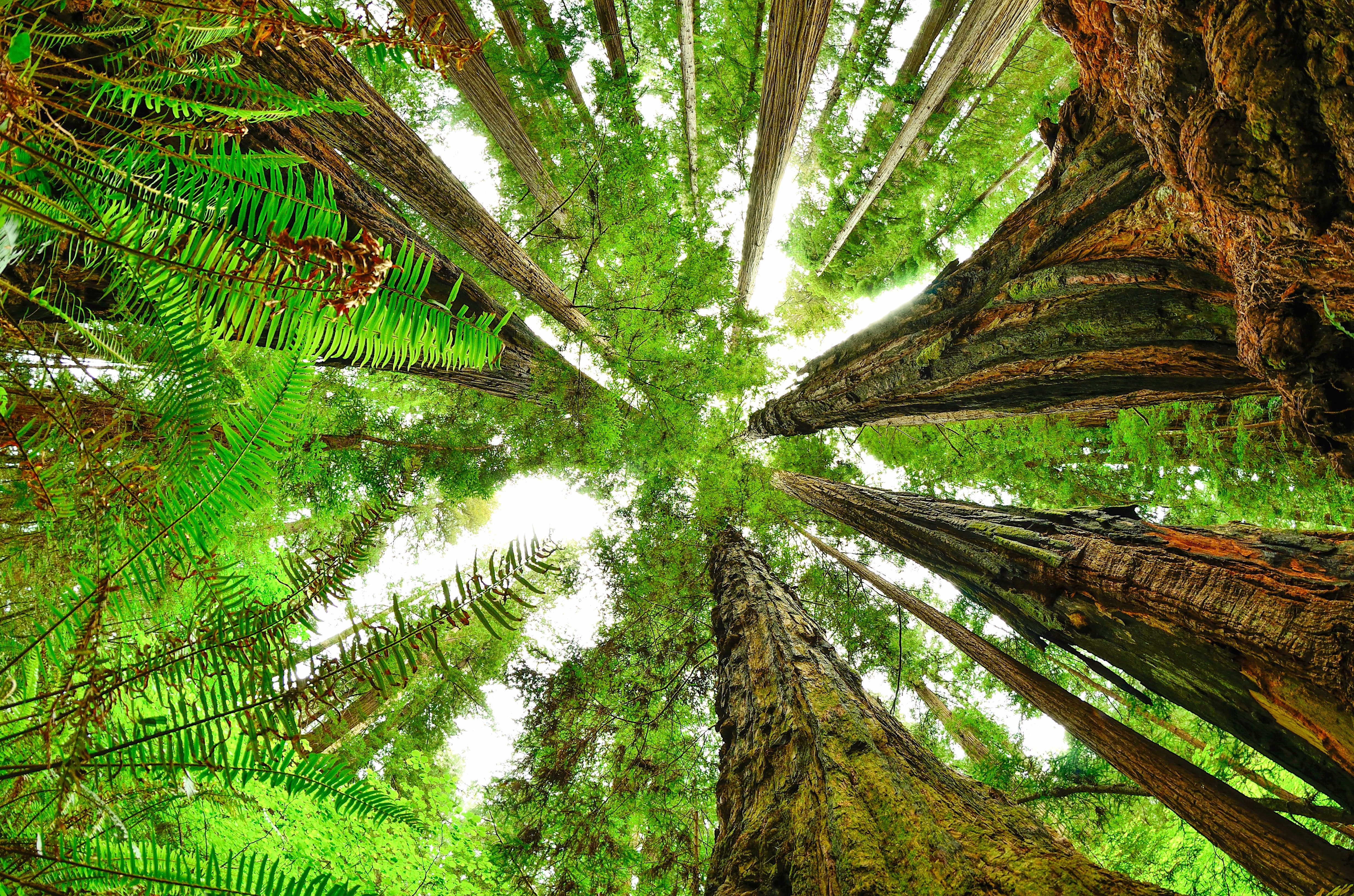
The Moment: Standing at the base of a 360-foot redwood and looking straight up. The trunk tapers to what looks like a thread against the sky. You can't photograph it - no camera captures the vertical scale. You just stand there and crane your neck until it hurts.
What Most Underestimate: The permit process. The free Tall Trees Grove reservation opens 24 hours in advance and fills within minutes during summer. Set an alarm. Also, the access road is 7 miles of narrow pavement with no turnarounds - do not attempt if you're uncomfortable with tight roads.
Best Time: Late September through October. The summer crowds thin out, the fog lifts earlier, and the fall light through the canopy is exceptional.
Photo: NPS via NPS.gov (Public Domain)
Moderate Options Worth Your Time
Trillium Falls Trail
Distance: 2.5 miles round trip
Elevation Gain: 400 feet
Trailhead & Parking: Southern end of the park, off Davison Road near the Elk Prairie area. The lot holds about 25 cars. This is a popular family hike, so expect competition for spaces by 10 AM.
The Trail: A gentle loop through old-growth redwoods, maples, and alders. The trail surface is well-maintained packed earth with some boardwalk sections. The falls at the midpoint drop about 30 feet over a moss-covered rock face. Not dramatic by Yosemite standards, but the surrounding forest makes it worth the stop.
The Moment: The section where the trail parallels a small creek for about a quarter mile. The sound of water over stone mixes with the bird calls - varied thrushes and winter wrens are common here.
Best Time: Spring, when the falls are running full and the understory wildflowers are blooming. Trillium itself peaks in April and May.
Zig Zag Loop
Distance: 3.9 miles
Elevation Gain: 600 feet
Trailhead & Parking: Starts from the Prairie Creek Visitor Center area, same as the James Irvine Trail. Parking is shared with that trailhead - arrive early.
The Trail: This loop heads south on Prairie Creek Trail (recently renamed the Karl Knapp Trail), then climbs via the Zig Zag Trail to a ridgetop with views of the surrounding watershed. The climb is short but steep - a series of tight switchbacks through second-growth forest. The return descends through a beautiful old-growth section along the creek.
The Moment: The ridgetop overlook around mile 2.5. From here you can see across the Prairie Creek drainage to the distant coastal hills. On clear days, the ocean is visible as a silver line on the horizon.
Best Time: Year-round, but the creek crossings can be tricky in winter months. Check at the visitor center for current conditions.
Short Hikes That Deliver
Lady Bird Johnson Grove
Distance: 1.5 miles
Elevation Gain: Minimal (less than 100 feet)
Trailhead & Parking: 10 minutes north of Orick on Bald Hills Road. The road is paved but narrow - RVs and trailers are not advised. The lot fills by 9 AM in summer.
The Trail: A flat loop on a well-groomed path through a classic old-growth grove. Interpretive signs explain the forest ecology. This is the most popular short hike in the park for good reason - it gives you the full redwood experience without the effort.
The Moment: The section where the trail passes through a gap in the trees and the full scale of the grove opens up. The trees here average 250-300 feet tall.
Best Time: Late afternoon, when the light slants through the canopy and the crowds have cleared.
Fern Canyon Loop
Distance: 0.8 miles (loop)
Elevation Gain: Minimal
Trailhead & Parking: Requires a reservation from May 15 to September 15 to drive to the trailhead. The parking area is at the end of Davison Road, about 8 miles of unpaved road from the highway. The lot fills by 10 AM.
The Trail: A short loop that goes through the canyon itself. The trail involves multiple stream crossings - you will get wet feet. The canyon walls are completely covered in ferns, creating a vertical garden effect.
The Moment: The entire canyon. It's short but unforgettable.
Best Time: Early morning, before the crowds arrive. The canyon gets congested quickly.
Photo: NPS via NPS.gov (Public Domain)
Seasonal Trail Conditions
Summer (June-September): The driest window, though "dry" is relative. Expect fog most mornings that burns off by late morning. Highs occasionally reach the low 70s°F. This is the only month where your gear has a chance of staying dry overnight. All trails are accessible, but Fern Canyon requires reservations. The James Irvine Trail is at its best during this window.
Fall (September-October): The sweet spot. Fewer visitors, more stable weather, and the fog lifts earlier. October is the start of the rainy season, but September typically offers perfect conditions. The Tall Trees Grove is particularly good in October when the light angle creates long shadows through the canopy.
Winter (November-March): Heavy rain is the norm. Trails become muddy and creek crossings can be dangerous. Howland Hill Road and Bald Hills Road may be impassable at times. The Boy Scout Tree Trail is still accessible but expect wet conditions. Pack extra water for this stretch - actually, pack extra everything. This is for dedicated backpackers only.
Spring (April-May): Wildflowers peak in April and May - trillium, rhododendron, and Pacific dogwood are common. Streams run high, and Fern Canyon is at its most spectacular. The trade-off is rain. Bring waterproof everything.
Trailhead Logistics
Parking Strategy: The Prairie Creek Visitor Center lot fills earliest - by 9 AM June through August. The Hiouchi lot near the Boy Scout Tree Trail fills by 8:30 AM. For the James Irvine Trail, your best bet is to arrive by 7:30 AM or park at the visitor center and walk to the trailhead.
Cell Service: Drops out at multiple points. You'll have signal at the visitor centers and intermittently along Highway 101. The interior trails - Boy Scout Tree, Tall Trees Grove, James Irvine - have no service. Download maps before you arrive.
Water Sources: The Prairie Creek Visitor Center has a water spigot. The Hiouchi Visitor Center has one too. On trail, you'll find creek crossings on most routes, but treat all water. Giardia is present.
Bear Canisters: Not required for day hikes. For overnight trips, food storage regulations vary by zone - check at the visitor center for current requirements.
Ranger Station for Conditions: The Prairie Creek Visitor Center (open daily) and the Hiouchi Visitor Center (seasonal hours) are your best sources for current trail conditions. Call 707-464-6101 before your trip.
Photo: NPS via NPS.gov (Public Domain)
What to Carry
The single most important gear decision at Redwood National Park is your footwear. The combination of constant damp, soft duff, and occasional root-tangled trail sections means you need boots with good traction and waterproofing. Trail runners will leave you with wet feet by mile 3 in most seasons.
Footwear: Waterproof boots with Vibram-style soles. The roots and rocks in the Boy Scout Tree Trail and James Irvine Trail are slick when wet - which they usually are. Bring an extra pair of dry socks in a waterproof bag.
Rain Gear: Not optional. A quality rain jacket and rain pants are essential even in August. The coastal fog can produce a steady mist that soaks through everything within an hour. Umbrellas are useless on the narrow, tree-lined trails.
Layers: The temperature range is narrow but the conditions change fast. A base layer, mid-layer fleece, and waterproof shell will cover you from 45°F morning fog to 65°F afternoon sun.
Water Capacity: Carry at least 3 liters for a full day hike. The reliable water sources are at the visitor centers and the occasional creek crossing - but creeks can be dry in late summer. For the best backpacking Redwood National Park offers, plan for 4 liters minimum on overnight routes.
Navigation: GPS apps fail here. The canopy blocks satellite signals, and cell service is unreliable. Carry a paper map and compass. The trail junctions on the James Irvine loop can be confusing - the Prairie Creek Trail junction is particularly easy to miss.
Trekking Poles: Recommended for the James Irvine Trail and Boy Scout Tree Trail. The descent on both can be hard on knees, especially on the root-tangled sections.
Practical Takeaways
The Tall Trees Grove permit opens 24 hours in advance online and fills within minutes in summer. Plan around this - don't make it your only hike.
Howland Hill Road is a dirt road suitable for most vehicles, but check conditions before driving it after rain. The rangers at Hiouchi will give you an honest assessment.
The James Irvine Trail to Fern Canyon loop is the gold standard for best backpacking Redwood National Park offers as a day hike, but it requires early starts and good fitness.
Pack extra water for this stretch - the reliable sources are few, and the coastal section has none.
Fern Canyon requires a reservation from May 15 to September 15 if you're driving to the trailhead. If you're hiking in from the James Irvine side, you don't need the reservation.
The Boy Scout Tree Trail is better in winter and spring than summer. The low-angle light creates better photography conditions, and the crowds are thinner.
Most visitors underestimate how wet this park is. Even in August, expect damp conditions. A dry bag for your sleeping clothes is worth its weight.
The Prairie Creek Visitor Center parking lot is your best staging point for the southern trails. The Hiouchi lot serves the northern trails. Both fill early.
Cell service drops out at the Howland Hill Road turnoff and doesn't return until you're back on Highway 101. Download everything before you arrive.
The Zig Zag Loop is the best short moderate hike in the park - it gives you old-growth forest, creek walking, and ridge views in under 4 miles. Most visitors skip it for the bigger names, which means you'll have it mostly to yourself.