New River Gorge National Park Hiking: Best Hikes at New River Gorge National Park (2026 Guide)
12 min read
Hiking Guide
Avoid the rookie mistake at New River Gorge National Park—the hike down is easy, but climbing back out is 600-1,200 feet of work. See the best hikes for 2026.
This article contains affiliate links — we may earn a small commission at no extra cost to you.
Advertisement
What Hiking Here Actually Means
Most first-time visitors show up expecting a casual walk to an overlook. Then they hit their first set of switchbacks and realize this place demands more respect. New River Gorge isn't a rim-only park where you peer down from paved viewpoints - the best trails drop you into the gorge itself, which means you're climbing back out. The elevation profiles here are honest-to-god work: 600 to 1,200 feet of gain on most worthwhile routes, often on uneven sandstone and exposed roots.
Flow reliability
Seasonal consistency of median discharge from the curated USGS gauge for this place.
Spring
68%
year-to-year consistency
Summer
73%
year-to-year consistency
Fall
22%
year-to-year consistency
Winter
62%
year-to-year consistency
Median monthly discharge (cfs)
Median discharge in cubic feet per second by calendar month
Jan
Feb
Mar
Apr
May
Jun
Jul
Aug
Sep
Oct
Nov
Dec
8195
14800
10600
10600
9860
5585
3885
3755
2730
2750
3695
6330
In the last 10 falls, roughly 1 of every 3 September–November weeks sat inside this band (3370–11800 cfs); typical flow in those weeks 5545 cfs, median water temp 64°F (17.5°C).
Computed from 10 years of USGS daily records, station 03185400 (3,651 daily values). Last computed Oct 19, 2026.
Hydrological description only — not advice about wading, floating, or whether conditions are safe for recreation. Always check current USGS readings and local guidance before you go.
Advertisement
Rangers will tell you the single biggest mistake people make is underestimating the return trip. You walk downhill to the river thinking the trail is easy. It isn't. It's just saving the punishment for later. Pack extra water for this stretch - you'll need it on the climb out, especially July through September when humidity sits heavy in the canyon. The park's 70,000 acres offer over 50 miles of maintained trails, ranging from flat river walks to technical scrambles that require both hands. Know your limit before you pick your route.
Endless Wall Trail: The One You Should Not Miss
Distance: 2.4 miles one-way (4.8 miles out-and-back, or shuttle one-way)
Elevation Gain: 600 feet
Trailhead & Parking: Two access points. The Fern Creek Trailhead on Lansing Road is the main start. Parking fills by 9 AM on summer weekends - expect to park along the road shoulder. The other end at the Nuttall Trailhead has a smaller lot that fills even faster. The common strategy is to park at Fern Creek, hike to Nuttall, and have someone shuttle you back. Cell service drops out at both trailheads, so arrange your pickup in advance.
The Trail: This is the park's signature trail for good reason. The path follows the cliff edge along the gorge rim, giving you continuous views down to the river through breaks in the rhododendron. The surface varies from packed dirt to exposed sandstone slabs. About a mile in, the trail narrows here to a single-file width along the cliff face. The rock can be slick after rain - watch your footing on the sections where tree roots cross the path at odd angles. Several side paths lead to unofficial overlooks. Most are safe, but the drop is vertical. Keep children close.
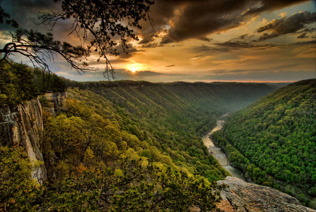
The Moment: Around the 1.5-mile mark, the trail opens to a wide rock shelf called Diamond Point. From this overlook you can see the New River Gorge Bridge to the east and a long sweep of the canyon bending south. The river appears as a green-brown line 800 feet below. On October mornings when fog sits in the gorge and the bridge cables emerge from the mist, this is the view that justifies the entire trip.
What Most Underestimate: The trail is listed as moderate, but the section between the two trailheads has no water sources and limited shade. On a 90-degree day, the exposed rock radiates heat. The return hike from Nuttall back to Fern Creek involves a steady climb that catches people who weren't paying attention on the way down.
Best Time: Early morning is your best bet for light on the canyon walls. October through November for fall color. April through May for wildflowers and lower humidity. Avoid midday in July and August unless you're fine with heat and crowds.
Photo: NPS via NPS.gov (Public Domain)
Long Point Trail: The Short Climber
Distance: 3.2 miles out-and-back
Elevation Gain: 700 feet
Trailhead & Parking: Located off Route 19 near the Canyon Rim Visitor Center. The lot holds about 25 cars. Overflow parking is limited - you'll be walking on the road shoulder if it's full. By 8:30 AM on weekends, expect the lot to be full.
The Trail: Starts with a steady downhill through mixed hardwood forest on a wide gravel path. The descent is gradual enough that you might not notice the elevation loss. You will notice it on the return. The trail surface transitions to exposed sandstone about halfway in, with several sections where the path crosses bare rock slabs. Follow the rock cairns - the trail markings on bare stone can be hard to spot. The final approach to the point involves a narrow ridge with steep drop-offs on both sides.
The Moment: Long Point is a sandstone promontory that juts out over the gorge, giving you a 270-degree view. The New River Gorge Bridge spans the canyon directly to your left. From this overlook you can see the bridge from below rather than above - a perspective most visitors miss. The rock shelf at the tip is wide enough for several people to sit comfortably. Early morning light hits the bridge cables and casts long shadows across the canyon floor.
What Most Underestimate: The return climb is unrelenting. There are no flat sections to catch your breath. The 700-foot gain comes in under 1.6 miles. Your calves will have strong opinions about every switchback on the way back up.
Best Time: Sunrise, for light hitting the bridge. Spring and fall for comfortable temperatures. The trail is muddy through March and early April.
Grandview Rim Trail: Best Views, Least Effort
Distance: 3.1 miles out-and-back
Elevation Gain: 400 feet
Trailhead & Parking: Grandview Visitor Center parking area. This lot is large and rarely fills completely, but the visitor center itself is only open Memorial Day through Labor Day. Outside those months, the parking area remains accessible.
The Trail: The trail follows the rim of the horseshoe bend at Grandview, the highest point in the park. The surface is mostly packed dirt with some gravel sections. This is the most accessible of the park's rim trails - the grade is gentle, the path is wide, and there are benches at regular intervals. The trail connects several overlooks along the rim, each offering a different angle on the gorge below. The main overlook is about 200 yards from the parking area if you want a quick view without the full hike.
The Moment: The horseshoe bend of the New River below Grandview is the most photographed view in the park. The river wraps around the base of the cliff in a tight curve, and the canyon walls rise 1,200 feet on either side. In late afternoon, shadows fill the bend while the rim stays lit. From this overlook you can see the entire sweep of the canyon - the river, the forested slopes, and the sandstone cliffs that give the gorge its name.
What Most Underestimate: This is a rim trail, not a gorge trail. You don't descend to the river. If you want to get down to the water, you need a different route. Also, the trail is popular with families and groups - expect company on summer weekends.
Best Time: Late afternoon for the light on the canyon walls. October for fall colors. The trail is snow-free by mid-April most years.
Photo: NPS via NPS.gov (Public Domain)
Castle Rock Trail: Short, Steep, Unforgettable
Distance: 1.2 miles out-and-back
Elevation Gain: 500 feet
Trailhead & Parking: Small pull-off on Route 19 near the Fayette Station Road turnoff. Parking for maybe 8 cars. No overflow options. If the lot is full, come back later.
The Trail: The park service calls this trail strenuous, and they mean it. The.6-mile descent to the river drops 500 feet on a narrow path that switches back down the cliff face. The surface is uneven sandstone with sections where you're stepping down rock ledges. This is where you use your hands - there are a few moves that require scrambling over boulders. The trail is not suitable for anyone with mobility concerns or a fear of heights. The climb back out is a straight 500-foot grind with no switchbacks to ease the grade.
The Moment: The trail ends at a massive sandstone formation that juts out over the river. You can walk out onto the rock - carefully - and sit directly above the water. The canyon walls rise vertically on either side. The sound of the river fills the space. It's a short hike, but it delivers an intensity that longer trails don't match.
What Most Underestimate: The trail is only.6 miles each way, but the grade is punishing. Plan 45 minutes to an hour for the descent and at least an hour for the climb out. The rock gets slippery when wet - don't attempt this trail in rain or immediately after.
Best Time: Late afternoon for shade on the descent. Spring and fall for moderate temperatures. Avoid midday in summer - the exposed rock absorbs heat and the trail becomes an oven.
Little Laurel Trail: The Quiet Option
Distance: 4.0 miles out-and-back
Elevation Gain: 800 feet
Trailhead & Parking: Located off Route 41 in the southern section of the park. The lot holds about 15 cars. This trail gets far less traffic than Endless Wall or Long Point.
The Trail: This is the trail you choose when you want solitude. The path follows an old logging road for the first mile before narrowing to singletrack. The surface is crushed rock for most of the route, transitioning to dirt and roots in the steeper sections. The trail descends to a small creek drainage before climbing back up the opposite ridge. The grade is steady rather than punishing - a measured 800 feet over 2 miles.
The Moment: About halfway in, the trail crosses a small stream with several shallow pools. In late spring, the rhododendron along the creek banks bloom in dense clusters. The quiet here is notable - no bridge noise, no crowds, just water and wind through the trees.
What Most Underestimate: This trail is less maintained than the popular routes. Fallen branches and overgrown sections are common in late summer. Bring a map - the trail junctions in the southern section aren't as well-marked as the main corridor trails.
Best Time: Spring for wildflowers and running water. Fall for solitude during peak foliage when everyone else is on Endless Wall.
Photo: NPS via NPS.gov (Public Domain)
Fayette Station Road Trail: Bridge from Below
Distance: 1.5 miles one-way (shuttle required for one-way)
Elevation Gain: 600 feet
Trailhead & Parking: Starts at the Canyon Rim Visitor Center parking area. Ends at the Fayette Station parking area near the river. You'll need two vehicles or a shuttle arrangement.
The Trail: This trail follows the old Fayette Station Road down to the river. The road was the primary route across the gorge before the bridge was built in 1977. The surface is paved but cracked and uneven - old asphalt broken by tree roots and erosion. The grade is steep and steady. The trail passes several historic structures including the remains of the old toll house and the metal truss bridge at the bottom.
The Moment: At the bottom, you walk across the old bridge directly under the New River Gorge Bridge. The scale becomes clear from this angle - the bridge deck is 876 feet above the river, and standing underneath it gives you a visceral sense of the gorge's depth. The rangers will tell you this is the only place in the park where you can appreciate both the natural and engineered scale simultaneously.
What Most Underestimate: The walk back up is on pavement, which is harder on the knees than dirt trails. The sun exposure is significant - the road cut has limited tree cover. Bring water and plan for the return to take twice as long as the descent.
Best Time: Late afternoon for shade on the descent. Spring and fall for comfortable temperatures. Avoid midday in summer.
Seasonal Trail Conditions
March through April: Trails are muddy. Snow lingers on north-facing slopes at higher elevations. The river runs high and fast from snowmelt. Water crossings on lower trails may be impassable. Castle Rock and Little Laurel should be avoided until they dry out.
May through June: Prime spring conditions. Wildflowers peak in late May - lupine, trillium, and rhododendron along the rim trails. Temperatures range from 60 to 80 degrees. Trails are drying out by mid-May. This is the best window for the strenuous routes before summer humidity sets in.
July through August: Hot and humid. Temperatures in the gorge can reach 95 degrees with 80% humidity. The exposed sections of Endless Wall and Long Point become dangerous without adequate water. Start hikes by 7 AM at the latest. Thunderstorms develop in the afternoon - be off exposed rim trails by 2 PM. The river is warm enough for swimming at the bottom of Castle Rock.
September through October: The best season for hiking. Temperatures drop to comfortable 60s and 70s. Humidity falls off in mid-September. Fall color peaks in mid-October, drawing crowds to the rim trails. The parking situation at Endless Wall and Long Point becomes difficult on weekends. Weekdays are the move.
November through February: Cold and quiet. Trail conditions vary dramatically with weather. Ice forms on exposed rock sections. The Castle Rock trail becomes dangerous with ice. Grandview Rim Trail is usually the safest winter option. Snowfall is unpredictable - some winters bring several feet, others barely an inch. The park is open 24 hours, but visitor centers operate reduced hours.
Photo: NPS via NPS.gov (Public Domain)
Trailhead Logistics
Parking Strategy: The Canyon Rim Visitor Center lot is your backup for most trailheads. If Long Point or Fern Creek are full, park here and add a mile of road walking to your hike. The Grandview lot almost always has space, but it's 20 minutes from the main trail corridor. For Endless Wall, arrive by 7:30 AM on summer weekends or accept that you'll be parking on the road shoulder.
Cell Service: Drops out completely in the gorge. The rim trails have spotty service on Verizon and AT&T - enough for a text message, not enough for maps. Download your maps before you arrive. The park's cell coverage map at the visitor center shows dead zones.
Water Sources: No potable water on any of the trails covered here. The visitor centers have water fountains and bottle fill stations. Carry at least 2 liters for a half-day hike, 3 liters for anything over 4 miles in summer.
Shuttle Options: No official park shuttle as of 2026. For one-way hikes on Endless Wall or Fayette Station Road, you'll need two vehicles, a friend, or a commercial outfitter. Several local guiding companies in Fayetteville offer shuttle services for hikers - call ahead to confirm availability.
Trail Conditions Hotline: The Canyon Rim Visitor Center maintains current trail condition reports. Call 304-465-0508 before you head out, especially after storms. Rangers update the board at the visitor center daily.
What to Carry
The terrain at New River Gorge demands specific gear choices. The 10 essentials apply, but this park has its own requirements.
Footwear:Hiking boots with good ankle support, not trail runners. The sandstone slabs and root-crossed paths will roll an ankle in low-cut shoes. The descent on Castle Rock requires a stiff sole for edging on rock. Waterproofing matters in spring and fall - wet feet on a 4-mile return climb is miserable.
Trekking Poles: Worth carrying for the descent on any trail over 2 miles. The downhill sections pound your knees, and poles take the load off. They're essential on Castle Rock and helpful on Long Point's return climb.
Water: Minimum 2 liters for any hike. For Endless Wall in summer, carry 3 liters. There are no reliable water sources on the rim trails. The creek on Little Laurel is seasonal and shouldn't be treated without filtration.
Navigation: Paper map from the visitor center or a downloaded digital map. The trail junctions at Little Laurel and the southern section are poorly marked. Cell service drops out at every trailhead. Don't rely on your phone.
Sun Protection: The rim trails have long exposed sections. Hat, sunglasses, and sunscreen are mandatory May through September. The sandstone reflects heat upward - you'll burn faster than you expect.
Rain Gear: Afternoon thunderstorms are a daily possibility June through August. A lightweight rain jacket weighs nothing and prevents a miserable 2-mile walk back in the wet. The temperature drops noticeably when storms roll in.
Headlamp: Even on short hikes. The return climb takes longer than you think, and sunset in the gorge comes earlier than on the rim. A headlamp weighs nothing and saves you from navigating switchbacks in the dark.
Practical Takeaways
Start every hike by 7:30 AM from June through August. The heat in the gorge builds fast, and afternoon thunderstorms are reliable enough to plan around.
The parking situation at Endless Wall and Long Point is the single biggest obstacle to a good day. Arrive early or plan to hike the less popular trails.
The return climb will take 1.5 to 2 times longer than the descent. Factor this into your timing. Most people underestimate it and end up hiking out in the dark.
Download trail maps before you arrive. Cell service drops at every trailhead and doesn't return until you're back on Route 19.
The best hikes at New River Gorge National Park require commitment. The views reward effort, but the effort is real. Don't bring unprepared companions on Castle Rock or Long Point.
Late October offers the best combination of weather, color, and manageable crowds. Early May is close behind.
The Fayette Station Road hike gives you the bridge perspective that photographs can't capture. It's worth the shuttle logistics.
Little Laurel Trail exists for people who want to hear the forest instead of other hikers. Respect its quiet by keeping voices down.
Check trail conditions at the Canyon Rim Visitor Center before any hike. Storms can close sections for days, and the park website doesn't always update quickly.
The New River is among the oldest rivers on the continent. The gorge took millions of years to cut. The trails here let you see that scale in a way that overlooks alone can't deliver.