If you are planning to visit Joshua Tree National Park and want to capture wildlife activity without disturbing the animals, a remote trail camera placed along the backcountry routes can reveal what moves through this desert after dark. But the park's 1,000-plus square miles of wilderness also demand a solid hiking plan, so this guide covers both - where to set up a joshua tree trail cam for best results and which trails in the park deserve your boot leather. Start with the complete visitor guide for logistics on fees, directions, and entrance stations, then come back here for the field-level detail.
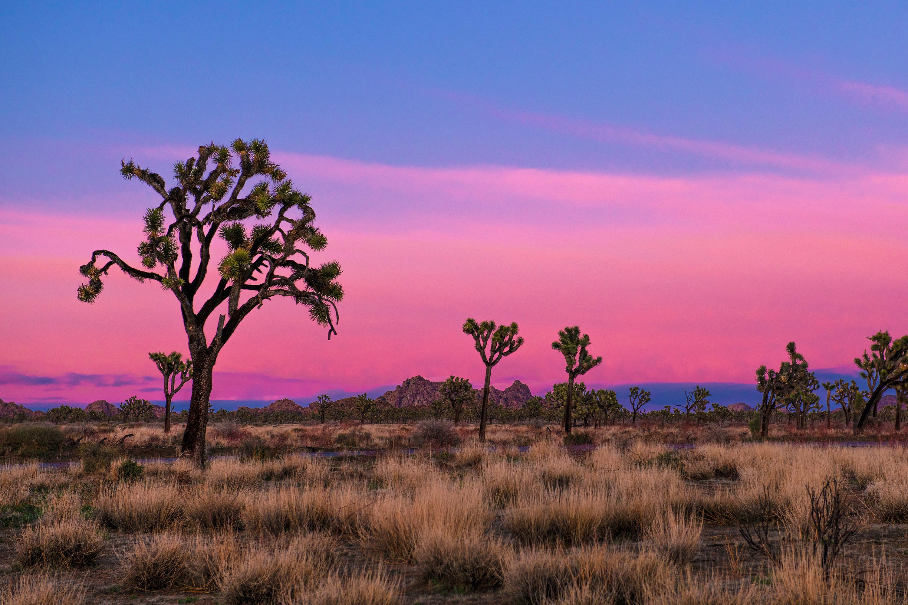
NPS via NPS.gov (Public Domain)
Joshua Tree National Park Gear Guide: Joshua Tree Trail Cam
6 min read
Gear Guide
Discover where to place a trail cam in Joshua Tree National Park and which hikes to take. Learn about Mojave and Colorado desert wildlife, plus tips for Cholla Cactus Garden and Hidden Valley Trail.
The park sits at the junction of two distinct desert ecosystems - the Mojave and the Colorado - and each supports different wildlife. The Mojave section, at higher elevations, gets the iconic Joshua trees and the cooler temperatures. The Colorado section, lower and hotter, hosts creosote bush, ocotillo, and the cholla that makes the famous cactus garden. A joshua tree trail cam positioned near a water source or along a game trail in either zone will pick up activity you would never witness during daylight hours: bobcats, coyotes, desert bighorn sheep, and the occasional kit fox.
Hiking Trails Worth Your Time
The park has 48 listed activities and a trail network that ranges from quarter-mile nature walks to multi-day backpacking routes. Most visitors underestimate how much time they need to get anywhere - cell service drops out at the entrance stations, and driving between trailheads can take 45 minutes.
Short Hikes (Under 2 Miles)
Cholla Cactus Garden - this is a quarter-mile loop with minimal elevation gain along Pinto Basin Road. It winds through a dense patch of teddy-bear cholla. Keep children close. The cholla segments detach at the slightest touch and hook into skin. Early morning is your best bet for this trail because the low light hits the spines and makes them glow gold. Allow 15 to 30 minutes.
Hidden Valley Trail - a one-mile loop near the Hidden Valley Picnic Area with 100 feet of elevation gain. The trail circles through a valley surrounded by monzogranite rock formations. This area was reportedly used by cattle rustlers in the late 1800s to hide stolen livestock. The trail narrows here in a few spots where boulders pinch the path, but it stays easy throughout. Allow 30 to 60 minutes.
Skull Rock - a 1.7-mile loop near Jumbo Rocks Campground. The namesake rock sits right along Park Boulevard and looks exactly like a human skull - two eye sockets formed by erosion. The loop passes through large granite boulder fields. Joshua tree hiking groups with young children do well on this one because the terrain stays mostly flat. Allow 1 to 2 hours.
Oasis of Mara - a half-mile paved loop at the park headquarters in Twentynine Palms. It traces the edge of a palm oasis that the Serrano people used for centuries. As of 2026, however, the trail past the oasis is closed due to heavy flooding. You can still walk the accessible portion near the visitor center. Allow 30 to 45 minutes.
Moderate Hikes (2 to 5 Miles)
Barker Dam Trail - a 1.1-mile loop with minimal elevation gain that passes monzogranite formations and a historic dam built by early ranchers. In wet years, the dam holds water and attracts birds. This is one of the better trails in joshua tree for spotting bighorn sheep if you go early. The trail connects to longer routes, so keep an eye out for signed junctions. Allow 30 to 60 minutes for the loop alone.
Fortynine Palms Oasis - a three-mile out-and-back with 300 feet of elevation gain each direction. The trailhead sits on the northern edge of the park off Highway 62. The hike climbs over a ridge and drops into a canyon with a palm oasis. This is a difficult trail despite the modest distance - the climb is unshaded and the sandy tread makes every step feel heavier. Pack extra water for this stretch; three liters minimum in warm weather. Allow 2 to 3 hours.
Hi-View Trail - a 1.3-mile loop in the Black Rock area with 400 feet of elevation gain. The hike reaches a high point with sweeping views across the Mojave. The trail surface changes from packed dirt to exposed sandstone slabs near the top. From this overlook you can see San Jacinto Peak on clear days. Allow 1 to 2 hours.
Indian Cove Trail - a 0.6-mile loop with 50 feet of elevation gain at the Indian Cove Campground. The trail weaves through large boulders and desert vegetation. It connects to the longer Boy Scout Trail system for those who want more distance. Allow 30 to 45 minutes.
Longer Hikes and Backpacking
Boy Scout Trail - 8 miles one way through the Wonderland of Rocks. Most hikers do shorter sections and turn around. The trail starts near the Indian Cove area and ends at Park Boulevard. The elevation gain is gradual, but the terrain is rocky and slow going. The Boy Scout Trail Zone is also a designated backpacking area requiring permits. Allow 4 to 10 hours for a one-way hike, 2 to 15 days for a through-backpack.
California Riding and Hiking Trail - 36.6 miles spanning from Black Rock Canyon to the North Entrance. This is a multi-day route through the backcountry. You will need to cache water or carry significant supplies. Rangers will tell you this trail is best done in spring or fall; summer is not safe.

Best Hikes in Joshua Tree for Wildlife Photography
If your interest in a joshua tree trail cam is about capturing wildlife - either a physical camera you deploy or simply wanting to know where animals concentrate - these spots produce consistent results:
- Barker Dam Trailhead - the water attracts birds, bighorn sheep, and coyotes. The dam holds water longest in spring.
- Cottonwood Spring - a short 0.1-mile walk to a lush desert oasis. This is one of the most reliable water sources in the Colorado Desert section.
- Lost Horse Mine Trail - the area around the historic mine sees regular deer and coyote traffic.
- Contact Mine Trail - a 4-mile round trip to a mining site with 700 feet of elevation gain. The secluded canyon sees less human traffic, so wildlife is more active.
The park service recommends leaving trail cameras on established trails and avoiding sensitive cultural or archaeological sites. Do not place cameras near springs or tinajas during dry months - wildlife needs those water sources without added disturbance.

Camping and Navigation Basics
Nine campgrounds operate in the park, and as of 2026, most require reservations. The largest is Jumbo Rocks Campground with 124 sites. Cottonwood Campground (62 sites, $35.00) has potable water and flush toilets. Hidden Valley Campground (44 sites, $25.00) has pit toilets and fire pits but no water - bring your own. Indian Cove Campground (101 sites, $35.00) sits off Highway 62 and has no water either.
For navigation, keep a paper joshua tree national park map in your vehicle. Cell service drops out at the park boundaries, and third-party hiking apps have been providing inaccurate trail information, according to an official NPS alert. Use the NPS app or a paper map.
The joshua tree park hiking trails vary in marking quality. Some trail junctions are well-signed; others require you to follow cairns or route-finding. The Discovery Trail (0.7 miles, 70 feet elevation gain) near Jumbo Rocks is a good shakedown hike to test your navigation skills before heading deeper.

Practical Takeaways
- Best season for hiking: Spring and fall. Average highs around 85°F, lows around 50°F. Winter days are around 60°F but nights freeze. Summer exceeds 100°F regularly and is dangerous for any hike over a mile.
- Water: No water at most trailheads. Cottonwood Campground has potable water. Carry one gallon per person per day.
- Permits: Backcountry camping requires a free wilderness permit from a visitor center.
- Trail cameras: Legal on trails. Avoid sensitive areas and do not block trail access. Check batteries monthly - the heat drains them faster than expected.
- Fees: Private vehicle entry is $30.00 for 7 days. Motorcycle entry is $25.00. Per-person entry for walk-ins or cyclists is $15.00.

Final Thoughts
Joshua Tree rewards visitors who plan around the light and the temperature. The joshua tree trails that look empty at noon come alive at dawn and dusk, and the best hikes in joshua tree park are the ones you start before the parking lots fill. For those running a trail camera - or just hoping to see what the desert does when nobody is watching - focus on water sources and transition zones between the two desert ecosystems. That is where the Mojave meets the Colorado, and where the wildlife tends to be.
For more information, see our complete National Park Guide.
Related: joshua tree hiking guide
Related: trails in joshua tree guide
Sources
- Official source: NPS — Joshua Tree National Park nps.gov/jotr/index.htm
Photo Gallery
More to Explore

Park Guide
Acadia National Park: Carriage Roads, Cadillac Mountain & 2026 Guide
Discover carriage roads, Cadillac Mountain, and rugged Maine coast. Complete 2026 guide to Acadia National Park — trails, fees, lodging, permits, and what rangers recommend.

Hiking Guide
Grand Canyon Hiking Trails: Day Hikes, Water Sources & Rim to Rim
Compare Grand Canyon hiking trails: Bright Angel, South Kaibab, Hermit, Grandview, and rim to rim, with distances, elevation, water stops, and trailhead access for each.

Best Of
Best of Glacier Bay National Park
The best of Glacier Bay is reached by boat: ranger-led day tours up the bay to the tidewater glaciers. What's worth it, how to book, and when to go (2026).

Campsite Guide
White Sands Backcountry Camping: Closed for 2026 — What to Know
As of 2026, backcountry camping at White Sands National Park is closed for site rehabilitation. What that means, and where to camp nearby instead.

Weather Guide
Guadalupe Mountains National Park Weather: Weather
Guadalupe Mountains National Park: weather guide guide updated 2026. Practical visitor information, reservations, and seasonal tips worth bookmarking before

Best Of
Best of Cuyahoga Valley National Park: Best Things to Do
Seeing a Cleveland Orchestra concert with the woods as your backdrop is a uniquely Cuyahoga Valley experience.
Sign in to join the conversation.
Sources & Attribution
Location data courtesy of the National Park Service (U.S. Department of the Interior). NPS data is public domain. Official NPS page.
Images: NPS; NPS; NPS; NPS; NPS.
Map data © OpenStreetMap contributors.
Park operations alerts: NPS.gov · Weather and weather hazards: National Weather Service · Live conditions.
Information may change. Always verify fees, hours, and conditions directly with the official source before visiting.
Did this guide help? Share it with a friend.