Isle Royale National Park weather is defined by one thing: Lake Superior. The lake creates a climate that surprises first-time visitors. You can have a sunny, 75-degree day in Houghton, Michigan, and arrive on the island to find a persistent 50-degree chill with a wind that cuts through fleece. The water temperature rarely breaks 60 degrees, even in August, and that mass of cold water moderates everything. Summers are cooler and foggier than the mainland, and winters are slightly less severe, but wetter. The official forecast for the Upper Peninsula is often irrelevant once you cross 15 miles of open water. Planning your visit means understanding this marine influence first.
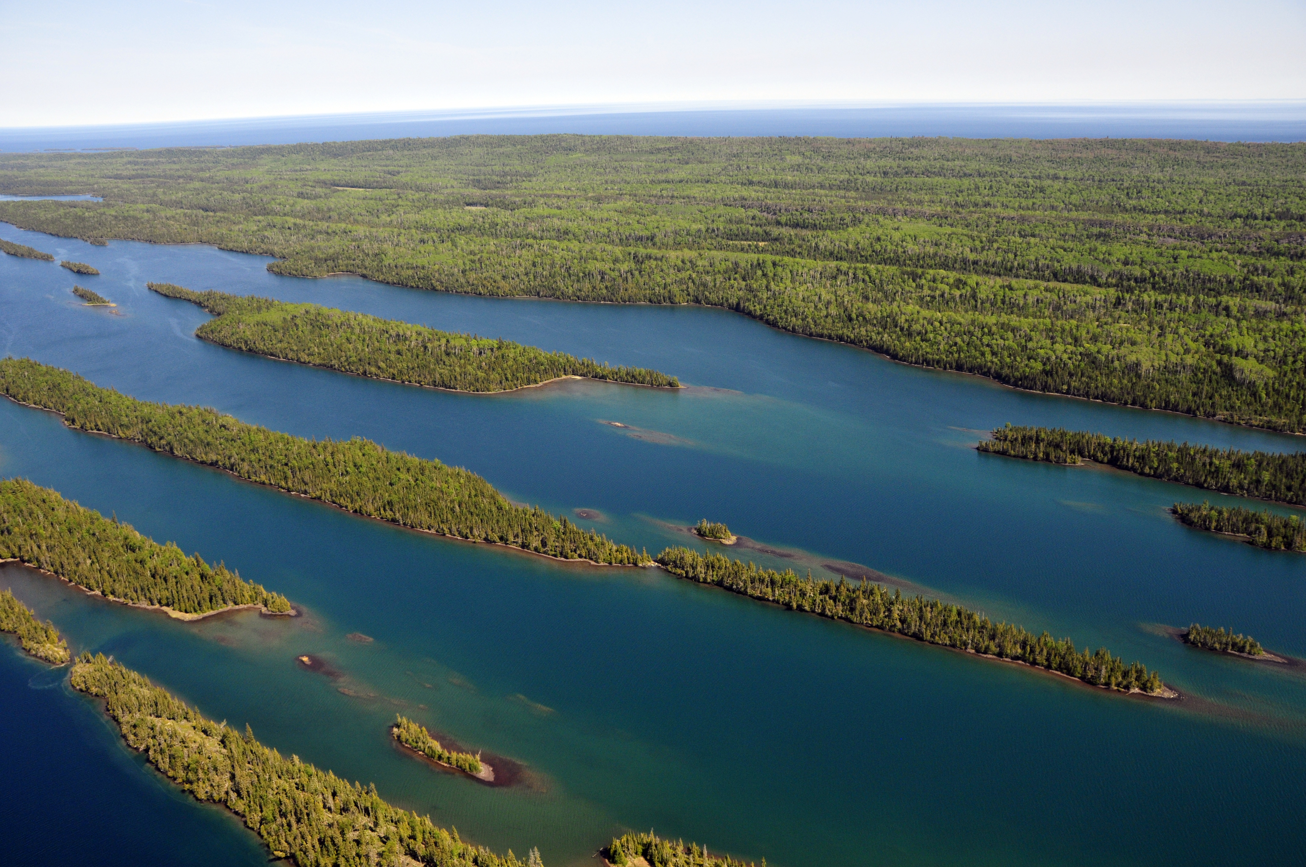
NPS via NPS.gov (Public Domain)
Isle Royale National Park Weather: Weather (2026 Guide)
8 min read
Weather Guide
Isle Royale's weather is controlled by Lake Superior, not the mainland forecast. Plan your 2026 trip around the lake's persistent chill and summer fog.
The Weather Reality
The dominant force here isn't altitude or latitude - it's the lake. Isle Royale sits in the largest freshwater lake on Earth by surface area, and that water dictates daily life. The park receives significantly more precipitation than the Michigan mainland, often as fog, drizzle, or sudden squalls. Dense fog can shroud the island for days, grounding seaplanes and making navigation by sight impossible. The wind direction is your most important forecast variable: a north or northeast wind brings the coldest air straight off the open lake, while a south or southwest wind might actually feel like summer.
Rangers will tell you that the island has its own microclimate, and the visitor centers at Rock Harbor and Windigo post conditions that frequently differ from what your phone's weather app says for "Isle Royale National Park." The lake also delays seasonal changes. Spring arrives weeks later than on the mainland, with ice often lingering into May. Fall colors peak later, sometimes holding into early October. The concept of a "warm summer day" is relative; 70 degrees under full sun feels hot here, but those days are not the norm. More common are days in the 60s with a breeze that never quite stops.

Month by Month
The park's official season runs from mid-April through October 31, but visitor services are tightly constrained. The ferries and seaplanes operate on a much shorter schedule, typically from late May through early September. Your month of travel dictates not just the weather, but what's open and who else is there.
May & Early June
Temperatures range from highs in the 40s to maybe 60 on a good day. Lows dip into the 30s. Snow and ice are possible, especially in inland depressions and on north-facing trails. This is the tail end of mud season.
Trails are often soggy, with standing water and blackflies emerging in force by late May. Mosquitoes hatch shortly after. Almost no visitor services are open; the ferries have just started running, and schedules are limited. You'll have the trails to yourself, but you pay for it with cold nights, uncertain conditions, and insects. Wildlife is active - moose are often seen in wet areas, and migratory birds are returning.
Late June, July, & August
This is the core visitor season. Highs average 65-75 degrees Fahrenheit, but can spike to 80 or drop to 50 with a wind shift. Nighttime temperatures are consistently in the 50s. Water temperatures in the protected harbors might reach the high 50s.
This is also the wettest period. Precipitation comes as frequent, sometimes daily, fog, mist, or rain showers. Afternoon thunderstorms can roll across the lake with little warning. The island is at its greenest, but also its buggiest. Mosquitoes and blackflies peak in July, requiring head nets and permethrin-treated clothing for any serious hiking.
All services - ferries, seaplanes, the Rock Harbor Lodge, campstores, and showers - are operational. Crowds are at their peak, especially in Rock Harbor and on popular trails like the Rock Harbor Trail and the Minong Ridge. Reservations for transportation and lodging are essential. It's the most forgiving time for weather, but also the busiest and most insect-prone.
September
Many consider this the best month. Daytime highs are pleasant, ranging from 55 to 65 degrees. Nights get colder, dipping into the 40s and even 30s by month's end. The first frosts can occur in inland valleys.
The biting insects vanish almost overnight after Labor Day. The crowds dissipate as families return to school. The ferries and seaplanes continue to run on a reduced schedule, and the lodge often operates into mid-September. The foliage begins to turn, with maples showing red and gold by late month. It's prime hiking weather - cool, dry, and quiet. The trade-off is shorter days and the increasing chance of a major storm system bringing prolonged wind and rain.
October
The park is officially open, but effectively closing down. Highs might reach 50, but often stay in the 40s. Lows are consistently below freezing. Snow becomes a real possibility, especially in the second half of the month.
All commercial transportation and visitor services cease by early October. The park itself remains open for self-sufficient travelers with private boats, but you are on your own. Trails are empty. It's a stark, beautiful, and challenging time to visit, suitable only for experienced backpackers prepared for winter-like conditions. The last of the fall color is gone by mid-month, leaving the landscape gray and brown.

Best Times for Specific Activities
Your ideal month depends entirely on what you want to do.
For Hiking
Aim for late August through September. The trails are dry(er), the bugs are gone, and the temperatures are cool enough for comfortable mileage. The hiking trails are clear of mud and the risk of hypothermia is lower than in spring or late fall. Early mornings in September are crisp, with fog burning off to reveal clear skies.
For Wildlife Viewing
Different seasons offer different sightings. May and June are best for seeing moose, as they frequent open wetlands and beaver ponds to feed on aquatic plants. September is also excellent, as bulls are in the rut and more visible. For wolves, sightings are rare year-round, but your best chance is in early spring (May) or late fall (October) when foliage is down and they are more active during daylight hours. Birders flock in May for the spring migration.
For Solitude & Photography
Late September is the sweet spot. The summer crowds are gone, the ferries are still running (just), the light is lower and golden, and the first frosts add texture to the morning landscapes. October offers absolute solitude, but with significant logistical challenges and harsher light.
For Avoiding Insects
This is simple: go after Labor Day. The first cold snap of early September decimates the mosquito and blackfly populations. Any visit in June or July requires a tactical approach to bug defense.

What to Pack by Season
Forget generic packing lists. Isle Royale demands specific gear to handle damp cold and variable conditions, regardless of the forecast.
For Summer (June-August):
* Rain Gear: A waterproof jacket and pants are non-negotiable. Not "water-resistant." Waterproof.
* Layering System: A moisture-wicking base layer, a warm mid-layer like a fleece or puffy, and your rain shell. Cotton is a liability.
* Footwear: Waterproof hiking boots. Trails are rocky, rooty, and often wet. Sandals for camp are a luxury.
* Bug Defense: A permethrin-treated outfit, a head net, and a reliable DEET or picaridin spray. The bugs here are relentless.
* Warm Hat & Gloves: Even in August, a chilly evening on the shore demands them.
For Shoulder Seasons (May, September, October):
* Everything above, plus:
* Warmer Layers: A heavier insulated jacket. Thermal underwear for sleeping.
* Winter Hat & Gloves: A beanie and insulated gloves are essential.
* A Warmer Sleeping Bag: Rated for at least 20 degrees Fahrenheit, preferably lower.
* Traction Devices: For October, microspikes for your boots are not overkill if there's ice.
Year-Round Essentials:
* Multiple pairs of wool or synthetic socks.
* A durable water bottle or hydration system (water is plentiful, but needs treatment).
* A detailed map and compass. GPS and cell service are unreliable.
* Food storage: As of 2026, new guidelines require hard-sided bear-resistant containers or specific food hangs in certain areas to protect wildlife, particularly wolves, from accessing human food.

What the Forecast Doesn't Tell You
- The Fog is a Physical Barrier. It doesn't just reduce visibility; it saturates everything. Your pack, your clothes, your map will be damp to the touch within an hour. It also muffles sound, creating an eerie silence on the trails.
- Wind Chill is a Summer Phenomenon. A 65-degree day with a 15-knot north wind off Lake Superior can have a wind chill in the low 50s. That's a hypothermia risk if you're wet from rain or sweat.
- Sunburn and Hypothermia Can Occur on the Same Day. The sun reflecting off the water is intense. You can get a serious burn on your face and neck while your core temperature drops from the wind.
- Trail Conditions are Weather-Dependent. A trail that's a dry path one day can be a running stream the next after a night of rain. The rocky, rooted trails become slick as ice when wet.
- Lake Superior Decides Your Schedule. Ferry and seaplane cancellations due to wind or fog are common. Always build a flexible buffer day into your travel plans on both ends of your trip.
- Microclimates are Extreme. The temperature difference between a sunny, sheltered inland ridge and a wind-blasted campsite on the exposed north shore can be 15 degrees or more.
Practical Takeaways
- Target September. For the best balance of good weather, no bugs, fewer people, and open services, plan your trip for after Labor Day.
- Pack for Damp Cold, Not Dry Cold. Your rain gear is your most important piece of clothing. Test it before you go.
- Check the Marine Forecast. Before you worry about the air temperature, look at the Lake Superior wind and wave forecast for the Isle Royale area. It dictates travel and conditions.
- Embrace the Layers. You will put them on and take them off multiple times a day. A system you can manage quickly is key.
- Your Feet are a Priority. Waterproof boots and quality socks prevent blisters, which are the most common reason for cutting a trip short.
- Have a Contingency Plan. Assume your ferry or flight might be delayed by a day. Don't book tight connections off the island.
- Respect the Food Storage Rules. The 2026 guidelines are there for a reason - to keep wolves wild and your food safe. It's a core part of the Isle Royale experience.
For more details on trip planning beyond the weather, consult the park's complete visitor guide. Once you've picked your dates, you can dig into the specifics of the hiking trails and camping options to finalize your itinerary.
For more information, see our complete Isle Royale National Park Guide.
Related: isle royale national park guide
Sources
- Official source: NPS — Isle Royale National Park nps.gov/isro/index.htm
- Official source: National Park Service nps.gov/places/isle-royale-national-park.htm
Photo Gallery
More to Explore

Park Guide
Acadia National Park: Carriage Roads, Cadillac Mountain & 2026 Guide
Discover carriage roads, Cadillac Mountain, and rugged Maine coast. Complete 2026 guide to Acadia National Park — trails, fees, lodging, permits, and what rangers recommend.

Hiking Guide
Grand Canyon Hiking Trails: Day Hikes, Water Sources & Rim to Rim
Compare Grand Canyon hiking trails: Bright Angel, South Kaibab, Hermit, Grandview, and rim to rim, with distances, elevation, water stops, and trailhead access for each.

Best Of
Best of Glacier Bay National Park
The best of Glacier Bay is reached by boat: ranger-led day tours up the bay to the tidewater glaciers. What's worth it, how to book, and when to go (2026).

Campsite Guide
White Sands Backcountry Camping: Closed for 2026 — What to Know
As of 2026, backcountry camping at White Sands National Park is closed for site rehabilitation. What that means, and where to camp nearby instead.

Weather Guide
Guadalupe Mountains National Park Weather: Weather
Guadalupe Mountains National Park: weather guide guide updated 2026. Practical visitor information, reservations, and seasonal tips worth bookmarking before

Best Of
Best of Cuyahoga Valley National Park: Best Things to Do
Seeing a Cleveland Orchestra concert with the woods as your backdrop is a uniquely Cuyahoga Valley experience.
Sign in to join the conversation.
Sources & Attribution
Location data courtesy of the National Park Service (U.S. Department of the Interior). NPS data is public domain. Official NPS page.
Images: NPS; NPS; NPS; NPS; NPS.
Map data © OpenStreetMap contributors.
Park operations alerts: NPS.gov · Weather and weather hazards: National Weather Service · Live conditions.
Information may change. Always verify fees, hours, and conditions directly with the official source before visiting.
Did this guide help? Share it with a friend.