Arrive before 7 AM to secure parking at the Fairy Falls trailhead. This 600-foot cascade remains one of Mount Rainier's quieter spectacles, tucked into Stevens Canyon. Most visitors head for the more famous falls along Paradise Road, so those who make this short trek often find solitude. The trail narrows as it weaves through old-growth forest, the sound of water gradually taking over.
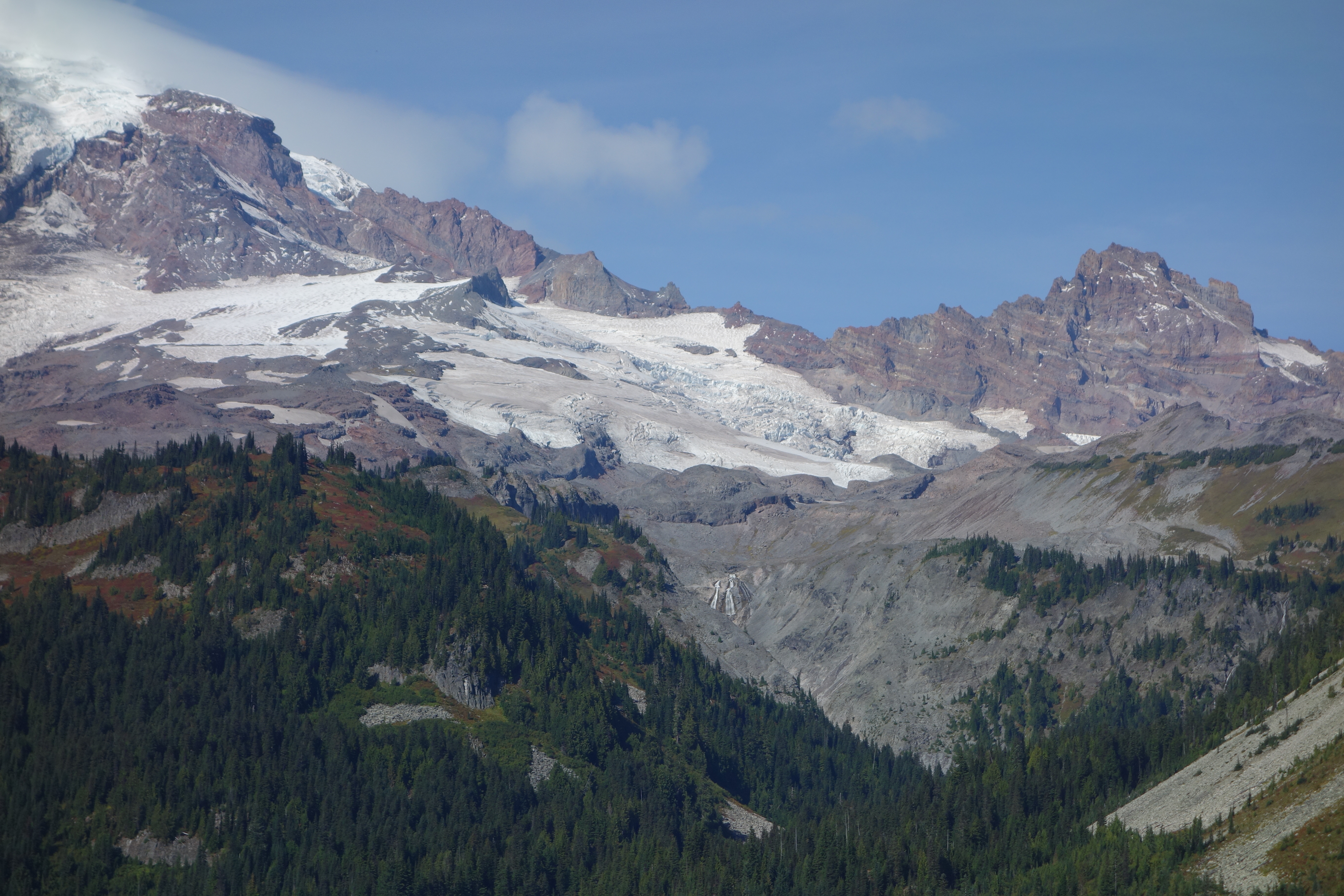
NPS via NPS.gov (Public Domain)
Fairy Falls: 600-Foot Cascade in Mount Rainier
8 min read
Places & Points of Interest
Plan your 2026 visit to Fairy Falls. Complete guide to trails, fees, lodging, best time to visit, and insider tips.
Your plans
Overview
Fairy Falls descends nearly 600 feet over Stevens Canyon's headwall in three distinct tiers. Rather than a single thunderous plunge, it's a series of delicate, stair-stepping veils that inspired its name. You'll hear the constant, hushed roar filtering through Douglas-fir and western red cedar before the falls come into view. At the base, mist hangs in the air and moss glistens on the rock face.
Located along Stevens Canyon Road, the falls are often treated as a quick stop between the busier attractions of Paradise and the east side of the park. That's a mistake. Rangers will tell you that the light here is best in the late morning, when the sun angles into the canyon and catches the spray. The trail register is full of comments about the surprising solitude, even on summer weekends when Paradise feels like a city.
Quick Information
* Entrance Fee: As of 2026, the Mount Rainier National Park entrance fee is $30 per private vehicle, $25 per motorcycle, or $15 per individual (hiker, cyclist). The pass is valid for 7 days. An annual park-specific pass is $55.
* Hours: Stevens Canyon Road, which provides access, is typically open from late June through September. Road status is dependent on snowpack; check the park website for current conditions.
* Best Time to Visit: July through September. The road is reliably open, runoff is high, and the trail is snow-free.
* Location: Mount Rainier National Park, Washington. The trailhead is along Stevens Canyon Road, roughly midway between Reflection Lakes and the Box Canyon parking area. GPS coordinates: 46.79455554, -121.6996446.
* Accessibility: The trail to the falls is a natural surface path with roots and rocks. It is not wheelchair or stroller accessible.
* Cell Service: Cell service drops out at the Stevens Canyon entrance. Do not expect a reliable signal at the trailhead or along the hike.
* Restrooms: There are no restrooms at the Fairy Falls trailhead. The nearest vault toilets are at the Box Canyon parking area, about a 5-minute drive east.
* Parking: A small, unsigned pullout on the north side of Stevens Canyon Road fits about 4-5 vehicles. It fills quickly. If full, do not park on vegetation or block the road; continue to the larger Box Canyon lot and walk back along the road shoulder (exercise extreme caution).

Getting There
From the Nisqually Entrance (southwest side), drive through Longmire toward Paradise. At Paradise, follow signs for Stevens Canyon Road. You'll pass Reflection Lakes; continue east for approximately 2.5 miles. Look for a small pullout on the right (north) side of the road. There is no prominent sign for Fairy Falls - just a subtle break in the trees and a trail leading into the forest. The drive from Paradise takes about 15 minutes.
From the east side (via SR 123 or Chinook Pass), enter the park and drive west on Stevens Canyon Road. You'll pass the Box Canyon parking area; continue west for about 1.5 miles. The pullout will be on your left. The park service recommends using the Nisqually/Paradise route if coming from the greater Seattle-Tacoma area, as it's the most reliable year-round access point.
What to Expect
The hike is short but not trivial. You'll drop about 200 feet in elevation from the road to the falls on a well-defined but rugged path. The forest is dense and damp, with a thick understory of ferns and vanilla leaf. The air smells of decaying wood and wet earth. After about 0.3 miles, the trail emerges at the base of the falls. The viewing area is a rocky scramble - watch your footing on wet, moss-covered stones.
The volume of water varies dramatically with the season. In July, it's a powerful, spray-soaked curtain. By late September, it can shrink to a graceful, silvery trickle over the dark basalt. The temperature near the base is always 10-15 degrees cooler than the road. You'll feel the mist on your face, and the constant white noise of the water drowns out any distant road sounds. It feels removed, which is the whole point.

Top Attractions & Points of Interest
Fairy Falls
The main event. The trail ends at a rocky outcrop directly facing the lowest tier of the falls. This is not a wide, panoramic viewpoint but an intimate, head-on perspective. You're close enough to feel the spray. Photographers should bring a lens cloth and a tripod for the low light and moisture. Early morning is your best bet for even lighting, before the sun creates harsh contrasts on the rock face.
Stevens Canyon Corridor
The drive itself is a major attraction. Stevens Canyon Road is an engineering feat, clinging to the canyon wall with constant views of the deep, forested gorge below. From the Fairy Falls pullout, you're perfectly positioned to continue a short drive east to the must-see Box Canyon, a narrow slot canyon carved by the Muddy Fork Cowlitz River. It's less than five minutes away by car.
Reflection Lakes
A 5-minute drive back toward Paradise, these iconic lakes offer the famous mirror views of Mount Rainier. They are packed at sunrise and sunset. The common mistake is to go only to the first parking lot; the view from the pullouts further along the road is often less crowded and just as good. This area is a hub for several other hiking trails.
Bench and Snow Lakes Trailhead
Located 1.5 miles east of Reflection Lakes, this is the start for a moderate hike to two subalpine lakes. It's a good option if you find the Fairy Falls parking full and want a longer walk. The trail to Snow Lake gains about 700 feet and offers open views of the Tatoosh Range.
Activities
Hiking
The hike to Fairy Falls is the primary activity here - a quick 0.6-mile round trip with a rewarding payoff. It's often combined with other short stops along Stevens Canyon Road to create a half-day of waterfall exploration. For a longer day, consider connecting it with trails from Paradise or the hiking trails near Sunrise.
Photography
This is a classic waterfall photography spot. The shaded canyon means soft light for most of the day. You'll want a neutral density filter to achieve that silky water effect with longer exposures. The moss-draped cliffs and layered cascade create natural leading lines. Rangers emphasize staying on the established rocks for your shot; the soils and plants at the base are fragile.
Scenic Driving
Stevens Canyon Road is one of the park's premier scenic drives. A "road trip around the mountain" often includes this segment. Drive it slowly, use the pullouts, and expect to share the road with cyclists (bicycles are permitted on park roads). The road is narrow and winding, with steep drop-offs in sections.

Seasonal Guide
* June: Stevens Canyon Road often opens in late June. The falls are at peak flow, fed by melting snow. The trail may have lingering snow patches or be muddy. Crowds are moderate.
* July & August: Prime time. The road is open, trails are clear, and wildflowers bloom in the meadows at higher elevations. This is also the busiest period. Arrive at Fairy Falls before 9 AM or after 4 PM to avoid the handful of other cars.
* September: An excellent month. Crowds diminish after Labor Day, the weather is often stable, and fall colors begin in the huckleberry bushes. Water flow at the falls is lower but still photogenic.
* October - May: Stevens Canyon Road is closed for winter. There is no vehicle access to Fairy Falls. Winter recreation is focused in the Paradise and Longmire areas.
For a more detailed breakdown of conditions, see our guide on the best time to visit.
Practical Information
Your entrance fee covers access. No additional permit is required for this day hike. The nearest camping options are at Cougar Rock Campground (near Longmire) or White River Campground (near Sunrise). Ohanapecosh Campground, which is typically the closest, is closed for construction through at least the spring of 2026.
There are no services at Fairy Falls. The last place for food, gas, and supplies is in the community of Ashford, outside the Nisqually Entrance. Pack extra water for this stretch - there is no potable water along Stevens Canyon Road. For lodging and accommodations, look in Ashford or consider the National Park Inn at Longmire.

Safety & Preparation
The main hazards here are traffic and terrain. When parking along Stevens Canyon Road, be hyper-aware of passing vehicles. When walking along the road shoulder to or from an overflow parking spot, face traffic and wear bright clothing.
The trail is rocky and can be slick with mist or rain. Trekking poles are helpful for the descent and climb back out. The rocks at the viewpoint are often wet and slippery with algae; test your footing before putting your full weight on them.
Weather changes rapidly. The canyon can be cool and damp even on a sunny day at Paradise. Bring an extra layer. Let someone know your plans, as cell service is nonexistent. In an emergency, drive to the Box Canyon parking area where there may be other visitors, or proceed to a park entrance station.
Insider Tips
- The Sign is Missing. The pullout isn't marked as "Fairy Falls." Look for a wide spot in the road with a visible trail heading into the woods at the north end. Your odometer is your friend: it's about 2.5 miles east of Reflection Lakes.
- Combine with Box Canyon. Park once. Visit Fairy Falls first, then drive the short distance to the large Box Canyon lot. You can comfortably see both in under 90 minutes.
- Listen for Dippers. The American dipper, a chunky gray bird, frequents the spray zone at the base of the falls. Watch for it bobbing on rocks, then diving completely underwater to feed.
- Skip it in the Rain. While the falls are more powerful, the trail becomes a muddy slip-and-slide, and the rocks at the viewpoint are dangerously slick. A light drizzle is fine; a steady rain is not worth it.
- The Gift Shop Doesn't Sell It. There's no water, snacks, or bug spray here. The nearest place to buy anything is the Longmire General Store, a 45-minute drive back the way you came. Come prepared.
- Better than the Guidebook Says. Many older guidebooks list this as a "roadside attraction" you can see from the car. You can't. The short hike in is what makes it worthwhile, separating you from the road noise and into the forest atmosphere.
- Check Road Status First. Even in July, a late snowstorm can temporarily close Stevens Canyon Road. Always check the park's current road conditions page before you make the drive out.
Links may earn us a commission at no extra cost to you. We only recommend gear we believe in. For this hike, a pair of waterproof hiking boots with good grip will serve you better than sneakers, and a compact rain jacket stashed in your pack is never a bad idea.
For more information, see our complete Mount Rainier National Park Guide.
Sources
- Official source: NPS — Mount Rainier National Park nps.gov/mora/index.htm
- Official source: National Park Service nps.gov/places/fairy-falls.htm
Photo Gallery
More to Explore

Park Guide
Acadia National Park: Carriage Roads, Cadillac Mountain & 2026 Guide
Discover carriage roads, Cadillac Mountain, and rugged Maine coast. Complete 2026 guide to Acadia National Park — trails, fees, lodging, permits, and what rangers recommend.

Hiking Guide
Grand Canyon Hiking Trails: Day Hikes, Water Sources & Rim to Rim
Compare Grand Canyon hiking trails: Bright Angel, South Kaibab, Hermit, Grandview, and rim to rim, with distances, elevation, water stops, and trailhead access for each.

Best Of
Best of Glacier Bay National Park
The best of Glacier Bay is reached by boat: ranger-led day tours up the bay to the tidewater glaciers. What's worth it, how to book, and when to go (2026).

Campsite Guide
White Sands Backcountry Camping: Closed for 2026 — What to Know
As of 2026, backcountry camping at White Sands National Park is closed for site rehabilitation. What that means, and where to camp nearby instead.

Weather Guide
Guadalupe Mountains National Park Weather: Weather
Guadalupe Mountains National Park: weather guide guide updated 2026. Practical visitor information, reservations, and seasonal tips worth bookmarking before

Best Of
Best of Cuyahoga Valley National Park: Best Things to Do
Seeing a Cleveland Orchestra concert with the woods as your backdrop is a uniquely Cuyahoga Valley experience.
Sign in to join the conversation.
Sources & Attribution
Location data courtesy of the National Park Service (U.S. Department of the Interior). NPS data is public domain. Official NPS page.
Images: NPS; NPS; NPS; NPS; NPS.
Map data © OpenStreetMap contributors.
Park operations alerts: NPS.gov · Weather and weather hazards: National Weather Service · Live conditions.
Information may change. Always verify fees, hours, and conditions directly with the official source before visiting.
Did this guide help? Share it with a friend.