If you have time for exactly one stop in Rocky Mountain National Park, make it the Beaver Meadows Visitor Center. It is the best visitor center in Rocky Mountain National Park for one simple reason: the rangers here will save you hours of wasted time. They know which trails are icy at 5 AM, which pullouts are already full by 8, and exactly where to send you based on your vehicle clearance and your group's fitness. Start here before anything else.
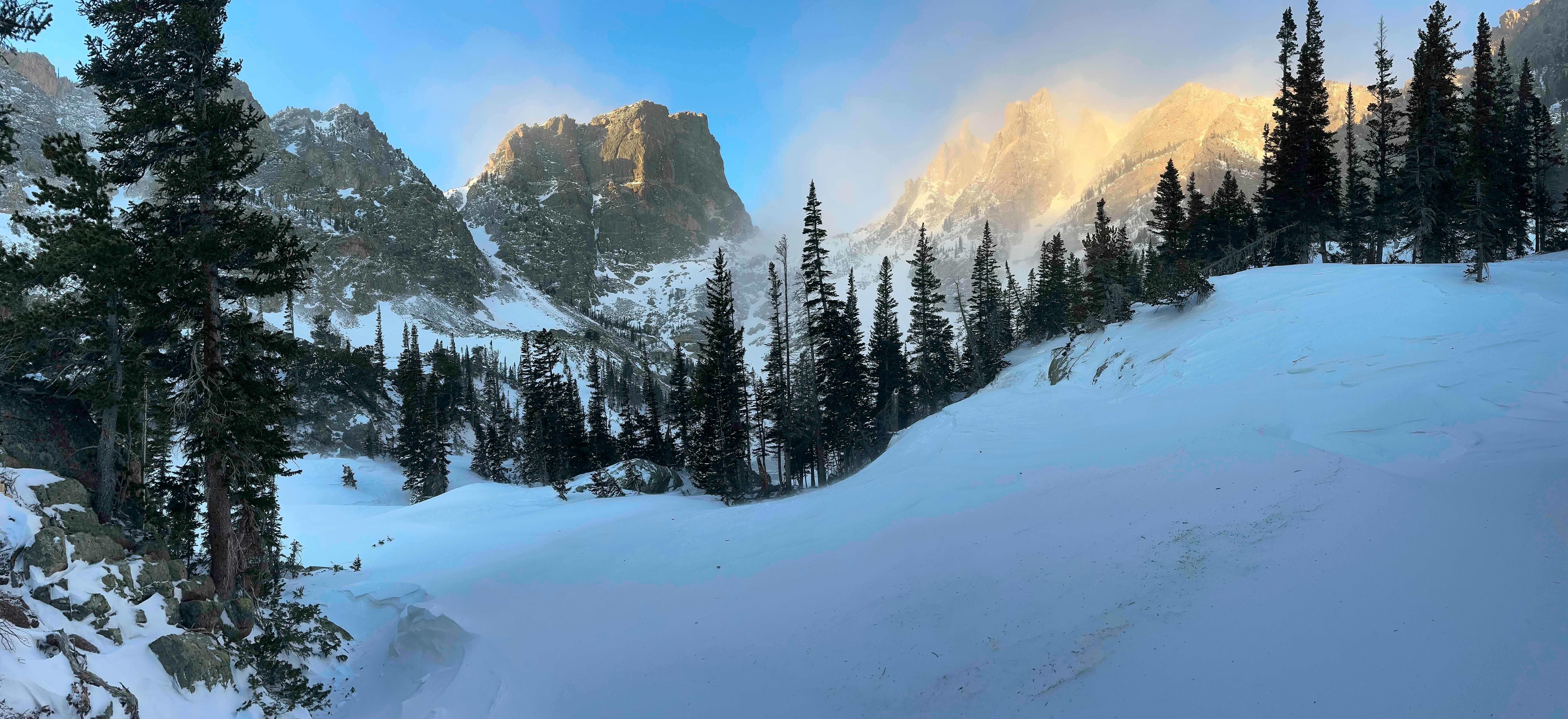
NPS via NPS.gov (Public Domain)
Best of Rocky Mountain National Park: Best Visitor Center
10 min read
Best Of
Talk to a ranger at Beaver Meadows Visitor Center to save hours on your Rocky Mountain National Park trip (2026).
This article contains affiliate links — we may earn a small commission at no extra cost to you.
If You Only Have One Day
Arrive at the Beaver Meadows entrance station (1000 US Hwy 36, Estes Park) by 6:30 AM. Buy your 7-day vehicle pass for $35 if you haven't pre-purchased online - the recreation.gov system works but the rangers at the gate process paper just as fast. Pull into the visitor center lot.
Spend 20 minutes inside. Talk to a ranger. Grab the park newspaper. Watch the 15-minute orientation film - it's short and it covers the elevation dangers most first-timers underestimate. From here, you have two options depending on Trail Ridge Road conditions. As of 2026, Trail Ridge Road is open to Rainbow Curve on the east side and Milner Pass on the west, but not through. Check the current status before you drive.
If you can get to the Alpine Visitor Center (roughly 12,000 feet), do that first. If not, head to Bear Lake corridor. Trailheads there give you maximum scenery per step. Hit Bear Lake trail by 8 AM - the lot fills before 9. Do the loop in 45 minutes, then hike Nymph and Dream Lakes if you have legs left. Back at the car by noon. Drive Trail Ridge Road as far as it's open. Eat lunch at the gift shop in Estes Park - pack your own sandwich; the park food is pricier.
In the afternoon, choose one longer hike: the Deer Mountain Trail is a solid 6-mile round trip with a 1,100-foot gain and views of the Continental Divide. If you're here in summer, do it. If it's late and you're tired, drive Old Fall River Road instead. Return to the visitor center by 4 PM to use the restrooms and fill water - the parking lot empties after 2 PM and you'll have the place nearly to yourself.

The Top Experiences, Ranked
These are ordered by return on effort for a first-time visitor. Time is limited. Prioritize accordingly.
#1 - Beaver Meadows Visitor Center: Your One-Stop Trip Planner
- Why it makes this list: It is the best visitor center in rocky mountain national park because it combines trip planning, exhibits, a bookstore, and the only reliable restrooms for miles. The rangers here have answers to questions the park website doesn't cover - like which campgrounds near rocky mountain national park actually have showers (hint: only Moraine Park). The park film runs all day and is worth every minute of your time.
- What it requires: 30-45 minutes. No reservation. Open all day, 365 days a year, as of 2026.
- The single best tip: Skip the gift shop for souvenirs - buy at the nearby Estes Park stores for better prices. Use the bookstore for trail maps and field guides only.
- What most visitors do wrong: They walk in, grab a map, and leave without talking to a ranger. That is a mistake. A two-minute conversation can save you from driving to a trailhead that's closed or packed.
#2 - Trail Ridge Road: America's Highest Continuous Paved Road
- Why it makes this list: It climbs from 7,800 feet to over 12,000 feet in 48 miles. The alpine tundra up there is unlike anything else in the lower 48. The road is the main reason 4.5 million people visit annually.
- What it requires: 2-3 hours driving time one way. A vehicle in good condition - no low-clearance issues. Check the NPS alerts: as of 2026, the road is closed between Rainbow Curve and Milner Pass due to recent winter weather. This limits you to the east and west sections separately. Plan accordingly.
- The single best tip: Drive east to west if you want the sun behind you in the morning. The views are better looking west. And pack extra water for this stretch - there's no place to refill above the visitor centers.
- What most visitors do wrong: They assume it's open all summer. It isn't. Even in June, snow can close the road. Call ahead.
#3 - Bear Lake and the Emerald Lake Trail
- Why it makes this list: The Bear Lake trailhead gives you access to the most scenic subalpine area in the park with the least effort. The 0.8-mile Bear Lake loop is wheelchair-accessible. The 3.6-mile round trip to Emerald Lake is probably the best single day hike for a family with moderate fitness.
- What it requires: 30 minutes for the loop, 2-3 hours for Emerald Lake. No special equipment beyond good shoes. The parking lot fills by 7:30 AM in July - take the park shuttle from the Park & Ride.
- The single best tip: Arrive before 6:30 AM. If you're parked by 6:45, you might beat the crowd. After 7 AM, you'll be walking a mile from overflow parking.
- What most visitors do wrong: They stop at Bear Lake and think they've seen it. Keep going to Nymph Lake, Dream Lake, and Emerald Lake. Each one gets better.
#4 - Deer Mountain Trail: The Best Quick Summit for Views
- Why it makes this list: This 6-mile trail gains 1,100 feet and delivers a 360-degree view of the Continental Divide and Longs Peak. It's less crowded than the Bear Lake corridor and starts from a lower elevation (9,000 feet), so altitude affects you less.
- What it requires: 3-4 hours. Moderate fitness. Start early to avoid afternoon thunderstorms - typical in summer.
- The single best tip: The trail is exposed for the top mile. Sunscreen and a hat are not optional. And the deer mountain trail rocky mountain area has excellent wildlife viewing - keep an eye out for elk and mule deer in the meadows near the trailhead.
- What most visitors do wrong: They don't account for the air. At 9,000 feet, the trail feels harder than it looks. Take breaks. Drink water.
#5 - Moraine Park Campground: The Best Campgrounds Near Rocky Mountain National Park
- Why it makes this list: It's the most centrally located developed campground, with 247 sites, flush toilets, and a amphitheater with ranger programs. Reservations open six months out and sell out within minutes.
- What it requires: A reservation made exactly six months in advance. It's not walk-up friendly. The campground opens mid-May and closes in late October.
- The single best tip: Book a site in loops A, B, or C for proximity to the restrooms. Loops D and E are quieter but farther from water spigots.
- What most visitors do wrong: They show up without a reservation in July and think they'll find a campsite near rocky mountain national park. They won't. Moraine Park fills every night. Check the park's recreation.gov page.
#6 - Kawuneeche Visitor Center: The West Side's Best Stop
- Why it makes this list: If you enter from Grand Lake, this is your first and best resource. It's smaller than Beaver Meadows but has equally helpful rangers and a short nature trail along the Colorado River headwaters.
- What it requires: 20-30 minutes. Located just inside the west entrance on US 34.
- The single best tip: Fill your gas tank in Grand Lake before you enter. There's no fuel inside the park.
- What most visitors do wrong: They skip this center because it looks small. Don't. The rangers here know the west side trails and can tell you which campgrounds near rocky mountain national park are open on that side.
#7 - Alpine Visitor Center: The High-Elevation Reward
- Why it makes this list: It sits at 11,796 feet - the highest visitor center in the park. The views from its deck stretch across the tundra toward Lulu Mountain and the Never Summer Range. It's open only when Trail Ridge Road is fully open, typically late May through mid-October.
- What it requires: A drive up Trail Ridge Road - currently limited due to the road closure between Rainbow Curve and Milner Pass as of 2026. Check conditions.
- The single best tip: Even if the visitor center is closed, the overlooks nearby are worth the drive. The Alpine Ridge Trail starts here - a 0.5-mile accessible boardwalk that climbs 100 feet onto the tundra.
- What most visitors do wrong: They don't bring layers. At 11,796 feet, the temperature is 20-30 degrees cooler than Estes Park. Wind gusts over 50 mph are common. Pack a jacket and a hat.
#8 - Rocky Mountain Hiking Trails: The Best Multi-Day Options
- Why it makes this list: The park has over 300 miles of trails, and a multi-day backpacking trip is the ultimate way to experience it. The Flattop Mountain-Hallet Peak combination is the classic, and it's possible as a day hike if you're fit, but better as a two-day trip with a backcountry permit.
- What it requires: A backcountry permit (available online), good navigation skills, and bear-proof food containers. Cell service drops out at the trailheads - plan to be offline.
- The single best tip: The most underrated rocky mountain hiking trail is the 10.3-mile (round trip) to Lake Helene. It has wildflowers in July, fewer crowds than Sky Pond, and a waterfall at the end.
- What most visitors do wrong: They underestimate the elevation gain. The Flattop Mountain trail gains 2,849 feet. Most day hikers turn back. Be honest about your fitness.

What Most People Miss
The Grand Lake Entrance - 90% of visitors enter from Estes Park. The west side near Grand Lake is quieter, with excellent moose sightings in the meadow below the Kawuneeche Visitor Center. If you have time, drive around and enter from the west. You'll see a different park: deeper forests, fewer people, and the headwaters of the Colorado River.
The Tundra Communities Trail - A 1-mile round trip boardwalk on Trail Ridge Road at 11,000+ feet. It's flat, easy, and teaches you about the fragile alpine ecology. Most people drive right past it. Stop. Read the signs. It's free.
The Ranger-led Programs - The park offers astronomy programs, geology talks, and guided hikes from June through August. The night sky programs are excellent - Rocky Mountain is a certified International Dark Sky Park. Check the schedule at the visitor center.
The Fall River Visitor Center - This smaller center near the Fall River entrance has less traffic and a mounted wildlife exhibit that kids love. It's a good backup if Beaver Meadows is packed. It's also a stop for the shuttle.

What's Overrated (and Better Alternatives)
Longs Peak (via Keyhole Route) - Yes, it's the highest summit. Yes, it's iconic. But it's a 15-mile, 14-hour climb that requires technical scrambling and an alpine start at 2 AM. If you're not an experienced mountaineer, skip it. Do Flattop Mountain instead - a 8.4-mile round trip with a 2,849-foot gain that still gets you above treeline.
The Carriage Road Trail - Often listed as an easy walk. It's actually a gravel road with no shade and mediocre views. The Coyote Valley Trail on the west side is better: a 1-mile paved loop along the Colorado River with excellent wildlife viewing potential.
The Park Shuttle - Convenient, yes, but in peak July it's overcrowded and the wait at the Park & Ride can be 40 minutes. The better alternative is arriving before 7 AM when you can still park at trailheads. Early morning is your best bet for a parking spot at Bear Lake without the shuttle.

Practical Takeaways
- Start at the best visitor center in rocky mountain national park (Beaver Meadows) before you do anything else. Talk to a ranger. Buy your pass. Get a map. Watch the film.
- Book your visit online. As of 2026, the park requires timed-entry reservations from May 24 through October 20. These sell out weeks in advance. Reserve at recreation.gov. Without one, you'll be turned away at the gate.
- Trail Ridge Road is not guaranteed. Even in June, snow closures happen. Check the NPS alerts page the morning of your visit. As of this writing, the road is closed to through travel - verify before you drive.
- Altitude is real. Elevation in the park ranges from 7,800 to over 14,000 feet. If you're flying in from sea level, spend your first day in Estes Park (7,500 feet) before attempting strenuous hikes. Drink twice as much water as you think you need.
- Pack extra water for this stretch. There are few places to fill up once you're above the visitor centers. Carry at least one liter per person per hour of hiking. The thin air dehydrates you faster.
- The parking situation here is brutal. Bear Lake lot fills by 7:30 AM. Trailhead lots are full by 8 AM. Use the shuttle, or arrive before 7. If you're camping at Moraine Park, you can walk to the shuttle stop.
- Cell service drops out at the park boundary. Don't rely on your phone for navigation. Download offline maps on your GPS app, or better yet, buy a paper map at the best visitor center in rocky mountain national park - it won't run out of battery.
For more information, see our complete National Park Guide.
Recommended Gear
What experienced visitors bring to Best of Rocky Mountain National Park: Best Visitor Center
Links may earn us a commission at no extra cost to you. We only recommend gear we believe in.
Hiking Essentials
Hydration Pack (3L)
Hands-free water for long trail days
Trekking Poles (Pair)
Save your knees on steep descents
Hiking Boots (Ankle Support)
Sturdy footwear for rocky, uneven trails
Sun & Heat Protection
Wide-Brim Sun Hat
Full coverage UPF 50+ protection at altitude
Insulated Water Bottle (32oz)
Keeps water cold in desert heat all day
Electrolyte Mix Packets
Replace what water alone cannot during intense heat
Winter Gear
Microspikes / Traction Devices
Essential for icy rim trails in winter months
Packable Down Jacket
Lightweight warmth that stuffs into a pocket
Sources
- Official source: NPS — Rocky Mountain National Park nps.gov/romo/index.htm
Photo Gallery
More to Explore

Park Guide
Acadia National Park: Carriage Roads, Cadillac Mountain & 2026 Guide
Discover carriage roads, Cadillac Mountain, and rugged Maine coast. Complete 2026 guide to Acadia National Park — trails, fees, lodging, permits, and what rangers recommend.

Hiking Guide
Grand Canyon Hiking Trails: Day Hikes, Water Sources & Rim to Rim
Compare Grand Canyon hiking trails: Bright Angel, South Kaibab, Hermit, Grandview, and rim to rim, with distances, elevation, water stops, and trailhead access for each.

Best Of
Best of Glacier Bay National Park
The best of Glacier Bay is reached by boat: ranger-led day tours up the bay to the tidewater glaciers. What's worth it, how to book, and when to go (2026).

Campsite Guide
White Sands Backcountry Camping: Closed for 2026 — What to Know
As of 2026, backcountry camping at White Sands National Park is closed for site rehabilitation. What that means, and where to camp nearby instead.

Weather Guide
Guadalupe Mountains National Park Weather: Weather
Guadalupe Mountains National Park: weather guide guide updated 2026. Practical visitor information, reservations, and seasonal tips worth bookmarking before

Best Of
Best of Cuyahoga Valley National Park: Best Things to Do
Seeing a Cleveland Orchestra concert with the woods as your backdrop is a uniquely Cuyahoga Valley experience.
Sign in to join the conversation.
Sources & Attribution
Location data courtesy of the National Park Service (U.S. Department of the Interior). NPS data is public domain. Official NPS page.
Images: NPS; NPS; NPS; NPS; NPS.
Map data © OpenStreetMap contributors.
Park operations alerts: NPS.gov · Weather and weather hazards: National Weather Service · Live conditions.
Information may change. Always verify fees, hours, and conditions directly with the official source before visiting.
Did this guide help? Share it with a friend.