Start before 9 AM if you want a parking spot. Beagle Gap is a small, functional trailhead on Skyline Drive, not a destination in itself. Its value is as a quiet access point to the Appalachian Trail and a handful of other routes that get less traffic than the famous park hubs. The parking lot holds about a dozen cars, and it's a first-come, first-served situation. Rangers will tell you it's a good spot to avoid the crowds at Big Meadows or Hawksbill, but only if you time it right.
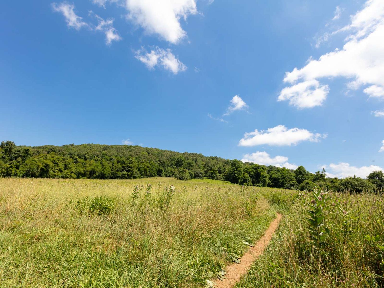
NPS via NPS.gov (Public Domain)
Beagle Gap: Complete 2026 Visitor Guide
10 min read
Places & Points of Interest
Plan your 2026 visit to Beagle Gap. Complete guide to trails, fees, lodging, best time to visit, and insider tips.
Your plans
Overview
At 2,495 feet on Skyline Drive, Beagle Gap is a classic Blue Ridge Mountain gap—a low point between ridges that serves as a practical portal into the woods. You'll find a paved pull-off with a gravel lot, a couple of portable toilets, and a trailhead sign. Its value lies in simplicity and connection: from here, you step directly onto the white-blazed Appalachian Trail, with access to over 500 miles of park routes. The air carries pine and damp earth; sound is often just wind through oak and hickory, or the distant thwack of a trekking pole on rock. Remember, this is a working trailhead, not a scenic overlook—the views come after you've earned them.
Quick Information
Entrance Fee: Access to Beagle Gap requires a Shenandoah National Park entrance pass. As of 2026, the park fee is $30 per private vehicle, valid for seven days. The park transitioned to a fully cashless system in 2025, so have a credit or debit card ready at the entrance station.
Hours: Skyline Drive and Beagle Gap are open 24 hours a day, year-round, but this is subject to weather closures. The road is occasionally closed due to ice, snow, or fog. The portable toilets at the gap are theoretically always available, but their servicing schedule varies.
Best Time to Visit: Late spring (May) and early fall (October). May brings milder temperatures and fewer bugs. October offers reliable fall color and crisp air. Summer weekends see the lot fill quickly.
Location: Shenandoah National Park, Virginia. Nearest major access is via the Swift Run Gap entrance (U.S. 33) at roughly milepost 65.7 on Skyline Drive. The GPS coordinates for the parking area are 38.073191, -78.793198.
Accessibility: The parking lot is paved and level. The Appalachian Trail access from Beagle Gap is a natural surface trail with roots, rocks, and grade changes - it is not wheelchair or stroller accessible. The portable toilets are not ADA-compliant vault units.
Cell Service: Cell service drops out at Beagle Gap and across most of central Shenandoah. Expect no signal or a single bar that comes and goes. Don't rely on your phone for navigation or emergency communication on the trails here.
Restrooms: Two portable toilets (vault style) are located at the trailhead. They are the only facilities. No running water.
Parking: One gravel lot fitting approximately 10-12 vehicles. No fees beyond the park entrance pass. It fills by mid-morning on pleasant weekends from April through November. If full, do not park on the grassy shoulders or along Skyline Drive; rangers patrol and vehicles are towed. The next closest legal parking is at the Meadow Spring lot a few miles north.

Getting There
Beagle Gap sits at milepost 57.5 on Skyline Drive. From the north, take I-66 to Front Royal and enter at the park's north entrance (milepost 0). It's 57.5 miles south on Skyline Drive from there—allow 90 minutes minimum, given the 35 mph limit and likely stops at overlooks. From the south, use I-64 to the Rockfish Gap entrance (milepost 105), then drive 47.5 miles north. Coming from Charlottesville, U.S. 33 via Swift Run Gap is usually the quickest approach. to the Swift Run Gap entrance (milepost 65.7), then a 8.2-mile drive north to Beagle Gap.
The parking situation here is simple but strict. Pull completely into a gravel space. The common mistake is parking along the edge of the pavement, which blocks traffic and will get you a ticket. The lot is plowed in winter, but access depends on Skyline Drive being open. Always check the park's social media or text SHENALERTS to 888777 for real-time road status before you go in the colder months.
What to Expect
You're parking in a forest clearing on a mountain ridge. The ground is packed gravel and dirt. The trailhead kiosk has a basic map, but it's not detailed - bring your own. The Appalachian Trail crosses Skyline Drive here, so you'll often see through-hikers in spring and fall filtering water at the drainage ditch or taking a break on the stone wall. They move with a specific, efficient weariness.
The terrain immediately off the road is a typical mid-Atlantic forest floor: a mix of leaf litter, moss, and exposed tree roots. The trail narrows here, with mountain laurel and rhododendron crowding the path in places. In summer, the humidity can be thick, and the buzz of insects is constant. In winter, the silence is broken only by the crunch of frozen leaves underfoot and the croak of a raven. The elevation at the gap is 2,495 feet, but trails leading from it will take you both up and down several hundred feet. Weather changes fast. A sunny morning can turn to fog so dense you can't see the next trail blaze by afternoon.
First-time visitors are sometimes surprised by how utilitarian the spot is. This isn't a viewpoint with a grand panorama. The reward requires walking. The sound of cars on Skyline Drive fades within five minutes on the trail, replaced by forest sounds. What the park website doesn't mention is the particular quality of afternoon light in the gap itself - around 4 PM, the sun slants through the trees and hits the gravel, turning the whole lot a warm gold for about twenty minutes. It's a good time to return if you've timed your hike right.

Top Attractions & Points of Interest
Beagle Gap is a launch point, not a cluster of attractions. The points of interest are the trails and destinations you reach from it.
Appalachian Trail Access
This is the main event. The famous 2,190-mile trail crosses the pavement here. Heading north, the A.T. climbs towards Blackrock Summit and eventually to the park's southern districts. Heading south, it connects to the trails around Big Meadows and Lewis Mountain. Even a short out-and-back walk gives you the feel of the trail - the well-worn path, the consistent white blazes on the trees. You'll likely meet through-hikers here from April to June (northbound) and September to November (southbound).
Beagle Gap Overlook
A short walk east from the parking area (not the trailhead, but along the road shoulder) brings you to the formal Beagle Gap Overlook. Facing east from 2,495 feet, the view stretches outside the park boundary to the Virginia Piedmont. On a clear day, you can see the rolling foothills receding into the distance. It's a quieter overlook than most, often skipped by drivers speeding between bigger attractions.
Connection to Big Meadows Area
Via the Appalachian Trail or other connecting paths, Beagle Gap provides a backdoor route into the popular Big Meadows area. This lets you visit the lodge, wayside, and the meadow itself without fighting for parking at the main lots. It's about a 2.5-mile hike from Beagle Gap to the edge of Big Meadows.
Trailhead for Less-Traveled Routes
While major trailheads for Old Rag or Dark Hollow Falls jam up by 8 AM, Beagle Gap offers access to a network of trails that see a fraction of the traffic. It's a starting point for longer loops that dip into the Shenandoah Wilderness, where you're more likely to hear a pileated woodpecker than another human.
Stargazing Base
Because it's away from the major developed areas, the parking lot at Beagle Gap gets quite dark at night. It's a known spot among park regulars for pulling over, turning off the lights, and looking up. The lack of ambient light from lodges or waysides makes for a decent view of the Milky Way on a moonless night.
Activities
The activity here is hiking. That's it.
Day Hiking: This is a premier day hiking launchpad. You can craft loops of nearly any length by combining the A.T. with fire roads and other trails like the Pocosin Trail. A popular moderate day hike is a loop using the A.T. south to the Pocosin Fire Road and back, covering about 7 miles with good ridgeline views. For a shorter leg-stretcher, walk the A.T. north for a mile to a minor summit with limited western views.
Long-Distance Hiking: Obviously, it's an on-ramp for the Appalachian Trail. Section hikers use it as a resupply point, often getting picked up or dropped off here to access towns like Stanardsville via Swift Run Gap.
Wildlife Viewing: The mature forests around Beagle Gap are good for spotting white-tailed deer, eastern gray squirrels, and a variety of birds, including scarlet tanagers and wood thrushes. Black bears are present but less commonly seen here than in the berry-rich areas like Big Meadows. Still, know proper bear country protocol.
Photography: The best photography isn't at the gap, but from the trails that start there. Early morning light on the A.T., especially after a rain when the fog clings to the hollows, provides classic Blue Ridge mood scenes. The overlook offers a classic layered landscape view for sunrise.
Stargazing: As mentioned, it's a decent pull-off for night sky viewing. Bring a red-light headlamp to preserve your night vision and a warm jacket - even summer nights are cool at 2,500 feet.
For more detailed route suggestions, see our guide to hiking trails accessible from this area.

Seasonal Guide
April - May: The lot fills later than in summer, maybe by 10 AM. Spring wildflowers like trillium and lady slipper appear along the trails. Temperatures range from 40s to 70s. Blackflies can be pesky in May. This is prime northbound A.T. hiker season.
June - August: Arrive by 8:30 AM for parking. Heat and humidity build, with afternoon thunderstorms common. The forest is a dense, green tunnel. Deer flies are aggressive. This is the busiest time for general tourism, but Beagle Gap remains relatively calm compared to headline trailheads.
September - October: The most competitive parking. On peak fall foliage weekends (usually mid-October), the lot is full by 8 AM. Days are crisp, nights are cold. The A.T. sees its southbound thru-hiker bubble. This is arguably the best time for hiking, if you can handle the crowds on Skyline Drive itself.
November - March: You'll have the place to yourself on a weekday. Skyline Drive may be closed for ice or snow - always check. The portable toilets may be locked or inaccessible after heavy snow. Temperatures routinely drop below freezing. Hiking requires traction devices like microspikes from December through February. The bare trees open up long views through the forest that are hidden in summer.
For a deeper dive on weather patterns, consult our best time to visit guide.
Practical Information
Fees: The $30 per vehicle park entrance fee applies. Annual Shenandoah passes are $55. The America the Beautiful Interagency Annual Pass ($80) also covers the entrance fee. No additional fee or permit is required to park at or hike from Beagle Gap, unless you are planning to hike Old Rag (which requires a separate day-use ticket).
Permits: No permits for day hiking. Backcountry camping requires a free permit, available at self-registration stations at park boundaries or at the visitor centers.
Campgrounds: The nearest camping options are Lewis Mountain Campground (mile 57.5, about 1 mile away, 30 sites, $30/night as of 2026) and Big Meadows Campground (mile 51.2, about 6 miles north, 221 sites, $75/night). Both require reservations through Recreation.gov.
Lodging: For lodging and accommodations, the closest is Big Meadows Lodge (mile 51.2), offering hotel rooms and cabins. Skyland Resort (mile 41.7) is 16 miles north. Both book up months in advance for fall.
Food & Supplies: The nearest food is at Big Meadows Wayside (mile 51), which has a dining room and grab-and-go market. Lewis Mountain Cabins (mile 57.5) has a small camp store with basics. The only in-park gas station is at Big Meadows, so fuel up before entering.

Safety & Preparation
Your main hazards here are weather and getting lost.
Weather: Conditions change rapidly. Hypothermia is a risk even in summer if you're caught in a cold rain. Check the forecast for the specific elevation (2,500+ feet), not the valley. Afternoon thunderstorms with lightning are a real summer threat - be off the ridge by early afternoon.
Navigation: The trail network is complex. The A.T. is well-marked, but side trails can be confusing. Carry a detailed topographic map and compass, and know how to use them. GPS devices are helpful but can fail due to tree cover or dead batteries.
Wildlife: This is black bear country. Make noise while hiking, carry bear spray, and know how to store food properly. Never approach wildlife. Ticks are prevalent; wear treated clothing and do thorough checks after your hike.
Trail Conditions: Expect rocks, roots, and mud. Footing can be slippery, especially on wet leaves or frost. Trekking poles are recommended for most hikes leaving the gap.
Emergency: Cell service is unreliable. In an emergency, note your location (trail name, nearest milepost if possible) and send someone for help. The closest ranger station is at Big Meadows (mile 51). For urgent emergencies, dial 911 and hope for a patch of signal.
Insider Tips
- The Quiet Alternative: When the Bearfence Mountain or Hawksbill parking lots are overflowing, Beagle Gap is your best bet for finding a spot and still accessing the central park trail network. You can piece together a hike to similar vistas with 90% fewer people.
- Water Source: There is no potable water. The only "source" is seasonal runoff in the ditches near the parking area, which through-hikers sometimes filter. You must carry in all the water you'll need. The gift shop at Big Meadows sells water for $4 a bottle. Bring your own.
- Sunset Strategy: The Beagle Gap Overlook faces east, so it's for sunrises. For sunset, hike about 1.5 miles south on the A.T. to a rocky outcrop
For more information, see our complete Shenandoah National Park Guide.
Sources
- Official source: NPS — Shenandoah National Park nps.gov/shen/index.htm
- Official source: National Park Service nps.gov/places/000/beagle-gap.htm
Photo Gallery
More to Explore

Park Guide
Acadia National Park: Carriage Roads, Cadillac Mountain & 2026 Guide
Discover carriage roads, Cadillac Mountain, and rugged Maine coast. Complete 2026 guide to Acadia National Park — trails, fees, lodging, permits, and what rangers recommend.

Hiking Guide
Grand Canyon Hiking Trails: Day Hikes, Water Sources & Rim to Rim
Compare Grand Canyon hiking trails: Bright Angel, South Kaibab, Hermit, Grandview, and rim to rim, with distances, elevation, water stops, and trailhead access for each.

Best Of
Best of Glacier Bay National Park
The best of Glacier Bay is reached by boat: ranger-led day tours up the bay to the tidewater glaciers. What's worth it, how to book, and when to go (2026).

Campsite Guide
White Sands Backcountry Camping: Closed for 2026 — What to Know
As of 2026, backcountry camping at White Sands National Park is closed for site rehabilitation. What that means, and where to camp nearby instead.

Weather Guide
Guadalupe Mountains National Park Weather: Weather
Guadalupe Mountains National Park: weather guide guide updated 2026. Practical visitor information, reservations, and seasonal tips worth bookmarking before

Best Of
Best of Cuyahoga Valley National Park: Best Things to Do
Seeing a Cleveland Orchestra concert with the woods as your backdrop is a uniquely Cuyahoga Valley experience.
Sign in to join the conversation.
Sources & Attribution
Location data courtesy of the National Park Service (U.S. Department of the Interior). NPS data is public domain. Official NPS page.
Images: NPS; NPS; NPS; NPS; NPS.
Map data © OpenStreetMap contributors.
Park operations alerts: NPS.gov · Weather and weather hazards: National Weather Service · Live conditions.
Information may change. Always verify fees, hours, and conditions directly with the official source before visiting.
Did this guide help? Share it with a friend.