A World of Fish is a roadside interpretive site on US Highway 89/191/287, 5 miles north of Moran Junction, with no separate fee beyond the park entrance pass. Open year-round, best visited late May through September; expect a quick, wheelchair-accessible stop with limited parking for about six vehicles.
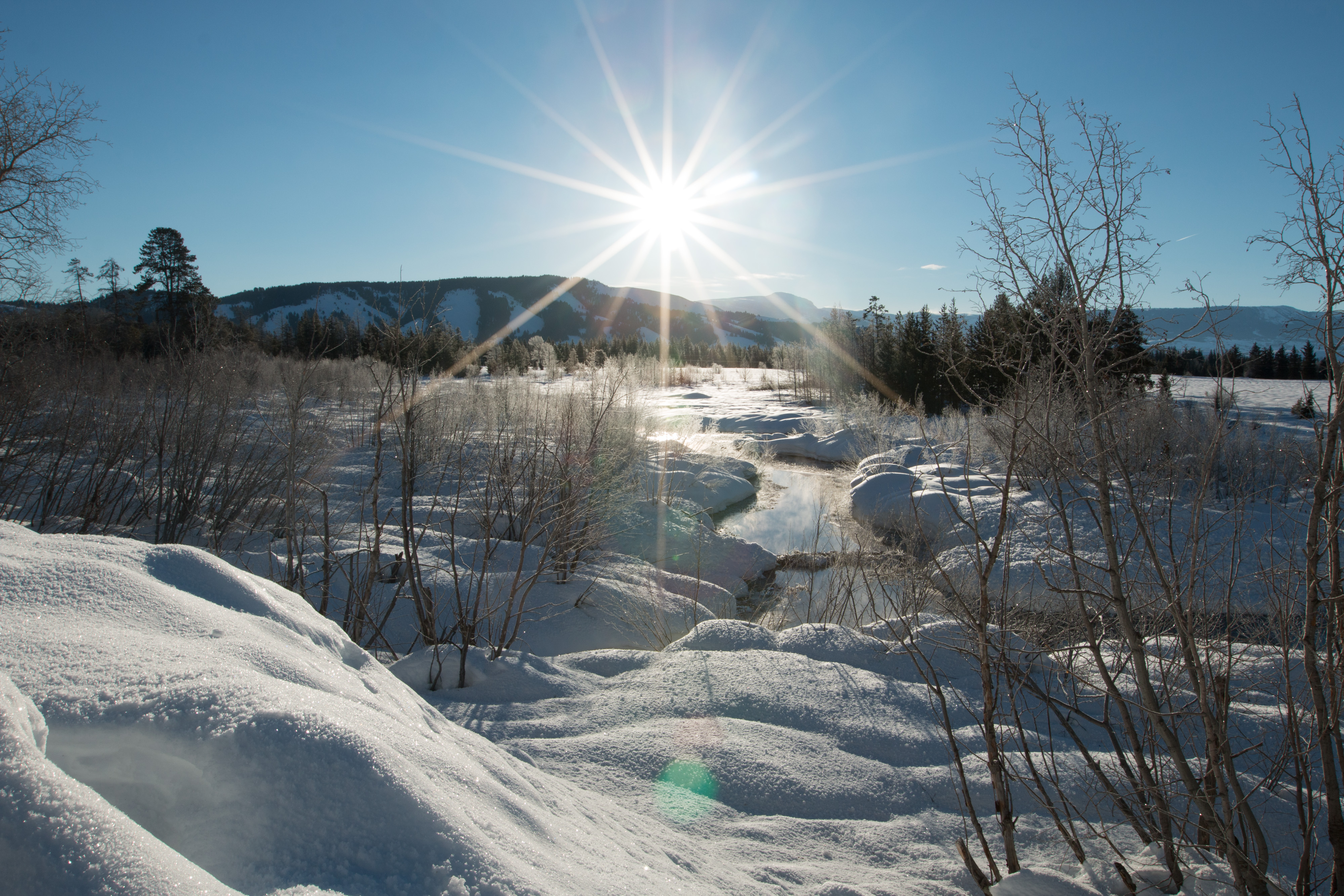
NPS via NPS.gov (Public Domain)
A World of Fish: Complete 2026 Visitor Guide
6 min read
Places & Points of Interest
Plan your 2026 visit to A World of Fish. Complete guide to trails, fees, lodging, best time to visit, and insider tips.
Your plans
Quick Information
As of 2026, there is no separate entrance fee for this specific point of interest; access is included with your Grand Teton National Park entrance pass. The site is open year-round, but accessibility depends on seasonal road conditions. The best time to visit is from late May through September when the interpretive exhibits are clear of snow and the surrounding landscape is active. It's located in Grand Teton National Park, Wyoming, along US Highway 89/191/287 between Moran Junction and Jackson Lake Junction. The site is wheelchair accessible, with paved pathways and benches. Cell service here is typically one bar of LTE at best - don't count on it. There are no restrooms or dedicated parking at the site itself; you'll use a roadside pullout. Parking is limited to a handful of vehicles, so it's a quick stop.
Getting There
A World of Fish is situated on the east side of US Highway 89/191/287, approximately 5 miles north of Moran Junction and 12 miles south of the Jackson Lake Junction. If you're coming from Jackson (about 30 miles south), drive north through the park, pass the turnoff for the Teton Park Road at Moose, and continue north. The pullout will be on your right, marked by a standard brown park service sign. From Yellowstone's South Entrance, it's about a 20-mile drive south; you'll pass the Jackson Lake Dam and the turn for Signal Mountain before reaching the site on your left. The drive from Jackson Hole Airport takes about 45 minutes. There's no specific address - you navigate by highway mile markers and the sign.

What to Expect
This is a compact, thoughtful stop, not a grand spectacle. You'll pull into a paved turnout that fits about six vehicles. A short, flat path leads to interpretive panels set in stonework. Listen for the wind rushing through sagebrush and the distant hum of traffic. You'll smell dry pine and sage, with the damp mineral scent of the river beneath—though you can't see the water from here, you sense its presence. The terrain is flat sagebrush grassland, backed by the Teton Range to the west. Many first-timers are surprised by the depth of information in this small space; it's more about understanding the river's story than taking photos. At 6,800 feet, expect intense sun and nearly constant wind.
Top Attractions & Points of Interest
The Interpretive Panels
The core of the experience. The panels detail the Snake River's journey, the impact of the Jackson Lake Dam, and the native fish species that call these waters home. Rangers will tell you this is one of the more detailed hydrological explanations in the park. Take five minutes to read them - it will change how you view every other stretch of the river you encounter.
The Sagebrush Vista
While the panels face east, turn around. The view west frames the central Tetons across the broad valley. It's a classic, unobstructed panorama that illustrates the scale of the watershed you're learning about. Early morning or late afternoon light paints the peaks in sharp relief.
The Pullout Itself
This is a prime example of a well-designed roadside interpretive stop. It's fully accessible, has sturdy benches for contemplation, and is far enough from the road to feel separate. It's a model of how the Park Service integrates education into the travel corridor.

Activities
This location is primarily for learning and reflection. The main activity is engaging with the interpretive exhibits. It also serves as a convenient, less-crowded pause on a scenic drive. It's an ideal spot for travelers who need a break from driving but want to avoid the crowds at larger turnouts. For photographers, the eastern morning light on the Tetons from here can be exceptional, with the sagebrush foreground providing texture and scale. It is not a trailhead, a picnic area, or a wildlife viewing platform in the traditional sense, though you might spot raptors soaring over the flats.
Seasonal Guide
Winter (Dec-Mar): The pullout is plowed, but the panels may be banked with snow. Access is easy from the highway, but it's a cold, windy stop. You'll likely have it to yourself.
Spring (Apr-May): Snow melts, revealing muddy ground around the pavement. This is when the interpretive content becomes fully readable again. Crowds are low.
Summer (Jun-Aug): Peak season. The pullout may fill by mid-morning. Visit early or late in the day to have space. The sagebrush is green, and the heat is dry.
Fall (Sep-Nov): Arguably the best time. Cooler temperatures, fewer visitors, and the chance of golden cottonwoods along distant river corridors. The information is fully accessible until snow closes in.

Practical Information
Your standard park entrance pass covers access. No permits or reservations are needed for this stop. For broader trip planning, including camping options and lodging and accommodations, you'll need to look at developed areas like Colter Bay or Signal Mountain. The nearest services are at Moran Junction (limited) or Signal Mountain Lodge (5 miles north). There are no garbage cans, so pack out anything you bring in. This is a "leave no trace" stop in the purest sense.
Safety & Preparation
The primary hazards are vehicular - watch for traffic when pulling in and out of the highway turnout. Sun exposure and wind are significant; wear a hat, sunglasses, and sunscreen even for a short stop. The elevation is over 6,800 feet; if you've just arrived from lower altitudes, take it easy. There are no guardrails or steep drop-offs at the site itself. Wildlife is not typically concentrated here, but always be aware of your surroundings in bear country. Carry water in your vehicle.

Insider Tips
- Timing is Everything: Stop here on your way to another destination, not as a destination itself. A 10-minute investment yields a lot of context.
- The Quiet Alternative: If the Cathedral Group Turnout is packed, this spot offers a similarly oriented (though more distant) mountain view with zero crowds.
- Read the Fine Print: One panel specifically discusses the dam's impact on fish migration. It's a nuanced take most visitors miss.
- Windbreak: The stonework holding the panels provides the only wind shelter for miles. Stand close if the breeze is biting.
- Combine Your Stop: Pair this with a visit to the Jackson Lake Dam overlook a few miles north for a full picture of the river's managed flow.
- Check for Updates: As of 2026, parkwide construction is planned. While this site likely won't be affected, road delays could change travel times to get here. Always check the official park road page before you go.
- The Unseen River: You can't see the Snake River from the panels. To connect the lesson to the landscape, continue north to the Jackson Lake Dam or south to the wildlife viewing areas along the riverbanks.
For more information, see our complete A World of Fish: a world of fish Guide.
Sources
- Official source: NPS — Grand Teton National Park nps.gov/grte/index.htm
Photo Gallery
More to Explore

Park Guide
Acadia National Park: Carriage Roads, Cadillac Mountain & 2026 Guide
Discover carriage roads, Cadillac Mountain, and rugged Maine coast. Complete 2026 guide to Acadia National Park — trails, fees, lodging, permits, and what rangers recommend.

Hiking Guide
Grand Canyon Hiking Trails: Day Hikes, Water Sources & Rim to Rim
Compare Grand Canyon hiking trails: Bright Angel, South Kaibab, Hermit, Grandview, and rim to rim, with distances, elevation, water stops, and trailhead access for each.

Best Of
Best of Glacier Bay National Park
The best of Glacier Bay is reached by boat: ranger-led day tours up the bay to the tidewater glaciers. What's worth it, how to book, and when to go (2026).

Campsite Guide
White Sands Backcountry Camping: Closed for 2026 — What to Know
As of 2026, backcountry camping at White Sands National Park is closed for site rehabilitation. What that means, and where to camp nearby instead.

Weather Guide
Guadalupe Mountains National Park Weather: Weather
Guadalupe Mountains National Park: weather guide guide updated 2026. Practical visitor information, reservations, and seasonal tips worth bookmarking before

Best Of
Best of Cuyahoga Valley National Park: Best Things to Do
Seeing a Cleveland Orchestra concert with the woods as your backdrop is a uniquely Cuyahoga Valley experience.
Sign in to join the conversation.
Sources & Attribution
Location data courtesy of the National Park Service (U.S. Department of the Interior). NPS data is public domain.
Images: NPS; NPS; NPS; NPS; NPS.
Park operations alerts: NPS.gov · Weather and weather hazards: National Weather Service · Live conditions.
Information may change. Always verify fees, hours, and conditions directly with the official source before visiting.
Did this guide help? Share it with a friend.